As explained in part 1 of this account, this is a personal journal of a visit to the Intergeo 2025 event in Frankfurt.
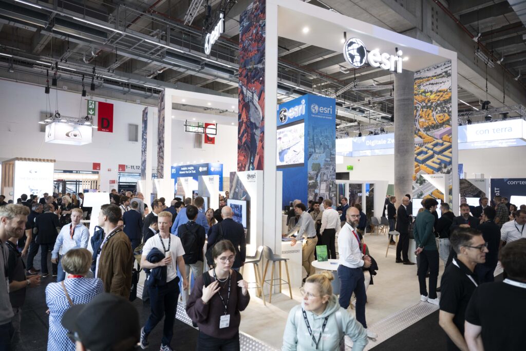
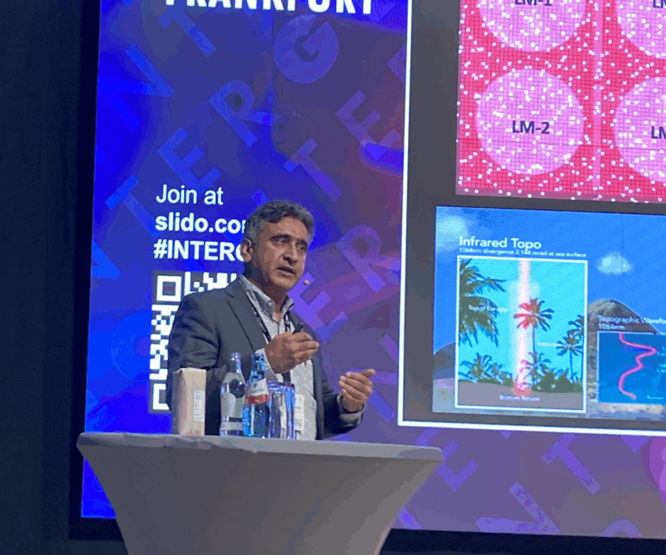
Though my Wednesday began with brief visits to a number of booths, the highlight of the morning was another session in the theater. There were three compelling, energetic presentations in a session entitled “Digital twins”. Our contributing writer Amar Nayegandhi talked about Woolpert, where he is global head of technology and innovation, and its airborne acquisition efforts. Woolpert describes itself as an AEG company – architecture, engineering and geospatial – and has expanded to 75 offices as its global expansion continues, including acquisitions of Murphy Geospatial in Ireland, AAM in Australia, and Bluesky International in England. Among its huge collection of sensors are systems that it has developed in-house for particular purposes – BuckEye2, BULLDOG and Zeus, in chronological order. Zeus is an incredibly high performance topographic lidar system, a mix of linear-mode and Geiger-mode, which Amar said could accomplish 150 ppsm from 10,000′ with 5-10 cm accuracy. He emphasized that these sensors are for internal use only, for specific purposes, and their development does not endanger Woolpert’s purchases of commercial sensors. Equally importantly, Woolpert has invested heavily in software, such as GeoAI developments and a DaaS platform with QA/QC and a portal for digital products. Amar showed enough examples to convince me that Zeus is real. One application area is utilities.
Esri, long-time GeoAI advocate, showcased a complete AI layer in its GIS platform.
He was followed on the podium bv Brad Li, senior solution engineer for geospatial at DJI, who gave a superb presentation, “From data to digital twins: how DJI Enterprise is transforming 3D reconstruction,” and his theme was smart data capture and smart model construction. He provided a whistlestop of the DJI portfolio, then detail on the workflow. There was, of course, emphasis on the planning and execution of the mission, and the capabilities of the Terra 5.0 software (with Gaussian splatting!) He ended with an example of 4.3 km2 in Qingdao, China, including an amusement park, acquired with 22,113 images, and showed the comprehensive range of products and measurements that were possible. The notion of DJI as a one-stop-shop photogrammetry supplier with a mature solution is quite new, but Brad’s breathless enthusiasm and copious material stemmed any scepticism.
Third on was Victor Ruiz of Cintoo, with “Turn point cloud complexity into data clarity within Esri.” He focused on massive data, which is difficult to share and complex to integrate. Cintoo brings data inside Esri. Cinto offers a mesh capability, sensor-agnostic, with no data decimation yet 10-20x lighter. Esri challenged Cintoo to bring its core technology inside ArcGIS and they did (they had to add map projections!).
Not surprisingly, therefore, the Esri booth was lively, then I went to UP42, which I thought was essentially a broker of satellite data. But it’s more. It’s located in trendy Kreuzberg in Berlin and offers a platform for acquisition (including tasking), management and processing of a wide variety of data. An interesting aspect was the number of satellite operators UP42 works with and how many of these are smallsats, including SAR.
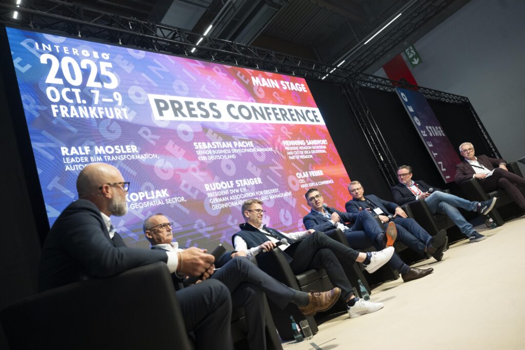
Tuesday’s press conference, “Rethinking data – geodata in the age of AI, sovereignty and digital realities”.
I returned to the main stage for a superb press conference, “Rethinking data – geodata in the age of AI, sovereignty and digital realities.” The panelists were all eminent: Prof. Rudolf Staiger, president of DvW – German Society for Geodesy, Geoinformation and Land Management, which owns Intergeo; Ralf Mosler, BIM transformation lead, Autodesk; Sebastian Pache, business development manager, Esri; Henning Sandfort, president, Hexagon Geosystems; Boris Skopljak, Vice President, Geospatial Sector, Trimble; Olaf Freier, CEO, Hinte. Staiger and Freier were the hosts; the other four represented platinum sponsors.
We’re in a new era, in terms of how we think and the way we use data – it’s no longer a static snapshot, but refreshed through sensors and IoT. We are moving from passive to predictive, evolving to decentralized processing with edge computing bringing intelligence to data collection. How can we ensure data is trustworthy? Who controls the flow?
Staiger was, “… very happy – attendance good.” These are insecure times in terms of safety rather than technology, but our profession is looking forward positively. He cited a session on “BIM – what is next?” Its message was that we have the technology, knowhow and tools, but we need a positive mindset. The obstacles are financial and legal, but these can be overcome with common sense and common ground. “AI does not put our life in the hands of others.”

Rudolf Staiger, president of the German Association for Geodesy, Geoinformation and Land Management.
Mosler agreed, exclaiming that Intergeo is “a great place to design and make a better world.” The audience was passionate to drive and deliver on successful projects.
Pache similarly had a positive impression” “This is the place to be, feel the heartbeat of the community. The future of work is here and it’s now.”
Henning, like Pache, was an Intergeo rookie, but noted that Hexagon goes back to the beginning of the event. He loved fairs, talking to customers, partners and competitors, and felt the “vibe”. The new Leica TS20 is AI-enabled.
Skopljak added that Trimble was also fine. He felt lots of energy, there were many young people around, the future was bright. He expressed the contents of the Trimble booth in an intriguing way: the company was on a mission to transform by connecting physical and digital. It was becoming increasingly difficult to draw the line where office begins and field ends. He acknowledged the accomplishments of not just Trimble, but partners and competitors: there was no dominant solution, everyone had “some cool stuff.” The opportunity was bigger than we perceived it.
Staiger started the discussion of rethinking data. 90% of data created by mankind is less than two years old, so we need new techniques and strategies. Measurement has evolved through manual, semi-automatic, automatic, autonomous, to responsive. IT used to be hard work, now it needs strategy and management. How do we validate? We rely on AI, but we have to prove it. We have to solve it on an economic basis. The profession has to adapt and develop new skills, including management and selling ideas.
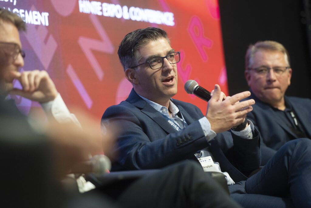
Boris Skopljak, Vice President, Geospatial Sector, Trimble.
Pache said that all stakeholders are responsible for standards. We need open ones. We have fine organizations, e.g. OGC, but the challenge is to speed up. Staiger added that solutions hinge on interoperability, but we are still siloed and don’t like to share data. We think in terms of granular data, but we give access on platforms.
Skopljak urged us to think of ourselves as geospatial engineers rather than instrument users, though turning on and using an instrument still matters. How do we integrate better with APIs? Moving data around must work better.
Henning felt that we need to be more differentiated. The goals are productivity and efficiency for customers. Data is not the gap. – what we do with it is the gap.
The discussion moved to AI, which is transforming BIM and CAD. Freier pinpointed its growing role, while Staiger saw it as extending human capability. Mosler added that Autodesk has integrated many AI features into the construction cloud, managing risks in different stages of a project, and launched an extension of Autodesk Forma with predictive, generative AI for infrastructure.
Skopljak discussed how AI can help surveying and construction: it will be an integral part of every solution. Trimble first used AI in its eCognition product eight years ago. Also, the company reduced its programming-intensiveness in Trimble Business Center. AI is used in feature extraction and point classification and the focus has moved to connecting multiple AI agents, which all communicate. It’s Trimble’s version of Google Translate! AI was added to Trimble Connect just a few months ago. AI can do things in a more optimized way than humans.
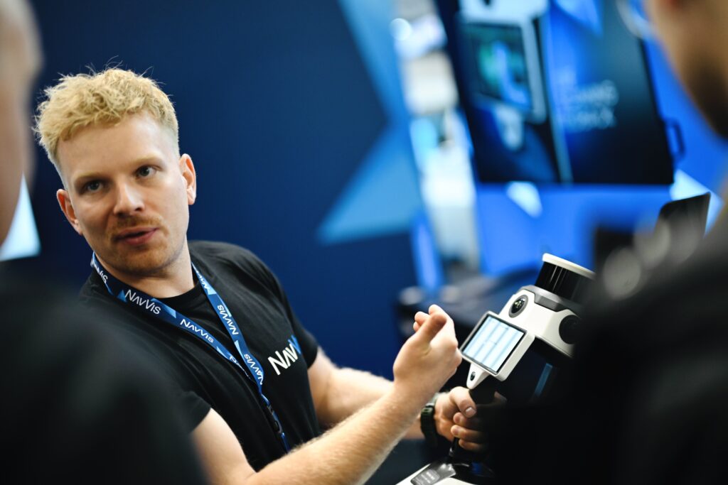
Demonstrating NavVis’ MLX, a user-friendly, handheld dynamic laser scanner.
Henning warned that any productivity downstream on the applications side must be built on the expertise of surveyors and we must empower them to perform. Hexagon has brought AI into the field with the Leica TS20. It helps the user to address common sources of mistakes, e.g. choice of prism, disruption to field of view, mist, rain, check connectivity. It is a bridge between productivity and reliability.
Pache mentioned best practices and reminded the audience that AI is nothing new for Esri, which has advocated for GeoAI for many years. Now there is a complete AI layer in its GIS platform, a game-changer.
Skopljak pointed to Trimble subscription models and how can they empower professionals. You can think about the cloud in multiple ways, but it’s one of the best-selling tools to present geospatial data to many more customers than ever before. How do we put our technology into the hands of more people, who can’t always afford high-end instruments? Trimble Catalyst can be an inexpensive subscription hooked to a phone. Trimble has attracted emergency responders, landscape artists, glacier people, i.e. lots of new users because it has subscriptions.
There was an interesting foray into the question of collaboration. Do former competitors have to become partners? Henning said this is not the future, it’s happening now, but will be more relevant in the future. Construction wants meaningful change. Mutual or joint growth should be used if we can. Skopljak joked that the USB stick and pen and paper are the biggest competitors. Staiger repeated that we are siloed, it’s about interoperability between the platforms, but collaboration is a big opportunity to drive value for customers and communities.
Pache was a fan of competition, which brings choices. The customer doesn’t care about silos, we know how to break them. If competitors act this way, all is well. Staiger, as a neutral observer, noted that we were talking about competition between suppliers, but it’s also in the public sector and academia. We must break the barriers.
Mosler concluded that Intergeo 2025 shows clearly that live events are irreplaceable. We could not have perspectives otherwise. “Technology meets the community.” The challenge is to translate the momentum into continuous engagement through the year. We must bear responsibility, building trust on transparency and interoperability.

Technology meets the community, day two.
Henning concluded with exchange in the community. Talent shortage is a theme. He sensed enthusiasm in this fair, but we need to talk outside our community.
The panelists tried to look five years ahead. Skopljak judged that AI is truly transformative, but we’re at the beginning, so it’s hard to predict. The future certainly includes AI, IoT, ubiquitous connectivity. People don’t want data – who cares? – they want answers.
Staiger added that in five years we will have many new friends, agentic AI, industry talking to BIM models. AI models will improve enormously, LLMs are big today, but there is a trend to more AEC-specific data models.
Pache reminded us that AI without geodata doesn’t make sense: it needs the context. In five years we will be at the center of digital transformation.
Henning agreed that we would jump into AI and agentic AI, but considerable work on underlying digitalization would be required.
Staiger ended the session with his outlook on Intergeo 2026, as president of DvW, a scientific/technical association run by volunteers to boost the whole geospatial profession. Intergeo is the ideal platform for exchange and dialog. There will be more interactive formats in 2026, back in Munich after 20 years. Oktoberfest occurs immediately afterwards.
I felt humbled at the end of this. These six panelists displayed astonishing powers of comprehension, distillation, synthesis and articulation. In an hour we were told how far along the road we have come and what we must do to travel faster.

Mobile data collection demonstration, a common sight at INTERGEO.
Shortly after the press conference, I had the pleasure of an interview with Boris Skopljak, the first of three Trimble sessions organized for me by Cas Heuvelmans, senior manager, public relations Europe. Skopljak and I immediately discovered something in common: in early life, a relative had helped us to find vacation work in surveying, leading to our education choices, then careers in the industry! Skopljak had studied geomatics in his home country of Croatia, worked as a land surveyor, continued his education at The Ohio State University, and added an MBA later, at the University of Denver, not far from the Trimble office in Westminster, Colorado. Skopljak mentioned the innovations in laser scanning that had come to Trimble with the acquisition of Mensi in 2003, then moved on to the current partnership with Hilti. He mentioned Trimble’s ability to manufacture at scale and the long-term stability it could offer.
We talked about the new data collector tablets that Trimble was introducing, the TSC710, TSC510, and T110 tablets, which can be teamed with many field instruments. Skopljak explained that these are physical devices at the heart of Trimble’s digital strategy. They are touch devices that connect to instruments by Bluetooth and NFC (near field coms) and to the outside world with 4G/5G. Obviously, the specifications are high and the screens, user experience and software, state-of-the-art, but I was impressed by Trimble’s goal of robustness in the field, in the sense not only of toughness, but also of helping the user avoid mistakes, as we had heard in the press conference. Furthermore, the device knows about the status of the project before being taken into the field, ready to help the surveyor from the start of the day. I think this plays to the point about new skillsets being required.
I moved on to one of my own fascinations in the Trimble complex – Inpho. Skopljak explained that the Inpho software is now fully integrated in Trimble Business Center (TBC) – and thus democratized. He did not disagree when I pointed out how convenient it is that both Trimble and Esri have R&D facilities in Stuttgart.
The ever-lively STONEX booth.
Before Intergeo, I received a paper entitled “Trimble 2026 Industry Outlook” from Meredith Bagnulo at Keaton PR. It’s an intense assemblage of the opinions of several senior Trimble leaders, focused primarily on the construction segment. Topics includes special aspects of data center construction; agentic AI in the AECO segment; technology and training as key to the next-generation workforce; democratization of reality capture; increasing autonomy of tasks and machines – interoperability, leveraging enormous data sets, cloud, AI; rapid adoption of common data environments, giving a single source of truth and replacing silos; more data integration and interoperability; smarter, GIS-centric infrastructure and asset lifecycle management; purchasing and operability advances; visualization and 3D models/BIM for improved collaboration; more focus on comprehensive, integrated financial management, with greater adoption of ERP systems. Heuvelmans and Skopljak explained that these were the writers’ reactions to the results of one of Trimble’s regular customer surveys. Successful players seek feedback, then use it!
Skopljak emphasized the cloud and astonished me with numbers – more than 30 million users and 24 million projects on Trimble Connect, which has AI within, several hundred thousand copies of TBC fielded.
We could have talked for hours – so I’ll pursue Skopljak as a podcast guest! We ended on another note that surprised me. He mentioned the use of Trimble equipment in the construction of data centers, which is a very specialist activity with special demands in terms of accuracy and finish. These facilities are always urgent, the high specifications must be met, and there is no time for re-work.
I came back to earth after this riveting conversation and realized that Wednesday afternoon and evening are party time at Intergeo. First, however, I visited a booth with both Inpho and DAT/EM, the latter with its usual impressive collection of screens with stereoscopic viewing. These exhibitors were not located on the booths of their parent companies, Trimble and NV5 respectively, partly because customers like to see them together and partly for historical reasons, dating back to the GeoToolBox Team around the turn of the century!

Prost! A toast among friends.
Adult beverages were appearing all over the halls, but I was invited to a reception by EAASI, on the OPeGieKa and Geofly booths and the space in between. It was a delight to catch up with marketing manager Ada Perello, who is working on the fourth part of her “Elevations for the Nations” series about national elevation datasets in Europe, for LIDAR Magazine. EAASI is working hard on behalf of its members and I was able to discuss some of its activities with president Florian Romanowski, of Polish company OPeGieKa, and secretary general Marcos Martinez. It was pleasing to see that EAASI is continuing its tours of the exhibition for students, which provide focus and perspective they would be unlikely to achieve on their own. EAASI’s investment in activities for young professionals will bear fruit.
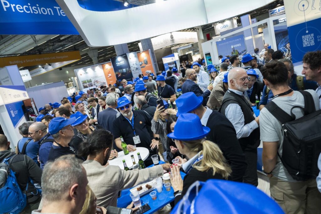
I had a second, generous invitation from Hexagon, but partook only briefly as the booth was overrun by thirsty patrons. If only age did not creep on so relentlessly!
###
Editor’s note: Continue on to part III, here, or return to part I, here.