So much happens at the annual Intergeo event in Germany – enormous exhibition, conference, company events and more – that it’s impossible to produce an acceptable synthesis. Here, therefore, is one scribe’s journal. Though my hotel was close to an entrance to the massive Frankfurt Messe, there was then a walk of nearly a mile, to Intergeo. The size of the venue is impressive: one estimate puts it at 578,000 m2 (~124 acres). Intergeo was housed in the newish Hall 12, completed in 2018, which provides 95,070 m2 of floorspace in two spacious halls arranged one above the other. The theme this year was, “AI, reality capturing, and digital twins”.
Intergeo attracts speculation about the state of the industry. “The market is getting softer” or “So-and-so’s not here” provide anecdotal evidence of putative slumps. Geospatial activity outside the defense segment could well be suffering from global uncertainty, but there’s plenty going on and it’s easy to find impressive financial results, investments, mergers, acquisitions, and ubiquitous construction. Even if growth has flattened, technological development proceeds apace, as the 2025 Intergeo testified.

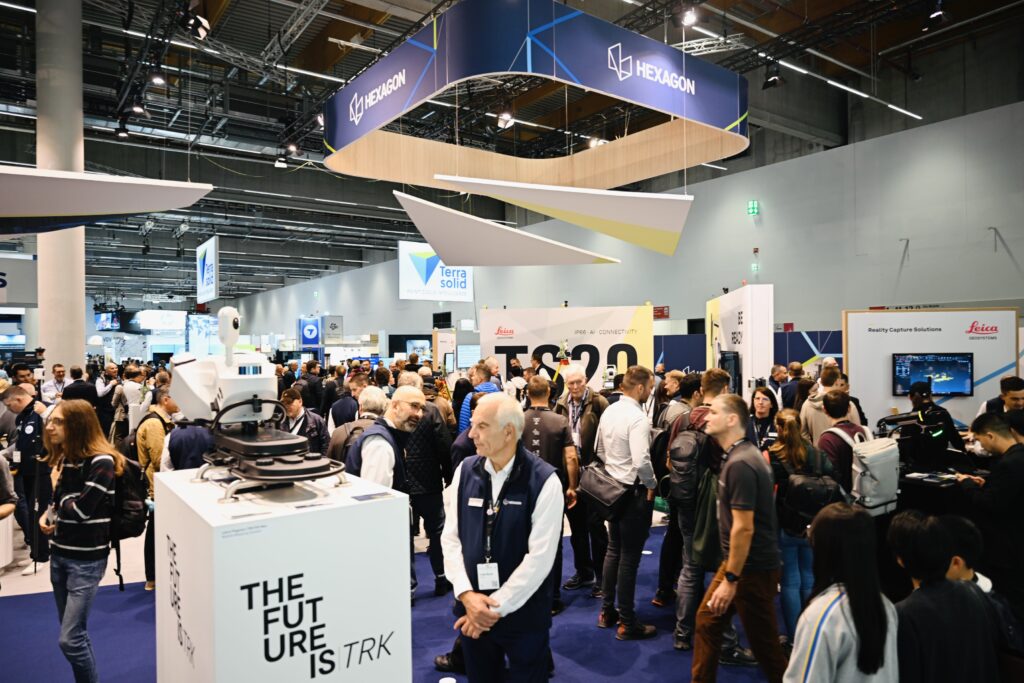
Attendees flood the exhibit hall on opening day.
The statistics from event organizer Hinte gave attendance of over 18.500 visitors from 119 countries, 530 exhibitors, and more than 1200 from 52 countries at the adjacent conference. The corresponding numbers for 2024 in Stuttgart were 17,000 visitors from 121 countries, 579 exhibitors and 800 conference attendees from 47 countries.
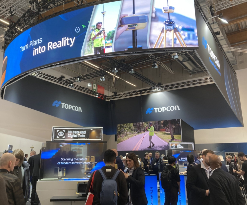
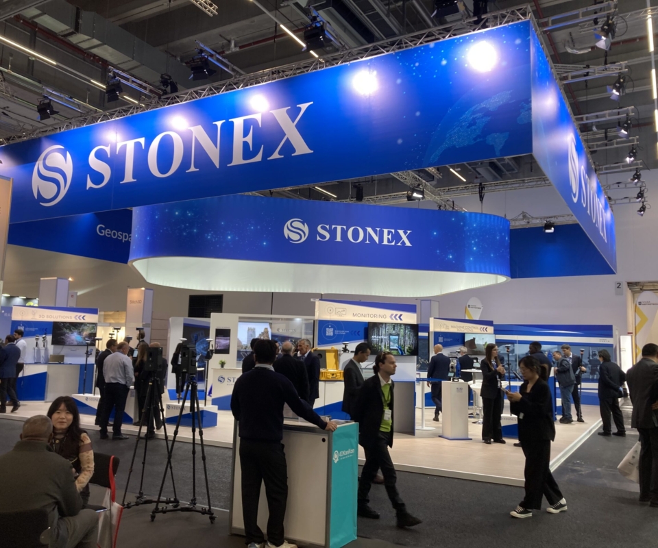
At the very front one of the halls was Topcon. The company didn’t exhibit in 2024 in Stuttgart, so this was a welcome return and the booth was packed. I didn’t catch sight of Neil Vancans, my boss at Leica from 1988 to 1990, who has re-entered the fray to head Topcon’s newly created, dedicated geomatics sales unit, following some time in gentler pursuits. Neil will make a difference for sure!
Topcon was an exemplar of the booths that were buzzing, similar to Hexagon, Trimble and NavVis, whereas others were unexpectedly quiet.
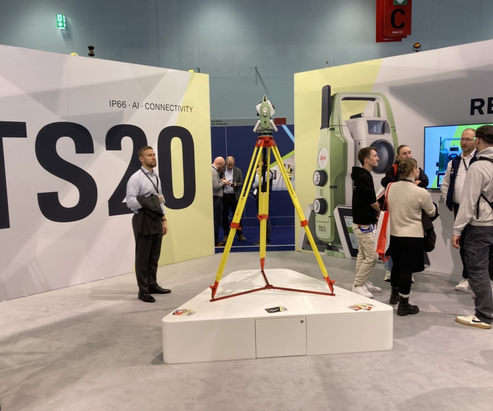
My first interviewee was Anders Ekelund, vice president, airborne bathymetric lidar at Hexagon Geosystems. We met inside the expansive Hexagon booth, where the centerpiece was the new Leica TS20 robotic total station, complete with edge AI through a neural processing unit. Designed to assist surveyors’ workflows, identify mistakes before they happen and increase data reliability, this instrument is significant, because total stations are the very heart of Hexagon Geosystems.

Anders Ekelund, vice president, airborne bathymetric lidar at Hexagon Geosystems.
Anders thought that the event was similar in size to 2024. We both knew that Hexagon would make an important announcement (see below), but decided to focus on the Leica CoastalMapper, taking up where my conversation with John Welter earlier in the year had left off. Anders sounded relieved that the development, which is based on ideas dating as far back as 2018, is almost complete. The objective is increased efficiency, but a key feature is a half-mile swath – a US requirement – compared to the 290 m of the previous generation. The system incorporates all the latest Hexagon components – Hyperion-3 lidar module from Leica TerrainMapper-3, the new Theia bathymetric lidar module, MFC250 camera for RGB (starring the Sony IMX811 247-megapixel chip) and MFC150 for NIR, 60º of view (FoV), Leica PAV200 gyrostabilized mount.
Squeezing all this in has been a major accomplishment, but I churlishly commented on the large size of the system. Anders countered that the Leica HawkEye-5 is actually two large systems on the aircraft floor. CoastalMapper, therefore, is half its size! The large upper part accommodates the liquid cooling system for Theia. The system is Hexagon Geosystems’ first bathymetric lidar system that doesn’t have its origins in the original AHAB group that was spun off from Saab in 2002 and acquired by Hexagon in 2013. Much of the technology is new. Nevertheless, the culture, capabilities and many of the people from the AHAB group are still there in Sweden.
As data is acquired, the software is being refined and includes AI for point classification. The advanced full-waveform processing needs to be optimized for every sensor. The hardware is also undergoing tuning as well as compliance tests, for example in harsh environments, including the exacting DO-160 standard for airborne equipment. The Leica LiDAR Survey Studio software which has been used for bathymetric lidar for some time is being fully integrated into HxMap, bringing major benefits such as distributed processing.
Leica CoastalMapper has not been fielded yet, but some systems have been sold (more details below).
I ended by asking Anders whether we would see bathymetric lidar data in the Hexagon Content Program, but that’s a long way away for security reasons. We ended up marveling, 24 years after LH Systems had acquired Azimuth Corporation and 23 years after AHAB had left Saab, how incredible the technology has become and how fantastic are the developments.

Demonstrations aplenty.
I bumped into my boss from Leica in Switzerland in the early 1990s – David Hughes, looking sprightly and happy, now an octogenarian and thoroughly enjoying his motorbike. As we reminisced, David said that my name had been on the lips of a geospatial contact whom he had recently met. Readers who visit Europe will have enjoyed the experience of ordering a coffee that arrives with a small container of long-life milk or cream. A similar product is typically among the coffee-making paraphernalia in a European hotel room. To access the milk, it is necessary to peel back the top. It transpires that, if the top is carefully removed intact, it can become an item worth collecting. There is an enthusiastic bunch of collectors in Switzerland. Furthermore, one of the officers of the leading Swiss society of such hobbyists lives in Hünschenwil, between Aarau (of Kern fame) and Zürich. I lived in the same village from 1991 to 1994. That’s how to be remembered…
After lunch I went to the first of a number of very good sessions held in the theater at the edge of the exhibition hall. This one, “Data to decisions,” featured panelists from the World Geospatial Industry Council (WGIC), chaired by John Renard (Airedale Advisory), a WGIC statutory director. The panelists, all involved with WGIC, were well known: James van Rens (RIEGL International), Dr. Hannah Brocke (PlanBlue), Rachel Tidmarsh (Woolpert – the Bluesky International part; and Deputy Lieutenant of Leicestershire to boot!), Dr. Dejan Vasić (DataDEV) and Jeremiah Johnson (Esri). I couldn’t hear a word until I noticed that I was the only attendee not wearing headphones! I had missed the distribution point on the way in. Theatergoers receive headphones on entry to receive sound from the microphones on the stage and block extraneous noise. These theaters within exhibitions are a way of conducting sessions without attendees feeling they are being shepherded into a room. The sound quality was superb.
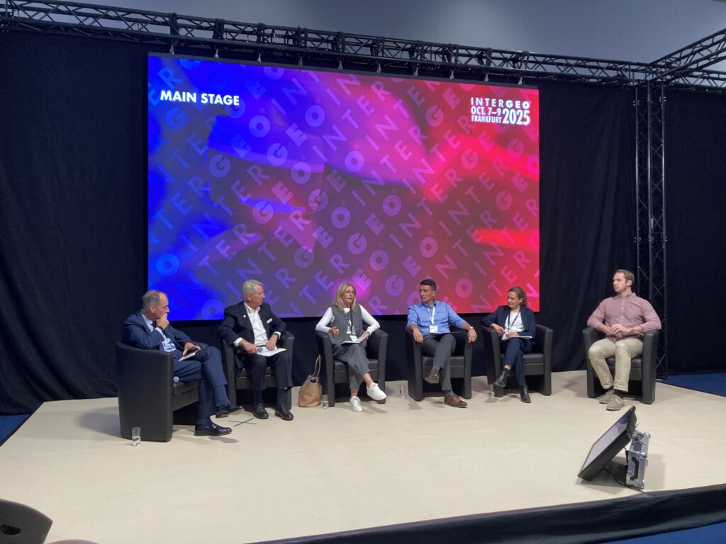
Monday’s “Data to decisions” panel, featuring various members of the World Geospatial Industry Council.
The conversation was wide-ranging, well prepared yet somewhat spontaneous, and insightful. James emphasized messages he has promoted before: more signal, less noise; operational clarity; efficiency; power; precision to provide trust in the data; intelligent pre-processing; AI, i.e. deep learning; human in the loop, for example to ensure that AI outputs are not nonsensical.
Jeremiah underlined the need for a system of record for geospatial assets; data only as important as it is accessible; bathymetric data means enterprise geospatial assets; more space data than ever – it costs 10-15x less to launch a satellite than 10 years ago.
Hannah gave the example of 2TB/day of data from one underwater robot to highlight the challenge of transforming large geospatial datasets, requiring both AI and the most modern computing. Furthermore, data can be analyzed years later, to extract new insights. Dejan noted that MMS data in urban areas faces similar challenges.
The themes of data discoverability, accessibility, reliability and trustworthiness were covered repeatedly. This was a microcosm of Intergeo and of our industry: we have increasingly brilliant sensors capable of acquiring more data, faster and cheaper than ever before. For satisfactory final results, however, the right people have to do the right things. Digital twins are ubiquitous, but their creation and maintenance depend on this high-end data.
The right things.
Rachel and others considered the merits of free data. The pricepoint is alluring, but provenance and metadata are critical. Data underlying big decisions by government and the private sector must be reliable. Data is seen as a commodity, but maintaining data sets is an expensive business. James added that the GIS director of Los Angeles had compared his high-quality data sets from known collectors with low-end, cheap data that fire and police departments had purchased, giving rise to nightmares at critical times.
Hannah added that ground-truthing is key. We have <1% in the oceans, which cover 2/3 of planet. Her company layers hyperspectral data on orthophotos, which can create more trust and reliability.
James made the important observation that many countries have huge national mapping programs, which set standards. These programs’ approaches to acquisition, governance and process optimization are a boon to us all.
The discussion turned to people and Rachel pointed out that there would be an impact on jobs, with upskilling of low-level staff, and an emphasis on critical thinking: AI/ML doesn’t have emotional intelligence or the creativity of humans. Training data is so important, especially for feature extraction. Dejan thought that in the next 10 years, we’ll have to train people to train models. The skills question occupied much of the Q&A time with the audience.
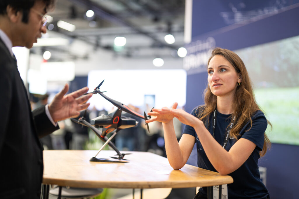
I spent time at YellowScan. The booth was different from the company’s previous exhibits: it was peppered with UAVs from partner companies and their very knowledgeable staff, including Beyond-Vision, MOST Robotics, Quantum Systems and Wingcopter. YellowScan had produced numerous marketing pieces related to these exhibits. The big Wingcopter 198, for example, was promoted as pursuing the space between crewed aircraft and low-end UAVs.


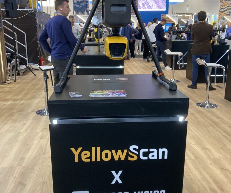

The YellowScan Navigator, Ultra and Voyager systems were on display too, of course, and a brochure, entitled “Navigator Success Stories Catalog,” contained five topobathymetric case studies. I was excited to pick up a flyer about the YellowScan LiDAR Convention 2026, its Europe and MEA user conference, to be held in Aix-en-Provence on 15-16 April 2026. I haven’t forgotten the wonderful 2022 event, set in another beautiful part of France, so this meeting has appeal. Its title, however, raises the possibility of other events for other world regions…
Much as I needed to visit dozens of booths, I was drawn back to the theater (indeed, there were two theaters, one on each floor, so the attractions were just too much…) for part of a session on “Aerial imaging and mapping”. Strong speakers from DJI and CHCNAV presented their wares. The DJI Dock for landing and recharging UAVs, in combination with the company’s FlightHub 2 software, came across well, as did several of the CHCNAV products. So many companies now offer standard deliverables, such as orthophotos, from UAV imagery that it is hard to discern the differences, but there seemed to be universal focus on saving time while maintaining product quality. I returned to the show floor for a while, then back to the theater for “Unmanned systems – UAV applications for agriculture and forestry.” I had been been fascinated by work in precision agriculture presented at the Photogrammetric Week in Stuttgart in April, so the topics in this session – UAV weed mapping and SLAM lidar for vegetation mapping – did not disappoint.
I was privileged in the evening to be invited to “Airborne Product Reveal”, a VIP event hosted by Hexagon. Many familiar faces were present, such as Dr. Simon Musaeus, whose book I have recently reviewed for the magazine. I had a long talk with Guilherme Brechbühler and Luis Antonio from the Brazilian company Fototerra, not so well known in Europe but operating aircraft teeming with sensors and completing projects far and wide.

The Z+F FlexScan®, a mobile mapping SLAM platform.
The formal part of the event was introduced by Steve Cooper, Hexagon Geosystems’ global sales manager – airborne systems. He announced two major new airborne systems currently in testing, the compact Leica MultiMapper hybrid sensor for helicopter and wing-strut applications and a new generation of the Leica SPL single-photon lidar product line. He added that NV5 had become the first purchaser of a Leica CoastalMapper and Kurt Allen, president, NV5 Geospatial, was there to say a few words. Kurt expressed special appreciation for the customer support NV5 receives from Hexagon Geospatial, which must be rather important to a company president overseeing purchases running to millions of dollars. The firm has recently joined OGC – oh, yes, and it’s also been acquired by Acuren Corporation, so it’s all go in the NV5 universe. LIDAR Magazine contributing writer, Amar Nayegandhi, noted that his firm, Woolpert, had also purchased a Leica CoastalMapper. Both firms should have these operational in spring 2026, so I’ll be chasing them for articles about the first projects!
Next on the podium was a colleague from my days in Switzerland, Werner Kirchhofer, vice president. We had worked together – or, rather, he explained the intricacies of the Leica SD2000 and ADS40 while I listened. Thirty years later, to this distinguished audience in Frankfurt, he gave a meticulously prepared, measured presentation in perfect English, ideal for participants listening in their second or third languages. His subject was the Leica MultiMapper, a brand new, compact hybrid sensor measuring 53 x 36 x 34 cm, weighing less than 25 kg and designed to fit to helicopters and small aircraft using nose and strut mounts from the Canadian company Meeker Aviation. Smiling broadly and clearly proud of his creation, Werner described it as the Swiss army knife of airborne sensors. The Leica CityMapper-2 has been reduced in footprint and Leica MultiMapper offers lidar with both vertical and oblique imagery, with a high specification. I asked, therefore, whether there was a danger that customers would prefer Leica MultiMapper to its bigger, pricier companions in the portfolio. No, they won’t: Leica MultiMapper will address a neighboring market to which Hexagon Geosystems needs to pay more attention, rather than constitute a lower price point in existing segments.

Leica MultiMapper offers lidar with both vertical and oblique imagery, with a high specification.
The SPL news was dramatic. The second-generation SPL sensor looks like a Hexagon Geosystems lidar system, with the beautiful Heerbrugg design features that we have come to expect. But the crux is the increase to 500 beamlets, five times as much as in the current SPL100. The result is a remarkable 6 to 10 million points per second, giving 8 ppsm at 4500 m or 20 ppsm at 3000 m, with flying speed 220 kts. The lidar FoV is 66° and the imagery one, 66.2°. There is some implication that Hexagon Geosystems will deploy this sensor mainly on its own aircraft or those of favored partners to generate data for the Hexagon Content Program. Werner made crystal clear the ongoing commitment to both linear-mode and single-photon.
The presentations ended with closing words from Layton Hobbs, product line director for airborne systems. He concluded with comments on some of the products, such as the HxMap 3D software now handling data from all the products and the integration of the Sony IMX811 into the MFC250 camera module in the Leica TerrainMapper-3. He continued by describing the latter’s scan patterns – circular, ellipse and skew-ellipse and the applications for which each was best suited. This was the first of many comments I heard in the three days about scan patterns. It’s no longer enough for a lidar system to produce accurate, dense point clouds and to be fast, reliable and well supported. Today’s customer cares deeply about the scan pattern and the suppliers have responded appropriately. Layton ended by showing several beautiful examples of imagery obtained on test flights, highlighting the forward motion compensation and the Leica PAV200 mount in combination with the 2.81 μm pixels of the Sony sensor. Work is continuing on the alignment of the MFC250 and the Hyperion-3 lidar module as well as simplifying users’ paths through all the altitude-to-GSD and FoV combinations that the systems offer.
Hexagon’s AI powered TS20 total station and other new sensors excited visitors.
At the time of this writing, Hexagon Geosystems has just conducted a user group meeting in Japan and another is scheduled for St. Gallen, Switzerland in January 2026. This was an evening well spent.
Editor’s note: Coverage continues, read on for part II.