The XXIV Congress of the International Society for Photogrammetry and Remote Sensing (ISPRS) took place in Nice, France, on 6-11 June. This photogrammetric blockbuster was in its third edition: as the conference world was wracked by covid, the organizers ran virtual editions in 2020 and 2021, complete with ISPRS’s rigorous review of abstracts and papers, and facilitated by pre-recorded videos of the presentations. The live event in 2022, therefore, was slightly compromised, since much research had already been reported. Moreover, of the expected 500-600 Chinese contingent, none arrived; other delegations, such as Japan, were absent too. Thus the face-to-face attendance was only 1250, but the underlying statistics were impressive: in its three editions, the conference resulted in over 7000 reviews and 2263 papers published in the ISPRS Annals or Archives. The live event attracted authors from 77 countries. There is no space here to attempt to summarize the technical program. Suffice it to say that copious, top-quality, peer-reviewed research was presented and many of the authors who could not travel by Nice were present in pre-recorded videos and/or on Zoom. Topics well represented included: bundle adjustment of GNSS, IMU, image and lidar data; SLAM; applications of SAR; data fusion; and digital twins. AI and deep learning were pervasive: these technologies are now used in multiple parts of both lidar and imagery workflows, and there is a variety of off-the-shelf tools that researchers can deploy without excessive pain. LIDAR Magazine is pursuing a number of authors for popular versions of their papers of keynotes.
The Acropolis Convention Centre in Nice was adequate but has reached end-of-life. It will be demolished soon and is unlikely to be the subject of a survey by Iconem, whose CEO, Yves Ubelmann, gave a stirring keynote describing how his company acquires laser-scanning data and imagery of critical historic sites where data acquisition is hazardous, for example in Afghanistan and Syria, then builds models for use in research and as invaluable records as our world’s conflicts result in the destruction of priceless heritage and artifacts.
One of the outstanding presentations wasn’t a keynote but maybe should have been. David Henderson of Ordnance Survey Great Britain (OSGB) gave a talk entitled, “Mapping fast in a fast changing world.” This offered considerable insight into the challenges facing a national mapping agency as it strives to update its databases and deliver change to its customers in near-real-time, and seeks to use satellite data after a long history of crewed aircraft and traditional photogrammetric workflows. David shared the same start in life myself: he is a former student of the late Professor Gordon Petrie at the University of Glasgow. Gordon was one of the greats who had passed since the XXIII Congress in Prague, recalled during a period of silence during the ISPRS General Assembly- others included Fritz Ackermann and Martin Isenburg.
There were 30 booths in the exhibition – rather fewer than in my first congress, in Kyoto, Japan in 1988 – and a Technology Track enabled exhibitors to highlight aspects of their wares. We learned, for example, that Leica Geosystems chose the Congress to launch Chiroptera-5 topobathymetric lidar sensor has 40% higher performance than its 4X predecessor.
ISPRS offers multiple awards, presented with elegance and gravitas in keynote sessions and at the Gala Dinner. It was gratifying, for example, to see professors emeriti Wolfgang Förstner and Bernard Wrobel receive the Karl Kraus Medal for their magisterial tome Photogrammetric Computer Vision. Professor Wolfgang Kainz received the Wang Zhizhou award for multiple contributions to GIS, but ISPRS also applauded his progress as editor-in-chief of ISPRS International Journal of Geo-Information, which, like ISPRS’s other two journals, is on a roll, with rising impact factors, popularity and paper count. Indeed, Professor Derek Lichti received the Schwidefsky Medal for his success as editor-in-chief of the ISPRS Journal of Photogrammetry and Remote Sensing.
The work of ISPRS is divided into commissions, which in turn organize working groups to foster research. Countries compete to run the commissions from one congress to the next. Management of the five commissions during the period 2022-2026 is:
- Commission I, Sensors Systems, China
- Commission II, Photogrammetry, USA-Switzerland
- Commission III, Remote Sensing, Brazil-France
- Commission IV, Spatial Information Science, Australia-Italy
- Commission V, Education and Outreach, Philippines-USA.
The ISPRS Council for 2022-26 is: Lena Halounová (Czech Republic) – President; Christian Heipke (Germany) – Past President; Jiang Jie (China) – Secretary-General; Stewart Walker (USA) – Treasurer; Derek Lichti (Canada) – Congress Director. The XXV Congress will be held in Toronto in July 2026, after the well-prepared Canadian bid fended off strong contenders from China and Korea.
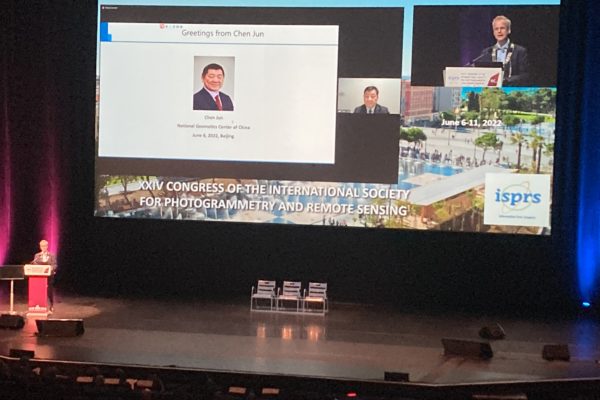
Christian Heipke, president of ISPRS, presents Chen Jun (China) with honorary membership during the opening plenary of the XXV Congress.
I left the Côte d’Azur for the wonderful train ride along the Mediterranean coast to Montpellier, where the YellowScan LiDAR for Drone 2022 conference was held in the opulent Domaine de Verchant, set amidst vineyards on the edge of town. Sadly, only 75 attendees were attracted to this magnificent setting, as both covid and the conflict in Ukraine fueled doubts amongst prospective attendees. Nevertheless, in addition to a big group of volubly enthusiastic customers, YellowScan distributors from Greece, India, Malaysia, Thailand, USA and other countries made the trip, as well as YellowScan employees from all over the globe.
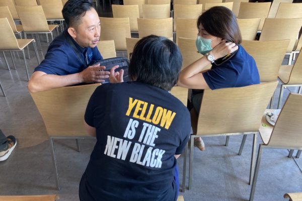
Attendee discussion at the YellowScan LiDAR for Drone 2022 conference.
The company’s yellow and black livery was everywhere and the tee-shirts on offer were black with pithy phrases on the back. Chief technology officer Dr. Tristan Allouis gave a fine overview of YellowScan’s portfolio and launched a new product, Voyager, based on the RIEGL VUX-120 and Applanix APX+ 30 AIR or APX+ 50 AIR, giving a range of up to 760 m. A mockup was passed around the audience, but the product is real enough: we were treated to a demo, Voyager units were flown above the vines simultaneously on a DJI M600 and in a crewed aircraft, an ICP Savannah S ultralight of the local company L’Avion Jaune. The ultralight was put in a holding pattern during takeoff of a commercial flight from Montpellier, but the audience was happy to wait to see two lidar collection platforms simultaneously in the air. The next demo covered the processing of the data using YellowScan’s CloudStation, with Applanix POSPac UAS. Tristan was succeeded at the podium by Philipp Amon, manager ALS business division at RIEGL, who covered RIEGL’s product range, scan patterns and point densities in a concise, accessible way.
Acecore NOA lifts 20 kg and is available with yellow highlights to match YellowScan payload.
The next day and a half included multiple presentations by YellowScan from all over the world. Topics included powerline monitoring, penguin colonies, environmental monitoring, disaster management, avalanche risk detection, forest defoliation, Maya structures in Guatemala, archaeology and holographic models, volume calculation in mining, and a magnificently digital twin of Budapest’s Széchenyi Chain Bridge. Other talks were more focused on business aspects and the UAVs themselves. Several presenters have agreed to author articles for LIDAR Magazine. All were compelling and many featured start-up service companies whose YellowScan systems had been workhorses during quests for growth. The small exhibition was dominated by Quantum Systems’ Trinity F90+, a eVTOL UAV that has proved popular in applications for which longer, faster flights are required than are usual with the ubiquitous DJI Mx00s and their competitors.
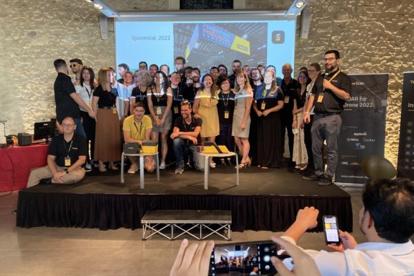
YellowScan team on the platform during the closing session of LiDAR for Drone 2022. Dr. Tristan Allouis is on the right.
The final session featured a lighthearted summary by Allouis of YellowScan’s 10-year history. Many of the graphics featured himself and were as much a cameo of changing fashion and aging as he matured from focusing only on technical innovation to running a rapidly growing enterprise. The YellowScan team gathered on the platform and their passion, talent and multilingual skills were loudly acknowledged. LiDAR for Drone 2022 was lively, fruitful, and informative. GNSS, IMUs, UAVs and lidar are our daily bread, yet it is valuable to reflect on the punch these technologies pack when integrated into highly functional systems that are professionally deployed.
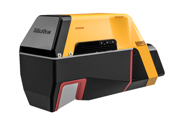
YellowScan Voyager