YellowScan, headquartered near Montpellier in the south of France, is different. It’s vivid yellow livery, its French culture and its low-key ambience belie broad expertise, notable innovation and fierce competitiveness. LIDAR Magazine was invited by YellowScan to cover its YellowScan LiDAR Convention 2026 Europe-MEA (YLC).
The meeting drew 130 attendees from 18 countries, of whom 45 were YellowScan employees or staff from partner companies. This was the 6th YLC. Previous ones were in 2016, 2017, 2019, 2022[1] and 2024. There were user meetings in Japan in 2017 and 2025. YellowScan also runs “Demo Day” events round the globe.
The venue was Thecamp, a conference center in attractive, wooded country on the edge of Aix-en-Provence, with striking design on the outside and unfussy, functional spaces within. The outdoor amphitheater was ideal for flying UAVs. All meals were provided as small bites to be enjoyed standing up, maximizing the networking opportunities and widening the remarkable range of tastes that we enjoyed. Attendees who took time to explore the cities of Aix-en-Provence and Marseille, with their architectural gems and memorable food and beverages, were richly rewarded.
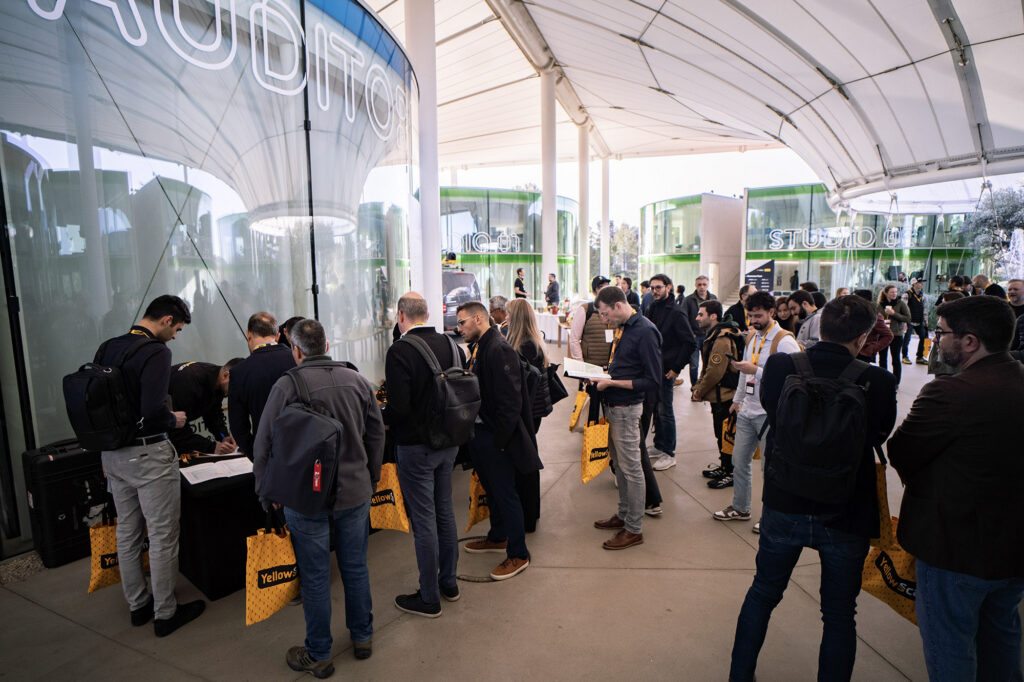
Event registration at Thecamp, a multifunction conference center and hotel compound that set the stage for YellowScan’s LiDAR Convention 2026
Day 1 – 15 April 2026
The entire program was in English. CEO Dr. Tristan Allouis opened proceedings accompanied by company president Dr. Michel Aschenbaum, who also heads L’Avion Jaune, the services company that preceded YellowScan (the two were split in 2015, so that L’Avion Jaune could focus on service and YellowScan, on systems).
Tristan and Michel entitled their duet, “Shaping the future: YellowScan vision and market outlook.” Tristan echoed themes that LIDAR Magazine has observed at other events: the challenge is not acquiring data, but working with it in a responsible, sustainable way; faster workflows are not enough; “don’t just observe the future – actively shape it.” Michel concurred and hinted that YellowScan was interested in focusing on certain verticals in order to understand customer requirements better. The two speakers alternated, stressing sensor fusion, extraction of useful information from billions of points with little or no human effort, new paradigms surrounding the use of AI, understanding the environment and making decisions accordingly.
YellowScan is a growing, healthy company, with an emphasis of sustainability. They welcomed their new companion in the C-suite, chief sales officer Philippe Charles.
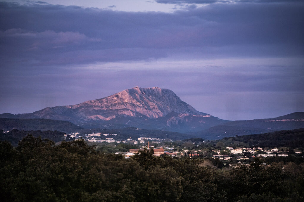
Sunset paints Sainte-Victoire mountain amidst the idyllic wooded country of Aix-en-Provence
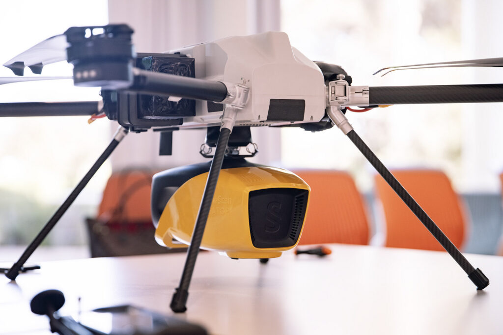
Michel covered two important topics. YellowScan has progressed from introducing its topobathymetric system, YellowScan Navigator, to market leadership in two years. The sensor began as a collaborative project with the French government agency Bureau de Recherches Géologiques et Minières (BRJM) about ten years ago and was introduced at the CES show in Las Vegas in 2024. Market response has been superb, but the high level of sales is attributable to YellowScan’s network of distributors and subsidiaries. Navigator has even figured at a “made in France” exhibition at the Élysée Palace.
After much soul-searching, YellowScan has entered the defense market, taking a responsible, selective approach, focused on military activities that save lives, such as mine-hunting and bridge-building, rather than targeting. YellowScan supports its approach with lists of go and no-go countries and an ethics committee.
Tristan acknowledged not only YellowScan’s technology partners and the many types of cooperation in progress, but also its banking partners – surely something that many firms ought to say. The YLC sponsors were named individually. And Michel gave tribute to the company’s 80 employees, who enable rapid progress to be made. Many of them enjoy shared ownership of the company. Listening to customer feedback and acting on it is the real key to maximizing the success that draws on the company’s considerable expertise.
The technical presentations began with Thomas Eder of Nokia, with which YellowScan is conducting a major collaboration in the area of powerline inspection. He listed the enormous savings available from UAV-lidar as opposed to helicopter-based systems (UAVs also vibrate less than helicopters), which have delighted the end-customer, Transnet BW, Germany’s biggest TSO (transmission system operator), with 24,000 km of high-voltage lines. The key factors are BVLOS, battery management, hardware reliability, connectivity and remote control. Despite its wide expertise and its history in rubber boots, phones and other technologies, Nokia is a UAV-lidar novice, but is happy with its role in the project.
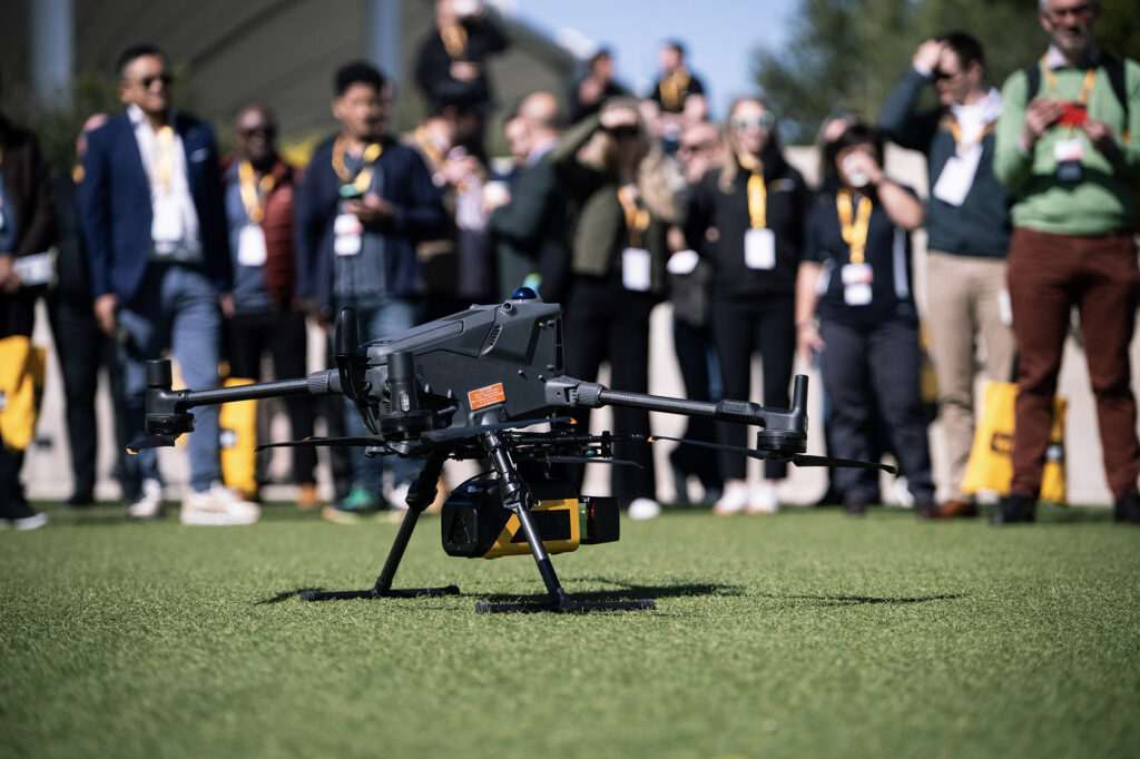
Outdoor demo of the NDAA-compliant Venturer system, completed with RIEGL miniVUX-3 lidar sensor and Trimble Applanix APX-RTX 20 GNSS/IMU
YellowScan’s brand manager, Morgane Selve, who was MC for most of the meeting, introduced Thibault Capra and Florian Caraveo, who unveiled the new YellowScan Mapper Ultra (yes, they removed a black shroud covering the system and the plinth below it), the third product in the Mapper portfolio, intended to cover long distances and be deployed for corridor mapping. The Mapper dates back to 2015, the discontinued Mapper II to 2018, and the Mapper+ to 2021. Mapper Ultra doubles performance to 500,000 pts/sec, with up to 7 returns, all in a package weighing 1.94 kg. One of their slides underlined how much YellowScan has broadened: there are five product series: Mapper, Venturer, Surveyor, Explorer and Navigator. Florian explained some of the applications. The system is intended for BVLOS and the monitoring of encroachment along corridors. Its high pulse rate and the number of returns, however, are suited to vegetation penetration and forestry applications. Terrasolid software is recommended for certain operations, such as counting trees. The full Mapper Ultra specifications can be found here. Several impressive data sets were shown to underline that this new system is operational.
There followed an outdoor demonstration of the NDAA-compliant Venturer system, completed with RIEGL miniVUX-3 lidar sensor and Trimble Applanix APX-RTX 20 GNSS/IMU. Back indoors, Thibault used the YellowScan CloudStation software (cloud means point cloud, not the IT meaning of the word) to explore a dataset of the conference site, flown two days previously with Mapper Ultra.
The next guest speaker was Prof. Ryan Perroy, University of Hawaii, Hilo. He had purchased his YellowScan system from US distributor Frontier Precision and had been pleased with the training and support. Ryan described multiple projects in Hawaii, both completed and ongoing, including applications such as shoreline setback, reforestation, invasive species, and past settlements in dense forests, but unfortunately his time expired before his material.
Ryan was succeeded at the podium by François Menassé of the Corsican geospatial services provider Helix. This small company (two people, growing to three, revenue €250K per annum) took the plunge and purchased a YellowScan Navigator in 2024. The risk has paid off, with numerous projects complete. The customer base is growing. This has been not without worries, however. The Navigator’s drone platform encountered problems with sand ingestion as it took off from and landed on beaches. Helix then flew the mission with a crewed helicopter, but of course the project costs were based on UAV estimates, so there were losses. With YellowScan’s help, nevertheless, the technical problems were overcome. During the process, several components, such as a mount and pilot-guidance system, were fabricated in-house to reduce costs. Helix therefore offers both UAV- and helicopter-based services. The latter is more expensive and generates more vibration, but each platform has its role. The company sourced its GNSS equipment from YellowScan sponsor EMLID, which is headquartered in Hungary and is not so well known in the US.
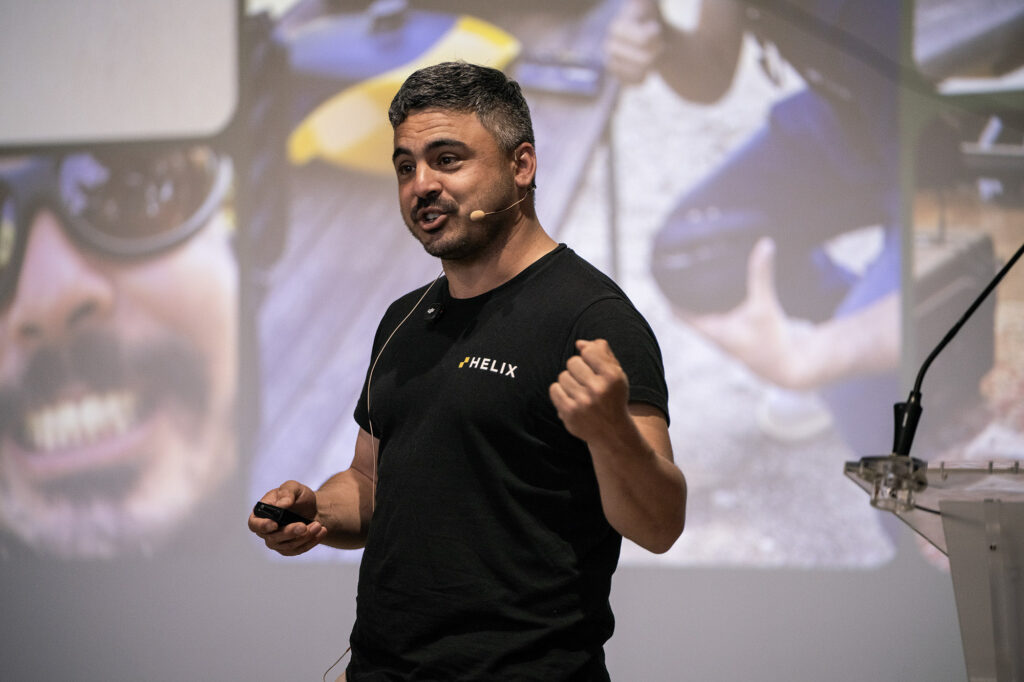
François Menassé of the Corsican geospatial services provider Helix
Drs. Eduard Nastase and Dragos Tataru of Romanian government’s INFP GEO EDU LAB described various projects from deep earth to high-resolution surface monitoring. They are fortunate to have access to a brace of wonderful, high-end equipment, which includes three YellowScan systems. Applications include geomorphology, such as mud volcanoes and salt-karst monitoring, infrastructure monitoring, natural hazards, such as post-earthquake assessment, and cultural heritage. The common theme was the ability to synthesize data from a multitude of appropriate sensors in each case. As they become familiar with their Navigator system, however, they are engaging in more bathymetric lidar work.
Most of the YLC was plenary. The exceptions were half a dozen parallel sessions divided into two, with participants able to choose a hands-on tutorial or a workshop focused on professional activities. LIDAR Magazine attended the tutorials, while Florian Caraveo ran the workshops, on which he reports later in this article. The tutorials were held in a room equipped with excellent AV technology and a laptop with pre-loaded software for every two participants.
The first workshop covered new features and workflows in Trimble Applanix’s flagship software POSPac. Product manager Nico Jaeger was a victim of the Lufthansa strike (as was your scribe – saved by British Airways!), so presented remotely, while the hands-on portion was supervised by his colleague Chembe Chisense. Nico’s presentation was fine, with plenty of detail on the product and licensing options (I have reported previously on the revectoring of Trimble Applanix licensing to subscription models), but little or no time remained for hands-on. Closer integration with YellowScan CloudStation is in the works.
Lunch was followed by a second tutorial, in which Célya Messaoudi of French GNSS/IMU supplier SBG Systems presented trajectory processing with the SBG Qinertia software. Sometimes we don’t fully realize the expertise of companies. Founded in 2007, SBG has more than 40,000 sensors fielded to 1000 customers in 50 countries. Célya gave a strong presentation, but the hands-on part was hard to follow. The software can integrate data from other sensors, such as odometers and magnetometers.
YellowScan’s Surveyor Ultra, billed as full 360° lidar for complex environments
Panagiotis Mertikas of Athens-based system supplier Metrica talked about successful riverine and coastal projects in Greece, executed with a YellowScan Navigator mounted on a Hexadrone Tundra UAV. The company uses a Norbit iWBMS multibeam sonar in deeper water and clearly has considerable experience processing and integrating data from the two systems.
Next to speak was Igor Vereninov, co-founder and CEO of Emlid (see above), who gave a short account of his firm’s economical GNSS/IMU offerings. Again, the breadth of one of the less well-known suppliers was amazing: founded in 2014, it has systems in more than 120 countries and sells through more than 130 dealers in more than 70 countries, so far more than 85,000 devices. He emphasized the continuous development process, whereby the systems are being updated to offer even better price-performance.
The next workshop was given by the Finnish start-up Lumi DB, though presenter Xabier Erana was defeated by the fact that his software had been updated since he had practiced the previous day. Lumi DB offers an online warehouse and processing engine for point clouds, but the fact that it’s online means that the software is restless! Lumi DB’s goal is to make data actionable. He explained the rationale behind the product rather well, drawing on statistics to prove that a huge volume of data is never used, because manual workflows are not fast enough. Lumi DB’s 3D point-cloud warehouse lets organizations store, query, combine and visualize large 3D datasets directly in the Lumi DB cloud. It supersedes file-based processing. It doesn’t compress, but it indexes excellently. There are strong bidirectional links to software products such as Terrasolid, Esri, QGIS and other big names. The data is stored on AWS in Ireland, but Lumi DB can cater for other data residency requirements. Like all the tutorials, this one was standing-room-only, with 30 or more enthusiastic participants.
There followed two outdoor demos, the amphitheater bathed in glorious afternoon sunshine. After a Quantum-Systems demo, Thomas Eder (Nokia – see above) showed his large BVLOS drone-in-a-box, mounted on a trailer towed behind a car or truck and looking not unlike a huge barbecue. Back inside, he explained Nokia’s expertise in communications and the development of a system whereby the drones went from one base to another along a powerline, using the M1 highway in Hungary as an example. The system is not finished yet, but substantial progress has been made.
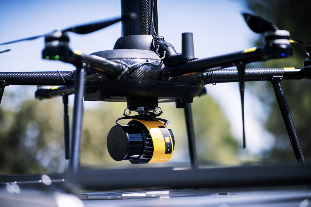
YellowScan’s Navigator, innovative and highly-lauded UAV bathymetric lidar for shallow-water survey
Tara Koopman of Vatenfall, a large European energy company owned by the Swedish state, talked about cleaning noisy lidar data to understand river profiles, for purposes such as change detection for dams constructed of loose rock, detection of cracks, and monitoring of fish habitats. Swedish rivers tend to be fast-flowing, turbulent, often with murky water flowing over rocks, so lidar data sets are inevitably noisy. Vatenfall has worked extensively on this, but there is more to do and a lack of ground truth.
The last component of the day was a panel discussion, moderated by Jean-Baptiste Monteignies of YellowScan (“JB”). The panelists were Martin Andersson (Scandinavian Drone, based in Bergen; YellowScan’s dealer in Norway) and three presenters from earlier in the day: Panagiotis Mertikas (Metrica), François Menassé (Helix) and Eduard Nastase (INFP). This was an experienced, talented groups and we were looking for real insights. JB drew out the panelists by asking them to describe a successful project, so, not surprisingly, YellowScan systems emerged well! It was clear, however, that topobathymetric lidar data was being routinely merged or compared with photogrammetric and MBES results and end-customers were happy. UAV-borne topobathymetric lidar data acquisition, however, is slower than topographic owing to the quite low flying heights and limited swath widths. This is not a problem, but has to be factored into quotations, project planning etc.
JB moved on to the limitations panelists had encountered. Eduard had been unable, for example, to acquire 1-cm data of the ancient city of Histria on the Black Sea coast, owing to turbidity. All panelists agreed that moderating customer expectations was a never-ending challenge. Identifying and exploiting the windows within which bathymetric collections were likely to be successful was key. The mixing of fresh and salt water at river mouths doesn’t help! There was some discussion of using satellite date – see also Emily French’s article in this issue[2]. Panelists emphasized the importance of QC but bemoaned the lack of ground control.
JB, reminding us that Navigator had been on the market for two years, asked panelists to suggest improvements. All the usual suspects surfaced – price, resolution, beam divergence, , image megapixels, power supply, attenuation etc. There was consensus, however, that battery management is a huge issue in larger projects.
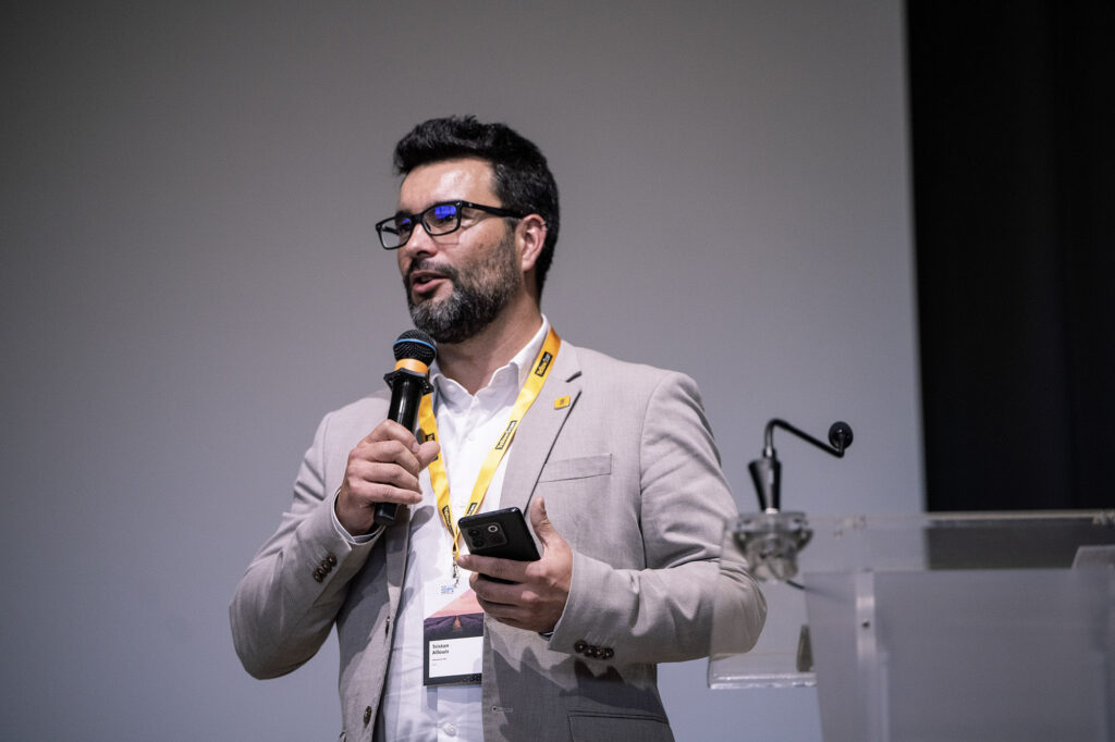
Closing remarks on day one from YellowScan CEO and Founder, Tristan Allouis
Tristan’s short closing words took place after 6:30 pm – this had been a long day and participants flocked eagerly to the conference dinner.
###
Editor’s note: Coverage continues at YellowScan LiDAR Convention 2026 – Day 2
[1] https://lidarmag.com/2022/06/24/nice-is-nice/
[2] French, E., 2026. Improving topobathymetric lidar planning and operations with satellite-based water clarity monitoring, LIDAR Magazine, 16(2): 26-32, Spring 2026.