Denver provided a bitterly cold destination for Geo Week on 10-12 February 2025. Lows as curmudgeonly as 5°F (-15°C) were insufferable for those of us from balmier climes, yet hardly dampened spirits as the event itself was a source of warmth. This was the most successful Geo Week ever, with 3222 participants from 49 countries, representing almost 8% growth from 2024, and 215 exhibiting companies.
Product preview presentations
There’s a plethora of reports on the Geo Week News site, so this is a personal account. Many of us for whom new or improved products were the focus flocked to the previews on the opening Monday morning. These 15-minute pitches are a godsend for those needing easily digestible, fast information, especially if the morning is optimized by flitting between the rooms.
Teledyne Geospatial emphasized its EchoONE lightweight lidar sensor, powered by Inertial Labs’ RESEPI, and its Fathom, with both topographic and bathymetric lidar capabilities, developed with help from SAM. There was also the GALAXY Network Surveyor for powerlines and a partnership with Pointerra3D. Big sensors were also to the fore in Vexcel Imaging’s presentation, especially the new UltraCam Merlin and Dragon models, highlighted in our fall 2024 edition.
The Esri presentation included beautiful mesh models, generated by its SURE software, and a digital twin of Oslo.
The latest and greatest geotech never fails to impress.
There was news also regarding smaller sensors. GeoCue announced two new models, True View 1 and True View 1 Lite, entry-level solutions based on the Hesai lidar sensor that the company has used for a while, but with different cameras. Like Teledyne Geospatial, the company pointed out its products’ NDAA-compliance. As always, GeoCue spent some minutes explaining pricing and financing in a refreshingly transparent manner. These arrangements, of course, cover not just the sensors but also the LP360 software.
On the software side, both Bentley and TopoDOT gave strong presentations, the former pleased with the reinforcement of its partnership with Google. TopoDOT supports 6500+ users in 750+ organizations, including a majority of the DOTs, and its products undergo continuous improvement.
Despite years of conscientious effort, I have proved unable to assimilate RIEGL’s extensive range of sensors, so I always rely on the firm’s beautifully designed charts to distinguish one sensor from another and understand which may be suitable for which sort of customer. The presentation at Geo Week covered the VUX-10025, introduced late in 2024, and the RiLOC-E25, and RiLOC-F GNSS/IMU subsystems (LOC = Location/Orientation Component), as well as the VQ-840-G(E) economical bathymetric sensor. There is a new model, VQ-860-GE, with more penetration owing to larger laser. At the high end, so to speak, RIEGL’s flagship solution for crewed aircraft is the VQ-1560 III-S dual-channel topographic lidar system, complete with Trimble Applanix GNSS/IMU subsystem and SOMAG gyrostabilized mount. The company emphasized the incremental improvements that were announced at INTERGEO.
Hexagon Geosystems described the Hyperion3 lidar engine at the heart of sensors such as the Leica CountryMapper and TerrainMapper-3, but the big news was the new Leica CoastalMapper, a spectacular airborne bathymetric sensor that the company claims is 250% more efficient than the previous generation. The system combines an innovative high-performance bathymetric lidar module, Theia, with a Leica TerrainMapper-3 topographic lidar and imaging sensor system into one lightweight sensor head. The requirements imposed by several US government agencies have been met. It’s abundantly clear that the acquisition of bathymetric data is easier than ever before, through the efforts of Hexagon Geosystems and its competitors. Wow!

Attendees take in keynote sessions on day two of the show.
It’s easy to listen to these presentations, write some notes and move on, but I tried to reflect for a few minutes. Underlying the morning’s fare was a collection of first-rate companies, populated by talented, creative geospatial professionals. The products are without atrophy. Users have access to increasingly capable products at economical price points. The end-users of geospatial products are the ultimate beneficiaries, and they are fortunate indeed!
I followed up with Trimble and had a superb conversation with Joe Hutton of Trimble Applanix and Skyler Neumeyer. Joe’s a stalwart of the GNSS/IMU world and Skyler is on the mobile mapping side. Joe talked about the Trimble APX RTX system, launched at INTERGEO in Stuttgart in September 2024, which offers 1 cm accuracy in real time without a base station, by using the Trimble CenterPoint® RTX correction service. It’s a response to customers’ desire for immediate results, while the aircraft is still in flight, with the option of further processing later if even higher accuracy is necessary. Flying a UAV is so simple now that waiting for results has become increasingly uncomfortable. The APX RTX includes a license for the famous PosPac software suite, giving automatic access to post-processing, for example for final refinement of position and attitude after landing. There are four models at increasing levels of accuracy and price – 15, 20, 30 and 50. The product range has broadened as customers have wanted to fly higher with longer flightlines. There is always an IMU on the board, but an external one can be used too. And of course the IMUs come from Trimble. We pondered whether we were digging a grave for ground control but agreed vehemently on the value of check points. Another beauty of RTX, in contrast to a base station, is that there is only one datum. We’ll delve deeper into this in a forthcoming podcast with Trimble Applanix president Dr. Steven Woolven. Joe ended by describing the Applanix PX-1 RTX, a system for control and navigation of UAVs that is sold to UAV manufacturers: it too is based on the same concept.
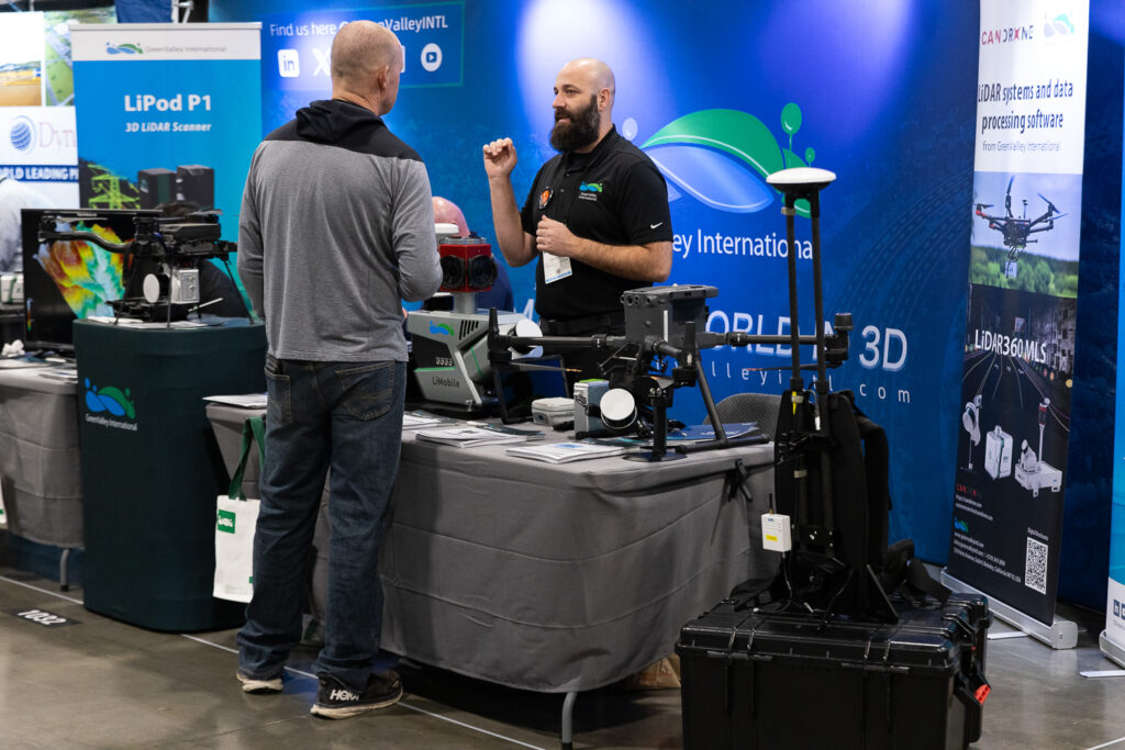
Cody Mccoll of Green Valley International explains the intricacies of modern lidar data collection.
Skyler updated me on the MX60/90 mobile mapping systems, which also use the IMUs. They have Teledyne Ladybug cameras for 360° viewing. Skyler was particularly pleased that customers are making use of the accessory port, for example to connect cameras from Teledyne FLIR or ground-penetrating radar from suppliers such as ImpulseRadar. Trimble use RIEGL lidar sensors, while RIEGL use Trimble IMUs – as the manufacturers jostle for market share, the customer always wins! Skyler was particularly pleased that customers are making use of the accessory port, for example to connect cameras from Phase One or Teledyne FLIR or ground-penetrating radar from suppliers such as ImpulseRadar or Kontur.
Keynotes and plenary
After the product previews, Geo Week opened formally with a keynote about the Dallas Fort Worth International Airport. Three speakers enthusiastically explained the geospatial effort to maintain and develop this enormous facility, which we were told is larger than Manhattan.
We have all followed the recent tragedy when the container ship Dali collided with the Frances Scott Key Bridge in Baltimore. Rapid action by local police limited the death toll to six maintenance crew who were working on the bridge at the moment of impact. Moderated by USGIF’s CEO Ronda Schrenk, the second keynote session included commentary from the Army Geospatial Center’s (AGC) Jeremy Wasson as well as Mike Aslasken from NOAA’s National Geodetic Survey (NGS). Mike’s presentations are always polished, and the sincerity and clarity of Jeremy’s account of the first response struck a special chord with me. I found it odd, however, given the massive power of US geospatial services companies, with vast arrays of people, aircraft and sensors, that little was said about data collection by the private sector.
On the morning of the last day, there was a fine plenary by four USGS speakers. The 3DEP program is 98.3% complete and work is underway on its successor, which will include bathymetric data. This is an astounding achievement, given the size of the US and the variety of topography and conditions, but the presenters were, if anything, self-effacing and provided informative, no-frills material that left the audience in no doubt that the country will be well served with public domain elevation data for a long time to come, all collected, quality-controlled and turned into final products with the requirements of end-users fully taken into account. Well done, USGS.
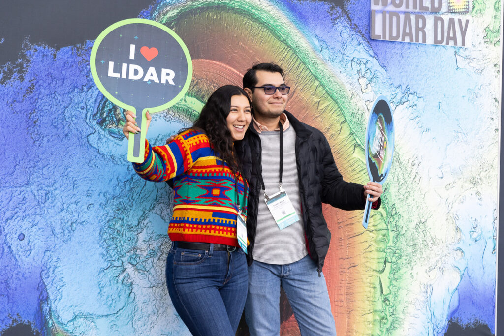
Celebrations for World Lidar Day, February 12th, 2025, were in full swing.
The exhibition
Alongside the big hitters were the integrators that we know well, now on the scene for a long time – they have every right to be proud of the different they have made to the geospatial world with their UAV-photogrammetry, UAV-lidar and vehicle-mounted systems. GeoCue, LiDAR USA, Phoenix LiDAR Systems and YellowScan showed the latest versions of their products, always marching in step with new sensors from the suppliers. These players continue to prosper, but many newer, smaller players were also there. I had a good conversation with Dr. Erik Frohmann of GEOTECH Bratislava, whose Lidaretto-branded systems are available for UAVs, vehicles, backpacks and boats. They use Hesai and Teledyne Geospatial sensors plus Novatel GNSS/IMU components. One of the others I visited was 3D Target from Italy with its Scanfly portfolio. I pondered whether all these companies can survive, but the expanding marketplace is vast, and complex. Small firms can bring local advantages, such as geography (customers sometimes like local sales and support contact in their own language), labor costs, supply-chain nuances and application niches. Let’s acknowledge the talents and courage of those who enter this milieu by developing their high-tech products and honing their go-to-market strategies.
Also present was the team from rapidlasso (producer of LAStools) and BayesMap Solutions, the latter having celebrated its 10th birthday. Just around the corner was Cardinal Systems. Owner Mike Kitaif and his team, as usual, entertained a steady stream of customers and prospects. It’s interesting how this small company continues to develop its software, the origins of which go back more than 30 years, with recent additions including modern triangulation capable of solving UAV blocks and extensive functionality for lidar and manipulation of elevation data. Next door, VRMesh CEO, Dr. Chao Han, showed me some indoor rendering generated with recent additions to his product line.

Show attendee procuring recent copies of LIDAR Magazine from the media table.
We tend to be excited by hardware and software, but the services companies were there too. Indeed, NV5 is now a software company too, thanks to its acquisitions of L3 Harris Geospatial Solutions and DAT/EM. The latter is a safe haven for those of us who want to enjoy stereoscopic displays, as is Kayln3D, the North American distributor of PluraView systems. In addition to NV5, the booths of Woolpert and Dewberry always seemed to be buzzing, demonstrating another dimension of the geospatial success: strong service companies undergird demand for hardware and software.
Sessions on the show floor; World Lidar Day
Over the years I have worried about the Exhibition Hall Theater, located rear center of the hall, ideal for attracting audiences who have to take only a few steps to get there, but beset with background noise. I think the setup has improved over the years – the skills of the Colorado Convention Center AV folk ensured that we could hear what was going on – and I thoroughly enjoyed the two sessions I attended there. “Pitch the Press” requires company representatives to give two-minute pitches to a jury of cynical press-persons, then answer their awkward questions. This was highly entertaining, and the deserving winners were Mad Nadir Mapping, NOVI and Tersus GNSS. Mad Nadir was represented by founder and CEO Dr. Austin Madson, who is also one of the hosts on The LIDAR Magazine Podcasts. I was taken, however, by a pitch by OxTS, of Oxford, UK, about lidar inertial odometry, i.e. using lidar data in conjunction with MEMS GNSS/IMU and time-stamping for an optimal solution. We’re going to chase this up and report on it in more depth.
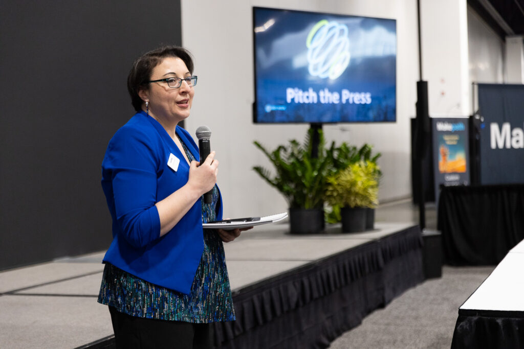
Carla Lauter, Senior Content Manager at Diversified Communications, opens “Pitch the Press” 2025.
For my second session in the Theater, I had the privilege of being moderator for a top panel consisting of Tim Burch (NSPS), Layton Hobbs (Hexagon), Amar Nayegandhi (Woolpert), Dr. Jason Stoker (USGS) and My-Linh Truong (RIEGL USA). The date was 12 February, so the title, unsurprisingly was, “The Power and Progression of Lidar: A Celebration for World Lidar Day.” Panelists had a broad brief, so we were able to reminisce on how we became involved in lidar as well as tackling some of the big issues and trying to discern trends. The standing-room-only audience included many students as well as industry veterans, movers and shakers. Carla Lauter of Diversified Communications has provided a fine summary. Throughout the event, the Hall and lobby outside were attractively decorated to acknowledge World Lidar Day, with graphics in various places and floor decorations in front of the booths of the 11 founding organizations. There were even tchotchkes, such as tee shirts generously provided by Woolpert.
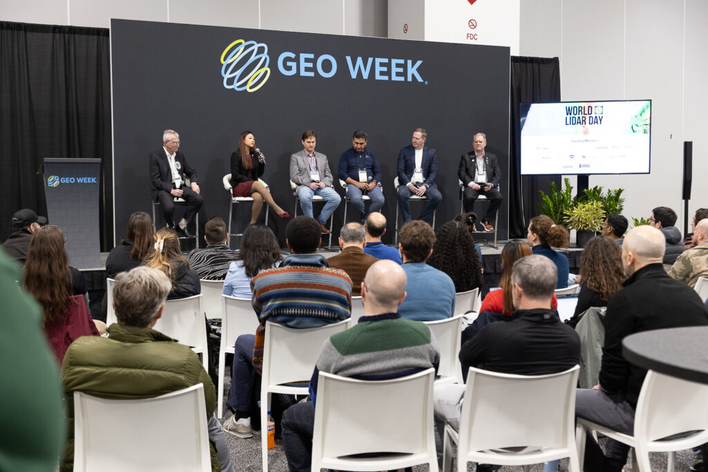
My-Linh Truong, division manager of RIEGL USA, speaks during the World Lidar Day panel discussion, moderated by yours truly.
Parting thoughts
As Geo Week concluded, attendees reflected on its growing status in the geospatial industry. By acquiring and co-locating previously independent events such as the SPAR conference and International LiDAR Mapping Forum (ILMF), Geo Week has become the leading geomatics-focused tradeshow in North America for product discovery and networking, all under one roof. For those in the geospatial field, these industry gatherings remain essential. With careful planning, attendees can maximize their experience and stay ahead in this rapidly evolving sector. Save the date for the next Geo Week: 16-18 February 2026, Denver.