This year’s Geo Week event was as professionally managed as ever by Diversified Communications (DivCom). Records were broken: over 3400 registrants, including 2976 professionals, from 45 countries, 200 exhibitors and more than 200 speakers. DivCom, the event organizers, had had some concerns that participants would be distracted, since the event was bookended by the Super Bowl (for non-US readers, this is the largest event on the calendar of American football and this year was special because it was attended by entertainer Taylor Swift) and Valentine’s Day. Skilful planning surmounted this, however, with an early stop on Sunday 11 February for a “Tailgate Party” in the exhibition hall that left attendees plenty of time to seek out the big game on television. Doubtless other attendees rushed home at the close of Geo Week for the second bookend, sustained by the Valentine’s Day candy available from some exhibitors’ booths.
Arriving bright and early on the first (Sunday) morning, I dropped in on the workshop given by GreenValley International. This firm supplies a host of lidar products and is following a well -trodden path by running its own user conference, which will take place in Berkeley, California, on 8 April 2024. The portfolio is considerable, including lidar systems for UAVs, handheld, backpacks and tripods, described in a 32-page brochure given out at the workshop.
The Product Preview Presentations were fast and furious as always. There were two rooms, each with 15-minute slots running for about three hours. Sadly, I incorrectly inferred that when a firm, such as GeoCue, Hexagon and Trimble, had more than one slot, it would repeat the same presentation, but no, the multiple slots were to accommodate different presentations. Speakers have tuned their skills to the 15-minute format over the years, with the result that their efforts are measured, informative and blissfully free of unadorned company doggerel. In many cases, such as Blue Marble Geographics, Pix4D and TopoDOT, renowned products have enjoyed incremental developments. In GeoCue’s case, new products have been added to the True View line: 540 (CHC Navigation lidar), 545 (Hesai) and 585 (an NDAA-compliant offering with Ouster lidar). It was possible to infer from the Microdrones presentation that the integration of GeoCue is ongoing and fruitful.
Software products almost all include some Cloud capabilities, either in the base product or as an option – Pix4D and Teledyne Geospatial’s CARIS are but two examples.
Hexagon announced that they have shipped several units of their massively productive Leica CountryMapper, which debuted at Intergeo in Berlin in 2023. The design principle of multiple cameras and lidar in a single unit permeates the Leica Geosystems airborne portfolio – Leica DMC-4 and Leica CityMapper-2 draw from it too. It’s interesting that this sort of approach has been championed by firms such as IGI for decades. Layton Hobbs’s topographic part was followed by Anders Ekelund summarizing the topobathymetric and bathymetric offerings, Leica Chiroptera-5 and Leica Hawkeye-5.
The fact-filled presentations were fine precursors to My-Linh Truong’s tour of RIEGL’s lengthy product line for unmanned laser scanning. RIEGL slides are always good and there was a very handy one about which lidar sensor is suited to which UAV. She concluded with an interesting point: RIEGL is perceived by some as the Maserati of lidar sensors (I could hear grumblings from Porsche and Ferrari owners in the audience who felt they were being disenfranchised), so there are significant price cuts on some products.
Vexcel Imaging, Vexcel Fleet, Vexcel Data – this Austrian company is broadening its efforts and offers a significant content program, much more recently established than but nevertheless with some similarities to Hexagon’s. Jerry Skaw gave the second part of the firm’s presentation, highlighting the cameras and he too suggested ways to reduce costs: the new Merlin 4.1 product has no panchromatic channel, thus making savings for customers who don’t need this. In a very exciting development, the Dragon 4.1 is basically an Osprey with a RIEGL lidar.
A few minutes after noon the main program kicked off with the opening keynote, “The bright future ahead: navigating AEC, 3D, and geospatial innovation and change”. DivCom’s favored formula is a session with one or two energetic keynotes followed by a panel discussion by the speakers. These sessions were well hosted by DivCom professionals such as Matt Collins. Claire Rutkowski (POWER Engineers), Andre Springer (CDM Smith) and Ben Stoker (Skender) held our attention and covered expected topics, for example how many bridges need fixed, UAVs, AR/VR and generative AI, while weaving important issues such as sustainability (changes to rebar; alternatives to cement), business models (Denver P3 Eagle project, for example) and humanity (empathy, compassion, communication, continuous learning) into the narrative. “Resiliency will be a key skill”.
Even up to the last minute, adrenalin rush prompts me to tune and tune my own duties, so I felt compelled to attend a session entitled, “The democratization of survey technologies”, looking for insights to enhance the session I would moderate the following day (see below). Five talented panelists agreed that modern technology enables a wide variety of people to acquire vast volumes of data that is increasingly precise. But what are the implications? There were some pithy quotes as this concern was addressed. A workforce trained on the job could push buttons and collect coordinates, but, “Lack of knowledge is a problem,” and, “Are we infiltrating the licensing bit?”
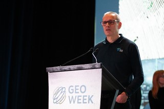
The second day was Monday 12 February 2024 – a very important date as it was the inaugural World Lidar Day, a celebration of lidar technology and its expanding applications. Already supported by numerous movers and shakers in the lidar world, this will grow and will be marked by attractive events in the years to come.
The opening keynote was “Geospatial for good: how is geospatial technology changing the world”. This session was staggering – its impact on the audience was dramatic! First off was Esri’s chief medical officer, Dr. Este Geraghty (she’s a proper doctor, an MD rather than a PhD). Her presentation was, quite simply, one of the best I have heard for years. Obviously, her focus was GIS and it is indeed being used to advantage all over the world. She used art such as tapestries as a springboard, then accelerated, with short, compelling examples. I could feel the pricking of tears as she described the white flags in Washington, DC to commemorate the victims of covid. I want to read her book, Learning from COVID-19: GIS for pandemics. Her act was hard to follow, but Rhonda Schrenk, CEO of USGIF, did a fine job starting from geospatial tradecraft and illustrating her themes with carefully selected examples. Conference attendees who chose this session for their agendas made good choices! I learned an important, reassuring medical fact, “Spatial thinking advances with age.”
On Monday and Tuesday I enjoyed three short talks with Trimble experts, trying to focus on trends as well as products. Kevin Andrews is a Trimble Applanix veteran of 24 years who is now director, land products, guiding the part of the Trimble Applanix portfolio that is embedded in systems on cars, SUVs, trucks, trains and so on. He is deeply experienced, having previously managed the well-known indoor system TIMMS. He sees a significant trend whereby lidar data is used to assist with the positioning, i.e. lidar results are not simply built on GNSS/IMU results. He mentioned the Applanix LiDAR QC Tools, already featured in our recent article, https://lidarmag.com/2023/12/31/transformed-trajectories/. While Kevin was modest about the incremental developments taking place in his product line, it was clear that there are significant, sophisticated advances going on. In contrast, we touched on the Applanix DSS Digital Sensor System, a digital camera that Applanix introduced in the first decade of this century. Kevin said that they are still in use for post-hurricane mapping!
Ben Messer, product manager for Trimble Business Center (TBC), has been with Trimble only five years, but early in his career spent time with Trimble visionary Bryn Forsburgh at Wisconsin DOT. TBC’s use of ground control points is changing. Ben went on to say that the Inpho team in Stuttgart now inputs new features to TBC. There are also third-party modules, for example for UAVs. Major developments would be announced soon!
Last to spend time with me was Jason Hayes, market manager 3D laser scanning solutions, an 18-year Trimble veteran. It’s intriguing to discover, when I talk to people in many of the larger, established geospatial companies – Esri, Hexagon and Woolpert are other examples – how long many of them have been with their employers. Is this low turnover rate a feature of our industry and is it a good thing – as it certainly seems to be? Proud of the MX90 sensor, Jason explained that the building market is simply much bigger than the geospatial and other ones and that, again, many incremental developments were taking place to the advantage of customers. AI, of course, is pervasive and is now inside the Trimble RealWorks and TBC software, for example for automated classification and feature extraction. See also the press release, https://geospatial.trimble.com/en/resources/blog/ai-based-feature-extraction-in-tbc-adds-value-to-collected-data.
We ended by talking about new capabilities in Trimble SiteVision for lidar collected by mobile devices, including iPad and iPhone There’s a lot more information at https://geospatial.trimble.com/en/resources/blog-1/bringing-data-to-life-one-point-at-a-time.
My own session on Monday afternoon was, “Essential surveying practices” and I had the privilege of hosting three fine presenters/panelists – Jim Gillis, a professional land surveyor currently consulting for VeriDaaS; Brian Shaw, the local NGS Regional Geodetic Advisor, and Mohamed Mustafa of Trimble Applanix, who needs no further introduction. We tried to cover fundamental topics such as ground control, precision, accuracy, datums, coordinate systems, NSRS, and GNSS/IMU. The discussion was a little slow to begin after the presenters’ strong presentations, but by the end the microphones in the aisles were well used. There’s a fine write-up at https://lnkd.in/eZXcm5iv.
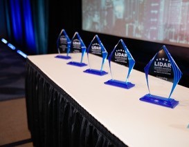 As always, presenting the Lidar Leader Awards at the Geo Week Awards Celebration was both a pleasure and a privilege. This year the selection of the winner for the Outstanding University Achievement in Lidar Award was carried out by a small jury reviewing eligible posters in the Academic Hub. This was a rewarding task, not only seeing the well-presented, informative posters, but entering into lively discussions with the researchers ready to answer questions beside their work. The winner was North Carolina A&T State University with “Advanced wetland prediction for flood resilience in southern North Carolina”.
The Lidar Leader Award for Outstanding Innovation in Lidar went to Blue Marble Geographics for its Custom Point Cloud Classification tool for training classifiers, part of Global Mapper Pro.
A most unusual situation unfolded with respect to the Lidar Leader Award for Outstanding Team Achievement in Lidar. The summation of the votes of the jurors resulted in such a close result that Diversified Communications generously provided two trophies, going to very different organizations: Singapore Housing & Development Board and the U.S. Army Corps of Engineers. These teams’ projects were, respectively, Intelligent Mapping and Querying of Singapore’s Residential Estates and the National Coastal Mapping Program.
 The winner of the Lidar Leading Award for Outstanding Personal Achievement in Lidar was Arttu Soininen of Terrasolid. Arttu is very well known, having started the company more than 30 years ago. He has traveled the world endlessly, covering all the bases when the firm was small to more specialized efforts at conferences and customer sites as it has grown. Arttu was formally introduced by Christian Stallings of BAAM.Tech, but I couldn’t resist retelling my own anecdote. I visited him in Helsinki, on a dreich day at the end of autumn 1995, to learn about Terrasolid, at that time with photogrammetric data rather than lidar in mind. In due course, customers with the Leica ALSxx airborne lidar scanners depended on Terrasolid products to generate their deliverables. Nowadays, there’s a wide choice of software for these tasks, but Terrasolid set the pace. The structuring of Terrasolid software atop Bentley Systems’ MicroStation, moreover, changed how we viewed and used technology in those early days. Arttu gave a gracious speech of acceptance.
The remainder of my time was spent in the exhibition, partly fielding inquiries at the LIDAR Magazine booth and partly rushing round to renew acquaintances and make new ones. This process is a strange mixture. It’s exciting to feel the buzz and meet new products and people. But this is tinged with frustration, because there simply isn’t time to do the exhibition justice. The same can always be said of Intergeo, so maybe that’s a symptom of a successful exhibition.
I made a point, however, of talking to three exhibitors which will be the subjects of LIDAR Magazine articles and/or podcasts in the near future. GIS Surveyors is located near my home, but my article will take longer than I planned, because the company has grown and is moving to a new facility. 3DEO is a supplier of Geiger-mode lidar systems and the article will not only highlight the company and its products but also trace the development of Geiger-mode. Founder and CEO Dr. Dale Fried knows a lot about that – before 3DEO he spent 10 years with MIT Lincoln Laboratory. Technology specialist Brandon Call came from Lincoln Labs too, via Lockheed Martin. On the YellowScan booth, product manager Thibaud Capra and CEO Tristan Allouis were enthusiastic about their new UAV-borne topobathymetric lidar system, called Navigator, and were at pains to explain to me that the sensor is homegrown – it’s not an integration of a third-party sensor.
My event ended with a couple of short conversations. I bumped into John Parker, geospatial manager at Cyberhawk, whom I had first met when he was at Intergraph 30 years ago, then we became colleagues at LH Systems. Alongside John, however, was his colleague Duncan Jamieson, technical manager (visualization and geospatial), a fellow alumnus of mine from the University of Glasgow. Indeed, so is Cyberhawk’s CFO, John Comiskey. Duncan and I had never met, but within a minute or two the name “Gordon Petrie” was on our lips – and we weren’t the only folks in the room whom he had mentored and guided into geospatial careers.
Finally, I spoke briefly with Dr. Qassim Abdullah, whom everybody knows, on the subject of employment. I remember clearly his phrase, describing today’s additions to the geospatial workforce, “… a new generation with a different work ethic.” This was said in a positive, inquiring way, implying that we have to strive to focus employment opportunities on the aspirations and requirements of jobseekers who are not the same as they were 10, 20, 30 or more years ago. Maybe this ties in with the imbalance between those excited by today’s glittering technology and the dense, rich data it can acquire, and the much smaller group with an interest in becoming professional land surveyors. Yet several sessions underlined the need for the latter, not only for their seal or stamp on deliverables, but for the depth of knowledge and understanding that entitles them to provide that imprimatur. We need to fix that disparity. Looking forwards, I wonder whether, as our data and the information, knowledge and wisdom derived from it cast increasing light on the world’s terrifying problems, we are a little frustrated. Do we want to be more than providers of data and its derivatives to decision-makers? Do we want to be the decision-makers too, yet in many cases haven’t quite got there? If we were there, would our profession be even more attractive – and to a wider group of adherents? I think I glimpsed this future during those three memorable days in Denver.
The above is my personal account – one of 3000, remember, and as idiosyncratic and eclectic as anybody else’s. Geo Week has deservedly continued to grow and should undoubtedly be a fixture on the calendars of geospatial folk in the US and beyond. Congratulations, DivCom, on optimizing a successful formula!
