I missed Commercial UAV Expo in Las Vegas, after years of perfect attendance before and after covid. There had to be substantial justification! Readers may know that, rather to my surprise, I was elected treasurer of ISPRS during the XXIV ISPRS Congress in Nice, France in June. As a result, my schedule included an ISPRS Council meeting in Prague in mid-September. On the way I was going to England on ISPRS business and to see my old friend Professor Jon Mills, who has supervised extensive lidar work at the University of Newcastle upon Tyne. But between these two commitments I discerned a gap – enough to attend the bulk of the Photogrammetric Week (PhoWo, short for Photogrammetrische Woche) in Stuttgart, which had been postponed in 2021 owing to covid. After leaving a rather gray Newcastle, therefore, I found myself enjoying a sunny, late afternoon flight from Paris to Stuttgart, trying to remember lectures in geography well over 50 years ago as I attempted to interpret the field patterns far below.
Though it has always covered the latest developments in photogrammetry, PhoWo thrives on tradition. Indeed, we’ve already provided a brief history[1]. A much more comprehensive account is available[2]. It was unusual, therefore, that the 2022 edition was not held in the brutalist concrete blocks of Universität Stuttgart, across Keplerstraße from the Institüt für Photogrammetrie (ifp), but in the imposing Haus der Wirtschaft on Willi-Bleicher-Straße, built in extravagant neo-baroque style. The building is a state museum of industry as well as a central resource for local businesses. The interior is elegant and restrained and the King Karl Hall was a fine venue for the plenaries that took place every morning. Indeed, Professor Uwe Sörgel, chair of ifp, was so keen that he started early -but with good reason!
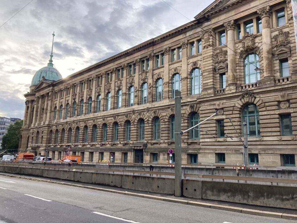
The Haus der Wirtschaft on Willi-Bleicher-Straße in Stuttgart, host venue for PhoWo 2022.
PhoWo 2022 began with a brief tribute to Professor Friedrich (Fritz) Ackermann (1929-2021), probably the biggest name in modern photogrammetry and certainly the father of aerotriangulation. Fritz founded ifp and remained chair until 1992. He organized PhoWo in Stuttgart every two years from 1973 to 1991. Uwe spoke quietly, the podium set below a projected slide of Fritz in typical pose – jacket, tie, benign, avuncular, not a hair out of place. Rather than deliver a protracted obituary or encomium, Uwe uttered the words, “Somebody is missing,” and called the audience to stand and participate in a minute’s silence while we remembered Fritz. He ended by reminding us that Fritz had been an enthusiastic and accomplished pianist. Indeed, at the age of 86, he had played a piano sonata during the 50th anniversary celebration of ifp in April 2016. Thus the morning continued with a local pianist playing Beethoven’s Piano Sonata No. 23 in F minor, Op. 57, “Appassionata”. Poignant, tasteful, memorable.
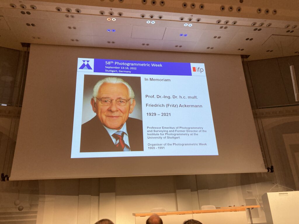
“Somebody is missing”. In memoriam, Prof. Dr.-Ing. Dr. h.c. mult. Friedrich “Fritz” Ackermann.
Uwe has changed PhoWo. It’s a day shorter, still with plenaries in the mornings and demos in the afternoons. Each demo used to be given eight times, four in English and four in German. The OpenPhoWo Partners[3], as the participating companies are called, are grateful that he’s reduced it to once in each language by simply providing more seats in the demo rooms. The audience was smaller than in previous years, it must be admitted – over 200 from more than 30 countries – and the formula was outstandingly successful. Uwe welcomed as guest of honor his predecessor as chair, Dieter Fritsch, then we entered the technical program.
The theme of PhoWo 2022 was “Advancement in photogrammetry, remote sensing and geoinformatics” and the focus was clearly upon top-class overviews of the state-of-the-art in various critical areas of geomatics. The majority of these were provided by experts from Germany and the Netherlands. We were treated to some quite remarkable syntheses, presented with authority and beautifully illustrated. Francesco Nex (University of Twente) packed an incredible amount of information into a review of the UAV situation. Norbert Haala (Stuttgart) talked about highly accurate imagery and point clouds from UAVs. Dominik Merkle (University of Freiburg and Fraunhofer) described custom-built laser scanners for particular purposes. Uwe himself gave an update on satellite remote sensing. Andreas Nüchter (University of Würzburg) explained novel 3D scanners developed in his institute, several of which looked like the transparent plastic globes which, when we were young, we gave to our hamsters to propel themselves round the house! Ville Lehtola (Twente) reviewed developments in SLAM (simultaneous localization and mapping) for indoor applications. Martin Weinmann (Karlruhe Institute of Technology) provided a very engaging review of sematic segmentation of point clouds, a critical topic as lidar processing evolves. Bruno Vallet’s talk was a little different – a summary of some of the activities of IGN, France’s national mapping agency, which is famous for its in-house, novel developments. All of these presentations provided invaluable perspectives. And I could list several more.
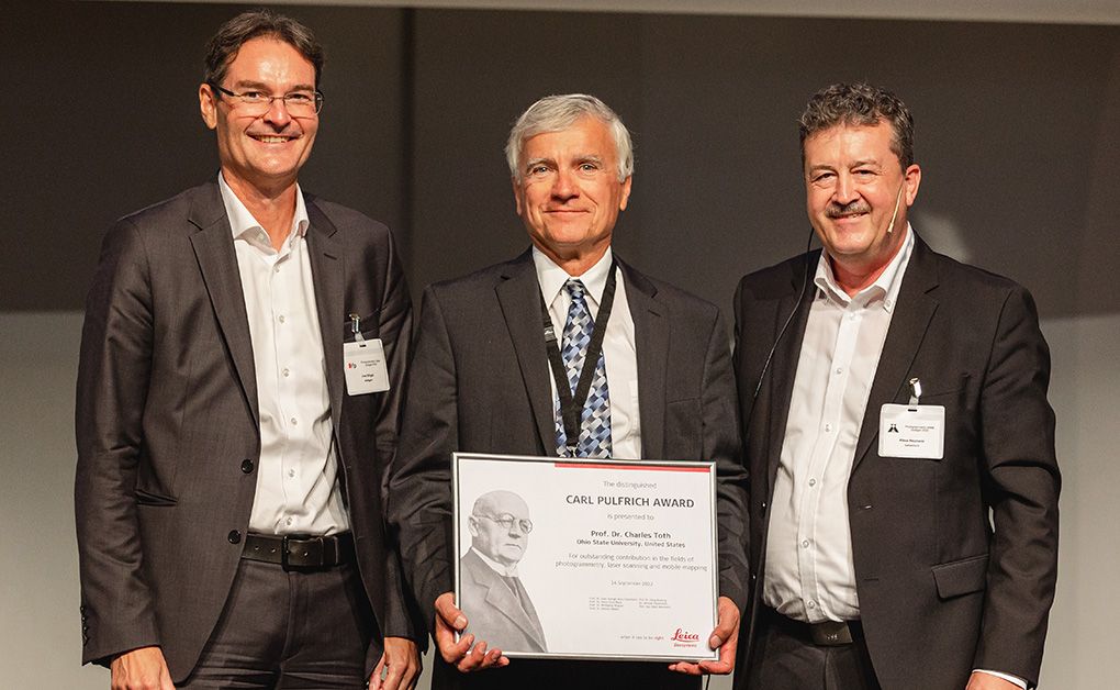
Prof. Dr. Charles Toth receives the 2022 Carl Pulfrich award. Image courtesy of Leica Geosystems.
The last two presentations each morning were short ones from the OpenPhoWo partners. These were well prepared, technical rather than commercial in emphasis. On the Wednesday, however, Klaus Neumann’s presentation about Leica Geosystems’ products was prefaced by one of the most important components of PhoWo – the presentation of the biennial Carl Pulfrich Award, which honors the memory of Dr. Carl Pulfrich, a member of the scientific staff at Carl Zeiss from 1890 to 1927. During his tenure, Pulfrich directed the design of the first stereo photogrammetric and surveying instruments from Zeiss. The award is financed and managed by Leica Geosystems. The 2022 winner was Professor Charles Toth of The Ohio State University, well known photogrammetry and lidar guru and co-editor of one of the most authoritative lidar textbooks[4]. He was clearly a popular recipient and gave well chosen, brief words of thanks.
The Thursday program began with four presentations on precision agriculture, a fresh, different direction from the previous days. Then, with Christian Heipke and Charles Toth, I sadly had to leave Stuttgart for the ISPRS events in Prague.
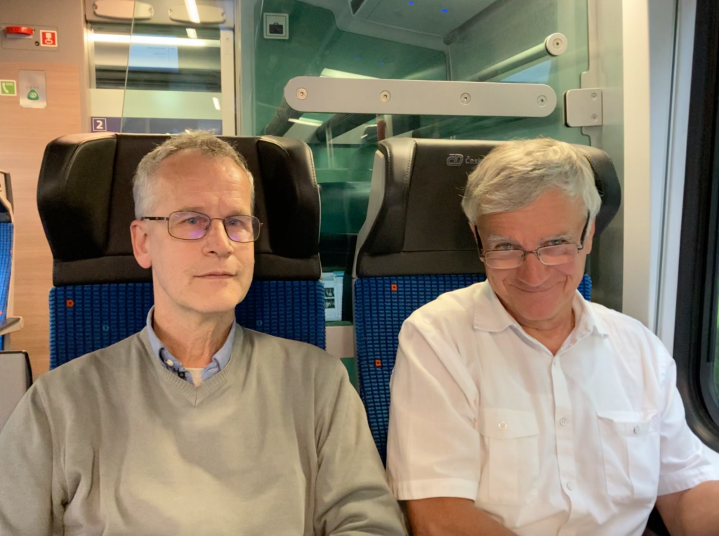
By train with colleagues Christian Heipke and Charles Toth.
The ISPRS meetings consisted primarily of internal business that need not be reported here. One part, however, does matter to readers of LIDAR Magazine. Most of the first two days were devoted to a joint meeting with the presidents and vice-presidents of ISPRS’s five Technical Commissions. The goal was to tune and agree the structure of each Technical Commission’s Working Groups, which manage the research that is at the very heart of ISPRS. This was not a trivial task, but the result was refinement of the Technical Commissions’ proposals. The result is a powerful structure that will result in considerable research and publication from now until the XXV ISPRS Congress in Toronto in July 2026. Interested readers can review the Working Groups on the ISPRS website, where the new Working Groups will soon be posted. Keep an eye on that: probably the most important Working Groups for readers of LIDAR Magazine will be those of Technical Commission I (Sensor Systems) and Technical Commission II (Photogrammetry). The president of the latter is Professor Alper Yilmaz of The Ohio State University. Being involved in this work, which will shape the development of photogrammetry and remote sensing over the next four years, is a great honor. My duty here will be to report to you in more detail as the Technical Commissions and their Working Groups develop.
The three flights home gave ample time to reflect on a wonderful trip. I am becoming familiar with the operation of ISPRS, which has steered our technology for over 100 years. And once again I was able to participate in PhoWo, which began in 1909 and is undoubtedly the premier event on my calendar. I hope I live to attend the next one, planned for March 2025, if pandemics don’t intervene.
[1] https://lidarmag.com/2017/12/23/changing-of-the-guardaddressing-complementary-technologies/
[2] Fritsch, D., 2005. The Photogrammetric Week series – a centennial success story, Fritsch, D. (ed.), Photogrammetric Week ’05, Wichmann Verlag, Heidelberg, 346 pp: 3-12.
[3] Esri, IGI, Leica Geosytems, RIEGL, Trimble, Vexcel Imaging.
[4] Shan, J. and C. K. Toth (eds.), 2018. Topographic Laser Ranging and Scanning: Principles and Processing, second edition, CRC Press, Boca Raton, Florida, 637 pp.