
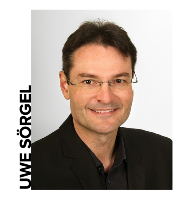
Following his accession to the chair of the Institute for Photogrammetry (ifp) at the University of Stuttgart, Professor Uwe Soergel chaired the 56th Photogrammetric Week in September 2017. Stewart Walker, new managing editor of LIDAR Magazine, interviews him to explore the evolution of this world-renowned center of photogrammetric excellence and the conference associated with it, and solicit his thoughts and ideas about the technologies that are shaping our LIDAR world.
Editor’s note: A 2.338Mb PDF of this article as it appeared in the magazine is available HERE.
In early September every odd-numbered year, photogrammetrists from around the world gather in Stuttgart, the capital of the province of Baden-Wrttemberg in southern Germany, for the Photogrammetric Week. This year the event was presided over by Professor Uwe Soergel, who replaced Professor Dieter Fritsch as chair of ifp in April 2016. Professor Fritsch, in turn, had, in 1992, succeeded Professor Fritz Ackermann, who had occupied the chair since 1966. The chair is not only prestigious and one of the most sought after academic positions in photogrammetry, but its occupant doesn’t change often. The arrival of Uwe Soergel, therefore, is a significant event and LIDAR Magazine took the opportunity to learn more about him and his ideas.
LIDAR Magazine: Professor Soergel, thank you for talking to us. Could you please tell us a little about yourself and your background?
Uwe Soergel: In 1997, I received the degree Diplomingenieur (equivalent to MS) in electrical engineering from the University of Erlangen-Nuremberg, Germany. During my studies, I focused on digital processing of audio, image and video signals. From 1997 to 2005, I was research associate at the Institute for Optronics and Pattern Recognition (FOM), located in Ettlingen (Germany), which was part of the Research Institute for Applied Natural Sciences (FGAN), a former German research establishment focusing on defense-related studies, now integrated into the Fraunhofer. At that time, I was mainly involved with pattern recognition of man-made objects from remote sensing imagery, with emphasis on synthetic aperture radar (SAR) data. In 2003 I received my PhD in electrical engineering and computer science from Leibniz Universitt Hannover, Germany. From 2006 I worked as assistant professor then associate professor for radar remote sensing and active systems at Leibniz Universitt Hannover. In 2013 I was appointed full professor for remote sensing and image analysis at Technische Universitt Darmstadt, Germany. Since April 2016 I have been full professor at the University of Stuttgart and Director of the Institute for Photogrammetry.
LM: What prompted you to seek the chair in Stuttgart?
Soergel: I was looking for a new challenge and the appointment at the Institute for Photogrammetry at Stuttgart University promised prospects of conducting larger research projects and organizing workshops to serve the scientific community. Moreover, since the very beginning ifp has enjoyed a high worldwide reputation in the field of photogrammetry and this itself has opened many opportunities for networking and project acquisition.
LM: When you arrived, what did you to consider to be the strengths of ifp and what did you wish to change? Have you been able to make the changes you would like?
Soergel: Due to its long history–more than 50 years–ifp has had two main areas of expertise. The founder, Prof. Fritz Ackermann, is widely considered as the most influential scientist of his generation in the field of photogrammetry, and his successor, Prof. Dieter Fritsch, added geoinformatics as a second research pillar. I am in the happy position that highly-skilled permanent staff are available in both research fields. Therefore, I would be well advised to continue research in these two very successful fields, photogrammetry and geoinformatics. In addition, we have started to establish remote sensing as a third pillar of the ifp curriculum, emphasizing SAR, airborne laser scanning, and time series analysis. We will of course strive for close cooperation with other research groups, which is easily achieved: in all areas we more or less deal with information extraction from mass geodata, pattern recognition and image analyzing methods–a common base which we will further develop.
LM: The Photogrammetric Week is changing too. We noticed the obvious things–more synthetic aperture radar (SAR) and remote sensing in the optional tutorial on the Sunday; some sessions were chaired by your deputy, Professor Norbert Haala, rather than yourself; there was no traditional group photo on the steps between the two buildings where the conference is held; and no hardcopy book containing the papers. But there must have been other changes behind the scenes–how do you perceive the event evolving?
Soergel: Well, also in the past the Photogrammetric Weeks (PhoWo) were not static events. My predecessors always focused on hot topics of the day. Core themes of the 2017 PhoWo were autonomous driving, precision farming, and BIM. The same applies to the tutorial, which covered remote sensing, in particular SAR interferometry, but also modern classification methods, which are useful for photogrammetry as well. The long-term basis of PhoWo is and will be the same as in the past: photogrammetry, remote sensing and geoinformatics, in terms of both research and applications. In my eyes, this combination of theory and practice is a unique selling point of PhoWo, a path we plan to continue in the future. In addition, an essential keystone of this event is and will be our OpenPhoWo partners, whose interesting demonstrations in the afternoons were well attended. Meanwhile we already have collected a lot of feedback from PhoWo attendees from academia, companies, and government as well as from our OpenPhoWo partners, which was in general quite encouraging. Hence, we will strive to follow the path of success so far: maintain the fundamentals but be open for innovation at the same time.
PhoWo is a joint activity of the whole institute. Prof. Norbert Haala and other senior staff members were involved in the selection of invited speakers for the scientific sessions taking place in the mornings. As Norbert is an outstanding expert in the field of photogrammetric image analysis, it was an obvious choice that he should chair the related sessions. Full papers of invited speeches are widely regarded as a kind of grey literature in the community. We therefore decided not to continue with full papers printed in hard copy, instead we provided the attendees with digital versions of the extended abstracts. In addition, the authors provided pdf files of their slides, enabling the audience during the talks to write their own comments and thoughts into such files for a later use. This new opportunity was widely appreciated.
LM: You are an expert on SAR and related technologies such as interferometric SAR (InSAR) and polarimetric SAR (PolSAR). How would you describe the principal contributions of these technologies within the geospatial toolbox? How are they changing? Also, we have come to associate these technologies more with satellites than aircraft, especially the well-known constellations Radarsat, COSMO-SkyMed and TerraSAR-X/TanDEM-X. We have noticed that several smallsat constellations have been announced that will carry SAR sensors–do you think they will be successful and how will they change the utilization of SAR data?
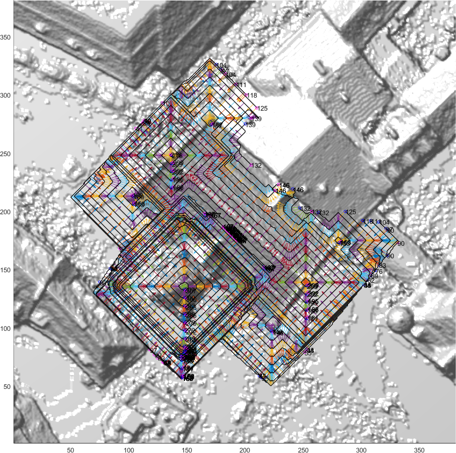
Top view of planned UAV trajectories; camera stations and viewing directions are estimated.
Soergel: In my opinion, SAR interferometry, including advanced variations such as differential interferometry (dInSAR) and persistent scatterer interferometry (PSI), are the hot topics of radar remote sensing, not to say remote sensing as a whole. Missions such as SRTM and TanDEM-X were tremendous success stories. One could argue, however, that comparable DEMs can be derived by other means, for instance, by stereo photogrammetry based on optical satellite imagery. Nevertheless, monitoring subtle surface deformation processes of various kinds for large areas is possible only by dInSAR and PSI based on time series of satellite SAR data. At the same time, we have had an enormous demand for such monitoring. On the one hand, we deal with surface motion due to natural processes or hazards such as volcanic activities, earthquakes, or landslides. On the other hand, we face issues caused by anthropogenic activities, which may in particular threaten urban areas. Most people’s first association with the latter is subsidence during or in the aftermath of underground mining or construction. For example, in the Ruhr area of Germany we saw in some places subsidence of about 20 m since the mid 18th century. And many other places in the world share the same problem. But there is another issue, which is often overlooked in public: subsidence caused by overstrained ground water removal, a problem which occurs notably in rapidly growing megacities around the world due to the high demand for water from incoming dwellers and illegal or at least uncoordinated well construction. Subsidence may lead, for instance, to amplification of flooding hazards because water from a river or the sea more easily finds its way into the city and takes longer to recede.
PolSAR is especially useful for land cover classification, in particular for tasks such as crop monitoring. The lack of spectral resolution (usually only one band is used at a time) is balanced by the dense temporal sampling capability of SAR due to its independence of weather conditions, as well as far longer wavelengths compared to the visible spectrum. Many studies have been conducted, which have never really found their way from academia into commercial operationuntil now. Agribusiness already begins to exploit such techniques based on PolSAR.
Except for defense applications, airborne SAR is still a kind of niche. Some private companies left the market, but there are others performing quite well. I think there are some applications that benefit from the higher ground coverage per time unit.
Finally, I believe SAR is on track for a bright future. In 2014 Europe started its Copernicus constellation purposefully with the launch of Sentinel-1, a SAR satellite. Other players in the world are continuing their programs too, for example, Japan and China. I am eager to learn the decision of Germanys government on the direction of the national SAR program, scheduled to be announced in the first half of next year.
LM: One of the messages from papers and demonstrations at the Photogrammetric Week was an acceptance that technologies are complementary rather than competitive. No longer are people arguing that we dont need LIDAR because photogrammetrically derived elevation data is so goodor vice versa! How do you see the complementary roles of photogrammetry, LIDAR and SAR for the generation of elevation information and the detection of changes of elevation through time? Also, airborne LIDAR data is being combined with LIDAR data from mobile mapping systems and terrestrial laser scanners: this is a powerful approach to the generation of information, but do you feel that the different error characteristics of these technologies are taken sufficiently into account during the data merge?
Soergel: I have made the same observation. Photogrammetry and laser scanning are complementary rather than competitive. There is a clear trend to use the technologies together, even simultaneously with cameras and sensor devices mounted on same airborne or terrestrial platform. In this way, LIDAR mitigates the shortcomings of image-based elevation models, for instance, blur at steep edges such as building facades or in vegetated areas. On the other hand, in contrast to LIDAR, images provide spectral resolution and sharper object boundaries. In addition, radar plays a role here: car manufacturers use cameras, laser scanners for close range and radar for long range and in case of fog or rain. Today the latter is still restricted to diffraction-limited real aperture radar, i.e., used for scanning not for SAR imaging yet. You mentioned the necessity of proper error modelling for such fusion. This is indeed currently a hot topic of research conducted also at ifp.
We have already discussed the successful SAR-based missions SRTM and TanDEM-X, providing global DEMs of unprecedented quality. The main shortcoming of SAR, however, is its restriction to side-looking viewing geometry, leading to undesirable effects such as layover and occlusions before and behind elevated objects, respectively. This is why for routine mapping of cities SAR is not the first choice and we should better rely on techniques capable of imaging or scanning in the nadir direction. Nevertheless, in the case of disaster or crisis, SAR may be the only means of rapid mapping required for quick response. As soon as we turn to rural or natural scenes, there are scenarios where airborne SAR is very useful: radar of long wavelengths such as L- or P-band can penetrate even very dense vegetation such as rain forest. Another example is coastal areas and river beds, which often require monitoring of vast areas on a regular basis; depending on scene characteristics, in such scenarios airborne InSAR can be more efficient than LIDAR.
LM: Our readership, of course, is primarily involved in LIDAR, which is central in the teaching and research going on in ifp as well as in the lectures and demonstrations at the Photogrammetric Week. We are all trying to understand and evaluate the new airborne LIDAR technologies that have entered the non-military mapping world in the last few years, such as Geigermode and single-photon LIDAR. The review paper at the Photogrammetric Week by Professor Jutzi from Karlsruhe provided insightful, dispassionate guidance. Meanwhile, the suppliers of traditional or linear mode airborne LIDAR systems continue to refine their offerings with spectacular developments such as full waveform, multispectral and topobathymetric LIDAR. How will the new and established technologies play alongside each other and how do you see LIDAR and its applications evolving? What about LIDAR from drones?
Soergel: I was delighted to learn how innovative the LIDAR industry has become today. From the engineering point of view, Geiger-mode and single-photon LIDAR are very interesting techniques. In my opinion, we are dealing again here with complementarity rather than competition, leaving room for these new technologies and conventional linear mode airborne LIDAR. The former are more efficient in terms of ground coverage, whereas the latter provides higher accuracy and precision of the 3D point cloud.
I am convinced that LIDAR on drones will become somewhat standard. On the one hand, small laser scanning devices tailored for such platforms have already entered the market, whereas, on the other hand, regulations in some jurisdictions have become relaxed (e.g., recently for some applications in Germany, the weight limit for UAVs was lifted from 5 kg to 10 kg), which allows the use of heavier devices. Multispectral LIDAR will definitely improve land cover classification down to species recognition of individual plants. Finally, laser bathymetry is meanwhile the first choice in coastal areas of low turbidity, complementing ship-based echo sounding focusing on deeper and muddy waters.
LM: This years Photogrammetric Week included numerous stimulating sessions: we heard about new airborne SAR and hyperspectral sensors; we learned about the role of photogrammetry and LIDAR in autonomous driving, precision agriculture and building information modeling. Would you like to try to predict the most significant developments in the near future, say two to five years?
Soergel: Well, I think it was Mark Twain who said: It is difficult to make predictions, particularly about the future. Nevertheless, I dare to share my thoughts about the near future to some extent. I believe that deep learning techniques such as convolutional neural networks will play an important role for 3D point cloud processing and analysis too. In addition, fusion of oblique imagery and LIDAR will become a standard set-up at least for urban mapping.
LM: Professor Soergel, thank you very much indeed. LIDAR Magazine is grateful for your responses and wishes you a long, successful tenure as the chair of ifp.
Dr. A. Stewart Walker is the Managing Editor of the magazine. He I am convinced that LIDAR on drones will become somewhat holds MA, MScE and PhD degrees in geography and geomatics from standard. On the one hand, small laser scanning devices tailored the universities of Glasgow, New Brunswick and Bristol, and an MBA for such platforms have already entered the market, whereas, on from Heriot-Watt. He is an ASPRS-certified photogrammetrist.
Sidebar: University of Stuttgart
![]() Founded in 1829, the University of Stuttgart has a student body of 28,000. It has campuses in downtown Stuttgart and Stuttgart-Vaihingen. Its strengths include engineering and computer science and it now offers masters courses in the English language. The University of Stuttgart is one of the leading technically oriented universities in Germany with global significance. It sees itself as a center of university-based, non-university, and industrial research. Furthermore, it takes a role as a guarantor of research-based teaching, focused on quality and holism.
Founded in 1829, the University of Stuttgart has a student body of 28,000. It has campuses in downtown Stuttgart and Stuttgart-Vaihingen. Its strengths include engineering and computer science and it now offers masters courses in the English language. The University of Stuttgart is one of the leading technically oriented universities in Germany with global significance. It sees itself as a center of university-based, non-university, and industrial research. Furthermore, it takes a role as a guarantor of research-based teaching, focused on quality and holism.
Sidebar: ifp![]()
The Institute for Photogrammetry (ifp) was founded in April 1966, coinciding with the appointment of Fritz Ackermann to Professor for Photogrammetry and Surveying. Prof. Dieter Fritsch succeeded Prof. Ackermann in 1992 and also served as Rector of the University of Stuttgart from 2000 to 2006. The Institute offers undergraduate courses in photogrammetry, image and signal processing, remote sensing, and geoinformatics. It has about 15 masters and 10 doctoral students. The faculty includes Prof. Soergel as chair, Prof. Norbert Haala as deputy (research area: photogrammetric computer vision), Dr. Michael Cramer (photogrammetric systems) and Dr. Volker Walter (geoinformatics). Prof Soergel is also head of the remote sensing research group. There’s a detailed account of the Institute’s first 50 years at http://www.ifp.uni-stuttgart.de/institut/50Jahre/ifp-50Jahre-Festschrift-Web.pdf.
The Institute is very active in international research and current work includes several areas where developments are made of technologies complementary to LIDAR. One example is flight planning for UAVs over structures, to ensure that the camera positions are optimized for point cloud generation and reconstruction of buildings and faades. Another is the use of persistent scatterer interferometry (PSI) for 4D change detection in urban areas.
Sidebar:
Merging Technology And Tradition
The Photogrammetric Week began as the “Vacation Course in Stereophotogrammetry” in 1909 (a detailed history has been written by Dieter Fritsch: http://www.ifp.uni-stuttgart.de/publications/ phowo05/010fritsch.pdf). The course was the brainchild of Dr. Carl Pulfrich, a brilliant employee at Carl Zeiss Jena, to whom the concept of stereoscopic measurement is attributed. The event attracted 46 participants from six countries and it is interesting that the proceedings were edited by another father of photogrammetry, Prof. Otto von Gruber. The course continued annually in Jena until 1913.
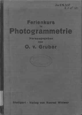
Ferienkurs in Photogrammetrie
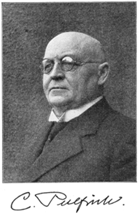
Dr. Carl Pulfrich
It was not until 1929 that von Gruber organized the 6th course, which attracted 41 participants from 14 countries. The pattern continued and the 20th course took place, still in Jena, in 1940. The term “Photogrammetric Week” was coined in 1937. After another interruption, the 21st Photogrammetric Week took place in Munich in 1951, though there were only 28 participants–nevertheless the US was represented! A preference emerged to team withuniversities, so the 21st to 29th events were in Munich from 1951 to 1963, then the next four, from 1965 to 1971, in Karlsruhe, withan average attendance of 160. The event moved to Stuttgart in 1973 and has continued there biennially, with attendances rising to over 500 photogrammetrists from academia, government and industry all over the world. The traditions of the event–invited papers in the mornings; demos by exhibitors in the afternoons, for which a rota is provided so that every participant is able to see every demo; evening receptions in the University and the Town Hall; conference dinner in a beautiful rural location–are strong and most participants are eager to return. Merged with tradition is leading-edge technology and often the exhibitors give pre-announcements of new products to be launched at Intergeo very soon after PhoWo.
A 2.338Mb PDF of this article as it appeared in the magazine complete with images is available by clicking HERE