Dennis Kemmesat, co-founder and CEO, Frontier Precision.
Frontier Precision, Inc. is a supplier of hardware and software products and related services for customers in geospatial and adjacent markets across large areas of the US. It is best known as a Trimble distributor, but has grown to embrace offerings from multiple suppliers and extend beyond a purely geospatial customer base. LIDAR Magazine was given the opportunity to interview co-founder and CEO Dennis Kemmesat, who spoke to us from his headquarters in Bismarck, North Dakota.
LM: Dennis, thank you very much indeed for taking time to answer our questions. Frontier Precision is extremely well known in the land surveying world, but perhaps some of our readers on the purely lidar side don’t know you so well—though this is rapidly changing as a result of your relationships with DJI, YellowScan and other big players in the UAV-lidar space. Please tell us something about your company.
DK: I founded Frontier Precision back in 1988 with my former partner Mike Althaus. It has been quite a journey. We both were working for a competitor here in Bismarck, back in the day when total stations were just becoming a mainstream product in the market. The company we worked for was looking to sell or just close the branch where we were both working. We felt there was a business opportunity and we decided to take the plunge. Buying the inventory and assets, we started Frontier Precision.
Frontier Precision (Corporate), Bismarck, North Dakota.
It was a two-man operation for a while. All the duties of a start-up business—salesman, service technician, bookkeeper, accountant, shipping and receiving clerk, and delivery guy—we did it all. We built everything around customer service. Over the years we slowly took advantage of opportunities as they presented themselves, first opening an office in Denver in the early 90s, then one in St. Cloud, Minnesota, then acquiring other Trimble dealerships over the past 34 years to give us the footprint today. I bought Mike out in 2000 and he remained with the business as our service manager until his retirement a few years ago.
We jumped into the unmanned/drone space a little over 10 years ago when Trimble purchased Gatewing and brought the Trimble UX-5 to market. We saw a future in UAVs with our customers even though Trimble decided to exit that space in 2016. At that point we decided to go “all in” on UAVs and began to build a bigger portfolio of products that would extend far beyond surveying and mapping.
One thing evident to me is that our “secret sauce” for success has been the people who are part of this company. We have been so blessed to have many long-term employees—some for the whole 34 years—but also the great young talent we continue to add over time, a perfect mix that preserves our culture of a company focused on customer service. In these days of the changing workforce we have been fortunate to continue to find great people committed to serving our customers and the whole company culture.
For our geospatial business we have 12 physical locations covering 11 states across the northern plains, mountain states, and Pacific Northwest including North Dakota, Minnesota, South Dakota, Colorado, Wyoming, Montana, Idaho, Oregon, Washington, Alaska, and Hawaii.
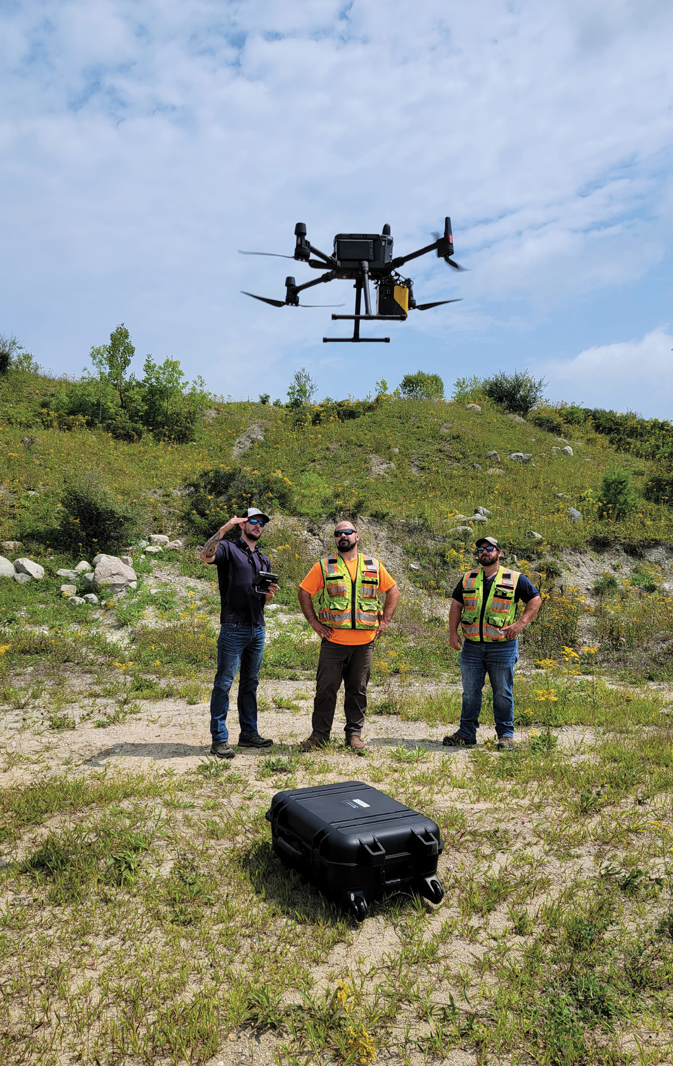
Nathan Stephenson, applied geospatial engineer at Frontier Precision, training employees from Sebago Technics, on the DJI Matrice 300 and YellowScan Mapper lidar solution, in Portland, Maine.
Frontier Precision Unmanned Division has personnel in several of our geospatial locations plus its own physical locations in Bend, Oregon, Fort Worth, Texas, and Jacksonville, Florida.
LM: Are the geospatial locations different from the other locations?
DK: We’ve evolved into different business areas. We’ve divisionalized, even though we still operate as a whole under Frontier Precision. We have our Geospatial Division, which is our primary business area for Trimble. We sell all their geospatial products. We’re part of their BuildingPoint group now, so we have a Buildings and Construction Division, which strictly focuses on vertical construction. We offer all the products in the Trimble buildings portfolio and their MEP1 portfolio. We have our Unmanned Division, which encompasses all our UAV products—sensors, underwater ROVs, pipe crawlers, and software and services. In that realm, we have two additional offices and plans to add a couple more, because, unlike our Trimble business, it’s not territory-restricted. With Trimble, we have our footprint and Trimble has other distributors throughout the country that have their own territories as well. On the UAV side, we represent several product lines across the whole country, so we have responsibilities to have a presence. The two additional offices, which are specifically for Unmanned, are in Fort Worth, Texas, and Jacksonville, Florida. And we’re looking at adding one or two more offices to give us a full breadth of coverage for the US.
LM: You’ve mentioned Bend, Oregon as well.
DK: Bend is part of our Unmanned Division. We acquired Air-Supply Aerial there late last year. They were an e-commerce hardware provider for UAVs. Their owner was originally from South Dakota and he had built a nice little business. E-commerce, specifically on the UAV side, was something where we really didn’t have a big presence. It was a good fit and we ended up buying them, so their team came across to our team. They touch into different areas outside the traditional land survey, engineering and construction markets. They were working with high-res cameras like Phase One, and other interesting stuff including extreme sports. It was a cool addition and they brought some fine talent for integration of sensors on UAVs, and things like that with some of our manufacturers. It’s been a great addition. They do things all over the country as well, more on the e-commerce side.
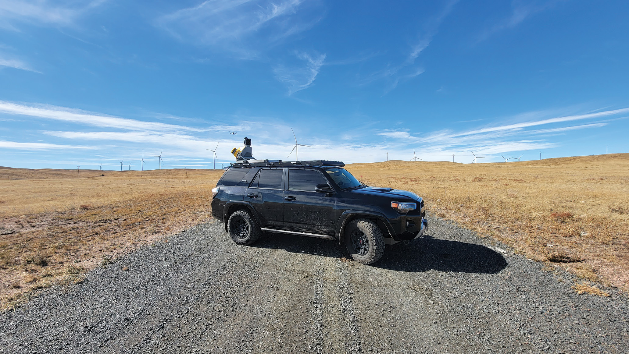
The Trimble MX50 Mobile Mapping System is a practical field-to-finish mobile mapping solution for asset management, mapping, and road maintenance.
LM: I’ve attended a couple of Trimble Dimensions meetings. One aspect that really impressed me at the last one was the outdoor demos—you go out into the desert and they have construction vehicles with sensors on them. Some of them can operate unmanned, but they always have a driver in the cab, and they do precision earthmoving etc. Do you sell that equipment for opencast mining and for construction?
DK: That’s one area of Trimble that we don’t get into. They have a dealer network set up under the brand SiTech for that, and most of the SiTechs are affiliated with a Caterpillar dealer. We do work alongside them in some respects. Even being as entrenched with Trimble as we are, there’s always fun new stuff to see.
You’re seeing a lot of autonomous stuff coming into the ag market. Deere just introduced an autonomous tractor. All the other manufacturers are following suit. I think people are still a little leery about really jumping into it. They want to see the technology mature a little bit more. But I think it’s on everybody’s radar. Give it another 12-18 months, you’re going to see a whole other generation, more mature and more reliable. I think you’re going to really start seeing some people adopt it into their workflows.
LM: Do you cover some of the agriculture market then?
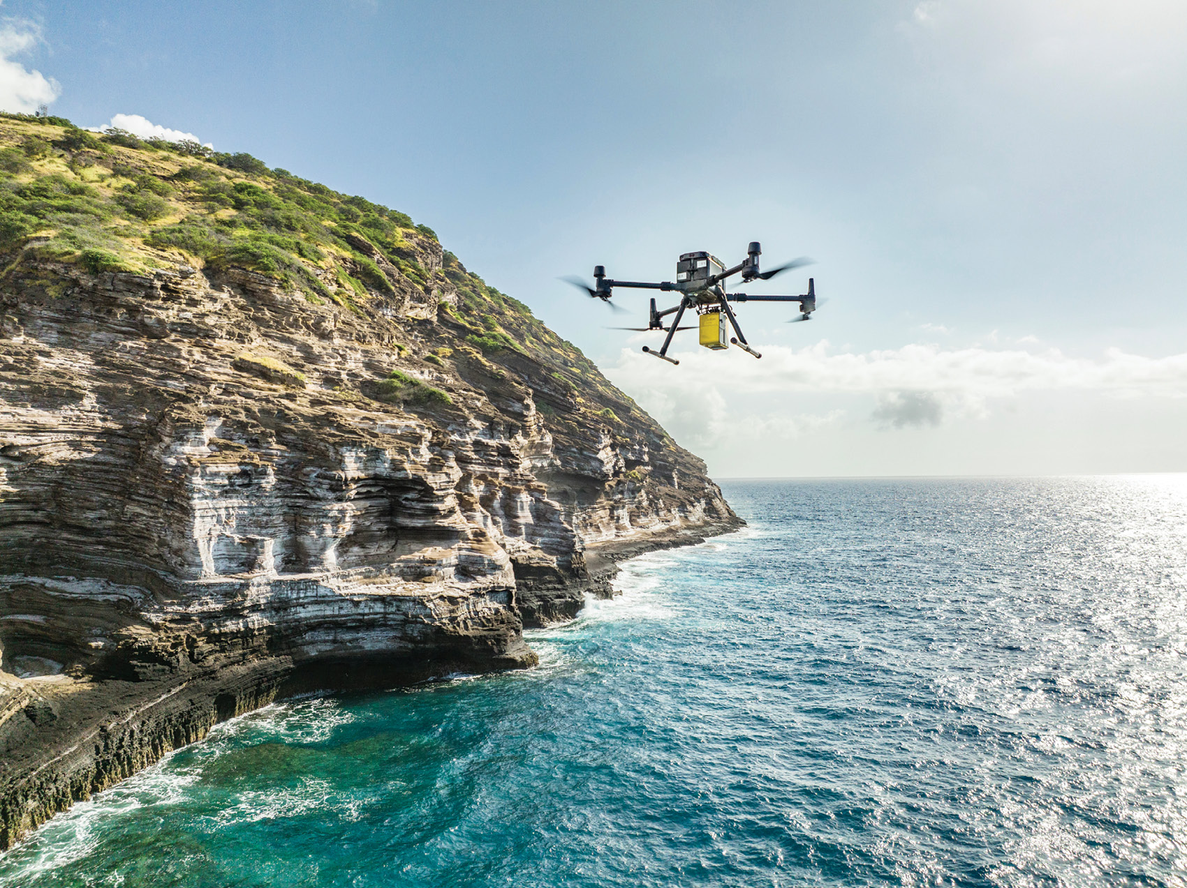
The DJI Matrice 300 and YellowScan Mapper on a recent training mission in Hawaii.
DK: Again, Trimble has another distribution channel, called Vantage, so we don’t really do anything in ag with Trimble specifically. We are starting to do a fair bit of business, though, in our Unmanned Division. We’re starting to see that gain traction. The sprayer drones are becoming a discussion topic. People are taking note of those as hopefully the FAA gets more clear definition of how to get properly licensed to fly them. Right now it’s quite a process and should get more streamlined. Beyond the sprayer drones, we’re starting to see many different segments of the ag market adopting UAVs just to scout crops, plant health, plant identification. It goes beyond traditional ag into range land management and forestry management. When I got into the business back in the mid 80s and our relationship with Trimble started, the development of RTK was a complete game-changer. I see this being a little bit beyond that, because it has such a widespread effect on society and every business.
LM: Please also tell us something about yourself. How did you begin your career and reach the decision to found Frontier? Were you brought up in Bismarck? Were you a land surveyor?
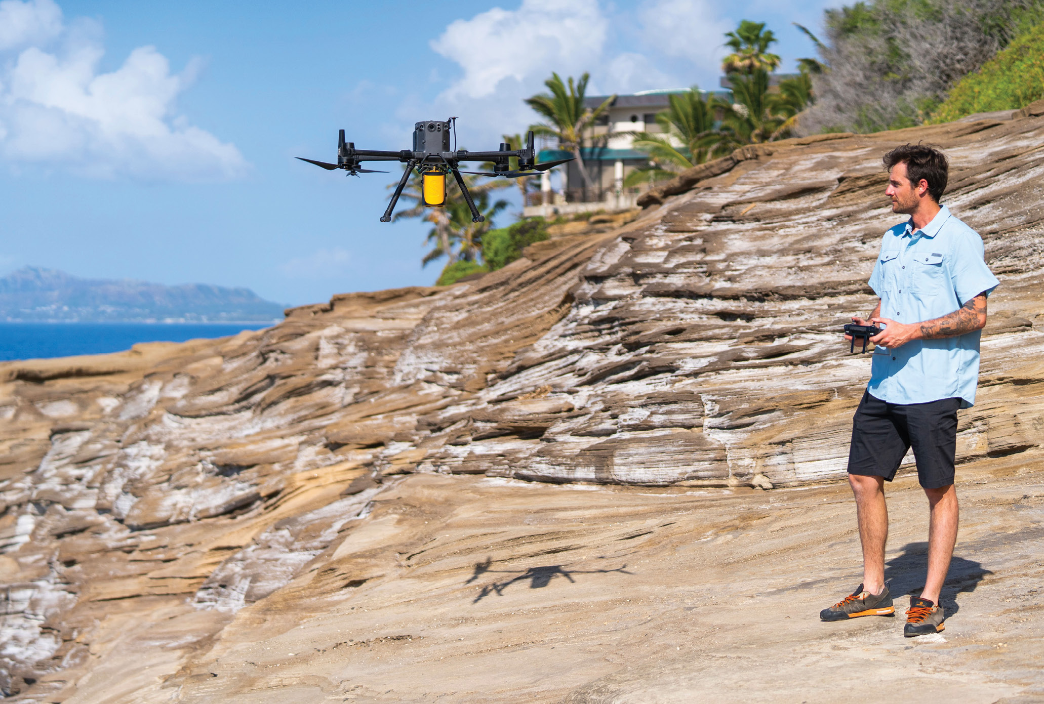
Sean Muldoon, UAS sales and support specialist at Frontier Precision, recently had the opportunity to train and educate environmental and engineering groups on UAS technology with the DJI Matrice 300 and YellowScan Mapper in Hawaii.
DK: I was a native of North Dakota, born here in Bismarck and grew up on a farm west of the town. As a farm kid growing up, I got a two-year business degree at our local college and began school for my computer science degree, but I figured out about a year in that that wasn’t going to be my bag, I didn’t see myself doing that the rest of my life. I ended up taking time off from school, I went to work for our competitor at that time, or one of our former competitors. That was back in the day when blueprint machines were a big thing, the mechanical transit was the standard survey tool and top-mount EDMs were the latest innovation. I got my start in this industry in ‘84, when the K&E Ranger and Wild Heerbrugg T1 and T16 were the predominant survey tools. I joined our former competitor, which is no longer around today, and ended up working for them for less than a year, because I got laid off and went to work for their competitor. This was the company we started from. They didn’t have a service job—I had transitioned into service work on blueprint machines and transits while I was at the other company—so they said, we have a sales job—you want to try that? Why not? I liked the technology—obviously, it was rudimentary compared to what we have today—but I got involved. I did not have a survey background, but I learned it. I had a lot of great customers who helped me learn. That’s how I got started and it grew from there. When the company we were working for wanted to close the branch here or sell it, my former partner and I thought, we need a job, we think we can make a business out of this, let’s give it a go. The worst thing we can do is fail. That’s how we started.
LM: It’s a great story. Success comes to those who take risks, as long as the risks work out, and that’s what you’ve done.
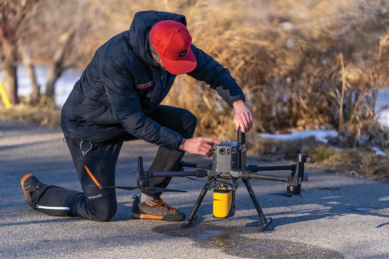
The Frontier Unmanned Team can provide the latest innovations in drones and sensors to deliver the right product for the right UAS application. Shown here are the DJI Matrice 300 and YellowScan Mapper.
DK: Yeah, 100% It’s not that we didn’t have some bumps along the way like any business, but you learn from those, you persevere, and I think businesses that do that are the ones that are successful. I haven’t done this by myself, we have a lot of great people who have been with me, from the very start. We’ve continued to add talent and people who buy into our culture and our customer-service values. It’s a team effort. I’m fortunate to find excellent people, really smart people, people smarter than I am on the technology by far, who know how to make this stuff just sing and dance, do the right thing by our customers and make sure they’re also successful with it.
LM: How many people do you have?
DK: We’re just over 100.
LM: Of all the business relationships Frontier has and the products you distribute, the Trimble representation is probably the best known. Would you like to talk more about how your relationship with Trimble began, then prospered?
DK: Our relationship with Trimble has been core to our business growth over the years and we could not ask for a better partner. We have grown together, starting back in 1989 when we first signed up to be a dealer, selling the Trimble 4000SE and 4000SSE GPS receivers. We were fortunate to be part of helping deliver the very first RTK system in the world with Trimble to a mine in Wyoming and then share in all the growth that Trimble has had over the past three decades. It has been quite a ride and, because of the partnership and the great products they continue to give us to sell, we have been fortunate to be one of their top geospatial distributors in the world for several years running.
LM: We consider GNSS and lidar similar in that they’re “sea change” technologies (as they relate to the process and procedure of land surveying). One could add UAS/UAV to this list. Having witnessed both “revolutions”, which do you believe made the bigger change? Alternately, speak to the similarities and/or contrasts between the two.
DK: I see many similarities and a differences in the evolutions of both technologies. RTK proved to be a complete game-changer as to how surveyors worked. RTK has evolved and expanded across other industries beyond surveying and construction. I see UAS technology and lidar having a much broader impact across society in general, as we now see lidar in not only scanning and mapping devices but automobiles, phones and many other devices—it is truly impacting everyday life and becoming familiar technology to the average consumer.
LM: Where do you see UAV/UAS technology headed from a surveying perspective? Is this technology essential to compete, moving forward? Whereas five or ten years ago, small sites were always surveyed using traditional methods such as total stations, today UAV-photogrammetry and UAV-lidar can provide fine deliverables, usually much more quickly. What does this mean for the future? Does it mean the emergence of new competitors, or merely the addition of UAV-borne sensors to the toolkits of land surveying firms?
DK: I foresee UAV technology becoming a standard tool for every surveyor, especially when it is coupled with high-res cameras for photogrammetry or with lidar. Of course the sensors are a small part of the equation: the back-end software is equally important—ease of use for photogrammetry processing or point-cloud processing is becoming more common with workflows that are easy to understand and learn. This was a hurdle early on for both photogrammetry and lidar—workflows were complicated and processing was time-consuming and needed a lot of computing power. We now are seeing many cloud-based software platforms that are simplifying the whole process. We offer one ourselves in the form of our FP Vision software, which allows a user an easy-to-understand workflow for photogrammetry processing and also a data depository that can accommodate all types of data including surveying, photogrammetry and lidar—all in the cloud.
LM: Please speak to Frontier’s experience with customers during the covid-19 pandemic and the ways (if any) in which you adapted.
DK: We were extremely fortunate during the pandemic to be in an industry that had many of our customers working outdoors and they were considered essential—so even though many traditional offices were shut down our customers were out working and still needing the equipment and services we provide. Our staff also did a great job of pivoting to online for many of the training and support services which our customers have come to expect, such as our annual user group meetings and in-person training classes. We moved to an online user conference called TechXpo in 2021, which offered breakout sessions on everything from GIS-related topics to drones. It was a great success, allowing our team to stay engaged with customers even though we could not be there in person. But it is better to be able to be in-person with our customers.
LM: Are you planning to go back to face-to-face events this year?
DK: A lot are centered around our state land survey trade shows, so we’ve pivoted back to in-person and we’re finding, as we’ve been attending different shows from the beginning of the year, that people are really happy to be back in-person. There was a little anxiety over online meetings, Zoom calls and online trade shows. People are happy to be back in-person and talking to people face-to-face, being able to shake hands, have a beer or whatever it might be. We’ve pretty much transitioned back to in-person.
LM: What is Frontier doing with augmented reality?
DK: We are approaching augmented reality as an evolving technology—our involvement is predominantly in the geospatial survey/mapping space and in construction with products from Trimble like SiteVision and XR10. While augmented reality seems to be the buzz in many circles we are seeing a more metered acceptance into the market. This will certainly accelerate as the technology becomes more mature and improves like all advanced technologies do.
LM: If you were operating a land surveying or geomatics business today, what would you emphasize?
DK: Be an early adopter—not bleeding edge but leading edge. The maturity and efficiencies of technology in our industry simply cannot be ignored—companies in the survey/mapping and construction industries are either embracing and adopting it or finding it very tough to compete with companies that are. In the present state of our economy and workforce this also becomes important, as qualified workers are becoming harder to find every day. The efficiencies of today’s technology allow more work to be done faster with fewer people, so a company can scale without necessarily adding workforce and other overhead and maintain a healthy bottom line.
LM: Please speak to your current portfolio.
DK: Our portfolio consists of two parts—hardware/software and services.
Our hardware/software portfolio consists of products from many different manufacturers. That is by design, as we have gone through an extensive process of seeking out and partnering with companies we feel are best-in-class in each one of the product categories. Our UAV portfolio includes products from DJI Enterprise, DJI Agriculture, Freefly, Inspired Flight, Parrot, Autel, Quantum Systems and Delair, covering all variations of aircraft from drones for survey/mapping applications to public safety to agriculture and everything in between.
With sensors we really sought out the best of the best—lidar sensors from YellowScan, DJI, Green Valley and others; cameras for photogrammetry and inspection from Phase One, DJI, and FLIR; sensors for agriculture, forestry, and other plant management applications from MicaSense; and then all the necessary components to go with them.
We’ve moved into the water—pipes and tanks—offering underwater ROVs from Deep Trekker for inspection, maintenance, and search and rescue applications, as well as pipe and utility crawlers for pipe and tank maintenance and inspection.
Our goal in developing the portfolio was to be able to provide a solution to our customers for any application they have—in the air, in the water, in a tank, in a pipe—and the software, training, and support to give our customers a complete workflow and solution, all from one source.
We developed our services portfolio after seeing a big need from our customers for a “try before you buy” scenario—without the huge capital outlay. Our customers had real jobs on which they wanted to give the technology a test run before investing—and they did not have an in-house resource who knew the technology, how to process and interpret data, and most importantly how to develop a deliverable product for their clients. Our services division allows our customers to partner with us and have access to expensive technology like mobile scanning, UAV-lidar, UAV-photogrammetry and terrestrial scanning without any capital outlay, plus experts from the Frontier Precision team guiding them through the whole process, so they have the competitive advantage of the technology but also the peace of mind knowing they have an expert running the equipment and helping them process the data.
LM: The hardware/software part of the portfolio includes training and maintenance—do you do a lot of work in those areas?
DK: We do. It’s a big part. We’ve been doing geospatial training for many, many years, since we started. We have a whole team that predominantly works in what we call our services area, and that falls in a number of different buckets, but we do designate our training as services. We do in-person training, online training, and on-demand training. There are different aspects of it, and it’s in all aspects of our business. We put a lot of stock in making sure that we have the highest qualified people to go out and assist the customer and get them properly trained, once they buy a product from us, whether it’s a GNSS system, a mobile scanner, a UAS, or UAS with lidar. We make sure that we have the right people in place who can promptly direct them down the right path and make sure they’re getting the proper training to use the equipment right way.
LM: I was interested in what you’ve described as your services portfolio. You’re assisting, or you’re working with, a customer to use a new technology through to results, then the customer will be enthusiastic and will buy the product you’re offering?
DK: That became important when we started getting into mobile scanners and UAV-lidar. A mobile scanner, for example Trimble MX9 or MX50, is an investment of hundreds of thousands of dollars. Most customers weren’t ready to spend that kind of money and not know, how am I going to put this piece of equipment to work and how am I going to make money with it? We started looking at that. We have the equipment, the hardware, the scanners, we have the expertise to run them, we have the expertise to help them on the back-end processing of the data—why don’t we offer that as a service to our customers? It gives them a chance to test-drive it, on a real project, where they’re very able to make real money. Then they can figure out the LOI, or we can help show them how it’s going to work, how much time they’re saving, how fast they can get a job done, how efficient it is. We did approach it with caution: we only do it where we are working for one of our customers, we don’t go out and directly pursue jobs on our own, it’s always in conjunction with a customer. We want to make sure that we stay in our lane and we’re not competing with engineering or other firms or agencies. We want to be our customer’s technology consultant and do everything we can to make them profitable with the technology we can sell. It’s always going to be under the umbrella of an engineering, survey, construction or related agency or firm looking to implement and eventually acquire the technology. We were very careful about that, because we take our relationships with our customers very seriously. The last thing we ever want to do is compete in that marketplace with them.
LM: We see that Frontier is employee-owned. How did that come about?
DK: In 2009, Frontier Precision became an employee-owned company. I divested my stock into an ESOP2, allowing our employees to become shareholders in the company. That was important to me, from the standpoint that the company wasn’t built by myself. It was built by a lot of outstanding people who have been part of this company over the years—that just speaks to how our employees really become family. I wanted them to have some tangible interest in our success beyond just getting a paycheck as an employee. It has worked out tremendously. Our employees have embraced it and I think it’s been huge part of making us the company we are today. People feel they have a vested interest in the overall success of the company, and they great pride in the brand and our place in the industry.
LM: The last question partly reflects my own experience back when I was with the UK distributor for Kern: you’re representing many different companies selling their products—do they ever give you any hassle, because they feel you’re not giving enough attention to their product compared to somebody else’s product?
DK: Oh, of course, all the time! Early on, when you’re taking on new product lines, in many cases you’re taking on products that are similar, it’s just the nature of the beast, where you’re trying to offer the best of everything to your customers. It’s gotten less and less of an issue over the years as we’ve developed our portfolios and, I think, done a good job of screening and working with different vendors and knowing what we’re looking for, understanding their business model and having them understand ours. Our long history and success with Trimble carry a lot of weight. That helps considerably and we can be a little more picky about the people we represent and the companies we affiliate ourselves with. We have a fabulous relationship with Trimble and have for years, but some other relationships are great too—we have fantastic relationships with YellowScan and Freefly. DJI, being a Chinese company, with superb products, is a little tougher to deal with logistically, because it’s a different culture, we have to deal with the importing of the products, and many times we are dealing with reps in a different part of the world. They approach things a little differently, which is fine moving forward, we learn to navigate that. We have found companies that we deal with on a regular basis and we feel we have strong partnerships with them. We’re on the same page as to how we want to approach bringing their products to market. They know they’re going to get properly represented. And we try not to have too much overlap in our portfolios.
LM: Dennis, once again, many thanks for finding time for LIDAR Magazine in your schedule. Our readers will be fascinated by what you have told us. We look forward to publishing this interview—and to further articles about your company and its successes in the future.
1 Mechanical Electrical Plumbing.
2 Employee stock ownership plan.