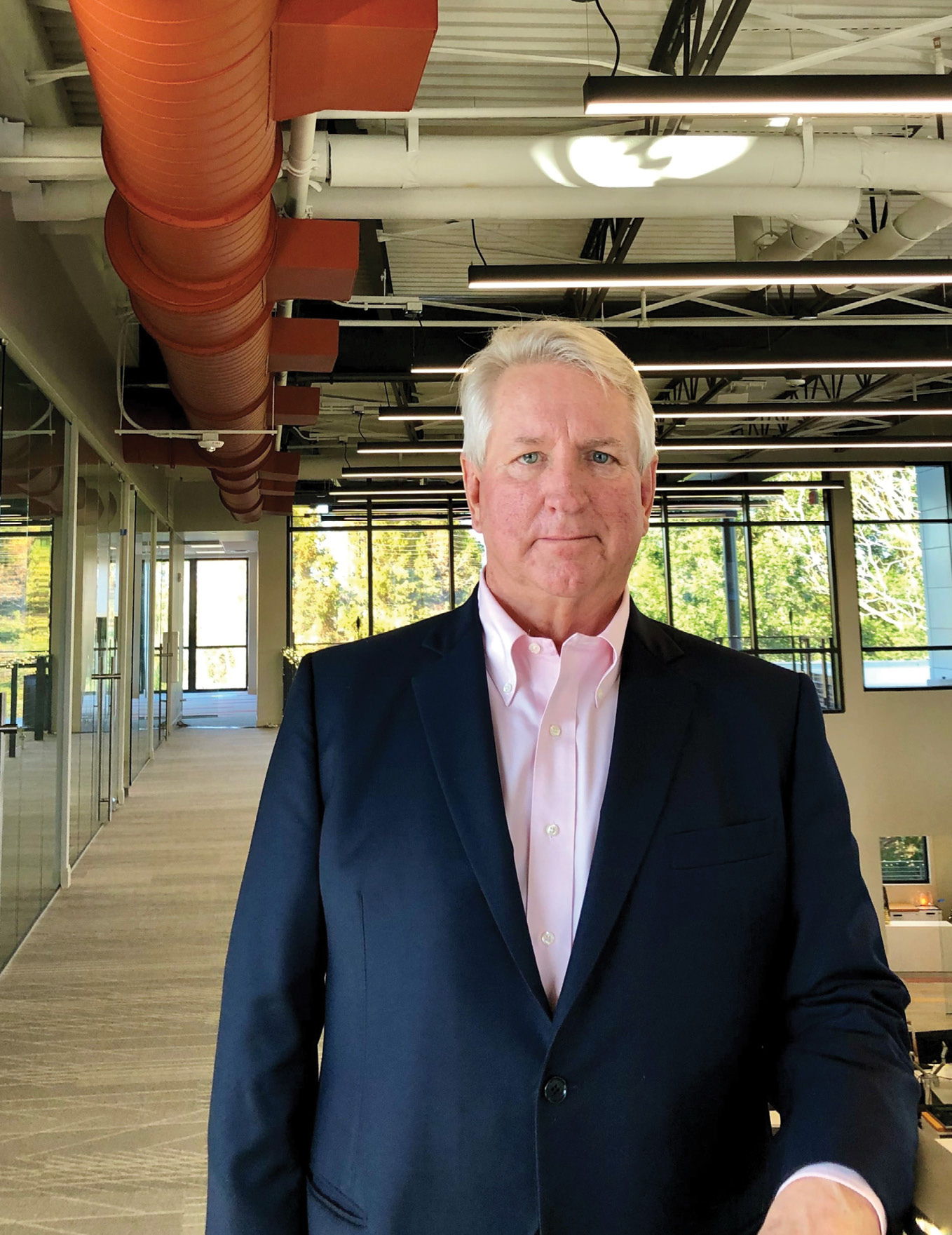
James Van Rens, senior vice president, RIEGL USA
The keynote at the Workshop was given by James Van Rens of RIEGL USA. LIDAR Magazine (LM) interviewed James (JVR) and put questions to him drawn from his keynote, which was entitled, “The next decade with lidar”.
LM: James, thank you for taking the time to talk to us. Our questions are based on your keynote at the Workshop. I’m sure almost all of our readers know you, but, in case some don’t, could you please tell us a little about yourself? How did you become involved in the geospatial world? You are currently Senior Vice President with RIEGL USA, Inc., headquartered in Winter Garden, Florida. When and why did you join RIEGL?
JVR: Most familiar to your readers is my role at RIEGL USA as Senior Vice President. Additionally, I serve RIEGL International as a strategic advisor and as RIEGL’s Board Member to the World Geospatial Industry Council.
RIEGL’s early product application was in hydrography. Involvement with the geospatial world is part of the RIEGL DNA. In the 1990s, RIEGL developed its first airborne scanner—this led directly to involvement with ASPRS. I was quite active with ASPRS during development of the LAS data exchange format. This standard was critical to lidar producers, surveying and mapping firms, and their clients.
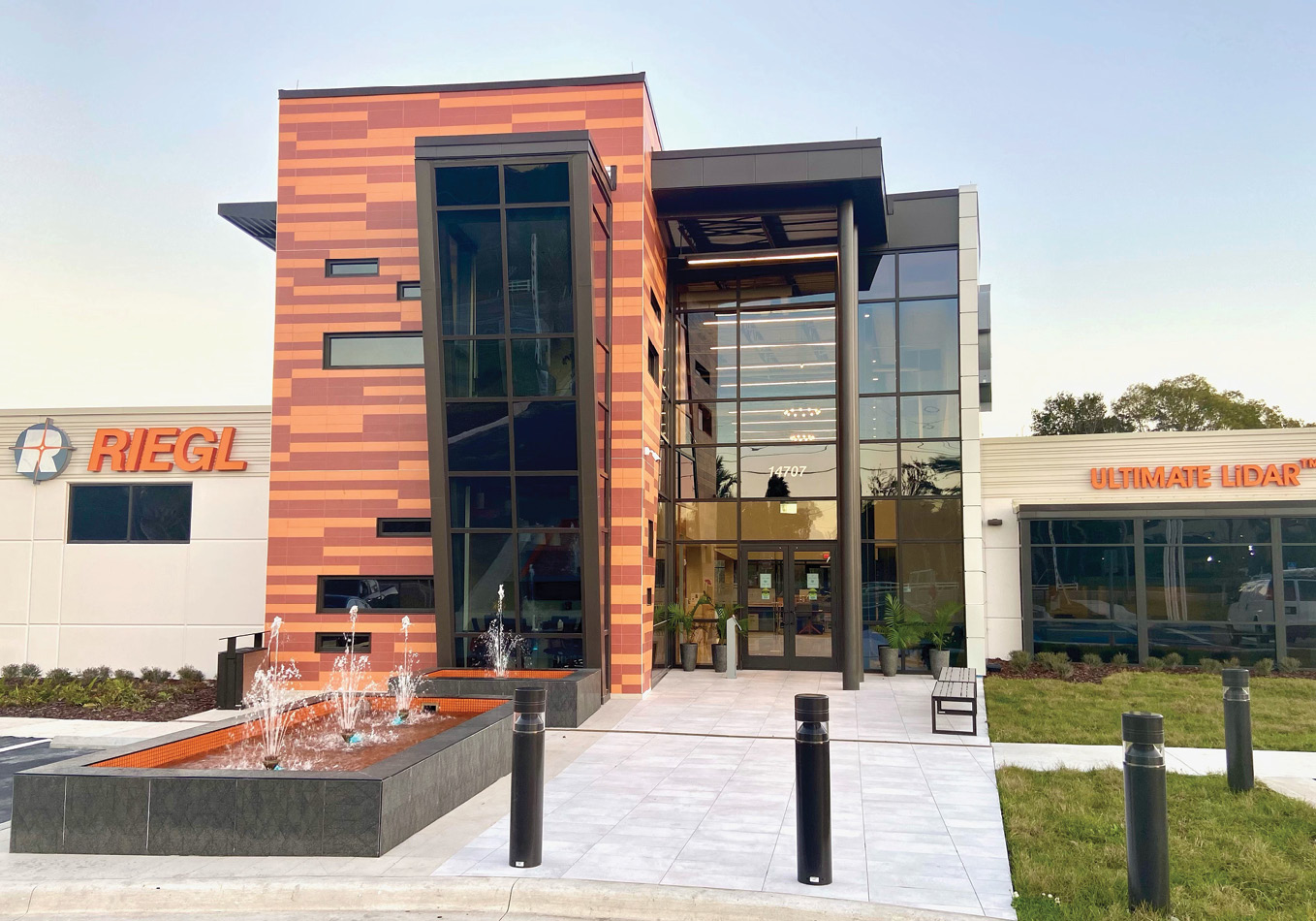
Entrance of RIEGL USA’s new headquarters
My attention was drawn to the world of laser rangefinding during the 1980s. Motorola was an innovator that I followed closely. It developed a method that monitored the environment for signals of technological change. Laser rangefinding was clearly a signal of change. So, in 1993, I started a business applying laser rangefinders to commercial and industrial situations. It was a very small field and led me to RIEGL. By 1997, it was clear that the instruments RIEGL produced were innovative, very robust, and accurate. This was critically important as those early applications would set the tone for further business. The rest, as they say, is history.
LM: Your presentation began with a historical review of lidar. What do you think are the most important innovations that RIEGL has contributed to the development of the technology?
JVR: Dr. Johannes Riegl, founder and CEO of the RIEGL Group of companies, has been visioning the RIEGL path since 1978 and still is one of the most forward thinking and innovative entrepreneurs in our industry.
In the 1990s, Dr. Andreas Ullrich joined the company. He would become chief technical officer, principal product development leader and the leading light of our digital waveform signal processing. And, of course, Dr. Martin Pfennigbauer, who heads up many of the current development and research projects at RIEGL, has also made important contributions.
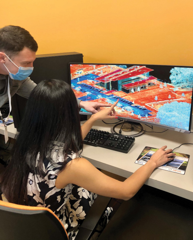
RIEGL USA team members processing data captured over RIEGL USA’s new headquarters.
Dr. Riegl’s foundational work with avalanche pulse generators in the 1960s and the application of the principles of radar measuring provided the critical start. This led to the development of a pulsed laser rangefinder in the 1970s. The 1980s featured new applications and products suited to them. In the 1990s, scanners with rotating polygonal mirrors were realized for important new applications such as airborne scanning. 1998 saw the arrival of the first 3D scanner. An important development occurred in early 2000 with the introduction of the LMS-Q560 digital full-waveform airborne scanner. By 2010 the digital signal processing regime had found its way from airborne to terrestrial to mobile platforms. In 2012, RIEGL fielded its first bathymetric system for coastlines and shallow waters. In 2013 the LMS-Q1560 was introduced. The importance of this design was to be seen with the “crossfire” scan pattern to minimize range shadows. This important design set the stage for high-density airborne mapping with superb data visualization. This was quickly followed by the introduction of the VUX-1 system for UAVs. Currently, we are introducing the VQ-840-G bathymetric system for UAV and helicopter applications.
LM: Let’s move straight into what is a thorny problem, perhaps, for traditional geospatial lidar suppliers. A great deal of ongoing development of the technology is taking place in the automotive world, funded by the deep pockets of the car and truck manufacturers, especially those involved in autonomous vehicles. One result has been the appearance in the geospatial market of very competitively priced sensors, suitable for mounting on both UAVs and vehicles carrying mobile mapping systems. Do you see this as a good thing for the geospatial world? How has RIEGL responded?
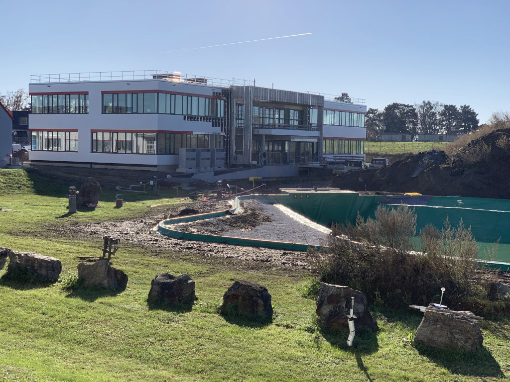
RIEGL’s additional new production facility on campus in Horn, Austria.
JVR: There is a website called “Our World in Data”1 that illuminates the issue. It features charts of technological change in various areas over the years. You can plot the development of lidar in a very similar fashion. A higher number of shots per second leads to greater productivity, which leads to better information and to new applications. The investment by the automotive companies is a natural development. For instance, there has been discussion that crowd-sourced transportation mapping with these onboard automotive sensors is the future of mobile mapping. It is an intriguing question. The car companies need sensors that are in the range of hundreds of dollars, not thousands. The intermediate sensors at the product development stage look for other applications to sell into. They are looking for new markets and new applications. Does this mean that they are “good enough” for surveying and mapping? The professionals in the industry will answer that question.
LM: The other side of the coin is that some people have suggested that the airborne lidar market, i.e. systems flown on manned aircraft and helicopters, is stagnant or declining. Yet we have noticed that the large US geospatial services companies seem to be prospering despite the pandemic, with plenty of contracts and a customer base that demands more data, more detail, more accuracy, and more repeat collects. What is your view?
JVR: The role of geospatial in managing our world is at an all-time high. Airborne acquisition for a wide range of customers is increasing. The marketplace, however, is changing in a very natural way. The forces of market maturity have led to various segments being emphasized at one time or another. As end users of the data become more sophisticated, they need better information for analysis and decision making. This leads to more data, requires better accuracy and involves repeat collects. This trend will increase.
LM: What are the most popular applications of lidar at the moment, first of all in the manned aircraft/helicopter case, then in the UAV case? What are the drivers behind this picture? How do you think the deliverables, supplied by the geospatial services companies to their clients, are changing?
JVR: The clients of our geospatial service companies need actionable information. That is driving many changes. Lidar point clouds are the base, but analytic information is what is required. Final deliverables from geospatial service companies are constantly changing to meet the needs of their clients. High-accuracy, high-density lidar provides innovative new visualizations and deliverables for many areas, such as forestry as an excellent example.
For traditional airborne mapping, the segment leaders are wide-area mapping, project mapping, corridors, and emergency response. However, they all have sub-segments within them that ebb and flow. For wide-area mapping, there are urgent needs for forestry mapping and shoreline mapping. In corridors you have different types of powerline mapping, and transportation has many different requirements.
For UAVs there are overlaps, but the dominant users are surveying and mapping firms for everyday projects. The world of construction is using drones in an increasing fashion to raise productivity and provide the job site superintendent with an overall view of the project. Electric utilities are chasing UAV mapping for beyond visual line of sight (BVLOS) to better manage their extensive networks. UAVs are here to stay with an increasing role in many areas. As with any new technological improvement, there is an initial period of exuberance, which settles into a solid growth path.
LM: In your keynote, you spent some time discussing accurate, authoritative data. Would you like to expand on that?
JVR: The key issue with data is veracity, reliability, and trust. The need for standards that are developed in conjunction with academia, industry and government is paramount. Who is to say that the data is correct and right? Do we rely on everyone to do their best or do we have standards? This is evolutionary. As the technology and the data change—so too must the standards, which must be authoritative and relevant. RIEGL is supporting the industry-university collaboration on fundamental matters of geospatial data referencing, standards, and analytics. We believe it will propel technological progress across private and public sectors and favorably impact the US’s strategic position in the global geospatial enterprise. A consortium of universities (The Ohio State University, Purdue University and St Louis University) is proposing an Industry-University Cooperative Research Center (IUCRC)2, the central goal of which is to accelerate technology development and commercialization.
LM: One of the developing applications that has generated special excitement has been smart cities. Could you please say more about this application and give some examples of how RIEGL and its customers are involved?
JVR: Authoritative surveying and mapping information is a planning requirement for the transportation network of the future. For example, New York City contracted with Tuck Mapping to provide high-density lidar mapping of various areas of the city for its planning database. Tuck Mapping used the latest RIEGL VQ-780 II to meet the requirements.
Technology and geospatial location data are at the heart of smart cities. As the world’s burgeoning population pours into major urban areas, it is difficult for city managers and planners to stay on top of all the issues necessary to provide livable conditions. The Internet of Things is a part of this new approach. Real-Time traffic information is critical for effective emergency response and smart cities. High-fidelity mapping information regarding the transportation network of the city and the implementation of a network of sensors to assess congestion is an example of the reliance on location information. Ford Motor Company has been issued a patent that combines blockchain technology, digital assets, and smart contracts to enable autonomous vehicles to communicate with each other. If there is an emergency vehicle trying to get to a location, all of this will enable faster response.
LM: During the Workshop, there were several presentations prior to yours about the wealth of public sector lidar data being collected in Florida. The whole country, moreover, is benefiting from the massive USGS 3DEP program. RIEGL’s customers are heavily involved in the data collection efforts. Do you think that open data is a healthy development, or is the “fly once, use many times” business model not ideal for system suppliers and their customers?
JVR: “Fly it once, use many times” was a slogan to address the redundancy of Federal Agency data collection. 3DEP has been effective in eliminating that problem. The 3DEP open data approach has created many more opportunities because of the strategic vision of the program and its importance to managing our country.
3DEP should be viewed in the light of being an open data geospatial utility. It is authoritative. The collection of the data is held to ASPRS-developed standards. Its data format is reliant upon the ASPRS LAS format. Anyone can download the data without a license or a cost. For instance, a satellite company downloaded the data to measure its products’ correctness. Distribution and trucking firms have used the information for route planning to save energy. Cities have used the information to recalculate vegetation mowing requirements due to the improved data.
LM: The next theme in your keynote was “information at the point of work”. Please elaborate.
JVR: The dominant industry players, Esri for GIS and Autodesk for CAD, are collaborating at unprecedented levels to improve product integrations and ensure information from one world can easily be leveraged in the other. RIEGL, which is a supplier to both, has embarked on a development program to improve the ease and efficiencies of importing lidar and image data into Esri’s ArcGIS platform. Benefits include improved storing, managing, analyzing, visualizing, and sharing of the scanner data.
During 2020, Esri and RIEGL partnered to demonstrate how the companies’ technologies could be combined in an AEC environment to store and manage a wide variety of different data sets in both 2D and 3D. Data types such as lidar scans (terrestrial, airborne and mobile), BIM (Revit models), CAD (architectural plans), UAS orthophotos, and field-collected information were included. A key benefit is that the information is available on any internet-connected device (with proper permissions), including desktop computers, smart phones, and tablets, whether in the office or in the field.
One potential example of utilizing these combined and more closely integrated technologies is the municipality inspector’s ability to perform a “virtual” review of as-builts of the project’s status to date, highlighting points of interest and adding comments so field inspections can zoom in on critical issues. With that, identified problem areas can be shared universally. Hence the phrase “information at the point of work”.
LM: What do you think are the critical lidar trends right now in terms of evolving technology? We hear a great deal about artificial intelligence, machine learning and, in particular, deep learning. What will be their role in the lidar world? Where will they be most successful? Is RIEGL involved in this?
JVR: RIEGL is heavily involved in AI and machine learning at various levels. In the workflow of our customers, one spot of processing congestion is the classification of point-cloud data. Machine learning will be highly effective at speeding up that effort. Object recognition is another area that will greatly benefit.
For AI/ML to be more successful and have faster adoption, high-fidelity image information is critical. High-fidelity lidar systems with advanced image sensors allow the algorithms to see the assets and learn correctly. Machine learning will handle many mundane tasks very effectively. Artificial intelligence will provide us options to analyze and assess the correctness of the models we use to define our world.
LM: I understand that RIEGL is expanding its campuses, both its headquarters in Horn, Austria, and its US headquarters near Orlando. Could you please tell us more about what’s happening?
JVR: RIEGL is investing in the future and expanding globally. RIEGL is determined to meet the sales, support, and service requirements of its customers.
In Horn, Austria, expansion is underway. 2019 saw the completion of a new assembly area for mobile mapping solutions. Currently underway is a new 100-meter indoor test range for RIEGL systems dubbed the “bunker”. The current summit of the expansion is the brand new production facility for manufacturing the latest PCBs and assembling instruments. This state-of- the-art facility is nearing completion.
Here in Winter Garden, Florida, RIEGL USA has moved into its new North American Headquarters. It is designed with future growth in mind. This multi-million-dollar headquarters and training facility features modern training rooms, service areas including climate chambers, laser test ranges for equipment testing and calibration, a customer support center, a distribution hub, and sales and administration offices.
LM: Like its competitors, RIEGL has been a strong and consistent supporter of ASPRS and its counterparts round the globe. It is heartening to listen to senior figures such as yourself speaking at regional events. How do you think the relationship with ASPRS works for RIEGL?
JVR: RIEGL has been a strong supporter of ASPRS, which is a critical linchpin in the geospatial ecosystem. The last slide of my presentation was a group picture of the last “in person” ASPRS Florida Region meeting. The title of the slide was “Who creates the future of lidar?”. The people in the picture are responsible for guiding us to new applications, new requirements, refinements of the processes and products. ASPRS plays a critical role in the development of standards, certification of experts, a peer-reviewed publication source and being The Imaging & Geospatial Information Society.
LM: James, thank you very much indeed for these full and fascinating responses. We look forward to hearing you speak again soon, both at ASPRS Florida Region events and, as covid recedes, on the wider conference circuit.
2 A National Science Foundation initiative: https://iucrc.nsf.gov