Three use cases demonstrate how combining mobile and subsurface mapping technology produces comprehensive 3D digital twins to document utility and transportation infrastructure.
For years, the promise of seeing beneath the surface to reveal hidden infrastructure remained just out of reach for widespread adoption in utility and transportation infrastructure projects. With technological advances such as AI adoption, ground-penetrating radar (GPR) is becoming more fully integrated into broader civil infrastructure workflows. Previously, GPR processing to extract information from the raw data could be laborious, but in recent years software has made significant progress.
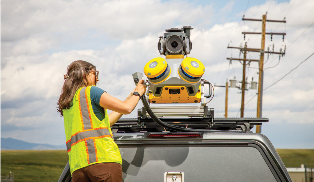

Despite historical challenges, sensor integration is now transforming surveying, civil engineering, and road construction/maintenance by offering accurate and efficient methods to generate comprehensive datasets. Mobile mapping is widely used to capture large volumes of geospatial information more quickly than traditional survey processes (Figure 1), and multi-array GPR plays a crucial role in locating buried utilities and detecting subsurface pavement anomalies. Integration of the two technologies enables simultaneous data collection at normal driving speeds, eliminating traffic interruptions and greatly reducing exposure to hazards for the field crew.
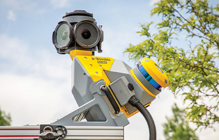


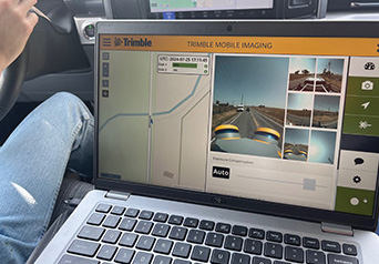
Figure 1: Views of the Trimble MX60 MMS, which contains an accessory port for the connection of complementary systems such as GPR.
The data from these complementary technologies can produce an all-inclusive 3D digital twin that provides critical information about above- and below-ground features to all stakeholders, which benefits the construction and management of utility and transportation infrastructure.
Three recent use cases demonstrate methods of combining mobile mapping and GPR and describe the benefits.
WestLAND Group: Integration yields intelligent dataset
Based on decades of experience, multi-discipline engineering and surveying firm WestLAND Group (WLG)1 knew that most large-scale construction projects required data both above and below the surface. Matthew H. Okubo, president, principal partner, and licensed land surveyor at WLG, decided to explore how simultaneous data collection could, “… save time, reduce the number of trips, and provide an underground constraints map before breaking ground.”
Mobile mapping systems (MMSs) are commonly used to obtain pre-construction survey data and as-built information, while the collection of underground data was traditionally done by people walking along a street with a GPR pushcart, often putting them in danger near traffic. New GPR technology installed on a vehicle is replacing the time-consuming manual process, making large-volume GPR data collection feasible for the first time.

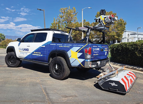
Figure 2: WLG’s equipment for data collection. A Trimble MX9 MMS is mounted above the bed of the pickup truck and an impulseRADAR Raptor GPR system mounted to the rear.
WLG experimented with the integration concept by installing a multi-array GPR and a Trimble MX9 MMS on the same vehicle (Figure 2)2, so that point-cloud data, imagery and GPR data could be collected simultaneously at normal driving speeds.
“The physical integration of hardware isn’t difficult, but bringing the data together in the processing phase can be more of a challenge,” says Okubo. “The mobile mapping point cloud is fairly simple to interpret visually, but understanding the subsurface data requires a different expertise.”
After perfecting the process, WLG is confident that the sensor integration produces reliable results to support data collection for design and construction activities. The possibility of serious injury to workers is significantly reduced, with the added benefit that GNSS positioning from the MMS improves the accuracy of the GPR data. Integrating advanced technology allows WLG to achieve better results while maintaining high productivity.
Kontur: Subsurface detection averts trouble
Around the world, government entities are struggling to keep up with repairs and maintenance on extensive transportation networks as bridges and roadways deteriorate and create driving hazards. Expanding the use of mobile mapping and GPR for asphalt and roadway management would help with early detection of surface problems like potholes and subsurface issues such as sinkholes, cracks, delamination and stripping.


Figure 3: Cargo van with Trimble MX50 MMS mounted on the roof and Kontur AIR system mounted to the rear.
Departments of Transportation would benefit from cost-effective pavement data collection to help avoid larger, more costly problems in the future. Automated tools for pavement analytics are now available to review large volumes of data and prioritize repairs and better support predictive and proactive routine maintenance.

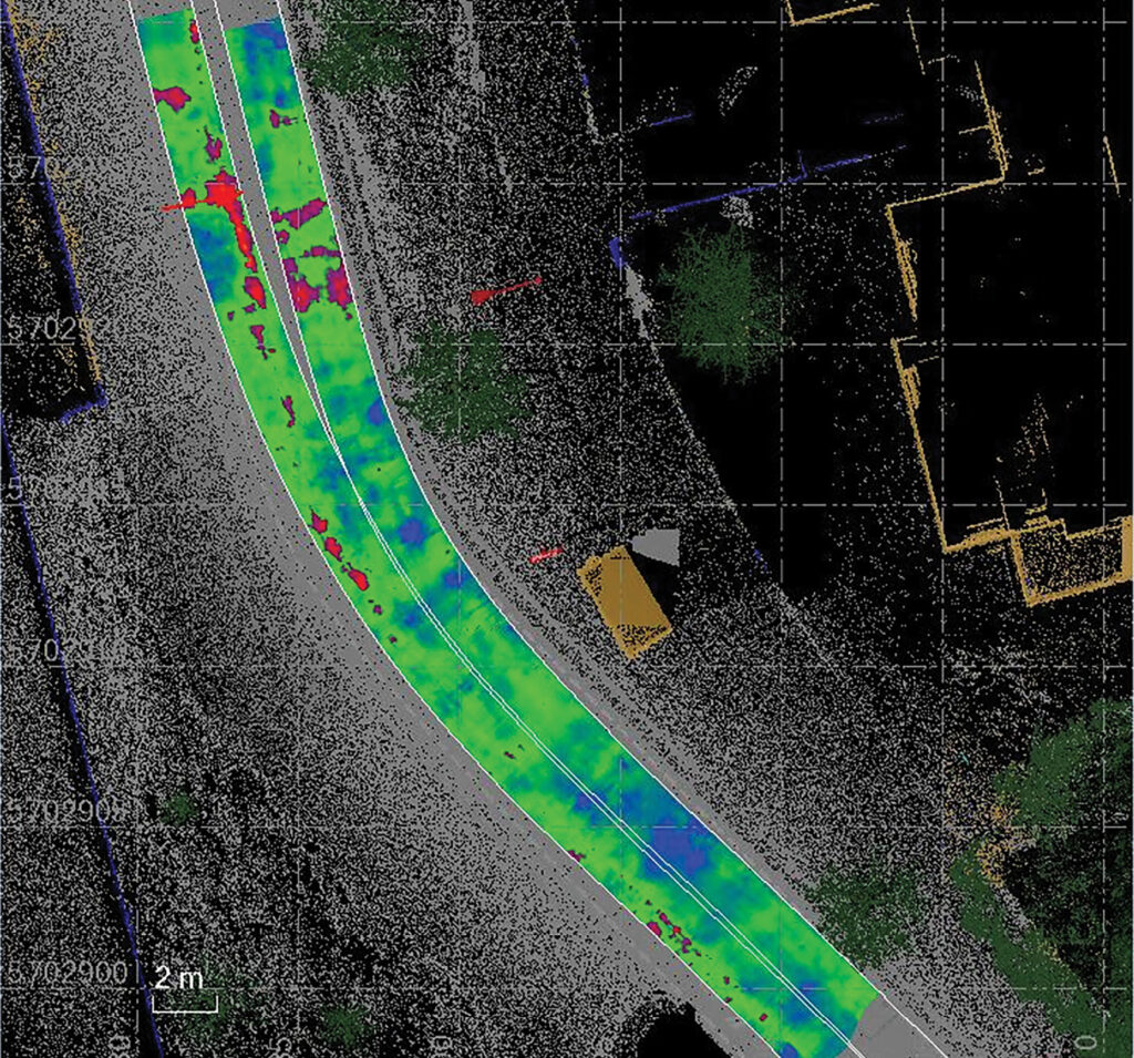
Figure 4: Results obtained from MMS and GPR system developed under a joint project conducted by Trimble and Kontur.
Norwegian company Kontur3 manufactures multi-array GPR units suitable for transportation infrastructure projects and subsurface utility location. In 2024, Trimble and Kontur executed a joint project in Italy that involved capturing data from a vehicle equipped with a Trimble MX90 mobile mapping system and a Kontur GPR system (Figure 3). The data-processing workflows were aligned to improve data integration and report generation (Figure 4). The use of Trimble Business Center software and Kontur software in combination resulted in enhanced data interpretation.
Italgas: Digital twins go underground
As part of its digital transformation strategy,4 has pioneered 3D Asset Mapping, a comprehensive digital twin of its gas distribution network, capturing both surface and subsurface infrastructure across its service area. This initiative enhances operational efficiency, improves safety, and streamlines maintenance and planning activities.
Starting with a pilot project focused on 5500 km of pipeline, Italgas implemented a new process for field surveys to identify underground gas pipes using georeferenced geo-radar scans, while simultaneously collecting lidar and panoramic images above ground.
They placed a GPR antenna on a van and installed a Trimble MX50 mobile mapping system on the roof of the same vehicle. In addition to being fast and accurate, vehicle-based data capture is conducted without interrupting traffic and avoids placing the field crew in danger.
The new mapping approach was deemed a success and was extended to the entire service area. The workflow from field to data processing is fully integrated to create a digital twin that is regularly updated and available on the web at any time or place, including information on surface and subsurface infrastructure elements. Any problems related to asset depths can be identified to prevent excavation accidents, and convenient sharing of information yields time savings for operations, emergency response and other third-party subservices.
Italgas benefits from access to up-to-date and complete information, which reduces costs and improves efficiency and safety. The integration of all known GIS asset information with mobile mapping and GPR data provides a true 3D digital reconstruction of the network.
Bridging surface and subsurface
The integration of mobile mapping and 3D GPR technology represents a significant advance in infrastructure management, bridging the gap between surface and subsurface data collection that has long challenged the industry. By combining these complementary technologies on a mobile platform capable of simultaneous data capture, the barriers of operational complexity, safety risks, and traffic disruption have been substantially reduced. This evolution transforms what was once a specialized, time-intensive process into a routine data collection operation that can be seamlessly integrated into standard infrastructure workflows.
The resulting comprehensive 3D digital twins provide stakeholders with visibility into both above and below-ground infrastructure networks, enabling more informed decision-making throughout project lifecycles. As these integrated systems continue to mature, they are positioned to become the new standard for infrastructure asset management, utility coordination, and transportation planning. The technology’s ability to deliver accurate, efficient, and safe data collection while producing digital representations of complex infrastructure networks marks a turning point in civil engineering and construction practices, promising to enhance project outcomes while reducing costs and risks associated with subsurface uncertainties.
- 1 https://westlandgroup.net/
- 2 Further detail on WLG’s system and its operation is available in videos: https://youtu.be/buGtoOgcmk8; https://youtu.be/9qOpMRauTvk; https://youtu.be/qMZKOYwuz0M.
- 3 https://www.kontur.tech/
- 4 https://www.italgas.it/en/