LIDAR Magazine, unsurprisingly, is focused on lidar, but we like to publish about other active sensors too. We have tried for some years to solicit articles on ground-penetrating radar, so I made a special effort to investigate this technology at Hexagon LIVE Global 2025.
On the afternoon of the first day, I attended a session, “From concept to reality: Hexagon’s vision for utility detection”, by Matthias Twardzik, Director Hexagon Detection, Hexagon Geosystems, to prepare me for an interview with him the following day. He started with a product just announced, the DS4000 ground-penetrating radar (GPR) system with Equalised Scrambling Technology (EsT), which provides deeper penetration and better detection that predecessor systems. Naturally, the AI enhancements in the software are key. This is especially important with GPR – until recently reading the signatures and developing an underground network from them was a task of which only trained specialists were capable. Finding pipes and cables is the main goal, but cavity detection is a growing market. Twardzik came from the Italian company IDS GeoRadar, which was founded in 1993 and acquired by Hexagon in 2016. His portfolio is much broader than the DS4000, however, consisting of several GPR devices as well as precision locators.
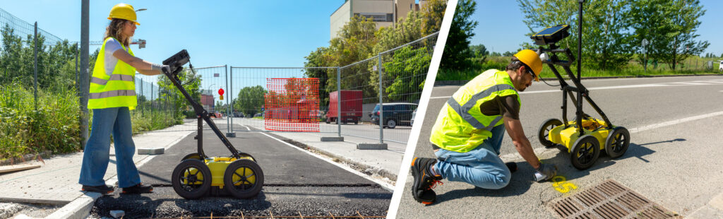
I followed this up by attending a session the following day by Andrew Watson of Subsurface Mapping Solutions, describing a GPR survey undertaken in preparation for a 13 km extension of a lightrail route in the Gold Coast area in Australia. The discrepancies in underground infastructure between this survey and the existing GIS records were amazing. GPR has an enormous future and both the hardware and software are now available to make it accessible. Watson’s client was delighted with the results. Subsurface Mapping Solutions also use the Leica TRK700, which featured in many customer stories throughout the event.
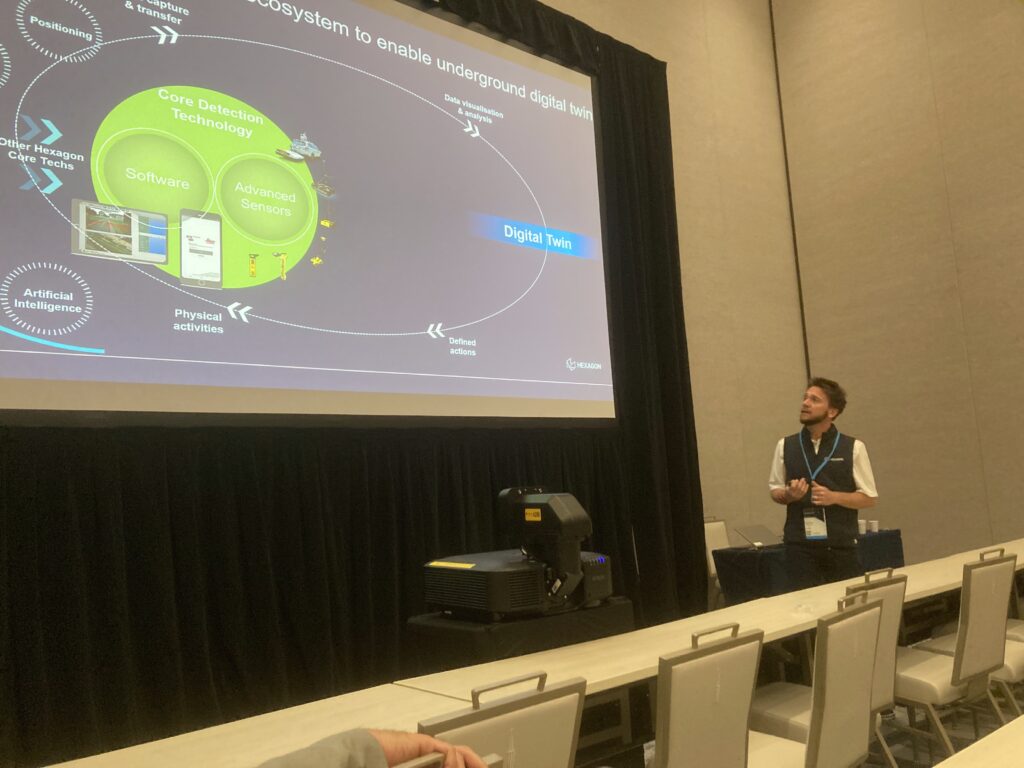
The GPR theme was further reinforced on Thursday morning in a presentation by Gianluca Paesanti, a product manager for the GPR portfolio, who was introduced by Heerbrugg veteran Craig Hill. The AiMaps software for GPR post-processing is not yet available for the DS4000, because training data has to be accumulated.
Later in the day, I interview Twardzik, who had joined Hexagon through the acquisition of IDS GeoRadar in 2016.
On my request, Twardzik talked about himself a little, before homing in on the technology, including EsT, as opposed to the cable locator product line, which is also radar but simpler. The big Stream array detector products have had EsT for a while, but the new DS4000 brings it into a lower-cost solution. An entry-level product opens doors, but when customers see the income stream, they want more. The DS4000 is 20K euro. They’ve sold a couple of thousand units of the various GPR products and have already received orders for the DS4000. The market-place is competitive, but Hexagon clearly has the sales and marketing heft, e.g. a team of five in the US dedicated to Twardzik’s portfolio.
EsT works by transmitting and receiving a signal at standard gain, then doing 111 more measurements while increasing the gain. Penetration can range up to 8 m depending on soil type and many other factors. There are also applications in archaeology and geomorphology, e.g. sub-glacial or englacial streams.
I enjoyed talking to Twardzik and wished we had longer. I mused on our conversation later. The GPR technology is impressive. It can see through the ground! In a sense, it is magical, just as I have always found interferometric synthetic aperture radar (InSAR). During my brief trip down memory lane with Hill at the end of the session he had moderated, he emphasized how important it is for surveying companies, even quite small ones, to consider adding GPR to the range of services they offer. The chance of this being profitable is high. I also wondered how young people who hear about the profession would perceive it. Which is more satisfying: generating a high-quality, underground GIS database through the use of leading-edge hardware and software, or finding boundary markers, perhaps after tussles with rattlesnakes, bison and the like, in order to wrestle with the cadaster? Maybe the answer is both. I couldn’t erase faint memories of the Gilbert and Sullivan 1879 tune as I wondered what is the very model of a modern land surveyor…