AI, cloud computing, and sustainability will redefine how we map and safeguard our planet. We take a first look at each.
The geospatial industry is entering a new era of demand. Organizations want to understand and manage what’s around them better, and technology is evolving to meet these needs, delivering geospatial solutions that provide higher-resolution data with faster refresh rates. So, what trends and innovations will shape the year ahead and beyond?
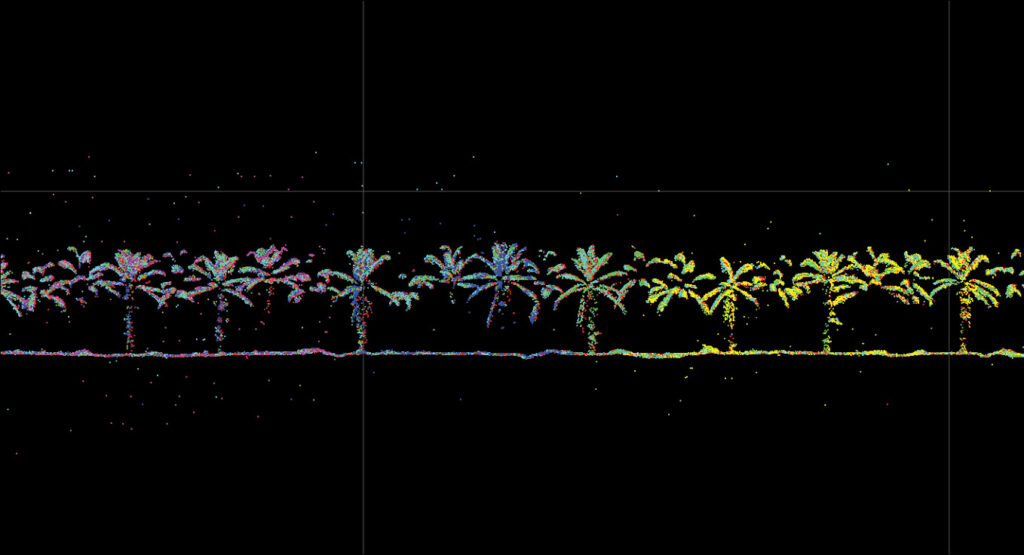
This beautiful point cloud of the biodiverse ecosystem of the La Gamba biological corridor, Costa Rica, has been constructed from airborne data and can be combined with data captured on the ground with the Leica BLK2GO handheld terrestrial lidar sensor.
AI solutions that drive business value
AI is at the forefront of everyone’s mind. More importantly, businesses are starting to look deeper into which AI solutions drive meaningful returns. The most innovative and successful applications of AI are those that are taking large quantities of complex geospatial data and simplifying it to drive decision-making for both experts and non-experts.
In the past, once new geospatial data was collected, any earlier datasets were typically set aside and rarely used. Organisations looked at them only after a disaster or during big environmental changes. Now, AI enables real-time data analysis to uncover trends and risks before they materialize.
AI algorithms can process vast volumes of geospatial data to identify changes in the environment, such as forests or water bodies, alerting experts to potential deforestation or flood risks. In Hexagon’s Content Program, for example, we map areas of the US every one to three years. We then use AI to quickly compare the new dataset against the old one and ‘spot the differences’. This helps identify and predict environmental changes, such as ‘this forest is changing faster than we thought’ or ‘the water is coming inland where not anticipated, which could lead to flooding’. By comparing pre- and post-event data, experts can quantify damage and justify investments in preventative measures, such as flood control infrastructure. In this way, AI is helping us make decisions faster. Another innovative way AI is used is to analyse complex data to create simple outputs. For example, one of our teams at Hexagon is taking geospatial data of cities and using AI to highlight levels of smog or noise in certain areas with a simple traffic-light dashboard system—a red, amber, or green alert. This provides quick, digestible information for urban planners and the general population to make decisions, for example about where to build a new house.
Sustainability is top of the agenda
Airborne mapping plays a crucial role in protecting the environment by helping us monitor and manage the planet’s resources. This heavily outweighs the environmental impact of flying an airplane or helicopter for data capture, but it doesn’t negate it.
In 2025, we’ll see the industry pushing for airborne data capture methods that minimize carbon emissions and increase efficiency. Hybrid sensors, which combine multiple data collection capabilities such as imagery and lidar in a single flight, are an emerging solution. These sensors reduce flight times and cut carbon emissions significantly, as recently demonstrated in a project in Nottingham, UK. The city council collaborated with Bluesky International, a leading aerial surveying company in the UK, to develop a 3D digital twin of Nottingham city1. This approach lowered emissions while advancing sustainable, data-driven urban planning.
Sustainable data capture is increasingly important as airborne mapping is used in more environmental and sustainability projects globally. For example, with rainforests depleting at an alarming rate, more frequent geospatial surveys are incerasingly critical. However, challenging weather conditions in these ecosystems limit when pilots can safely fly. Hence more businesses are assessing technologies that can perform aerial surveys in a single flight.
One project in Costa Rica2 saw researchers deploy a hybrid sensor for this very reason. With the data the collected, they are creating a 3D digital twin of the rainforest to monitor biodiversity, providing a model for similar conservation efforts elsewhere
We will continue to see more projects like these in 2025, potentially using hybrid sensors that integrate additional data types, further optimising efficiency and environmental outcomes.
Cloud computing is scaling geospatial solutions
While end-users demand more and faster data processing, traditional on-premise computing capacity has been a constraint for many businesses. Today, cloud platforms such as AWS and Azure make it easier and quicker to analyse and share geospatial data at scale, even for smaller geospatial companies.
The power of cloud computing became clear during the devastating bushfires that swept through Eastern Australia in 2019 and 2020. Emergency responders needed high-resolution geospatial data updated at regular intervals to coordinate their relief efforts effectively.
We were able to deploy an AWS cloud solution for the New South Wales Department of Customer Service that rapidly processed imagery and elevation data, delivering detailed maps to emergency services within 24 hours. This rapid access to high-resolution imagery and elevation data proved invaluable for guiding relief efforts, and earned an award for innovative emergency response.
There are multiple ways for geospatial companies to use the cloud in the future to support disaster resilience, for example, flood-mapping or even identifying areas of building rubble where somebody may be trapped.
Looking and staying ahead
The geospatial industry in 2025 will be defined by its ability to adapt and innovate. Successful businesses are adopting new technologies and tools to stay ahead of both competition and customer expectations. From harnessing AI for predictive insights to pioneering sustainable mapping and using the cloud for scalability, the industry needs new technology to meet the demands of a changing world. 
John Welter is president of geospatial content solutions at Hexagon’s Geosystems division. Based in Northern Arizona, USA, he has three decades of extensive and demonstrated experience in the information technology and services industry. He is an expert on topics including geospatial services, airborne mapping technology, big data concepts and IT strategy.
- 1 Gillespie, A. and L. Hobbs, 2024. A digital twin for Nottingham, LIDAR Magazine, 14(3): 26-30, Fall 2024.
- 2 Kerr, A., 2024. Digital twins open up new possibilities for rainforest conservation, LIDAR Magazine, 14(2): 22-25, Spring 2024.