Imagine a digital twin. Perhaps you are imagining the digital representation of a chip inside a phone or of a manufacturing shop floor, perhaps you are picturing a Formula One race-car engine or even an entire digitized city. Now imagine using this capability for a rainforest in Costa Rica where jaguars and tapirs roam and exotic birds perch in ancient and medicinal trees.
Advanced technology is used to map one of nature’s most complex creations—the tropical rainforest
Advanced technologies are now being applied to map one of nature’s most complex creations—the tropical rainforest. Hexagon’s green-tech subsidiary, R-evolution, recently launched Green Cubes, an initiative which combines technology, science, and environmental stewardship to revolutionize rainforest conservation. The biodiverse ecosystem of the La Gamba biological corridor (COBIGA), Costa Rica, is being captured with high-precision airborne and terrestrial lidar scanners from Hexagon, to measure and virtually visualize it for continuous monitoring and trustworthy conservation.
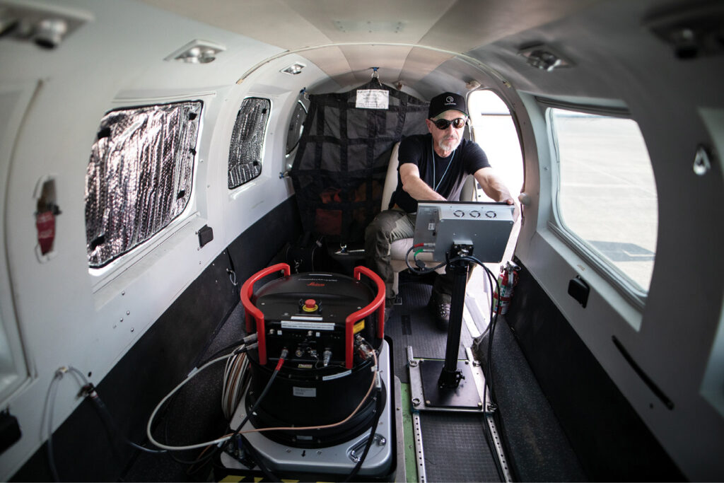
The Leica CountryMapper combines a large-format photogrammetric camera with a high-performance lidar unit into a single system to collect imagery and lidar over very large areas simultaneously.
Lidar technologies provide a unique opportunity to identify the complexity of the rainforest canopy. The digital twin combines airborne and terrestrial lidar data to unveil the forest in intricate detail and unlock new opportunities to manage the world’s natural wonders sustainably.
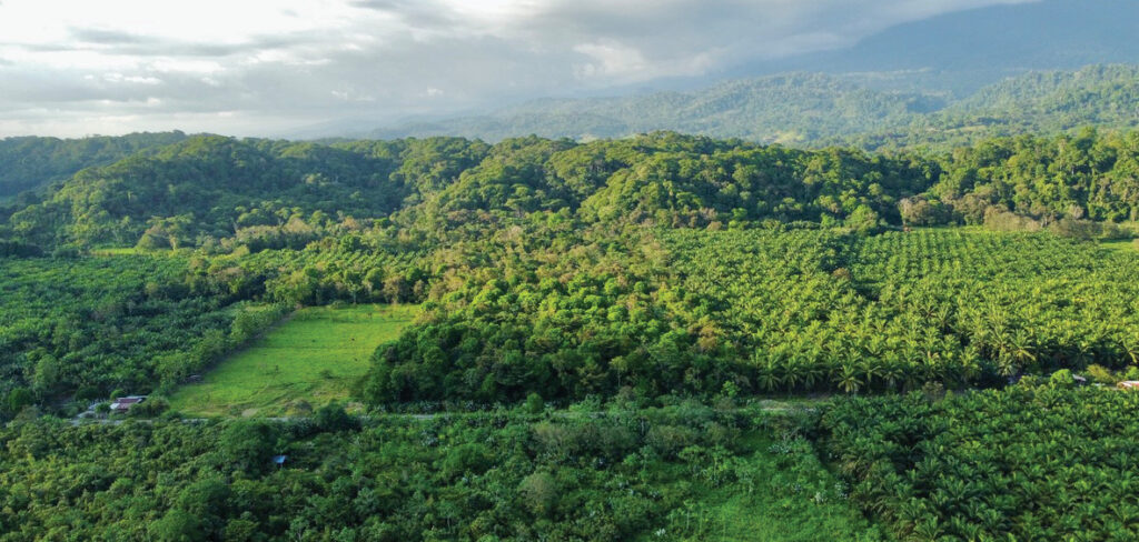
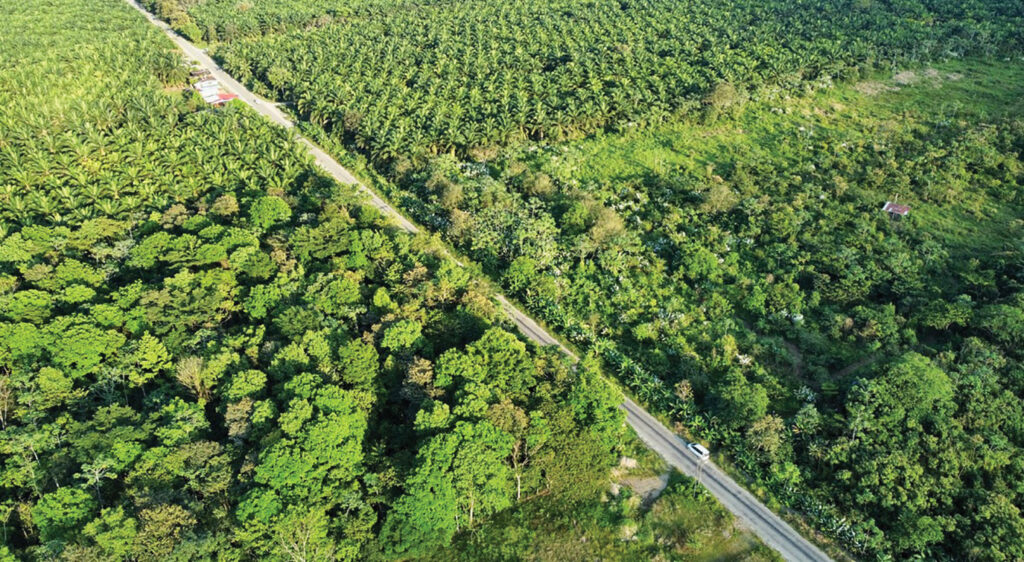
This view gives an impression of the biodiverse ecosystem and dense vegetation in the verdant La Gamba biological corridor (COBIGA), Costa Rica.
In an initial partnership with La Gamba Tropenstation, an Austrian research station associated with the University of Vienna, R-evolution is mapping 500 hectares to generate the first 125 million Green Cubes—a sponsorable asset that corporate sponsors can purchase to differentiate themselves through proactive contributions to biodiversity conservation and to meet ESG1 requirements.
Building the digital twin from the air
Through the combination of airborne and terrestrial lidar with ground sensors, imagery and GIS data, the rainforest’s development can be monitored over time with unprecedented precision.
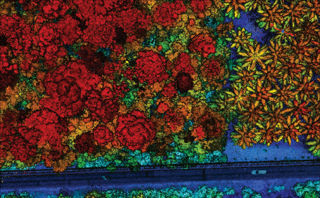
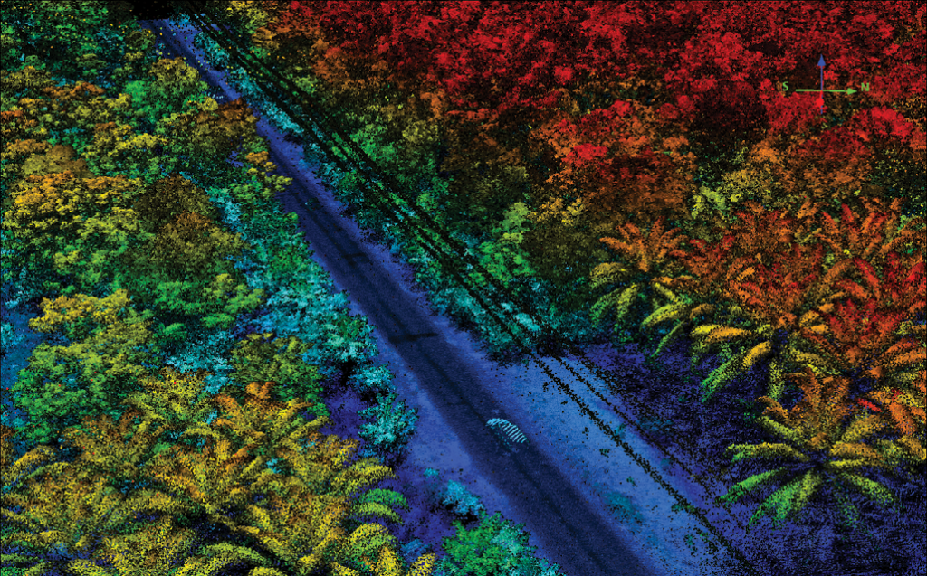
These vertical and oblique views of the point cloud from the airborne lidar data, colorized by height, give an idea of the detail that the Leica CountryMapper provides.
The core of this approach relies on state-of-the-art hybrid airborne sensors from Hexagon. Green Cubes utilizes the Leica CountryMapper hybrid airborne system, which combines lidar and large-format imagery in a single sensor.
The data collected with the hybrid sensor allows the creation of a 3D digital landscape of the rainforest to quantify its volume and to monitor changes in vegetation growth over time. This establishes a baseline for understanding the forest structure. The Leica CountryMapper image data in multiple spectral bands is registered with the lidar data. As a result, a detailed picture of the rainforest canopy emerges and an index of the different species can be constructed.
Beneath the canopy
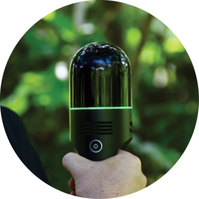
The handheld terrestrial lidar scanner, Leica BLK2GO, is applied beneath the canopy to provide high-resolution data for ground-truthing that improves the quality of the forest structure measurement and sets new standards for measuring and analyzing tree biomass volume and diameter measurements while reinforcing the data captured from the air. In addition, data captured by the Leica BLK2GO unlocks a virtual experience for corporate sponsors, bringing nature closer to business.
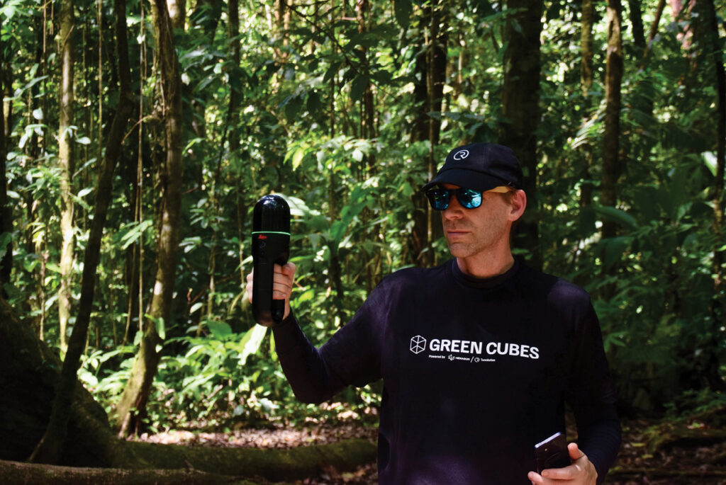
Andrew Kerr, forest lead at R-evolution, uses the Leica BLK2GO handheld terrestrial lidar sensor to capture data that will be combined with the airborne data to generate a remarkably detailed and precise representation of the rainforest.
From tape measures to digital twins
The COBIGA corridor work began more than thirty years ago to link the lowland rainforests of Golfo Dulce with the mountain rainforests of Fila Cal in Costa Rica to prevent forest fragmentation and genetic isolation. From 1993 onwards, the team, led by biodiversity researcher Dr. Anton Weissenhofer, always implemented some form of monitoring. Research teams would periodically measure the trees, recording the diameters using tape measures and notebooks.
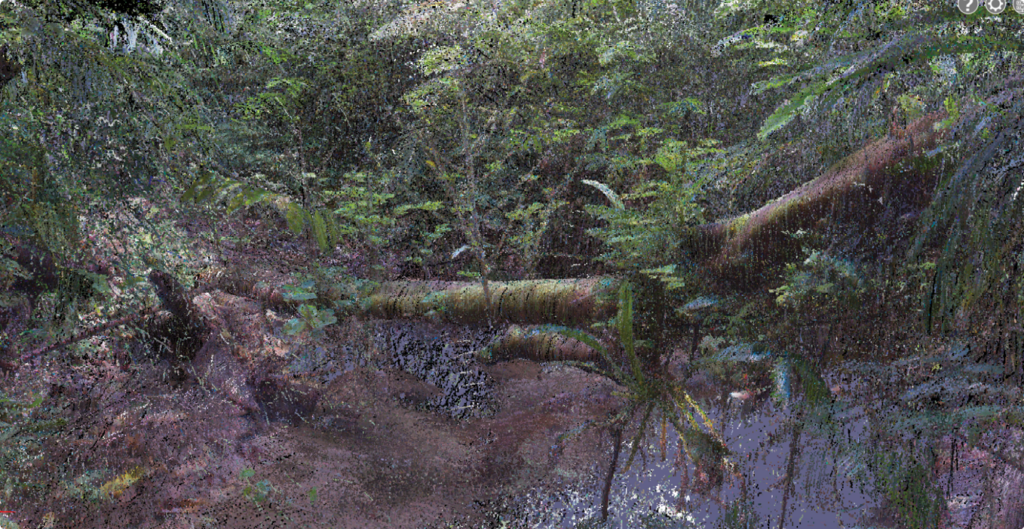
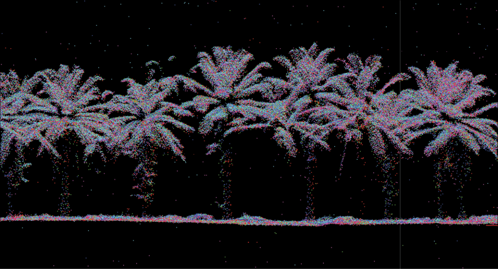
Point cloud generated from the Leica BKL2GO data.
The team upgraded its equipment as technology progressed. With a small sensor, it could measure the forest in a three-dimensional picture. That provided a good solution, but the data was so massive and unstructured that they were unable to leverage it well.
Now, with Green Cubes and a complete digital twin, visualized using HxDR2, it is possible to capture digitally not only the cubic volume of the forest, but also the structure, height, and diameter of the trees in order to calculate the biomass of the rainforest. Through Green Cubes, researchers can explore the data in vivid detail. They can create virtual tours, take measurements, and add annotations.
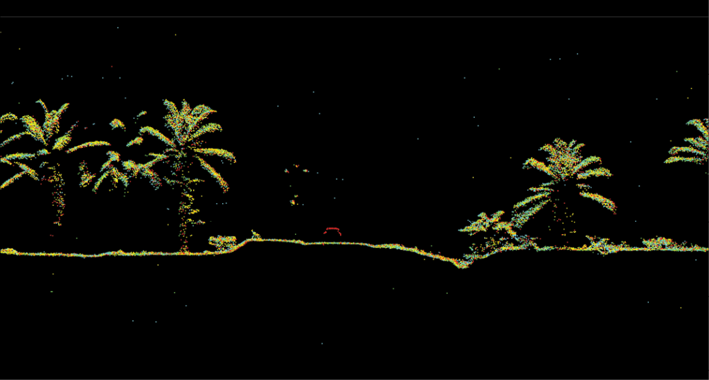
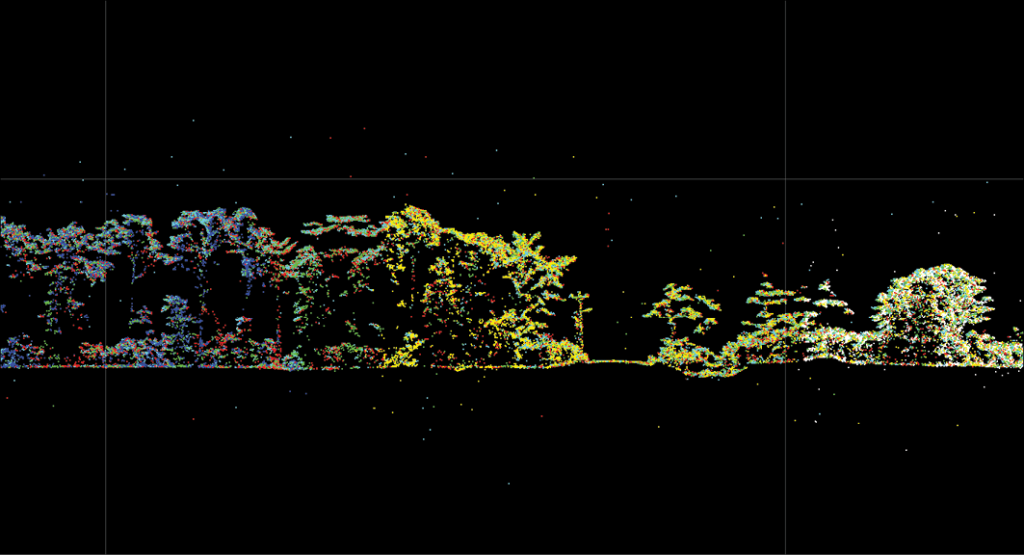
These images show airborne data.
The scientists can engage with the captured reality in a much more meaningful way by navigating through point clouds, meshes, models, and other data. Visualizing the data in this streamlined, user-friendly way allows scientists to accelerate scientific progress through enhanced insights and collaboration.
Enabling the change we want to see
 Every day, countries, companies and citizens have the opportunity to make positive change. As climate change escalates into an existential threat, we can adopt habits such as reducing waste and water, cutting carbon emissions, and eliminating single-use plastics. Beyond the changes we make, however, we also have a responsibility to enable the change we want to see in the world. With advanced solutions like digital twins, we can quantify and visualize natural environments in entirely new ways to enhance conservation efforts.
By leveraging lidar to replicate delicate rainforests virtually, this initiative opens new possibilities for sustainability. It embodies how cutting-edge technologies can empower humanity to enact the systemic change required to protect our planet. All our choices matter greatly, but we must also harness technology’s transformative power to build a sustainable future.
Andrew Kerr is forest lead at R-evolution, Hexagon’s division responsible for nature-based solutions, and is heading up the Green Cubes program. He has a background in GIS and digital management together with on-the-ground field experience. His projects have taken him from satellite tracking of wild dogs in Southern Africa to reforestation in Borneo, radio tracking of golden bamboo lemurs in Madagascar and scanning tropical rainforests in Costa Rica.
1 Environmental, Social and Governance.
2 https://hxdr.com/