Recent Vexcel Imaging announcements
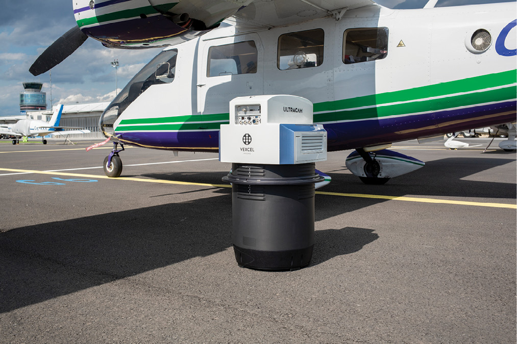
Vexcel Imaging, headquartered in the beautiful city of Graz in Austria, is familiar to most readers. Its high-performance aerial cameras, UltraCam Eagle 4.1, UltraCam Osprey 4.1 and UltraCam Condor 4.1, play hard in the global market, supported by UltraMap software. Vexcel Imaging’s announcements of sales successes figure prominently on our website. At Intergeo in Berlin in October 2023, however, Vexcel Imaging made two dramatic product announcements. The first was the UltraCam Merlin, based on Bayer-pattern sensors rather than a panchromatic channel to pan-sharpen the RGBN. The second brought Vexcel Imaging vividly into LIDAR Magazine’s bailiwick: the UltraCam Dragon is a hybrid, with a VQ-680 OEM 2.4 MHz lidar sensor from RIEGL integrated into the cone.
In some ways, these developments were natural. Vexcel Imaging is not unknown in the lidar market-place, because its big cameras are often flown in the same aircraft as lidar sensors from Hexagon, RIEGL and Teledyne Geospatial. Vexcel Imaging, however, battles for each camera sale primarily with Hexagon Geosystems, which offers the DMC-4 aerial camera as well as its TerrainMapper-3 lidar; but it emphasizes hybrids in its portfolio – its CountryMapper and CityMapper-2 lines. Furthermore, there are multiple competitors which integrate cameras and lidar units but have lower overheads. The core of all these products is medium-format cameras, typically 150 megapixels. To compete, then, a company must offer attractively priced hybrids. Regardless of the motivation, these developments ensure that Vexcel Imaging has captured readers’ attention. Thus we need to learn a bit more about this company’s origins and development path. Conveniently, events of a couple of years ago can help us.

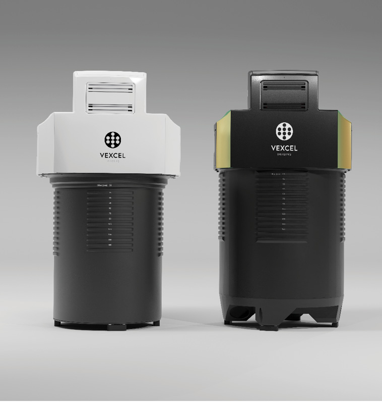
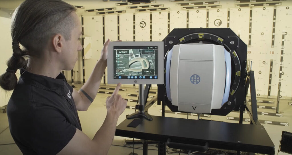
Vexcel Imaging introduced the Bayer-pattern-based UltraCam Merlin 4.1 (left) and UltraCam Dragon 4.1 (right), its first hybrid aerial mapping system, to the market in October 2023.
Visit to Vexcel Imaging in Graz
LIDAR Magazine attended the XXIV ISPRS Congress in Nice in June 2022, then the YellowScan LiDAR from Drone 2022 conference in Montpellier. From there it was possible, en route to visit RIEGL in Horn, Austria, to travel through Graz. Vexcel Imaging has an intriguing history and has been central to advances throughout photogrammetry’s digital era. It had just reached its 30th anniversary when managing editor Stewart Walker spent a morning with Chief Scientist Photogrammetry Dr. Michael Gruber to explore the company’s history and current directions. To be relevant to the bulk of our readers, however, publication of the interview had to wait for the Dragon to breathe fire!

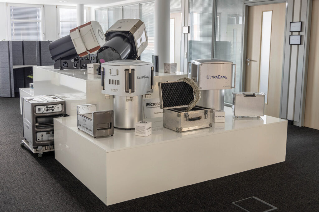
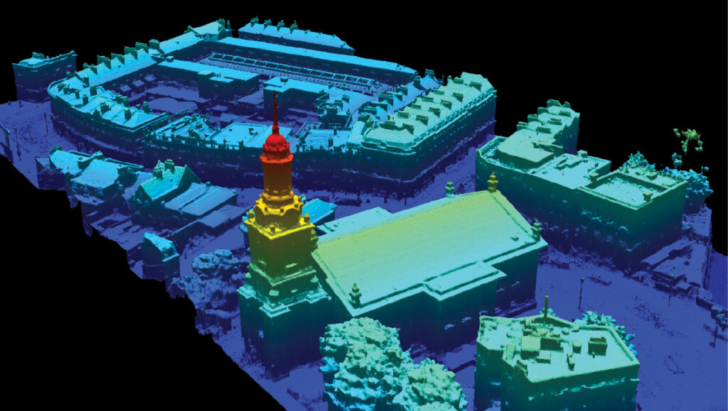
30 years of excellence: true ortho of Barcelona derived from UltraCam Osprey 4.1 imagery (left); every generation of UltraCam is on display in the museum (right).
Michael Gruber was waiting for me outside the early 21st century building, in which Vexcel Imaging occupies the first and fourth floors and part of the basement, within easy walking distance of Graz’s city center. Vexcel Imaging moved in during 2007. We started in the refurbished foyer and reception area, which serves also as Vexcel Imaging’s showroom and museum.

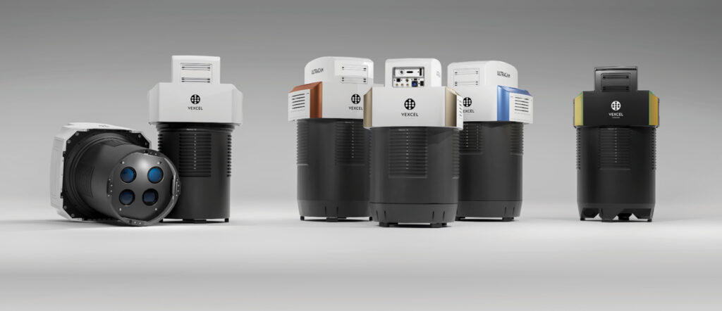
Vexcel Imaging provides a wide selection of aerial cameras and hybrid mapping systems designed to meet the needs of all aerial photogrammetry applications.
The scanner story
Our discussion began with the UltraScan 5000 scanner, a device to digitize film aerial photography. I knew, however, that earlier scanners, such as the VX2000, VX3000, and VX4000, had come before it. Michael explained: “Vexcel Corporation, founded by Franz Leberl in 1985 in Boulder, Colorado, had successful ventures in ground stations, radar imagery, GIS, and photogrammetry. The scanner division, starting with the VX2000, eventually led to the founding of Vexcel Imaging Corporation, which developed the VX4000 and launched the VX5000 at the ASPRS 2000 conference.”
In 1992, Vexcel Imaging GmbH was established in Graz, focusing on scanner development using Kodak’s 12,000-pixel linear CCD. Vexcel Imaging Corporation struggled and ultimately closed, however, while the UltraScan was successfully launched by Vexcel Imaging GmbH in 1999.
Michael added: “The initial idea was to market the UltraScan as a graphic-arts scanner, but that didn’t work out. So Franz said, ‘We’ll go for a mapping scanner!’ We did, and we’ve been successful.”
Michael paused to reminisce: “I joined Vexcel on February 7, 1993, shortly after its start in June 1992. We began with an empty apartment near the Technical University and had to quickly furnish it to present it as a company for potential funding visitors.”
I wondered about the origin of the name “Vexcel” and whether it had a specific meaning. Michael explained, “It’s likely a combination of ‘vector’ and ‘pixel,’ representing vector data and raster data. It might also incorporate the word ‘excellence.’ Additionally, Franz comes from a region near the Wechsel mountains in Austria, though with a different spelling.”
In 2009, the scanner business was outsourced to Geo Tool Box Ibérica, led by Miguel Pelas. They took over the entire scanner operation, integrating it with their existing software and resources.
The race to a digital aerial camera
In 2000, at the XIXth ISPRS Congress in Amsterdam, the emergence of the Leica ADS40 and Z/I Imaging DMC cameras marked a shift away from fading film camera and scanner technologies. Recognizing the need to adapt, the decision was made to develop an aerial camera as well, which was unveiled at the 2003 ASPRS Annual Conference in Anchorage, Alaska. Early challenges included large storage units and slow data transfer, but the first-generation UltraCam, with its 90-megapixel format, proved successful. This momentum led to the introduction of the UltraCamX in 2006, featuring improved storage and design.

UltraCam systems are serviced and maintained in the mechanics workshop.
Key to these advancements was the patent on which the cameras are based. Michael Gruber invented the fundamental principle of Syntopic Exposure, revolutionizing the field by enabling the use of true nadir cone arrangements and more efficient sensors that offered higher frame rates and significantly improved image dynamics.

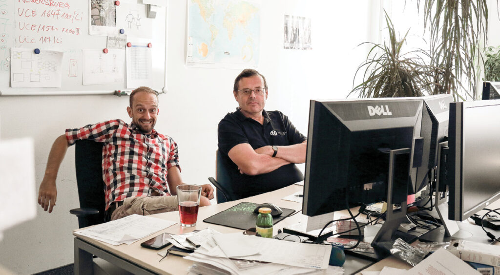
Marc Muick and Michael Gruber (from left to right) working in the office.
Michael remembered, “The large black and white photo in my office is one of the first UltraCam images, from what I call UltraCamA because it was the first one. It had a manual shutter—I had to operate the shutter string while the pilot gave me a sign based on what he saw on the navigation panel. He did this, and I pulled the string to get the proper overlap—no flight management system at the time.”
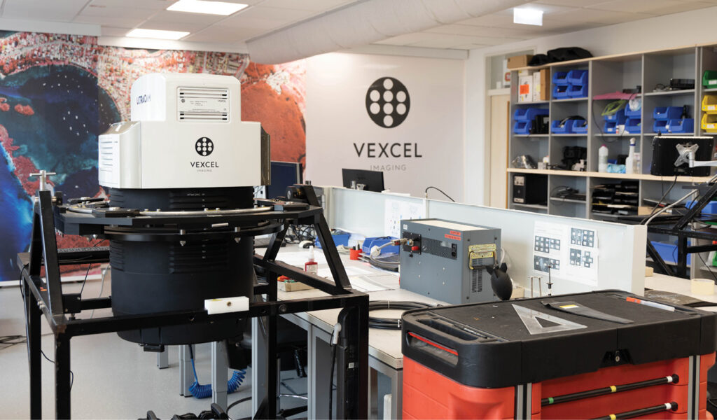
The mechanics workshop
We moved through the building to the rear offices, where I asked Michael about the headcount: approximately 75 in Graz and 10 in Centennial, Colorado. From there, we continued to the mechanics lab and workshop. Michael explained what we were seeing: “Here are our cameras on their special carriages, allowing our support team to handle them easily. When a new camera arrives from Wild Austria, we perform calibration, conduct all necessary tests, complete a final in-house quality control check, and then undertake a flight mission. Every camera undergoes a verification flight where we perform aerial triangulation, assess the camera’s quality, and conduct radiometric checks to ensure everything is functioning correctly before it goes to the customer.

A photograph captured by the very first UltraCam hangs on the wall in the office occupied for many years by Michael Gruber.
“We have a test area in Gleisdorf, a village near Graz, another in the village of Hartberg, and several ground control points in Graz itself. Additionally, we have a test area north of the Alps in case of bad weather.”
The second responsibility of this team is support. They handle repairs, servicing, and calibration of UltraCam systems.
Michael continued, “I believe that the variety in our work is why our support staff have an average tenure of over 12 years. Across all departments, we have a very stable team of developers, engineers, and experts with low turnover, which is extremely important. Their deep technical knowledge is central to our success, enabling us to develop faster, innovate more effectively, and respond quickly to market changes.”
Camera calibration
We moved to the basement, where Vexcel Imaging handles storage and camera calibration. Michael explained that the calibration process begins by precisely measuring fixed points using a total station. The cameras are set up in three specific positions, adjusted for different focal lengths, and then rotated to create a dense grid of control points. This method produces highly redundant images, which are essential for accurately evaluating camera parameters.

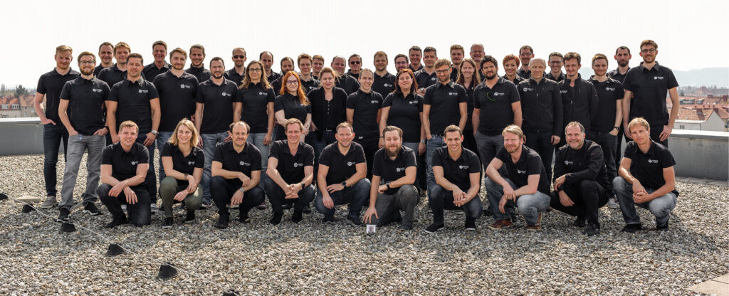
The highly skilled Vexcel Imaging team at their headquarters in Graz, Austria.
Michael noted: “Unlike some methods that use random targets, our approach relies on a limited number of precisely measured positions, ensuring greater accuracy. This method, supported by published papers, can be a strong selling point due to its precision and reliability.”

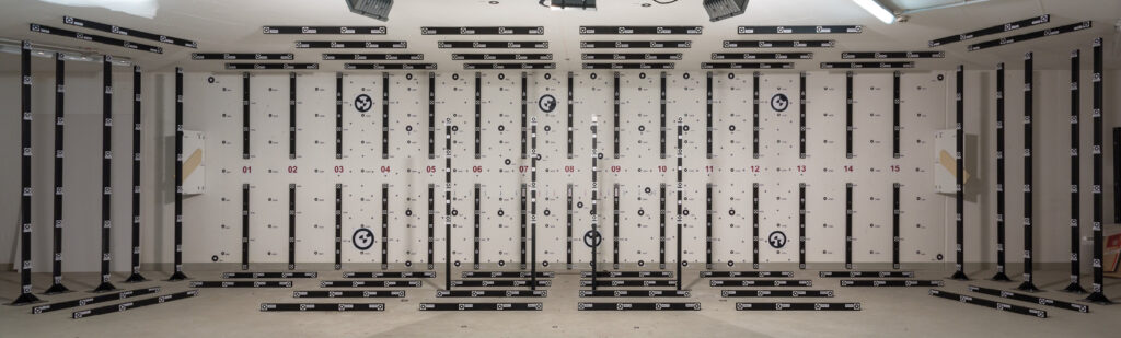
UltraCam calibration room.
The Microsoft years
During Vexcel Imaging’s time as a Microsoft subsidiary, the experience was transformative. Microsoft brought immense value to the company in many aspects such as management, the software development process and innovation, and the company almost doubled its size. In return, Vexcel Imaging was driving significant advancements for Virtual Earth and BING maps. The company also moved to a new building in 2007 that met Microsoft’s stringent security requirements.

A Vexcel Imaging engineer performing a camera calibration.
In 2016, ownership of Vexcel Imaging GmbH transitioned from Microsoft to a newly founded holding company in Graz, backed by four key individuals: Erik Jorgensen, former Microsoft Vice President; Stephen Lawler, former BING CTO; Martin Ponticelli, CTO of Vexcel Imaging; and Alexander Wiechert, CEO of Vexcel Imaging.

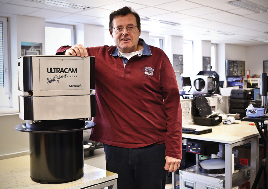
In 2016, a customer insisted that the mastermind behind the UltraCam sign their new UltraCam Eagle before delivery. Michael was happy to oblige.
When Vexcel Imaging became independent again in 2016, it was remarkable that the company sustained its unique culture, product focus, market, and business rhythm without disruption. Unlike many IT companies that struggle after being acquired by large tech firms, Vexcel Imaging remained intact, continuing to thrive on its own. “For me, it was the second wonder. The first wonder was when Microsoft acquired Vexcel Imaging”, Michael elucidated.
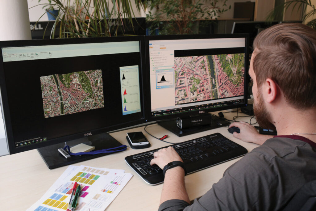
The UltraMap software
During our tour of the office, we discussed Vexcel Imaging’s software solutions, particularly the UltraMap photogrammetry suite, which includes five modules for processing UltraCam imagery into point clouds, DSMs, DTMs, ortho imagery, and 3D textured TINs. Michael noted that, of the 75 employees in Graz, only 20-25 focus solely on software development, acknowledging that this is a relatively small team. Remarkably, every line of code for UltraCam and UltraMap is developed entirely in-house.
UltraMap is Vexcel Imaging’s comprehensive all-in-one photogrammetric software suite for processing UltraCam imagery.
UltraMap was initially designed to process UltraCam image data, from raw files to what are called Level 3. Over time, the team expanded the software to encompass the complete photogrammetric workflow, including aerial triangulation. Initially, they integrated the BINGO software for bundle adjustment, but later transitioned to the CERES library, embracing new methods from computer vision.
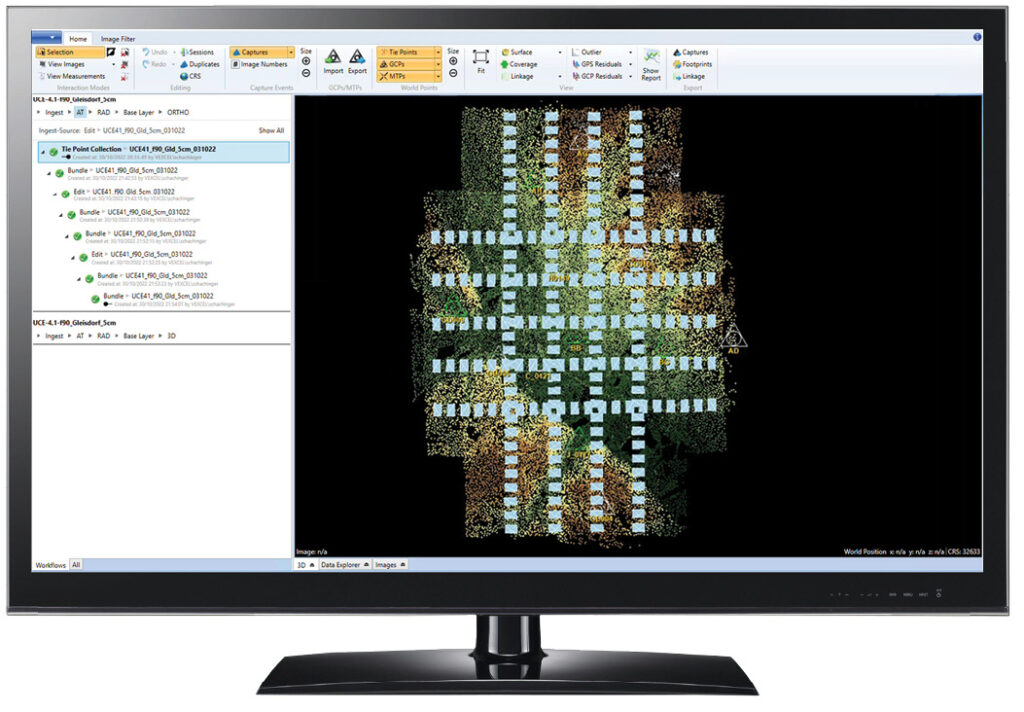
Michael highlighted how Vexcel Imaging benefited from Microsoft’s ownership. One of the key developments under Microsoft was dense-matching technology, although they couldn’t commercialize it at the time. Michael emphasized that while they couldn’t defend the technology in the market, they eventually introduced innovative features such as a visual analyzer in the aerial triangulation module. This tool helps users understand large data blocks, such as identifying different flight days or analyzing tie point collections, enhancing the overall usability and effectiveness of the software.
This user-friendly, highly automated software offers efficient data interaction, editing capabilities, and robust visualizations, complete with integrated quality control tools and options for manual adjustments. UltraMap guarantees successful project execution, no matter the scale or deadline, by providing flexible subscription licensing and distributed processing to maximize performance and scalability.
The next generation of UltraCam
Over the years, Vexcel Imaging has achieved significant milestones in aerial camera development, one of which was the introduction of the UltraCam Eagle Mark 3 in 2016. This camera marked a major leap forward, with its pixel count representing a fivefold increase to 449 megapixels per image over 14 years. In 2011, an earlier model of the UltraCam Eagle had become the first aerial camera to capture more than 20,000 pixels across the flight strip.

UltraCam Eagle Mark 3 ready for data capture. The image format is 26,460 x 17,004 pixels, i.e. 449 megapixels.
In 2020, Vexcel Imaging launched the UltraCam Osprey 4.1, the first of its fourth-generation cameras. This model included many innovations, for example, a transition from CCD to CMOS sensors, new sensor electronics, custom lenses, improved motion compensation, and a revamped computer and storage system. The Osprey 4.1 collects nadir and oblique imagery in four directions simultaneously, featuring advanced panchromatic, RGB, and near-infrared cones. This groundbreaking camera earned Vexcel Imaging a MAPPS Innovation Award.
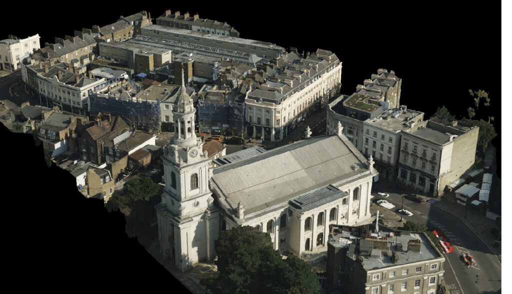
A key advance with the UltraCam Osprey 4.1 was the introduction of Adaptive Motion Compensation (AMC), a novel software-based solution that compensates not only for forward, but also for multi-directional motion blur, making it the only solution of its kind on the market. This technology proved crucial during a 2020 Vexcel Data Program (VDP) mission in London, where the UltraCam Osprey 4.1 successfully captured high-quality imagery at a 3 cm ground sample distance despite challenging conditions, including limited flight windows, cloud cover, and turbulence. The data from this mission remains in the VDP library today.
Given Vexcel Imaging’s long-term success and the constant innovations, I wondered what its secret is. Michael gave his opinion: “Besides the excellent team, we have been fortunate to have excellent products at the right time collaborating with the right partners. If you introduce something too early, you must spend a lot until the market is ready. If you’re too late, you face strong competitors and miss out on potential market share.”
The Vexcel Data Program (VDP)
In 2020, Vexcel Imaging expanded its long-standing history of remote sensing success by acquiring imagery and aviation assets from Verisk. This acquisition instantly increased the Vexcel Group team to around 450 people. Leveraging these new resources, VDP became the provider of the world’s largest aerial imagery and geospatial data library, covering over 40 countries. VDP offers eight different products, ranging from oblique to true ortho, DSM to multispectral, and includes Elements for the most up-to-date property and building attributes such as roof condition, roof material, defensible space metrics, and more.


Views of the same London area: (from top to bottom) 2.5D DSM and TrueOrtho mosaic (from nadir images); 3D mesh and textured 3D mesh (from both nadir and oblique images).
Michael elaborated on this, “A special program within VDP is the disaster imagery service, known as Gray Sky in select countries. Through this program, VDP collects imagery following hurricanes, wildfires, floods, and other disasters, and provides this data to insurance companies, governments, and first responders. We are pioneers in this damage assessment at that scale.”
The launch of the fundamental camera family Merlin
In 2023 Vexcel Imaging utilized the simpler technical approach of sensors based purely on Bayer-pattern technology for a new family of cameras called UltraCam Merlin 4.1. Two models, Merlin 2010 and Merlin 3020, have been launched, addressing different footprint sizes and budgets. The simpler technical concept of pure Bayer-pattern cameras enables more aggressive pricing in return for some impact on the image quality. Nevertheless, since the Merlins share a great deal with the premium line-up, such as lenses, shutters, camera design and Adaptive Motion Compensation, Vexcel Imaging is carrying the industry-leading UltraCam quality into this camera segment too, as Alexander Wiechert has emphasized on several occasions.

The UltraCam Osprey 4.1 was introduced in 2020.
The arrival of lidar: UltraCam Dragon 4.1
As we neared the end of the interview—and remember, this was more than a year before Vexcel Imaging announced the UltraCam Dragon 4.1 with its integrated lidar unit from RIEGL – our conversation moved on to lidar and hybrid sensors. Michael noted that the necessity of lidar would be determined by the market in the coming years, highlighting that Vexcel Imaging’s Osprey imagery already supports advanced photogrammetry, especially for urban mapping.
In October 2023, Vexcel Imaging announced its first hybrid aerial mapping system: the UltraCam Dragon 4.1. It produces high-resolution nadir and oblique aerial imagery enriched with precise elevation information from a powerful 2.4 MHz RIEGL OEM lidar scanner. The lidar sensor’s innovative multi-axis scanning geometry, including a true nadir scan line as well as forward- and backward-looking scan lines, ensures maximum coverage for truly impressive and complete digital twins. Two high-resolution nadir sensors (RGB Bayer pattern and NIR) and four oblique (RGB) sensors consistently deliver sharp and accurate imagery through advanced image processing techniques, including AMC. Vexcel Imaging’s assertion is that the integration of best-in-class sensors facilitates in-depth analysis and a profound understanding of the as-built environment.
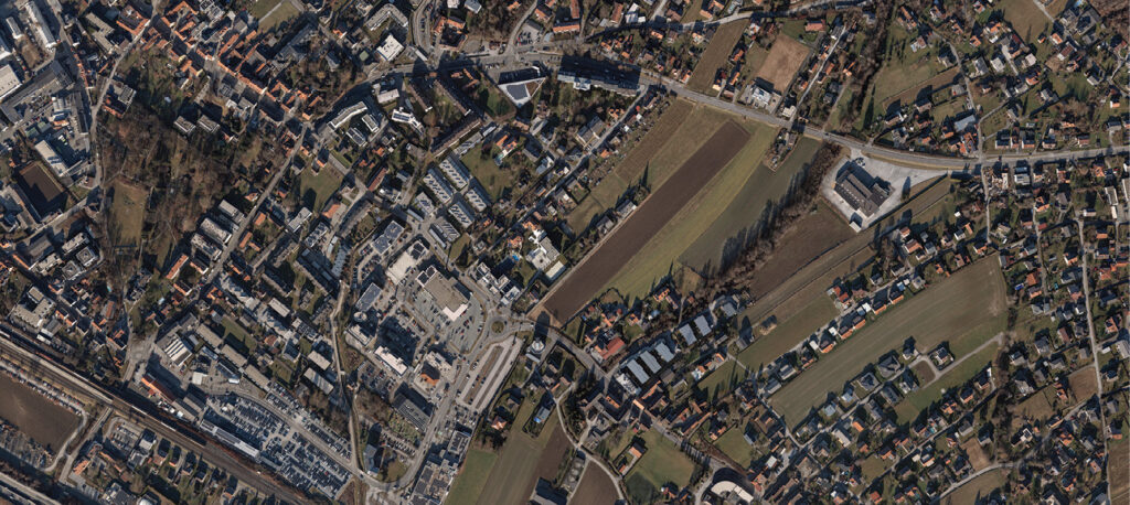


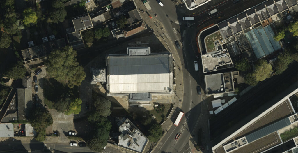
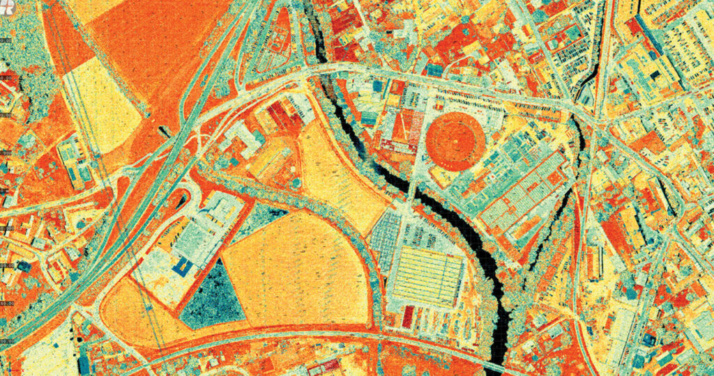
Aerial imagery and true ortho of Gleisdorf, a small village near Graz, from the UltraCam Merlin 4.1.
Michael Gruber retires
The final incentive to accelerate this piece into print was the announcement in July 2024 that Michael Gruber had retired from Vexcel after more than 31 years with the company. LIDAR Magazine congratulates Michael on making an enormous contribution to the aerial mapping business through his work with the cameras over three decades. We hope this article enables readers to remember Michael and value his innovations and energy.

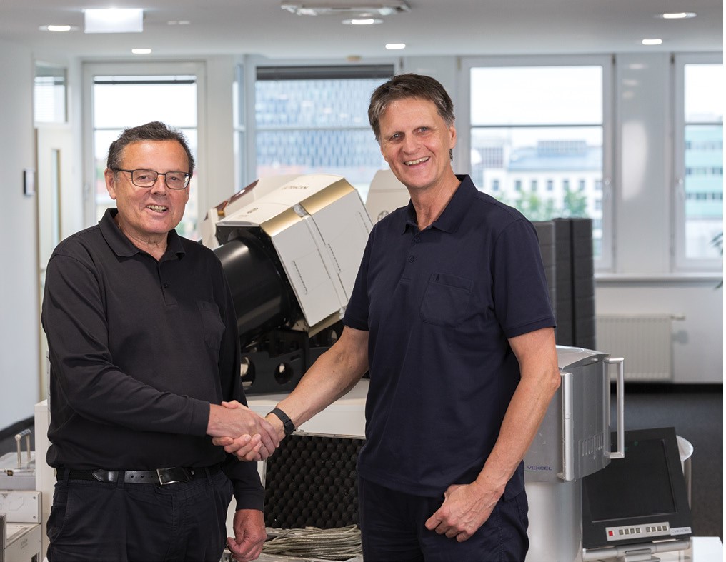
Michael Gruber and Alexander Wiechert, CEO of Vexcel Imaging (from left to right), on the occasion of Michael’s retirement.


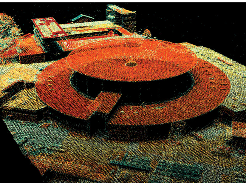
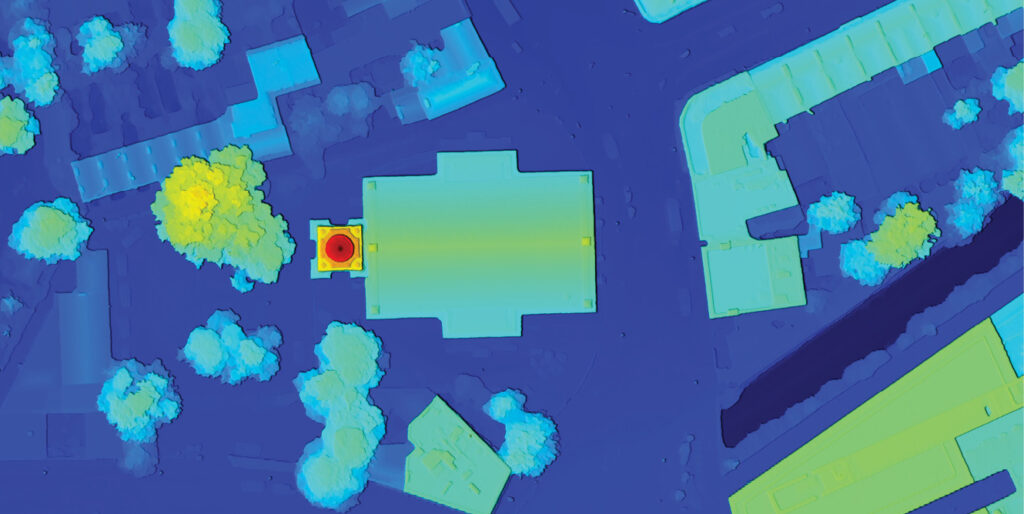
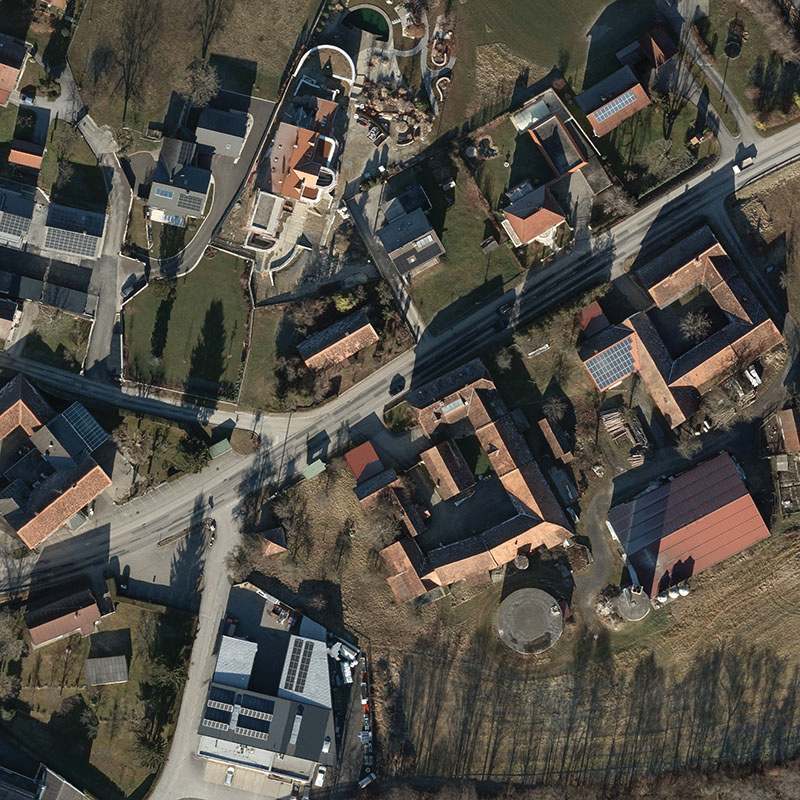
Lidar data from Gleisdorf, captured with the UltraCam Dragon 4.1 during a test flight.