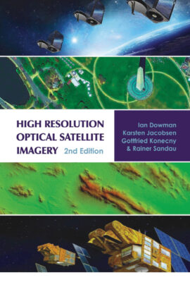
High Resolution Optical Satellite Imagery 2nd Edition
Ian Dowman, Karsten Jacobsen, Gottfried Konecny and Rainer Sandau.
- Whittles Publishing, Dunbeath, Caithness, Scotland, 2022.
- 247 x 175 mm, xvi + 271 pp, 202 color and black and white illustrations, 28 tables, index.
- Hardback, ISBN 978-1-84995-390-0, £95.
 This is a major update of a volume first published in 2011. The authors are all renowned—giants, indeed, of our profession—and your reviewer ought to reveal that he knows each of them well. All four have immense experience of researching and working with satellite imagery.
The authors set out their stall early. They start with the ASTER sensor and define “high resolution” as ground sample distance of 16 m or less. They eschew Landsat to some extent on the grounds that the imagery is typically not used photogrammetrically. Later on they further separate out very high resolution (GSD <2 m). The book does not cover lidar or radar, which are hardly “optical imagery”, though both ICESat-2 and IfSAR are mentioned, the latter, however, without acknowledgement of the new constellations that are becoming operational.
The book has nine chapters. After an introduction by Dowman, Konecny takes us on a whistlestop, rather idiosyncratic history of satellite imagery—a delightful, engaging read from someone who was involved in the photogrammetric treatment of space images from the very beginning.
Then we come to the entrée. Chapter 3, “Principles of high resolution optical sensors,” by Sandau, shows the author deep in his comfort zone. Moreover, he places many of the principles he introduces in the context of topographic mapping. The material is essential to a full understanding of the acquisition of optical imagery from space, but is intense in places and readers would benefit from going through it more than once. The next two chapters, however, are more descriptive than analytical: “Sensors with a GSD of greater than 2 m up to 16 m” (Jacobsen and Dowman) and “Sensors with a GSD of 2 m or less”. These are useful, but the short accounts of a large number of satellites constellations and the sensors they carry are not only a little daunting, but also the part of the book that will most rapidly become outdated. Jacobsen, in turn, is embedded in his own specialist area in the excellent chapter 6, “Calibration, sensor models and orientation.” Many of us have admired his presentations and publications in this area and, happily, the chapter is long enough to go into some detail. Jacobsen is also responsible for chapter 7, “Processing and products,” which is equally masterly. He covers a considerable breadth of material, yet there is enough detail to hold the reader’s interest and he manages to cite examples of products that emerge at the end of the processing workflow. The sections on image matching and elevation extraction are especially fulfilling. The part on orthorectification includes this apt remark (p. 217): “Qualified orthoimages should be corrected manually for deformed bridges to avoid scepticism of orthoimages.”
Chapter 8, “Applications,” by Dowman and Jacobsen, on the other hand, is quite short and does little more than scratch the surface of what is possible with modern satellite imagery. This is acceptable, because this topic could so easily swamp the book if any sort of comprehensive account were attempted. Dowman assumes the responsibility of the final chapter, “Conclusions and future developments,” and wisely provides a valuable summary of the state of the art while refraining from predictions. In both chapters 8 and 9, the authors mention some of the companies and organizations involved in acquiring, processing and disseminating imagery and touch on the mergers and acquisitions that lie behind some of them. There is welcome coverage of policy issues too. Perhaps the book would have benefited from even more discussion of business questions, such as the effect of free-to-download imagery that some government suppliers provide on the economics of commercial imagery from both large and small suppliers; the dependence of profitability on large infusions of revenue from government defense agencies; and the changing nature of the customer base. Some readers would conceivably benefit from advice on when to use images acquired from satellites, as opposed to aircraft, UAVs or ground vehicles—today we have an embarrassment of riches and the decisions become more complex as the resolution of satellite imagery increases.
This is undoubtedly a useful synthesis. Readers will be grateful for a source so up to date—at least until things change! The authors have done well to compress a wealth of material into a volume of reasonable size. The price is not unreasonable as modern textbooks go and the publisher has not been grudging in using color wherever it enhances the graphics. Nevertheless, your reviewer found innumerable small mistakes, not just typos, but incorrect cross-references to sub-sections and figures, many of which were presumably caused by insufficient checks on changes necessitated by the update from the first edition. The three German authors are completely fluent in spoken and written English, but many sentences have slipped through which, while correct sensu stricto, include mechanical, unnatural expressions in English. Your reviewer was left with the feeling that, in the rush to publish, a final check by a meticulous sub-editor did not take place. There are also some technical errors, such as referring to CE90 as a measure of elevation accuracy. Some initialisms and acronyms are not in the list at the beginning of the book. The result is a disappointing quota of irritants—unusual from this highly competent publisher with a strong track record in geospatial offerings. Nevertheless, the book is attractive and LIDAR Magazine readers with more than a passing interest in the extraction of geographic information from space imagery would do well to read it.