Have you noticed how the attention of cats – and doubtless of other species – focuses on anything that’s different, such as an addition to the toy box, or a new cushion on the sofa? Your scribe is similarly tempted by distractions. On waking up, I partake of a quick tour of the liberal elite press, usually devoid of front-page stories with any elements of hope. On the morning I was planning to write up my visit to Geo Week in Denver, my eye caught a story in The Guardian about the use of lidar to discover important archaeological remains in England [1] – lidar on the home page of a major national newspaper! The further excitement is that a star in the piece is GEO1[2] (now part of NV5), an adventurous flying company operating out of Hawthorne airport in Los Angeles, and its founder and CEO, Ron Chapple, who has written for – and been mentioned on numerous occasions in – LIDAR Magazine. GEO1’s work at Ciudad Perdida in Colombia has been invaluable. Co-star is David Ratledge, a retired engineer in the north of England, who uses public-domain lidar data from the UK Environment Agency to uncover Roman roads[3]. During his peregrinations, David met a tractor driver who was unaware of a Roman road on the farm, but knew that if he drove his tractor along the mysterious linear feature, it would not be bogged down in mud as it would off to the side! The key message, however, is that lidar-related discoveries enable archaeological work to go faster and be completed before priceless sites are destroyed by urban and agricultural spread, international conflict or climate change.
On a far less happy note, our technologies are in the forefront – and the world press – elsewhere. The Economist asked Ollie Ballinger, a geocomputation whiz at University College London, to use Sentinel-1 SAR data acquired before and after the Turkish earthquake on 6 February 2023, combined with building maps from Microsoft and OpenStreetMap, to identify damaged buildings[4]. The study areas exhibited 2% to more than 20% of buildings incurring damage. The impact was greatest in the poorest areas. The Economist surmised that, “… pricier structures are sturdier,” and concluded, “Living in an earthquake-prone region with lax building codes is risky. Doing so while poor is even riskier.” Sad, but probably true. For us the message is that our methods are gaining attention. That grants us credibility – but brings extra responsibility to work professionally and ethically to generate the best results we can.
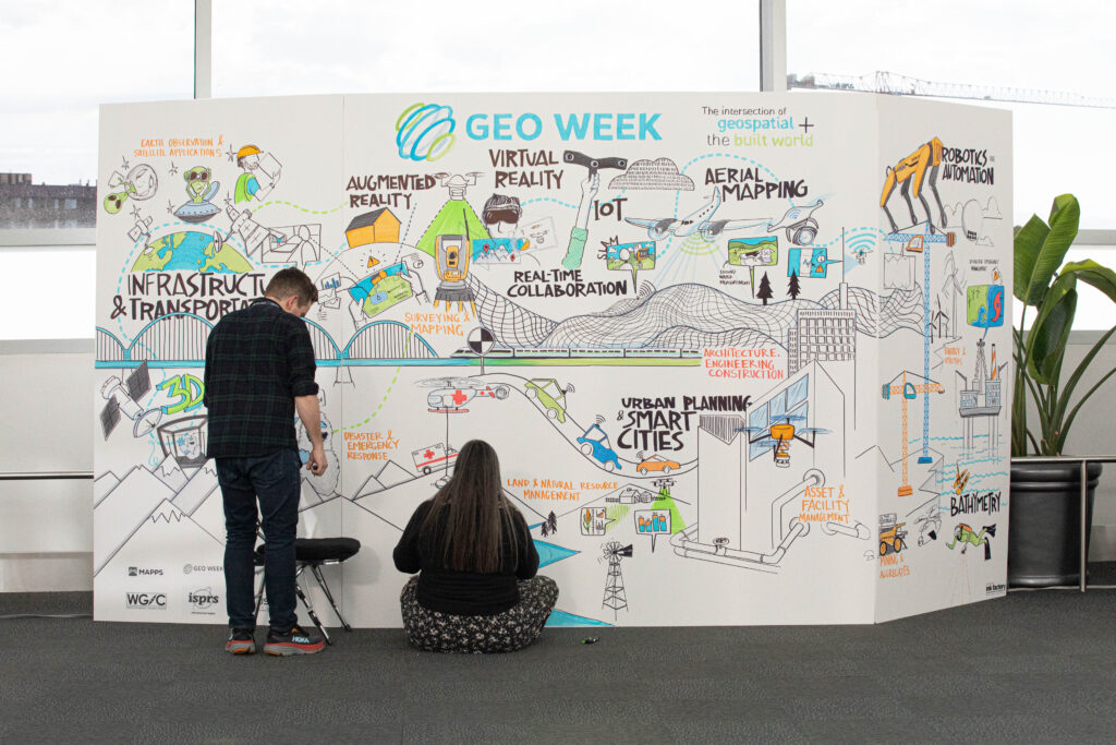
And so to Geo Week. The numbers, provided by Lee Corkhill of event organizer Diversified Communications, are amazing:
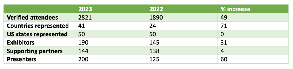
What is the reason for this success? Are people more sure of the receding danger of covid than a year ago? Or are they less risk-averse? Whatever the drivers were, it was a wonderful, vibrant event.
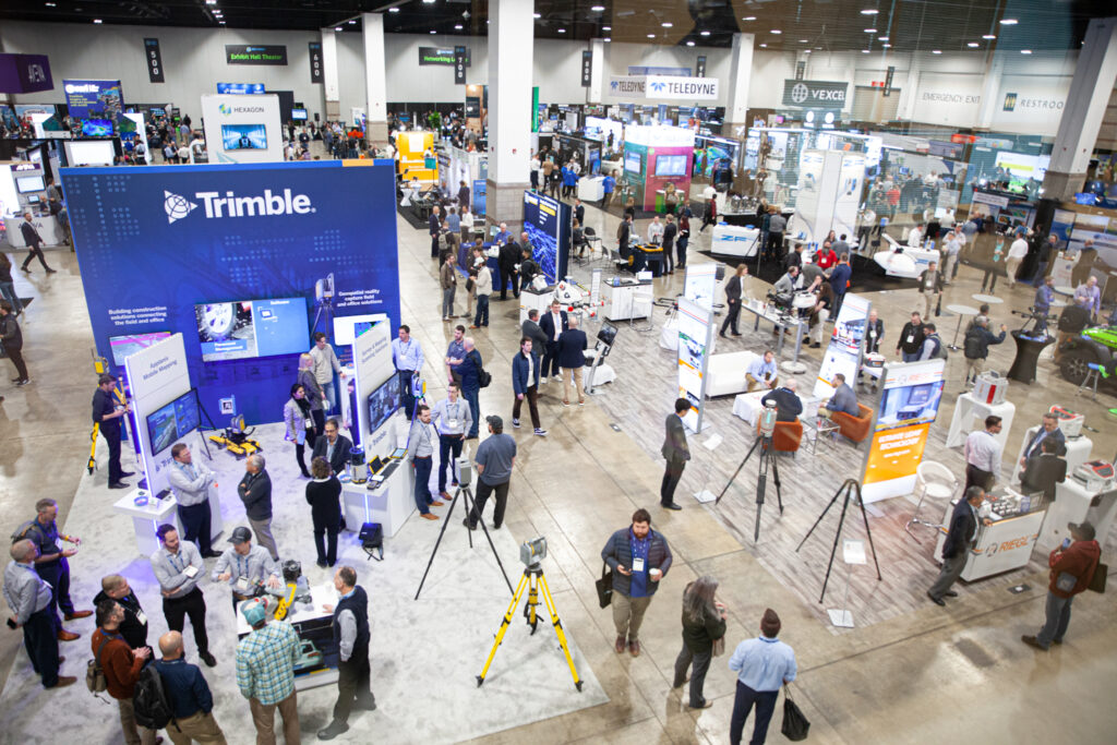
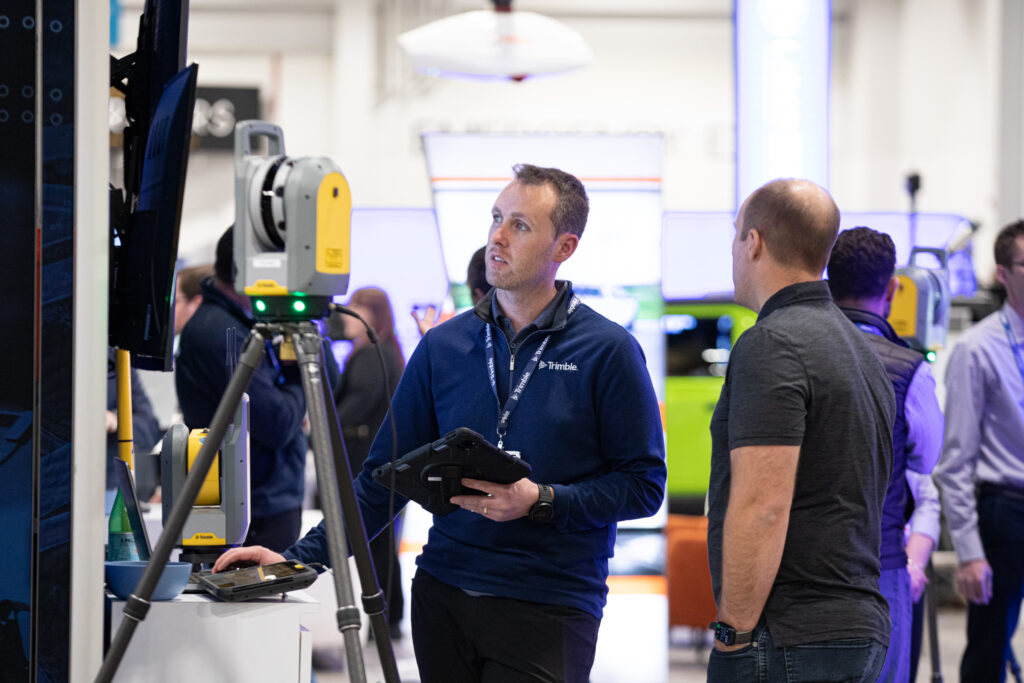
My event began with the long march from the entrance of the Colorado Convention Center to registration, then the product previews, a series of brief presentations of companies’ wares in two rooms. Many of us jumped between the two to hear particular vendors, a process occasionally stymied by one room or the other running ahead or behind the published timetable. Nevertheless, the session seemed less of an endurance test than in previous years and a valuable source of up-to-date information. As I listened, I marveled at how many of the players have staying power, i.e. I remember them being new but now they are established with many years of success and thousands of fielded systems, such as SBG in GNSS/IMU, TopoDOT in point-cloud processing software, and Phase One in medium-format cameras. Peter Becker gave a typically well prepared and polished update from Esri and, like many speakers, mentioned the growing role of AI/ML/deep learning. Other speakers from the big players, such as Michael Sitar and Tan Nguyen (RIEGL), Skyler Neumeyer (Trimble), Malek Singer (Teledyne Geospatial), Tom Cerchiara (Pix4D) and Jerry Skaw (Vexcel Imaging), were really good too! Moreover, with 190 exhibitors in action it would be impossible to visit every booth, so the previews functioned as a selection process. In these sessions – and all the others that I attended, except for the keynotes – there were less than 200 people in the room. Where do people go during conferences? At Geo Week, they go to the exhibition!
The opening keynote session, “How ready is the AEC industry for digitalization,” followed Diversified Communications’ favored format of a well briefed moderator and a group of distinguished panelists, but sometimes I worry that packing so much into an hour – which also must contain some audience questions – may damage the depth of the panelists’ contributions. The efforts of Steve Jones (Dodge Data and Analytics) at the helm were energetic and some interesting issues were probed on a topic that is critical. I’m not from the construction industry, but I find the contrast between the talented people and remarkable technologies at its disposal in parallel with the stubborn survival of ancient practices somewhat incomprehensible.
I had the privilege of moderating a session, “Industry spotlight: surveying and mapping.” Strong speakers from DroneNerds, HDR Engineering and SurvTech Solutions illuminated technologies and challenging projects, bringing a wealth of experience to a fascinated audience. I moved on to judge poster papers from three universities for the Lidar Leader Award for Outstanding University Achievement and enjoyed lively, wide-ranging conversations with representatives of Oregon State University, Embry-Riddle Aeronautical University and Queen’s University, Belfast, Northern Ireland.
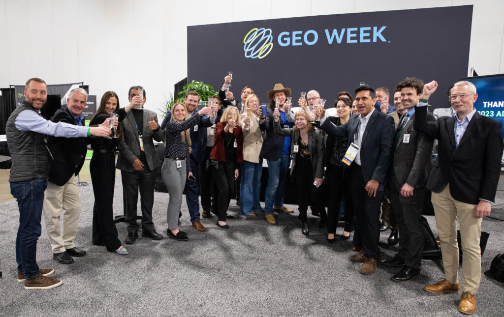
Having a reception in the exhibition area on two evenings rather than one was a welcome networking opportunity. Some of us old hands maybe reflect nostalgically on the “Lidar and Lager” evenings at the Wynkoop Brewery across from Union Station, but the 2023 attendance needs a bigger space – where better than in the exhibition itself?
I learned that GeoCue, which is promoting its in-house LP360 software, has split from Terrasolid. The latter is now represented by BAAM.Tech from Lenexa, Kansas. I learned a new acronym: JARI = just another RIEGL integration!
Tuesday’s keynote, like Monday’s, started late, but the audience was bigger, not surprisingly. Jack Dangermond took the stage – need I say more? He opened with a delightful perspective: he had addressed the annual meeting of ASP (ASPRS before remote sensing turned up) in Denver in 1982 and had said many of the same things! He was emphatic about GIS enabling the geographic approach to assist decision-making – “… a belief system, a basis for positive action” – and praised the work of the audience. I felt that he was a little quieter, a little less optimistic than usual, hinting, even, that we’ve passed the point where climate change can be reversed: “The world is in serious trouble.” A significant part of the talk was a masterly survey of eight significant innovations and trends, within which he necessarily discerned further trends. Jack has initiated some of them, leveraged others, carefully watched all. I hope we can gain access to the PDFs of the presentation: the wealth of slides in the familiar Esri format, lots of detail on a dark blue graphic, take times to absorb. All geospatial folk need this.
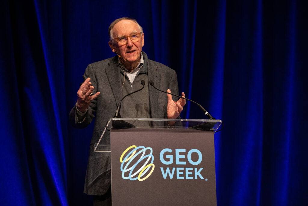
Esri founder and president Jack Dangermond delivers Tuesday’s keynote.
The next port of call was a session entitled, “Point cloud processing: best practices and tested workflows,” ably moderated by Martin Flood of GeoCue. The highlight was a presentation by Dan Bellissemo of GIS Surveyors, Inc. and Jon Leist of Deloitte about data management in a large power utility. During the Q&A, Martin provided the following advice, “… make sure you have a process, know your own best practices, then you can improve them.”
I joined a session, “AI/machine learning opportunities for geospatial data,” towards the end, soon enough to hear participants emphasizing that these technologies no longer need to be built from scratch – there are numerous, readily available toolkits to help. The keen audience participation reflected a strong awareness of the growing role of these technologies, tempered with apprehension that more knowledge and understanding are needed before the comfort level is right.
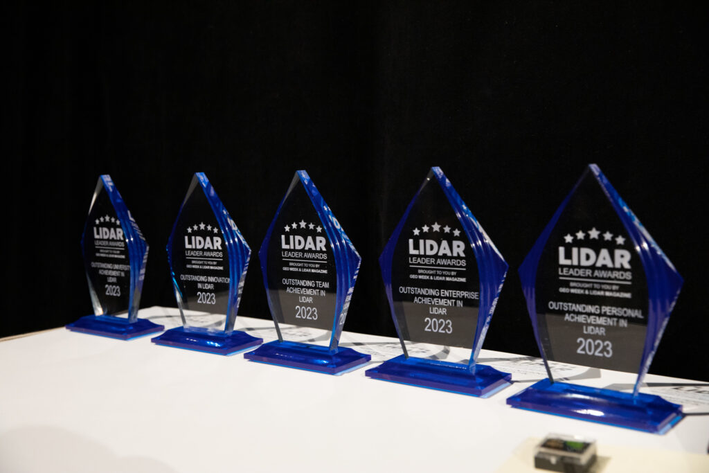
I presented the Lidar Leader Awards. This joint initiative of Diversified Communications and LIDAR Magazine began in Fall 2017 and the first awards were presented in 2018. We will report fully in the magazine, but a couple of comments are in order. The awards for Innovation Achievement in Lidar and Personal Achievement in Lidar were both won by Woolpert people – the former for the BULLDOG topobathymetric sensor and the latter by Dr. Qassim Abdullah. That says something significant. And the award for Outstanding University Achievement in Lidar was won by Queen’s University, Belfast, represented by Dr. Aaron Miller, presenting his university’s work in Denver only a few days after successfully defending his PhD thesis back in Northern Ireland.
Wednesday opened with an important session, ‘The collaborative impact and power of public, private partnerships from the natural (climate) environment to the “built world”’, co-moderated by Shawana P. Johnson of Global Marketing Insights and Barbara Ryan of WGIC. The panelists emphasized the importance of PPPs. I liked the pragmatism of Ed Kunz of Kucera International as he described some of the issues facing private surveying and mapping service companies, while at the same time underlining the global reach and remarkable technical competence that these organizations possess. Lisa Nisenson’s contribution on parking in Delray Beach brought us back to daily life and provided an interesting slant by describing the relationship between her company, WGI Geospatial, and the city government as a PPP. The Q&A began with a true teaser, “SDGs’ core foundation is to leave no-one behind, you’ve talked about raising the bar of technology, but it’s the west that does this, so how do you bring the others with you?” The panelists bravely argued that this really is happening – the input of the west in emerging economies gets the job done, while not only generating jobs during the in-country projects but also enabling local professionals to take over update and new mapping afterwards.
As we rejoice in the blooming of Geo Week, we have to retain a perspective. This is not a North American INTERGEO – it is only about a sixth as large – but it seems to be growing with surprising verve. Diversified Communications’ partners, ASPRS, ISPRS, MAPPS, USIBD, WGIC, bring their own flavors to a sumptuous geospatial smorgasbord. We look forward to Geo Week 2024.
[1] https://www.theguardian.com/us-news/2023/feb/23/lidar-technology-archeology-radical-thinking
[2] https://www.geo1.com ; https://lidarmag.com/2020/03/26/ready-willing-able-the-swat-team-of-lidar/
[4] Anon, 2023. Turkey’s earthquake, The Economist, 446(9334): 81, 18 February 2023.