LIDAR Magazine learned that a startup, ASTERRA1, was using L-band radar (frequency 1-2 GHz; λ = 15-30 cm) to detect leaks and enable clients to reduce unwanted waste of water. The company has an office in La Jolla, on the Pacific coast just north of San Diego, so managing editor Stewart Walker was despatched to talk to executive vice president James Perry, who joined ASTERRA in 2016 after spending the lion’s share of his career with Hewlett-Packard.
James Perry, executive vice president Americas, ASTERRA.
LM: James, thank you very much for taking time to talk to us. Please start by telling us something about yourself and how you came to be in a leadership position in ASTERRA.
JP: I had acquired experience, during an earlier part of my career at Hewlett-Packard, developing new businesses. HP is always looking for new inventions and Israel is a startup nation. Networking in Israel helped me find Utilis, which is now ASTERRA. I met Elly Perets [CEO] in 2016 and learned that he was looking for someone to lead the operations in USA.
LM: Please introduce us to ASTERRA. When and where was the company founded and why? Who were the founders and what was their motivation? How did the leadership team come together? How many employees are there? Is it public or privately owned? If it is private, I’m sure the financial data are very sensitive, but could you at least say whether the company is profitable and whether it is growing?
JP: The company was founded in 2013 by Lauren Guy, who is also CTO. He had participated in a grant by NASA to find water on Mars. He was working in the public sector and became conscious of how water is precious in Israel. Lauren used ALOS-2 PALSAR-2 to look for water in his parent’s yard. The control point was a garden hose. From there, he was able not only to develop views of soil moisture, but to develop a patented algorithm to differentiate water types. Using L-band, which is very sensitive to the dielectric constant of water, he was able to run an algorithm and find the signature of drinking water.
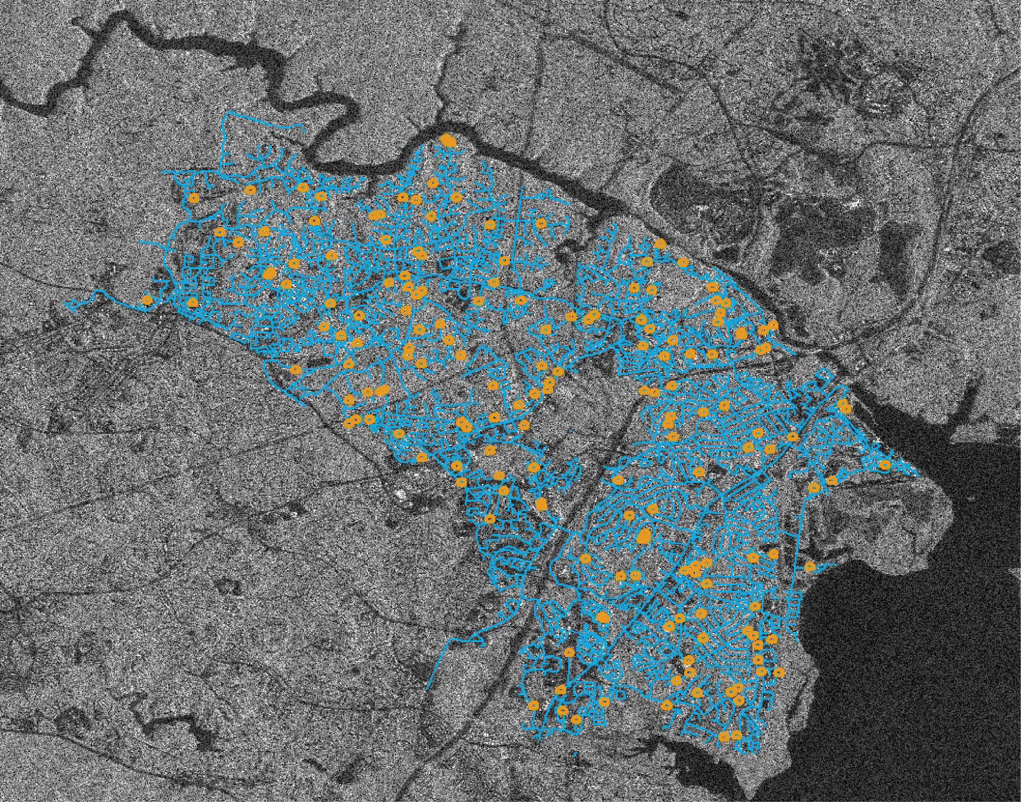
ALOS-2 SAR image over a municipality with the pipes in blue and leaks identified by ASTERRA in yellow. ©JAXA 2021.
Many PhDs in remote sensing say what we’re doing is impossible. Part of the challenge of invention in Israel, being a startup nation, is trying not to take no for an answer and look for creative ways to do things. To date, using our technology, which we provide to water utilities around the world, where we’ve done over 750 projects in over 60 countries, over various terrain, topographies and soil types, we have verified over 75,000 points of interest, finding leaks. So it’s an amazing success story, significantly better than the benchmark of how many leaks are found per day by manual inspection versus what you find when you’re using our technology, that digital approach to traditionally looking for leaks in water pipe systems.
Being an engineer, Lauren was looking at the size and repeatability of that signature to see if he could determine where pipes were leaking. Elly joined the organization in 2015 and he’s a businessman, not looking for perfection, but wanting to know, is it good enough to problem solve? Elly has the skills to be able to take complex issues and help find them a home. He took what we had and started to bring it to market. He tasked me with running North America, trying to do the business development and grow.
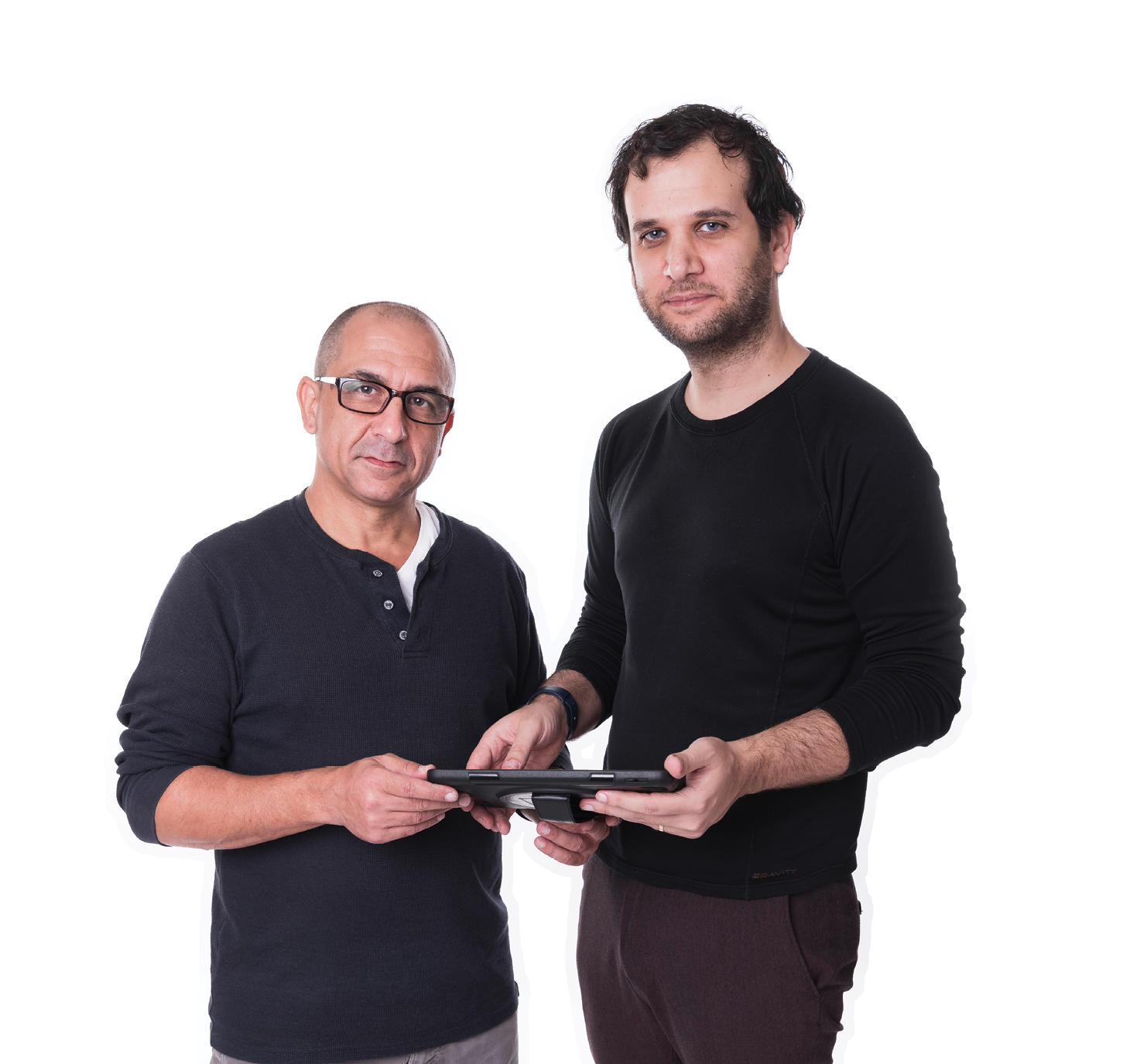
ASTERRA’s CEO, Elly Perets (left), and founder, Lauren Guy (right).
Recently, we added Central and South America, so we’re now the Americas organization, covering Latin America and North America. As you can well imagine, North America is the key market, half the business roughly, plenty of opportunity, enough homogeny to be manageable, even though there’s regional or application complexity.
Our second largest country is the UK, which has the right market dynamics for us with a lot of regulatory drivers. There are seven or so water utilities managing the entire UK, versus 50,000 in the US. We have a good partner in SUEZ Advanced Solutions UK. Italy is similar.
We’ve also started in China. It’s been a challenge. We’ve had some successes and we’ve learned a lot. We were doing well enough that we hired a resource, who is helping us run the market, which leads us into the potential to use the Chinese satellite for L-band that’s recently gone up. As in Italy, there are water scarcities and aging infrastructure—it’s the same story worldwide.
ASTERRA is a shareholder-owned organization with 75 employees. We started it like any startup. It’s usually aunts and uncles and family who are funding. After that, you go for more formal funding. We’ve done our Series A and, most recently, Series B. Some of the investors who actually knew Elly—again, it’s the Israeli tight community—saw that there was a need to move quicker from pure science into business. We’re in the midst of cycling into Series C. So you get investment, you still have to perform and get the right people who understand. It’s a real challenge to reach that tipping point for scaling, demonstrating doing one thing right; one time isn’t enough. We’ve been fortunate to bring in a good mix of investors who can help us with problems on scaling in the right way at the right time.
Initially we were very laser-focused in our problem solving. But our management has a skill set that not every startup has. We’ve moved from what we did first, which was essentially leak detection. We recognize that the skills that we develop are much more associated with Earth observation and monitoring. Our experience started with working with JAXA. As we’ve diversified and looked at new sectors, market segments and applications, we recognize that working with the data collectors, no matter what platform, is key—using it and commercializing it, the way that really no one has done, particularly in the sectors and segments in which we play. The winner of how this is going to look will be those who collaborate across the data that’s coming in—the downstream users of that data—and the problems and challenges that they’re going to solve are going to be the game changer.
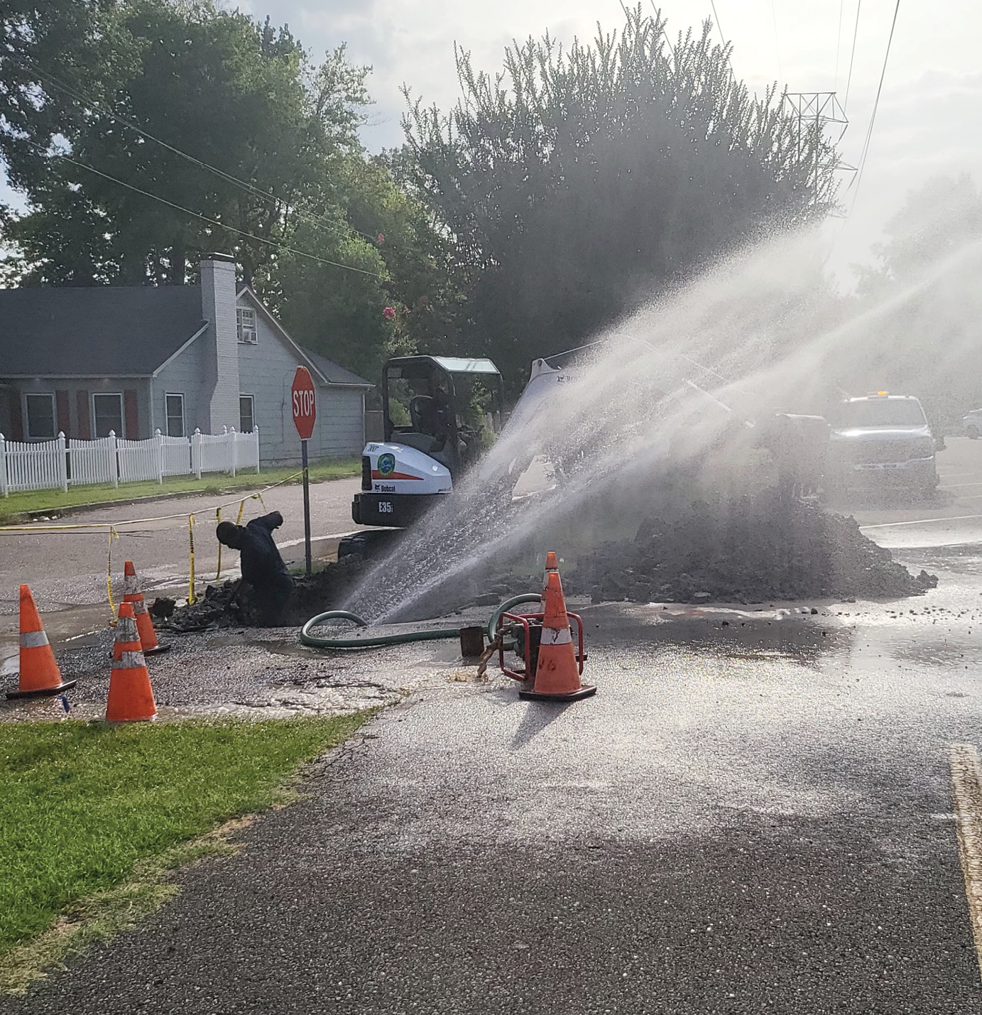
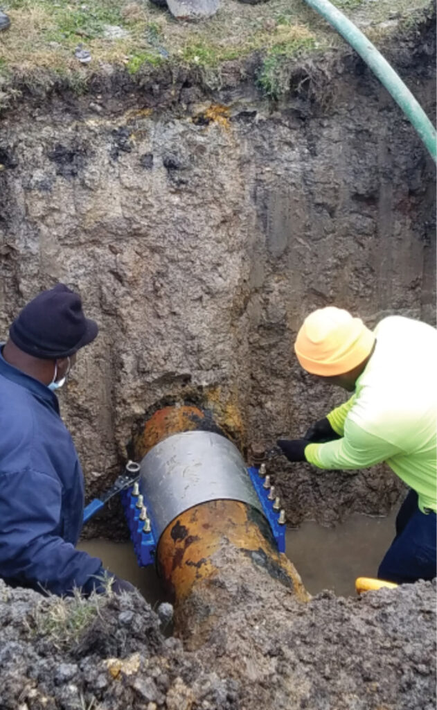
Images of an underground leak that was identified by ASTERRA in Greenville, Mississippi, after it was unearthed (above), and the subsequent repair (below). Credit: David Hangar, Water Maintenance Division, City of Greenville.
We’re looking for subterranean soil moisture with the expectation that failure will begin below ground before you see it and before being able to sense it with an in-ground sensor or something that’s going to read the surface. We’re going to be the first indication that there’s something going on. In any application, such as earthen dam monitoring, there are ways to use lidar, X-band, bands that are not going to penetrate below the surface, and to look for deformities. We can see below ground and estimate the percent of concentration of moisture, repeating it if you want to see change over time. By doing it consistently time over time, you’re going to build a profile of change and that really becomes the power of what we’re doing.
LM: Can you please sort out for us the difference between ASTERRA and Utilis?
JP: The company began as Utilis Ltd., and in the USA we were Utilis Inc. Utilis has been rebranded as ASTERRA. We changed the name because we were being identified as a leak-detection company only. We were struggling to get any awareness in other myriad applications that we see as key for growth. The name ASTERRA is derived from the Latin astra (stars) and terra (the earth on which we live) and the Greek Asterion (one of the three river gods). This rebranding will help us penetrate new markets around the world.
LM: Now we can move on to the technology! LIDAR Magazine is increasingly covering radar, so it’s exciting for us to encounter the novel applications for which ASTERRA is using it. Can you please describe the solutions you provide and the technologies you use to do so? We understand there are three—MasterPlan, Recover and EarthWorks. Is your approach unique? What technologies do your competitors use?
JP: It is unique. ASTERRA is the only company to do this. We use synthetic aperture radar to penetrate through snow, vegetation and ground. Water is a very important factor in any engineering project, so ASTERRA provides value by giving water data.
Yes, there are three key solutions: Recover, MasterPlan and EarthWorks. Recover and MasterPlan facilitate the recovery of water going through pipes—drinking water, wastewater or reclaimed water. Recover is the points of interest and MasterPlan is a full system survey. We can provide a deficiency layer for every single inch and don’t just pinpoint areas of interest. A single image covers up to 1400 square miles.
EarthWorks is field-verified, field-tested and field-proven to give soil moisture estimates underground. We are cost-effective and there is no competition. EarthWorks is the game-changer. We’re going into the mining industry, earthen dams and levees, and roads and rail. It’s a big market for us. It’s much more of a b2b play, including engineering firm work. That’s going to be our tipping point.
We know that traditional analog leak detection in the water industry can find about three quarters of a leak a day. These firms cover an entire system blindly, because it’s below ground. They’re trained to acoustically pinpoint below ground. When they went to our points of interest, they were finding four leaks a day. So instantly, you have a 400% improvement in the amount of leaks being found. We’re applying that methodology on some really key items like tailing dams with nasty chemicals in them that aren’t being monitored, that can fail. There’s no subterranean moisture view until we come along. In Brazil, there was a massive failure, 245 people died and chemicals were spilt. It happens every day: you hear about the big ones, but there are thousands of dams, some on mines that are shut down, that are supposedly monitored by the Bureau of Land Reclamation in the US—or not. They have limited tools. There are around four earthen dam failures a week. It could be a small pond. But they’re releasing, causing floodplain and channel damage. We’re looking at providing enough information covering big areas to make it cost-effective, working with engineering firms that will be tasked to monitor these things and do it in a way never done before.
LM: Which satellites do you use? What type of radar sensors do these satellites carry? Do you ever supplement the satellite radar data with data from satellite-borne multispectral or hyperspectral sensors or, indeed, from crewed aircraft, UAVs or ground systems?
JP: PALSAR-2 (1.27 GHz) data from JAXA’s ALOS-2 satellite is the primary data source. We’re the number one customer for JAXA! Secondly, we use L-band (1.275 GHz) data from SAOCOM-1A and -1B, an Earth-observation constellation from Argentina’s space agency CONAE in cooperation with the Italian space agency ASI. We’ve worked with the agencies on business plans. All three use L-band. By using these constellations, we can achieve an image around every five days. Indeed, many countries are recognizing the power and utility of L-band satellites. For example, China has launched L-SAR 01A—we’re helping them too. JAXA has plans for ALOS-4, NASA/Indian Space Research Organisation for NISAR, and DLR for TANDEM-L. The next big tech company that conquers the market for using satellite data hasn’t emerged yet, but it will combine data to provide solutions. There’s a good spirit to do that—people are willing to get together. We’ve shown how to develop a market and commercialize it profitably.
We also use small aircraft with L-band sensors for a different level of flexibility. In the future we plan to work with radar sensors in different parts of the spectrum, for example X-, P- and C-band, to provide complementary data and articulate movements below ground.
We worked with a company in Europe called MetaSensing2, which has a Cessna 185 and developed an L-band sensor, a quad-pole, airborne technology that is being used in Italy. The resolution is slightly better, you’re lower to the ground, you can use a stronger power source, etc.—a lot of advantages for us. The challenge has been operationalizing it. There have been some tax advantages that make it feasible for us to do operationally, profitably. We schedule flights around Padua and all over Italy daily. We’ve been working with it in the US, but have significant challenges with FCC certifications, and also costs. Flying a Cessna around at a moment’s notice has an associated cost, even though Cessnas generally are cheap and there are a lot of them up there willing to add multiple remote-sensing devices. There is a business model to be had, but we haven’t been able to get it to the point of an advantage operationally, or commercialize it, and satellites have been just fine for us.
LM: Have you explored making a deal with one of the large US commercial survey companies? I know them very well and they’re brilliant at what they do.
JP: We would love to talk to more of them. It can be a real challenge for us to match the point on the imagery to the ground. We used to do it successfully manually, but it takes time and money. So we’ve come up with ways to automate it and we’ve collaborated with people who do that in the mapping world, because it’s a pretty common challenge.
We have been able to work with MetaSensing in Europe to figure out a commercial model where they would build a second system and release it to someone here. The struggle has been getting FCC approval to be able to fly anytime, day or night. We’ve been able to coordinate some potential paths and times avoiding airports and that kind of thing. It’s more of an overabundance of caution than a real concern that you’re going to interfere with communication.
LM: Do you use lidar?
JP: We use lidar all the time, particularly for new applications, and setting up DEMs for areas of interest. We know that when you start to combine our subterranean moisture with other information, let’s say lidar, the greater the slope, the greater moisture equals significant likelihood of failure. So there are places like the Arizona cut on highway 101 in Oregon—there are only two north-south highways in Oregon and a lot of mountainous areas. If those roads are out, you risk shutting down, besides the people movement, the pulp industry, and instantly the CEO of Warehouser is going to call the governor and remonstrate. So they spend something like $35 million per year on one five-mile area where they constantly are using every tool currently available. They’re extraordinarily interested in the subterranean view, because they’re using surface-reading radar to be able to see what’s going on and, with what we’re providing now, they can add an additional data layer that will help inform them on where they want to pay attention. There are multiple examples of using slope with moisture to show hotspots, essentially, areas of concern for further field investigation.
We have many opportunities in coastal flooding, predictive analytics around failure. Insurance companies want to know, how high will the water go and how far inland. We can tell them and it involves lidar.
For example, we were working with a company that wants to buy a warehouse on the Chicago River. The seawall looks bad. The lender is saying the insurance is going to be very high because the seawall is going to fail. They contract us to see where the moisture is coming from. And then they fixed it, had lower insurance rates, and didn’t have to do the entire seawall but a small portion of it. It’s a private entity, so the insurance company was going to charge a lot of money that they didn’t need to charge because they didn’t have enough information. We gave them the information and they were able to save rates.
LM: So you must use a mixture of lidar where you actually commissioned flights, and lidar that is available off-the-shelf from federal, state, local government?
JP: For most of what we’re doing, with the exception of Italy, where we have access to more lidar information, off-the-shelf is good enough for us.
LM: You make extensive use of artificial intelligence. This is clearly an important part of your IP and you cannot disclose small details, but can you tell us something about how AI benefits ASTERRA?
JP: We take responses from field investigations. We have hand-verified over 75,000 leaks at the points of interest provided. These data points are fed back to our analytics team and this helps them strengthen our machine learning and AI models. We can leverage machine learning/AI along with our georeferencing data analytics to further develop markets and provide more solutions.
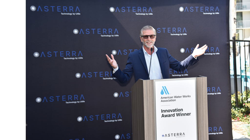
James Perry celebrates after ASTERRA wins an American Water Works Association innovation award in 2021. The celebration was virtual owing to the pandemic.
Dripping spigots on the side of a house cause a reflection strong enough for us to be able to differentiate. We have a buffer zone for field investigation, but that is more around the inherent properties of moisture: capillary effects like a sponge can combine multiple leaks. We had to find the sweet spot between what’s too small and what’s too big. Too small means too many points of interest to investigate; too big means low return on investment. How many miles do you walk in a field? How many leaks are you finding? How much water are you recovering? What is the water return?
Wastewater and reclaimed water are also part of our portfolio. But with gravity waste lines, there’s intrusion of groundwater, which leads to SSOs – sanitary sewer overflows. Systems with limited capacity can get inundated and nasty waters come to the surface. In the design-build phase, you need to know if there’s moisture below ground; in the operational maintenance phase you must make sure that the systems are tight and robust – we can inform.
We’re data scientists using remote sensing. The results are useless information if they are not comprehensible to the “plumbers”, who are out doing the field investigation work, who don’t have the same level of expertise. We had to walk in their shoes. I walked around many cities on the street, helping to find leaks as a proof point, not so much to prove empirically what we found, but to help them understand how to adopt the new technology, how to apply it, what it does and what it doesn’t do. It’s a real challenge not to be didactic and look like we’re telling them what to do when they have decades of managing a water system.
LM: Let’s talk about the business side. Do you provide your customers with one-off solutions, like a project, or do you offer them a service on some sort of subscription basis, whereby you provide regular updates? You are working in a market which, as yet, is not so well known to LIDAR Magazine readers, so please tell us, who are your customers—is there a clear categorization by, for example, public/private, type of industry, or geography? Is there a typical size for the area covered by solutions used by your customers? Can you give us some examples of customers?
JP: Our initial market strategy was to interview customers and understand their challenges. ASTERRA helps them save money. We work with water utilities, wastewater utilities, government agencies, AEC companies etc. by offering them a tool they never had before. In the early days, we ran pilots/projects to prove that our technologies work for customers to adopt. We provide a subscription model for all our solutions, and customers have access to data for problem-solving. East Bay Municipal Utility District (EBMUD) has been our customer from the beginning and we help reduce non-revenue water. We are active in 64 countries, working with all soil types to solve problems.
We’re orienting from a task-based model, for example a contract with a city to take an image and deliver what we learned from that, to much more of a SaaS or DaaS model, where you’re buying a data license for a period of time. We always knew we needed to do it that way, because of the depth and breadth of applications. The first thing customers want to do in the morning is download the latest data for any application or any location. That’s more of the data license model for us and shareholders like it, because it’s reliable, repeatable income. That’s the future of Earth observation and data analytics.
Central Arkansas Water, in Little Rock—a pretty innovative organization—they use our points of interest, which gets them close, but you still need to pinpoint below ground—not something you can see. Before you shovel, you need to field-confirm. They pinpoint with a dog that can sniff the signature of water; the chlorine in it. The annual American Water Works Association conference, ACE, was in San Antonio this year and the dog came to our booth!
LM: How do the UN Sustainable Development Goals impact ASTERRA’s strategy and business development?
JP: Sustainability is key for us. In our mission statement, we consider the importance of water (drinking water and wastewater) and saving this precious resource. We have worked with IDB3, UN, FEMA and EPA to raise awareness. Everyone at ASTERRA believes in campers’ rules (leave the place better than we found it). We recognize SDG goals 6 (ensure availability and sustainable management of water and sanitation for all) and 13 (take urgent action to combat climate change and its impacts). Sustainability is the key in all the segments and we believe in it.
LM: ASTERRA has its headquarters in Israel and, in addition to this office in San Diego, has an office in the United Kingdom. Is that correct? In addition, ASTERRA’s operations are supported by networks of partners, certified leak detection teams, and resellers. Could you please say more about how this all works?
JP: About half of our business is based in the US. The technology center and headquarters is in Israel. The UK is our second-largest market. We also have an office in Japan. We have significant business in China. Every country is covered by our reseller network and we sell direct in the US for the most part. We are pushing never-before-seen technology offerings into the private and public sector organizations, which are key on managing sustainability goals.
The leak-detection teams are third-party companies. We work with partnered leak detection teams; we call them “plumbers” in the field. We certify them, not to teach them how to pinpoint a leak, or work in the field, but regarding our best practices that we’ve seen from verifying 75,000 leaks. We’ve made sure that they’re up to date. We call them business partners, they’re subcontractors to us or they go direct. It’s not a business we prefer to be in, but we recognize we have to support the ecosystem for field investigation.
LM: There is no competition?
JP: No-one is using subterranean soil-moisture L-band to solve the problems, partly owing to our patent, and, probably even more, our IP and jumpstart. People are using other sensors to look for deformities at the surface, or moisture-reading sensors, or acoustic sounding sensors that go on hydrants. In the early days of doing this, there were tech wars: innovation officers at water utilities were asking which one works and why. Really, we all complement each other to solve problems.
LM: James, thank you very much for answering our questions. We look forward to publishing more about ASTERRA in the future.
3 Inter-American Development Bank