LIDAR Magazine returned to the annual INTERGEO trade show and conference in Essen, Germany, from 18 to 20 October 2022. Spanning three halls in the massive Essen Messe, the event attracted over 14,000 attendees from 102 countries and 457 exhibitors from 31 countries. The conference component of the event attracted 1,000 registrants. The event was hybrid and there were 1,800 remote attendees. For a feel of the venue, exhibition and more, check out INTERGEO TV.
We started on the Trimble booth, with explanations of the new X12 3D tripod-mounted laser-scanning system, covering not just the hardware but also on the workflows. Many other systems, such as MX50 and MX9, were drawing crowds to the spacious booth. Trimble staff highlighted a trend that we encountered elsewhere in the show: mobile mapping systems (MMS) are increasingly accepted, even to the point of being used for small projects that used to be carried out using tripod set-ups. MMS are sophisticated enough that accuracy levels for different purposes can be routinely achieved, with or without control points. To some extent, the vendors are still in an educational phase, i.e. users need to understand the capabilities and workflows before making large investments. Laser-scanners can be equipped with all kinds of cameras – panoramic, spherical, oblique, high-resolution vertical for examining road-surface conditions, etc. The Trimble folk mentioned update of digital twins as a target application. Applanix, a Trimble company, was adjacent, showing the AP+ Air GNSS/IMU: the company’s leading position in the UAV market reflects its strong, evolving portfolio. The growing significance of MMS was underlined in a conversation with Dr. Steven Woolven, president of Applanix, who referred to the uptake of mobile mapping as “unexpected” and cited a study that predicted a market-size of $70b by 2026. Mobile mapping has become, unarguably, mainstream.

Beauty in Essen: sunset behind the entrance to Gruga Park, with the Messe on the left and the Grugahalle concert hall on the right.
A chance meeting with RIEGL chief technical officer, Dr. Andreas Ullrich, on the evening before the event gave clues that RIEGL would make multiple announcements. When the magazine was given a booth tour the following day by Susan Licari, sales and marketing director at RIEGL USA, we began with the VQ-580 II-S, successor to the VQ-580 II, a powerful, compact sensor with increased measurement range. This is one of many RIEGL sensors that fits into the VQX-1 wing pod. Susan’s theme was that RIEGL is plugging gaps in its portfolio – certainly the company’s product range is now formidable. The VQ-1260 and VQ-1460 are new, coming in below the flagship VQ-1560 II-S. Their many features include PRFs of 2.2 and 4.4 MHz (a 20% increase) respectively and a range of 5400 m. The data recorder is integrated, they have touchscreens on top and red handles. We moved to TLS and the new VZ-600i, with features such as three cameras and GNSS integrated, ensuring that RIEGL retains its position as a leader in the long-range part of this market. On the topobathymetric side, the VQ-840-GL is a new design compared to its predecessor the VQ-840-G and boasts a 20% reduction in weight to 9.8 kg. There were yet more new products for UAVs, described for us by My-Linh Truong, division manager, unmanned laser scanning at RIEGL USA – the VUX-16023 and VUX-12023. The former weighs 2.65 kg and has a range of 1800 m. RIEGL has multiple products suitable for high-end UAVs, helicopters and lower-flying crewed aircraft, carving out space for itself – has someone in Horn been studying Blue Ocean Strategy? These come with the Applanix AP+ GNSS/IMU solutions. The performance of the VMY MMS range has been increased through integration of the miniVUX-HA sensor and the trend to compact, lightweight designs extends the platform possibilities. Finally, there were new releases of all software products. We came away breathless –RIEGL had not only produced an unexpectedly large number of new products but had densified its product range to suit the needs of a growing customer base.
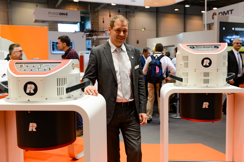
Peter Rieger, business division manager airborne laser scanning, with RIEGL’s new VQ-1260 and VQ-1460 systems for high point density and ultra-wide area mapping.
A presentation on the stage in one of the exhibition halls by Dr. Harald Teufelsbauer, RIEGL’s business division manager, mobile laser scanning, underlined the importance of these systems in the company’s portfolio – multiple products, suited to different applications and pockets, with various enhancement options.
Perhaps these stages, with indifferent sound quality owing to the babble from the nearby show, on which immaculately prepared presenters showcased their wares to audiences below 50, were hardly ideal, but it was easy to glean detailed information. Indeed, the stages in the exhibition halls offer access to information without walking hundreds of meters to conference halls and are a firm favorite at INTERGEO.
A second theme that resonated through the halls was, of course, digital twins, a direction strongly marketed by Esri and many others.
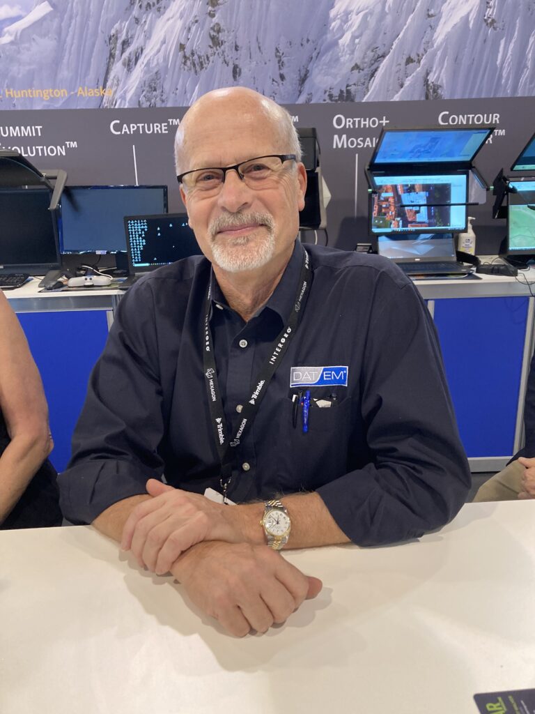
DAT/EM Systems general manager Jeff Yates celebrates 45 years with the company.
Though we felt the buzz as we walked the halls, it was impossible to visit every booth that seemed interesting. It was clear, however, that there are many new companies offering products somewhere along the value chain of UAVs, cameras, lidars, GNSS/IMU and processing software. Sorting this all out in three days was a herculean endeavor, but there are plenty of brochures and websites to absorb in the weeks to come. It’s not fair to single out companies but we’re going to anyway! On the DAT/EM Systems booth, not only did general manager Jeff Yates celebrate 45 years with the company, but there were no less than four stereoscopic viewing systems for the Summit PC digital photogrammetric workstation software. In addition to the current market leader, 3D PluraView from Schneider Digital, there were similar systems from Vision Engineering (Vectour) and VRLOGIC (SeeHawk3D), but most noticeable was a second Vision Engineering system, Contour, that didn’t require glasses to view. Using a technology with the exotic name TriTeQ3, the left and right channels were projected in such a way that the left eye sees the left channel and the right eye, the right. Vice president Stewart Mardell likened it to the complex optical systems of the analog and analytical stereoplotters of the past. Interest in stereoscopic viewing seems to be enjoying a resurgence and of course both point clouds and imagery can be seen to advantage with these systems.
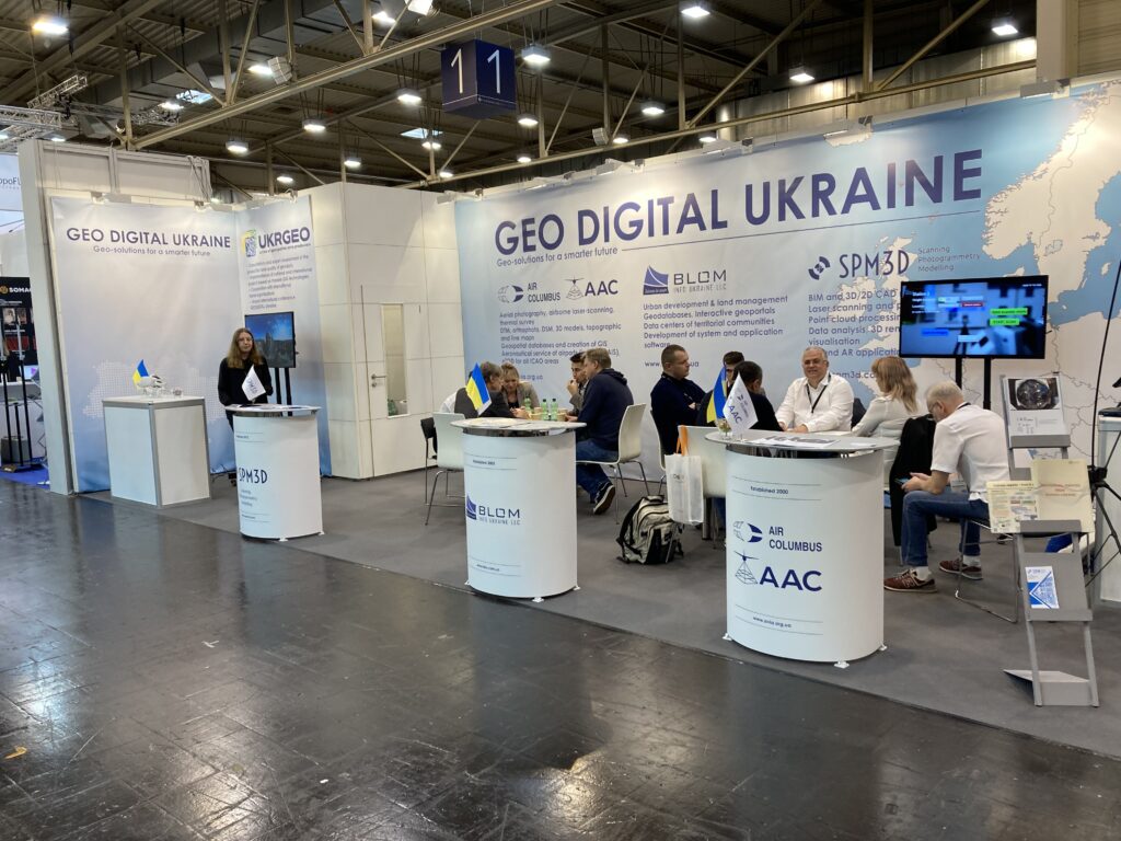
Ukranian bravery.
It was gratifying to see many Chinese and Korean players back on the road after covid and we talked at some length to Efrain Aldaz, global marketing manager, Green Valley International, and his colleague, Cody McColl, customer success manager, both from the Berkeley, California office of this Beijing-based UAV-lidar integrator. The thrust of the discussion was not the technology – the company uses products from well-known suppliers such as RIEGL, Hesai, Livox and DJI, so no worries on that score – but how to gain traction internationally in a packed, competitive market?
One of the new entrants was Advanced Navigation from Sydney, Australia, offering competitive, novel GNSS/IMU solutions that they build themselves in addition to intriguing devices and vessels for use in water, such as the Hydrus micro AUV.
The big press conference on the Wednesday was all about climate change. No longer do the higher echelons of our profession harbor deniers fawning to their fossil-fuel or red-state customers – if they ever did – because everyone accepts that there’s a planetary apocalypse threatening the future of homo sapiens. What can we geospatial folk do? This was addressed by the cream of the crop: Professor Martina Klärle (president of Duale Hochschule Baden-Württemberg and climate-change expert), Thomas Harring (Hexagon Geosystems), Scott Crozier (Trimble), Dr. Barbara Ryan (executive director, World Geospatial Industry Council) and Professor Hansjörg Kutterer (president of DVW e,V., the INTERGEO organizer). We have the tools, we know what’s going on, we are guiding our own companies to net-zero while making many environmentally appropriate innovations, there are digital twins (and even a “twin of twins”, whatever that is – quadruplets?), but can we rise to the next level and propose and implement solutions? Attendees probably came out of this convinced of our skills but unsure of our solutions. The big geospatial companies and NGOs shape our profession, but they don’t have the global heft of, say, big tech. Can they still make a difference? Maybe confidence is as much a factor as technology.
GeoCue was exhibiting, pushing its new, high-end True View 655/660 systems, based on the RIEGL miniVUX-3UAV and triple mapping cameras (right, left, a a newly added nadir one). GeoCue is now a member of the Microdrones group, which had a separate booth for the LP360 software – an interesting marketing bifurcation! UAV-lidar integrators Phoenix LiDAR Systems and YellowScan were among many companies featured in LIDAR Magazine which entertained steady streams of visitors on their booths. YellowScan, now employee-owned, was showing object-finding software, indicative of the transition of classification algorithms based on deep learning from R&D to marketable products.
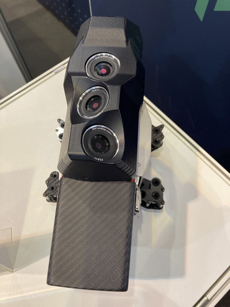
Underside of GeoCue True View 655 showing the new nadir camera (furthest away).
Other big kids on the block included Hexagon and Teledyne. We were aware of the UAV-borne CL-90 and CL-360 lidar sensors from Teledyne Geospatial: these are OEM versions, but the firm has added CLS-A, which will be sold to end users and shares the workflow designed for the bigger GALAXY. One of the attractions drawing visitors into the booth was the bright yellow Z-Boat 1800RP, equipped with lidar above, sonar below and various other sensors. We enjoyed a long conversation with Don Ventura, bathy lidar solutions product manager, about the CZMIL SuperNova deepwater lidar sensor and were also able to discuss the new Ladybug6.
Hexagon also was generous with access to experts to discuss the products. Anders Ekelund and Klaus Neumann were there to discuss the Leica DMC-4 and CityMapper-2 hybrid systems on display as well as the topobathymetric Leica Chiroptera-5 and deepwater HawkEye 4X. Leica PAV200, a new version of the renowned gyro-stablilized mount, had been announced the previous month. Interestingly, the DMC-4 shares the high-performance MFC camera modules used in the CityMapper-2, i.e. it is not a single-chip sensor like its DMC III predecessor. Anders emphasized Hexagon Geosystems’ desire to use components across multiple products where appropriate; moreover, recent developments in CMOS technology had not resulted in larger monolithic chips or longer linear arrays, the latter reflected in the absence of major enhancements to the Leica ADS100. This sensor is going well, however, and we learned from Paul Kane, general manager, survey, remote sensing and geodesy, Ordnance Survey Ireland, that OSI is delighted with the imagery from its two units traversing the Emerald Isle.
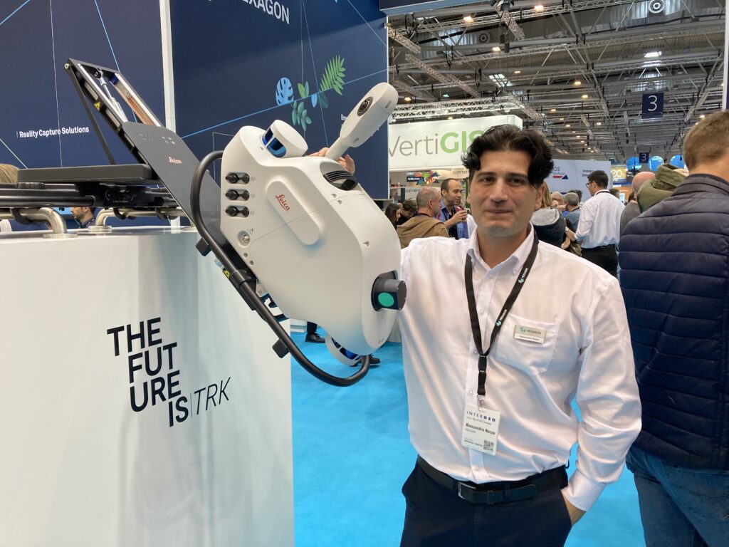
Alessandro Nuzzo, product manager for mobile mapping system on the Hexagon booth with the new Pegasus TRK Neo.
One of our most compelling conversations during the event was with Alessandro Nuzzo, product manager for mobile mapping system. He showed us the new Pegasus TRK Neo and explained how a design process lasting several years had resulted in a 50% reduction in size and two-thirds reduction in weight compared to the previous model. The product contains innumerable innovative solutions to subtle challenges and there’s a lot to it! On the Wednesday of the show, Hexagon issued a press release that it was partnering with Belgian geospatial provider Vansteelandt to collect airborne imagery and lidar of Belgium and Luxembourg with a Leica CityMapper-2. The results will be offered through the HxGN Content Program’s Metro HD city data offering, which includes digital twins of major cities. Indeed, the previous day, another Hexagon release announced a partnership with the German company LocLab, to focus on 3D digital-twin creation.
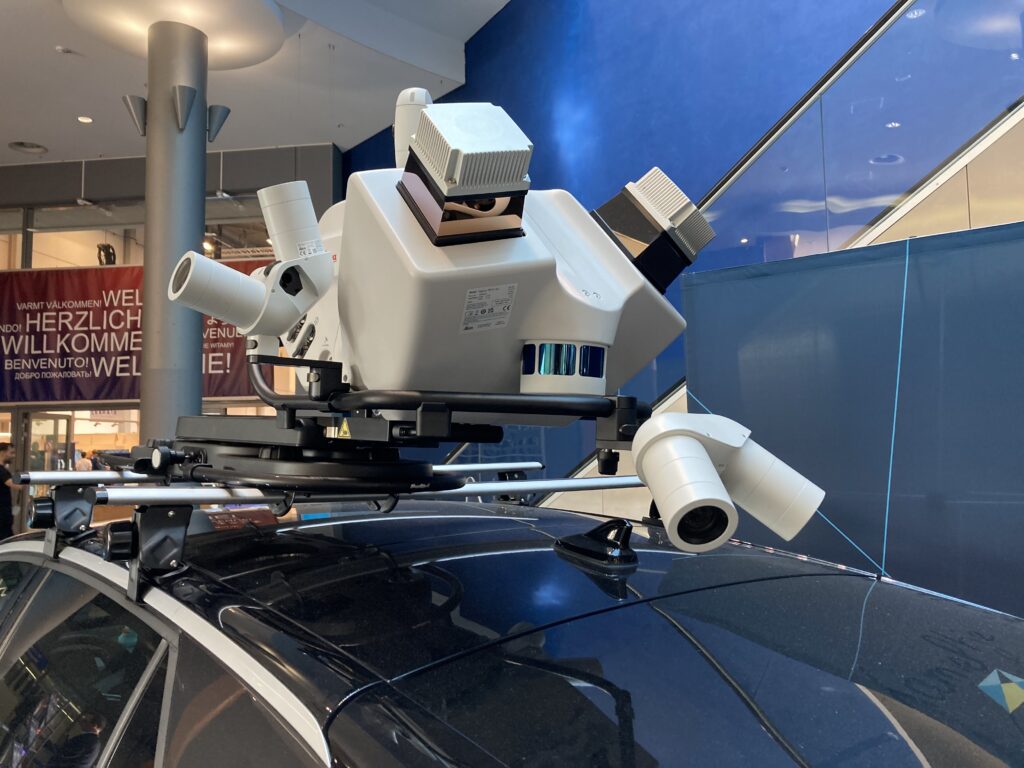
Pegasus TRK Neo. The units is seen, with optional additional cameras, mounted on a Volkswagen ID.3 electric car at the main entrance to the show.
IGI was showing their latest wares and issued an interesting press release on the day before the show: SaeHan Aero Survey of Seoul, South Korea, has purchased an IGI UrbanMapper-2P, a nadir- and oblique-imaging system, together with an LM-7802S lidar, both high-end systems. The stated prize is the Korean digital-twin market!
Rapidlasso GmbH invited LIDAR Magazine to display copies of the current print issue on its booth, which was dominated by a graphic of the company’s founder, the late Dr. Martin Isenburg. A steady stream of Rapidlasso existing and prospective customers was delighted that the LAStools, LASzip and BLAST products are alive, well, supported and evolving. All copies of the magazine that we brought to Essen were snapped up by lunchtime on the second day!
We didn’t forget Earth observation from satellites. One of the highlights was a superb presentation on the hall stage by Tero Vauraste, senior BD advisor, ICEYE, who made crystal clear that the firm’s constellation of SAR smallsats is real, growing and operational.
Alongside all the technical activity, trade show companies were touting future events. DVW had little difficulty selling booth space for the next INTERGEO, in Berlin in October 2023. Diversified Communications was equally successful in selling its Geo Week event in Denver, February 2023, and Commercial UAV Expo in Las Vegas, September 2023. And GoGeomatics stalked the halls seeking exhibitors for a prospective event in Canada in late 2023.
LIDAR Magazine was pleased to participate in INTERGEO. We enjoyed Essen, but especially appreciated the interaction, face-to-face, with international friends and clients. Long may it continue. The 2022 attendance was below pre-covid levels, but we expect both the increased confidence in face-to-face meetings and the multiple attractions of Germany’s capital to rectify this in 2023. The takeaways: MMS is mainstream; digital twins are center-stage; climate change angst is pervasive; stereoscopic viewing, shutters and image motion are being revisited; deep learning is in widespread use in practical ways, for example segmentation and object recognition in imagery or point clouds; the GNSS/IMU-camera-lidar-software value chain is being addressed by more and more companies – choose your solutions with care, but take the time to review a few options first.