The ASPRS 2022 Virtual Conference kicked off with some inspiriting sessions, including one about high-definition maps for autonomous vehicles, chaired by Qassim Abdullah, who adeptly managed speakers from RoadAR, TomTom, Here and Lidar News. GIS is not the truest arrow in my quiver, but I deeply enjoyed the session chaired by Denise Theunissen, with strong presentations from Robert Pitts of New Light Technologies and my former BAE Systems colleague, Dr. Don Widener. I’m looking forward to more — after this note is dispatched!
As I scanned the headlines for nuggets to combat depression fomented by the unfolding disaster in Ukraine, I noticed that scientists are asking NASA to extend the GEDI (Global Ecosystem Dynamics Investigation) mission on the International Space Station, which has been operational since 2019 and is currently scheduled to be deorbited in early 2023. The lidar sensor provides data found to be invaluable in areas such as forestry, climate change and biodiversity. Though one can’t help but be cynical about countries’ commitments to halt and reverse deforestation by 2030, one can heartily support measurement, without which, as we know, there can be no management.
Covid has abated, though of course we may be in a holding pattern between variants. Those with two vaccinations plus booster have been moving around with some comfort, though compliance with formal mask requirements has its rewards too. Thus LIDAR Magazine attended the Geo Week event in Denver in February 2022. Diversified Communications amalgamated its ILMF, AEC Next and SPAR 3D products and supplemented the results with conferences from three partners – ASPRS, MAPPS and USIBD. The result was three pulsating, packed days, with, perhaps, rather too much going on for many participants to attend their favorite sessions while also doing justice to the impressive, lively exhibition. Diversified Communications’ official statistics revealed, “… a sold-out exhibit hall floor featuring 140+ companies and … 1890 verified professionals out of more than 2100 registrants, representing 49 states and 48 countries, cementing [Geo Week’s] place as the premier event for increased integration between the built environment, advanced airborne/terrestrial technologies, and commercial 3D technologies” . There were more than 125 speakers, some very good indeed. The point is that the attendance is similar to or greater than what would have been expected before the pandemic: people were delighted to be back together. I commented in the past that the product previews on the opening day were a bit of an endurance test, but so refreshing was it to listen to the presenters live that the time flew by! The well-attended keynote sessions were animated and compelling. There were strong panel discussions. Nevertheless, the draw was always the exhibition.

It’s great to be back on the Denver light rail!
LIDAR Magazine was delighted to be involved once again in the presentation of the Lidar Leader Awards and it was poignant that the Outstanding Personal Achievement in Lidar Award went posthumously to Dr. Martin Isenburg. The CEO of Martin’s company, rapidlasso GmbH, travelled from Germany to receive the Award and provide an eloquent encomium against a background of collages of photos of Martin. The Younger Geospatial Professional Award and several ASPRS awards were presented in the same session as the Lidar Leader Awards, a most rewarding end to the second day of the conference. The Geo Week formula is to be continued next year, again in Denver, when I hope to be less inept in mastering the geography of the massive Colorado Convention Center.
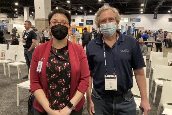
Carla Lauter of Diversified Communications and Kevin Dowling of Kaarta, Judges at the University Lightning Round component of the Lidar Leader Awards.
Next on the calendar was the Esri Developer Summit in Palm Springs, California. This was a different kind of meeting altogether, very technical and focused on the Esri community. Esri kindly provided me with statistics: 1201 registrations with 1047 attendees; 35 countries; 19% of the audience international; 726 different organizations; also 1394 virtual attendees from 38 countries. The drive north in dawn was spectacular, yet a sign of the times – blinded by the sunrise on the eastbound road segments through the massive fulfillment centers and associated communities, then parked at the still empty Palm Springs Convention Center as the sun unveiled the details of the mountains to the west, a view of which I never tire and which I always associate with Esri! Though Jack introduced the first keynote session, he played a lesser role than at the big plenaries in San Diego, yet the orchestration was typically Esri and the facts, features and possibilities rolled out. I was struck not only by the multiplicity of capabilities in the software – the uncompromising extent of the functionality – but by the skills of the presenters. Esri has strength in depth – software folk from all over the world who are not only brilliant at what they do but can present it articulately and professionally. The keynote on the second day was led by Sud Menon, Esri’s director of software, and brought in a dozen other presenters. Sud’s focus was billed as “the vastness of ArcGIS”. Yes, indeed. One could expatiate, so let’s highlight just one theme. Esri has implemented deep learning in many places where it can bear fruit and the tools are such that users not blessed by comprehensive knowledge of convolutional neural networks can take advantage. This is an enormous innovation and the applications, such as feature extraction from lidar or imagery, limited only by imagination.
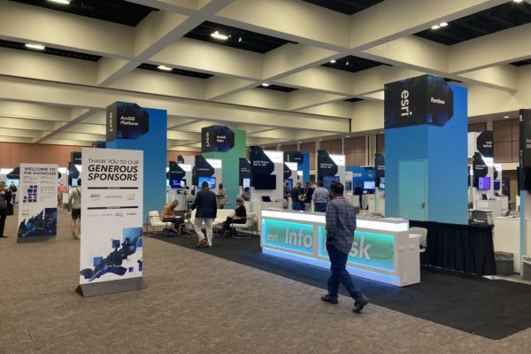
Inside the Esri Developer Summit, Palm Springs.
As the ASPRS 2022 Virtual Conference unfolds, one inevitably reflects on the different purposes and business models of the three events. The first was a collation of multiple modern conferences in the traditional live format, aimed at the geospatial community, including the private, public and academic sectors. The second was hybrid, with many sessions available remotely, designed to inform and enable those members of the vast Esri community capable of customizing the software to their requirements in one or more of the numerous ways available. The ASPRS remote event was available free of charge to those who had attended the ASPRS element of Geo Week and was focused more on providing a platform for students and early-career researchers to showcase their work. There were also fine panel discussions as well as information sessions to explain ASPRS and its structure and benefits. As with working from home, remote and hybrid conferences are a long-term outcome of the pandemic, part of a new pattern of life. We will relish its evolution.