Most practitioners in the lidar community know LiDAR USA, an acknowledged leader in the successful integration of lidar sensors on to land vehicles and UAVs. LIDAR Magazine managing editor Stewart Walker traveled to Hartselle, Alabama to interview founder and president, Jeff Fagerman. Here’s what he discovered.

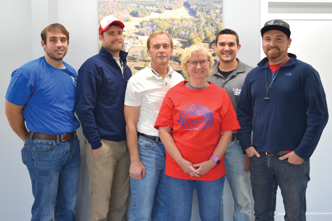
Jeff Fagerman, founder and president of LiDAR USA. King of all he surveys!
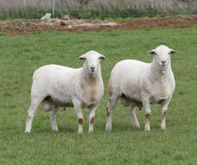
Driving down a country road amidst rural Alabama’s green swards, at the edge of the small town of Hartselle, I spied the sign—Fagerman Farm. Lower on the post, a smaller sign gave confirmation: LiDAR USA. Jeff Fagerman, renowned for his lidar integrations that have sold throughout the world, appeared as I parked. Equally accomplished as farmer and as lidar guru, Jeff waxed lyrical about a field of sheep quite unlike the ones I am used to seeing in Scotland. They had no fleece! Jeff explained that these are hair sheep, reared for the world’s most exquisite lamb. Indeed, his son, Daniel, was in Kansas at a sheep exhibition! Jeff’s ambition is to be the provider of these animals to farms throughout North and South America and perhaps his biggest event of the summer was a one-day reception, presentation and dinner for prospective ovine clients. And he will probably accomplish it—I learned over the next few hours that he has multiple successes behind him and several innovative, imaginative schemes racing in his mind.
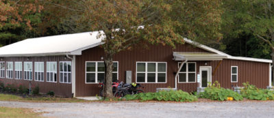
These shots of the main LiDAR USA building and some of the hair sheep underline the growth and rude good health of the Fagerman Farm/LiDAR USA enterprise.
Fronting the Fagerman Farm compound is a large dwelling, occupied by Daniel and his family. The building behind it used to be the company headquarters as well as Daniel’s home. Now it is partly empty, because all the LiDAR USA operations and materials have been moved to a brand new building next door to the sheep. The living area of the old home, however, now functions as a training center. Beside it I noticed the foundations of another building, which Jeff said would be partly open, like a hangar, and would enable outdoor training to take place even in scorching sun or torrential rain.
 We talked about the sort of geospatial topics that excite guys of a certain age, such as the difference between the Purdue and New Brunswick notations for design matrices in least squares adjustments, then settled down in the training area to talk. Jeff had already provided the basic facts and some of his thinking in the interview we had conducted by correspondence (see sidebar). He started by showing me a CNC machine where, early on, LiDAR USA could make its own small parts and save significant outsourcing costs. This is also where he wrote much of the software. There was a big UAV on one wall, and a tornado shelter, as buildings are required to have in Alabama. The company now has more than 25 employees. Daniel is CTO and Jeff’s son-in-law, Forrest Briggs, is COO. Jeff’s father passed on ten years ago, but his occupation as Director of Equalizations for the State of Michigan included cadastral and GIS duties, which clearly rubbed off on the young Jeff.
 Jeff returned to Purdue to embark on a PhD but didn’t say long, discouraged by the role of a graduate teaching instructor, and returned to Intergraph. His experience and contacts stood him in good stead when he left the company to set up a business offering photogrammetric service work, including scanning and triangulation, as well as the medical software he mentions in the interview. The big transition was Daniel’s graduation with an MS from Purdue in 2010—the father and son team marching on to the lidar playing field! Jeff had used conventional airborne lidar in his services business, but wanted to do much more. He saw an opening for mobile lidar services, which, like land surveying, couldn’t be outsourced as easily as airborne, but was disappointed when he looked for sensors to buy. Topcon, for example, had a system with SICK sensors and Optech had its ILRIS. He judged the StreetMapper to be prohibitively expensive in those days. He evaluated MDL, but the demo went badly. Riegl had a product almost ready, but Jeff didn’t want to be first. Topcon was not quite ready with its IP-S2 HD with a HDL-64E sensor from Velodyne LiDAR. And there was little software: Terrasolid and Virtual Geomatics were strong on the airborne side, but the mobile offerings were weaker. Jeff felt that a life in mobile lidar wasn’t the way to go.
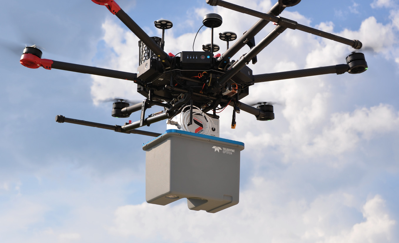
The Snoopy CL-90 product provides the highest quality data at the most affordable price. The Teledyne Optech CL-90 scanner integrated with the DJI M600 gives an accuracy of 7 mm and a scan width of 170 m at an altitude of 120 m.
Things changed, however, around 2010, when Velodyne LiDAR’s HDL-32 and the FARO Focus 120 appeared, though of course there was a gap between early product announcements and fully operational systems being fielded. Velodyne was doing DARPA challenges with the HDL-64, but the automotive lidar market didn’t really exist yet. Jeff also looked at the Italian firm Siteco, a good choice but a little too restrictive on the type of vehicle, mostly because the FARO Photon was a big device. So he decided to design his own! The Focus 120 changed terrestrial laser scanning—it was tripod-mounted at the then incredible price of $40K. FARO stopped it rotating and Jeff mounted it upside down below the HDL-32. The Focus 120 scanned roads with millimeter accuracy and the HDL-32 captured the assets. He offered services to private companies in the highway mapping space. Jeff even made his own 360° video camera (LiDAR USA still makes the odd sale!), which was a big challenge as it was fiddly to assemble. He acquired an ITAR-restricted LCI-100 IMU from NovAtel. This was a big investment—and so was the five-camera system he also bought. He discovered that there was no warranty protection against customizing the equipment—a salutary experience, but it induced caution. There was a personal factor here: Jeff liked to buy NovAtel equipment from Roman Kathofer, who is well known in the lidar world, and this relationship has been fruitful. Jeff wrote almost all the software, with a little help from Daniel. They showed the system on the FARO booth at a show in spring 2011. By now his living room resembled an electronics shop! The Focus 120 didn’t work too well initially. Even the NovAtel product had its teething troubles. Debugging and getting everything to work took weeks, then the IMU went back to NovAtel for months and the HDL-32 had issues too! These were worrying times, but he persisted and by 2011 the system was ugly but worked, mounted on a car, and he could sell services.
In a side conversation before we began to discuss the products, Jeff lauded many of the other UAV-lidar integrators and stressed the importance of a healthily competitive market to ensure the advance of the technology and the serving of the best interests of the end-users.
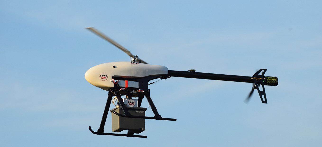
Galaxy CL-90. The Galaxy Helicopter provides a 45 minute flight time with the Teledyne Optech CL-90.
His interest in UAVs was aroused in 2012, at the first FARO conference in Orlando, Florida. He met Chris Lord, who was involved with power parachutes and gyro planes, but, sadly, died in an accident in 2018. Chris suggested putting a system on one of his vehicles and Jeff agreed. Chris brought a power parachute, which had a go-kart underneath. They put their one and only system on it. Off it went across a rough field! It carried two people—Daniel and Chris. They scanned a big area and proved the concept. Then Chris and Jeff considered a gyro plane. They were still thinking of service work. The gyro plane couldn’t hover, but could fly low and slow at a low cost. The new NERC regulations on US powerlines were a major driver and some surveys were done with Chris’s gyro plane.
Jeff and Daniel saw what Phoenix LiDAR Systems was doing with Velodyne scanners and UAVs at an ILMF conference in 2014. They were well aware of the potential of these craft, which had not yet exploded on to the civilian geospatial scene. People were talking about UAVs, but the US regulatory environment was not empathetic: FAA’s “333 waiver” process did not begin until 2014 and was laborious. In Jeff’s opinion, the UAV-lidar environment was transformed by two things: the introduction by FAA of the Part 107 process on 29 August 2016 (LiDAR USA took a UAV to the ILMF conference earlier that year), and the launch of the DJI M600 UAV [of which there seemed to be units in all Jeff’s buildings!], which could carry sufficient payload to handle lidar sensors. Yet he was well aware of the difference between his ongoing, conventional photogrammetric projects and the small areas that UAVs could cover, a point still not fully appreciated in the mapping community. Jeff and Daniel quickly saw that aerial surveying using a helicopter at $350 per hour would be realistic, especially over urban areas and would be competitive with UAV-lidar. They repackaged their system for UAV integration. Jeff explained that systems for use only on road vehicles are more expensive, because they incorporate GNSS/IMU systems with higher performance than UAVs require, whereas users want to switch the system between different kinds of platform—UAV, road vehicle, tripod. Therefore there’s more profit from an MMS unit. GNSS is available all the time on an aircraft, but not a car, so a very expensive IMU is essential. So by the end of 2016, Jeff was in—he was a UAV player! Customers also buy systems from him for backpack and road vehicles. Most competitors don’t offer such easy transfer between platforms. The autopilot of a UAV is satisfactory for flying the flight plan, but is not part of the data that is collected, which needs a higher performance GNSS/IMU set-up. Jeff resells UAVs and he’s also a reseller for Velodyne. He integrates RIEGL but is not a reseller.
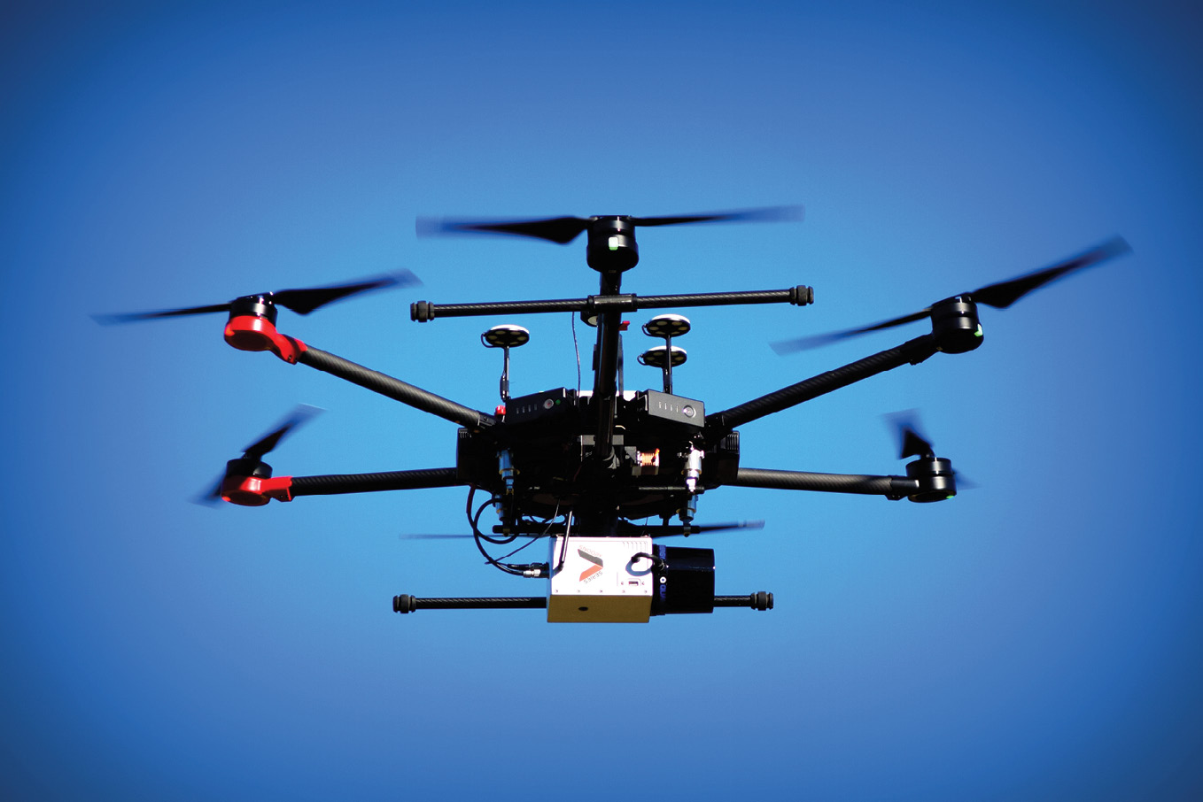
Revolution 120. The Quanergy M8 scanner, mounted on the DJI M600, can capture 100 acres of data in just one flight. It has the ability to provide 3.8 cm accuracy at an altitude of 50 m AGL.
The first product became LiDAR USA’s ScanLook, named because Jeff called the medical software MedLook. Most of the time they call it Snoopy. Jeff has always been heavily involved in product naming and in this case his rationale was that the product did not look like Peanuts—a cartoon character popular in the US but less well known elsewhere—but looked like a dog and snooped.
Jeff also developed his Matrice line of products specifically for the DJI Matrice, which carried a lesser payload than the M600. Only LiDAR USA and Emesent, with its Hovermap, cater for this platform. Jeff resells the SLAM-dependent Hovermap. The A-Series and Revolution product lines series are the same except for firmware options: Revolution is built for UAVs and knows that it will have good position and attitude estimates, leading to some cost-saving short cuts. The ScanLook Trex series is the same, but is aimed at Trimble customers, who want to use the Trimble software they already have. Jeff coined the name through an amalgam of references to T-Rex, Trimble and Applanix. The Phase One products are available with the popular Ronin mount, but Jeff makes and sells a better one. After racing through all his product lines, Jeff explained that one of his company’s strengths is its ability to integrate a very broad range of lidar sensors, for example from Cepton, Ouster, Quanergy, RIEGL, Teledyne Optech and Velodyne.
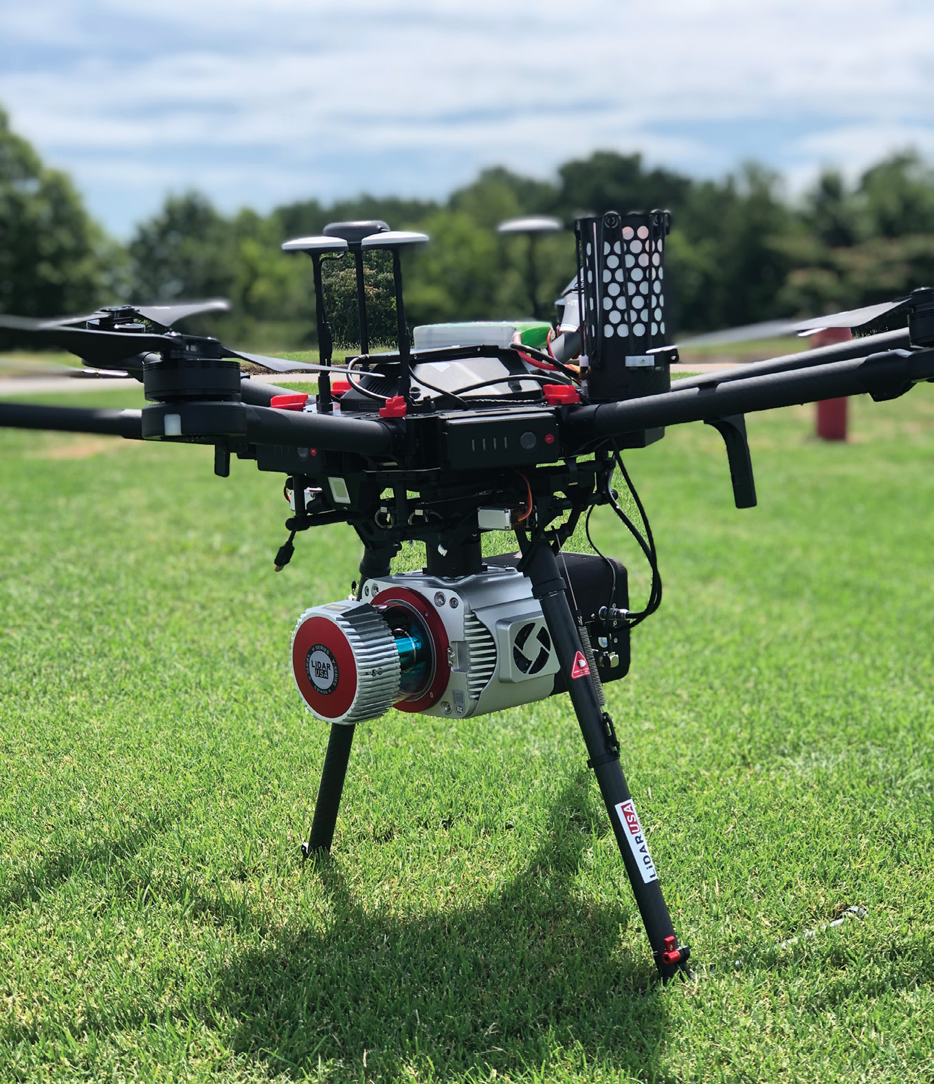
Snoopy VUX. The Riegl VUX-1UAV, mounted on the DJI M600, is a compact and lightweight laser scanner, meeting the challenges of emerging surveying solutions. It has the capability to capture 10 mm survey-grade accuracy.
Although LiDAR USA provides its customers with third-party software for processing GNSS/IMU data, for example Applanix PosPac or NovAtel Inertial Explorer, all the other software is homegrown, so that’s another unique aspect—the firm’s owner is the software developer. The software creates a georeferenced point cloud corrected with ground control points. The output then moves to the customer’s preferred solution for the generation of end-products, for example, Autodesk, Global Mapper or TopoDot. These products also perform point classification and generate deliverables. Jeff would like to take his software further, but doesn’t countenance the reinvention of functionality. His goal is to supply fast, reliable software for the critical aspects, then defer to the specialist producers. For imagery, LiDAR USA offers Ladybug, which is fisheye and panoramic, and other cameras, so that lidar point clouds can be colorized.
I asked Jeff about customers’ preferences in terms of payment models. US customers typically buy outright, though occasional users like to rent. The pricing is interesting, because lowering the price doesn’t make a difference—many products exhibit demand inelasticity. Clients in the low-end market have less expertise, as he learned in the medical market.
Although our conversation focused on UAV-lidar, it was impossible not to be aware of, and admire, Jeff’s widespread skills. We drove to lunch past the sheep, then, along the road, he pointed out another property he owned. This was purchased for a specific reason: it is at the edge of the service area of the local internet service provider, whereas his compound is outside. So he purchased the property and connected it to the compound using two tall masts and powerful antennae. But it has another use—as a residence for trainees! Although Jeff has left the medical software behind, he is very open to new ventures, one of which is a machine to wash solar panels, which will address a rapidly growing market.
We went on to the recent report from Global Marketing Insights and the prediction that revenues from UAV-lidar in the US will catch up with airborne by 2025. Jeff concurred. We talked about precision agriculture, measuring crop heights etc. and Jeff said that some of his customers are doing exactly that. One customer uses the system over clear-cut land, where some trees are left: they scan, to find the obstacles, then a UAV goes out and shoots pellets into the dirt, i.e. planting the next growth. His customers’ applications never cease to surprise him.
We turned to mergers, acquisitions and so on. He has numerous relationships, but no plans for joining up with another entity. He would sell his company if the price were enormous—he’s not short of other things he wants to do! He feels LiDAR USA could grow rapidly, but effective selling and marketing around the globe is not easy. He resells sensors (Velodyne, Hovermap), UAVs (DJI, Inspired Flight) and GNSS equipment (CHC, North Surveying). His Alabama location is special and he doesn’t want to compromise. Previous premises were in downtown Huntsville, then near Huntsville airport, then halfway home, now he has come home. Many of his employees are local.
“Daniel and Forrest are absolutely critical for me”, said Jeff, pointing to Forrest’s extensive experience in hospital management. He even does the advertisements for LiDAR USA. His other son-in-law was even better, thought Jeff, but elected to follow his chosen career of school-teaching. Jeff’s commitment to educational excellence and the improvement of facilities, as well as parental support, was palpable.
“Some people don’t believe you can capture really good data with an automotive lidar, but you can,” contended Jeff. His reseller in Atlanta managed 5/100 of foot, i.e. less than an inch, with good ground control points. We agreed that the bulk of the error budget is in GNSS/IMU, i.e. even if the laser were perfect it wouldn’t make a huge difference. Jeff has no doubts about the merits of ground control points: for most projects they are essential, but sometimes relative accuracy suffices—it’s a matter of understanding requirements. And customers should not underestimate the importance of correctly transforming into the final, local coordinate system: ground control points offer protection against errors in this critical phase.
We ended with a tour of Jeff’s spacious new building. On the way, we couldn’t avoid talking about the bleating flock! The sheep are on raised platforms, so they push everything through and lie on clear floors. It’s more healthy for the animals, who enjoy a balanced, sophisticated diet. The farm uses Excel pivot tables to assess their rams’ performances.
We passed the foundation of the latest, hangar-like building, started the previous day, a decision having been made the day before that. We went into the new building and started by looking at his massive inventory. The building is specially insulated so the valuable goods will not be compromised. A vehicle can be driven in, but the inventory prevents it! There were shelves of batteries, piles of M600s, backpacks, M200s, GNSS systems, various Velodynes, Quanergy systems and others. He thinks his competitors don’t hold so much, i.e he prides himself on having the components. “If we have it, we can sell it. Customers want it yesterday.” A room supposed to be saved for his grandchildren’s language lessons (German from their FedEx driver, Spanish from their live-in Venezuelan veterinarian) was expropriated by Jeff’s daughter to print tee-shirts, hats etc. LiDAR USA’s orange trainers for show staff have been noticed round the globe. They have a photo lab and both conventional and carbon-fiber 3D printers. There was space for finished products. Several RIEGL systems were awaiting integration, bought early as there is a very long waiting list. Jeff’s office location lets him view all the main activities as well as the arrival of delivery trucks—if they come late at night, he’s still there. I spoke to a happy intern from a local school. Jeff showed me M200 systems and the mount for the lidar unit—an integration unique to LiDAR USA. He had a Teledyne Optech CL-90—the integration is ready to go. Jeff enthused about a Z+F system for land vehicles. I remarked that he seemed able to get any sensor and integrate it successfully. Has has done a bigger range than anyone else. Also they have learned to be quick at assembly. If a lidar sensor is expensive, then the integration can take longer. He broke off to talk to a neighbor about a goat pen for the back of a pickup truck. He will sell a system before he knows he can build it, because he is confident he can do it! The software doesn’t need to change very much. They talk to the sensor manufacturers about what they can do while maintaining the warranties. Mike, “a master-tinkerer” according to Jeff, had just finished a RIEGL VUX system for a UAV or a car. Every system is thoroughly tested, in the lab and in flight. It’s all done fast. The universal mount allows systems to go on car, backpack or UAV. There were two backpacks ready to go. Mike said the VUX integration had taken about a week and a half, but there were interruptions—a week would be reasonable. With the more expensive systems, profit is bigger and the VUX is scarce, so optimizing the build time is less important. It looked fabulous. Multiple colors are available. We all liked the black.
We looked at a Cepton sensor, now in its third incarnation. It had changed a lot, opined Jeff, and now works pretty well. He was about to test it. Mike would start it up later in the afternoon. Then Jeff showed me the Ouster. I expressed astonishment at the sheer variety of systems. The summer intern is gaining experience that most people would envy! He showed me the Livox lidar from DJI, but DJI now prefers to recommend LiDAR USA, and the Triple-IN from Germany, as well as others I hadn’t even heard of! There were NCTech iSTAR and Pulsar360 panoramic cameras, then a huge VTOL UAV from China—this was perhaps the first one exported.
Just before I left, Jeff showed me his new conference room, so they can have meetings even when training is going on. This ended a remarkable, informative day. Not only is LiDAR USA a company acknowledged as a successful, international supplier of lidar systems for cars, UAVs and other platforms, but it has an unusual location, local flavor and small-business atmosphere. It has strength in depth and flexibility that have enabled a wider range of integrations than its competitors. But behind that is versatility and the desire to address completely different projects and markets, driven by the agricultural background in the family’s past. The driving force is founder and CEO Jeff Fagerman, a highly educated, competent surveyor with amazing flair and imagination, amply supported by talented family members and local employees.
Jeff’s Thoughts Up Front
Before traveling to Alabama, managing editor Stewart Walker conducted an interview with Jeff Fagerman by e-mail. Here is what he said.
LM: Jeff, we know you of old. You were well recognized as an ace software designer and developer at Intergraph, where you worked from 1985 to 1999. You came from a farming family in cold, cold Michigan, an upbringing that pushed you towards surveying as a career Your father was an Equalization Director. You have degrees in geomatics from Ferris State and Purdue, the former chosen on the bases of proximity and lower fees. Please tell us about that part of your career and why you left the big corporate world. Then you became a professional land surveyor in the State of Alabama. Readers can find out more on the heartfelt, articulate page https://beasurveyor.com/jeff-fagerman.
JF: Yep, 1985 to 1999 with a short stint back at Purdue from ’89 to ’90. BS Surveying in ’84, later converted to BS Survey Engineering (adding one chemistry class). Both very good schools with good programs and instructors. Mr. Sayed Hashimi stands out as a beacon for sure at Ferris and Prof. Mikhail at Purdue.
Intergraph was great. I got to use the vast majority of what I went to school for—something few can say is true: software, calculus, physics, and of course, geomatics (surveying and photogrammetry). Working with the latest hardware and software was a blast. We had only one competitor (Leica then LH Systems) and I was classmates with one of the key guys there (Kurt DeVenecia). We used to compare notes at conferences and drive our management crazy—as if two little guys can in any way change the direction or speed of the Titanic aboard which they found themselves. Wishful thinking. Great job though, very hard to leave. In ’99 I had done about as much as could be done with the current hardware and decided it was a good time to strike out on my own. I had always told the VPs at Intergraph that when the system was truly commercial-worthy and affordable I would likely do this—so I did it. It was a big leap of faith with a single income and four young children. My first week at home was the week the fourth kid started kindergarten—no break for my wife, Nancy.
From 1999 to about 2003 the focus was photogrammetric services (mostly aerotriangulation, but also some scanning and orthos), custom software and consulting. This also included sales of BINGO from Dr. Kruck in Germany. If you are going to be a small company, you have to be the best and able to do the impossible (so it seems). About that time I also purchased a moribund medical billing and practice management software suite. That was an interesting adventure. I learned a lot about things I’d rather not know (such as filing insurance claims!).
LM: Please tell us about setting up LiDAR USA. Why did you do it and why did you think the timing was just right?
JF: In 2007 I looked at mobile lidar—far too expensive, huge, clunky, etc. The software for exploitation was almost non-existent. I waited until 2010, when my son Daniel finished grad school in civil engineering at Purdue. Now I had a partner. We chose lidar because you can’t ship the service aspect overseas—you have to be on site to physically capture the data. After a great deal of research we were compelled to build our own system using FARO and Velodyne sensors. 18 months later those scanners were working. Part of the learning curve was with expectations. I expected the sensors to work when I bought them. New products very rarely do, it seems, and you learn to expect at least a 12-month period of struggle. In any case, we debuted the system at SPAR 3D under the FARO umbrella. The interest was high, so we spent another year developing our first commercial product. It’s a tricky business—if you are too early you lose, or too late you lose. Timing is critical. We spent a lot of time considering the market but we were also lucky and very blessed. Both FARO with the Focus 120 and Velodyne with the HDL-32 “told” us the timing was right.
LM: There are numerous integrators in the market who produce systems that combine UAV, GNSS/IMU, camera and lidar sensor. Please tell us what makes LiDAR USA different.
JF: First, this isn’t a secondary attempt or trial for us. This is what we do. We’re not just jumping on a wave and hoping we can ride it out. I am a surveyor and photogrammetrist—this is what I do.
Our software is fully functional yet not overly complicated. Nevertheless, there is a tremendous amount of simplification still to be done. There is no other vendor that integrates as many scanners, IMUs, etc. as we do. We are a one-stop shop for mobile and UAV lidar—everything but static [TLS] and conventional airborne [ALS].
LM: Tell us something about the history of LiDAR USA. How has it developed, how many staff, premises, product lines, etc. You have a lengthy, complex product line, so please explain it to us.
JF: 15 to 20 people. Lots of products. We are not yet in the commodity business, so there are numerous custom options.
LM: We have learned from a recent Global Marketing Insights report that the lidar market is likely to grow at remarkable speed from now till 2025. LiDAR USA is clearly well positioned to enjoy this growth. But the report also says that there will be partnerships, mergers, acquisitions and so on as companies jostle for positions to take advantage of the increase in market size. What do you think about this? Will LiDAR USA participate? What partnerships do you have and what others do you anticipate creating?
JF: Well, we aren’t planning to buy anybody yet. We are growing fast and plan to continue to grow very rapidly, not so much in numbers but in products and sales.
LM: Please take this opportunity to make some remarks about the movers and shakers in your company. I know from experience that successful entrepreneurs are skilled in recruiting good people to work with them. Does this apply to you?
JF: Ah, the hard part of the job—finding the right people. I reared mine and then had them marry in. Personally, since childhood, I have been in business (raising bees, selling honey, truck gardening, etc.). You have to learn how the consumer reacts. Most customers will give you a push on price!
LM: Jeff, it seems that there are several trends emerging in our UAV-lidar world. For example, the enormous automotive market engenders big R&D efforts, which seep into the UAV-lidar world, resulting in cheaper, lighter sensors. Deep learning seems set for a major role in point classification. There has been a debate on formats, i.e. LAS and E57 were the leaders, but vendors such as Esri and Martin Isenburg are involved as well. Indoor lidar surveys are a growing market and it is necessary to marry indoor and outdoor point clouds. On top of all this, Cloud processing is becoming increasingly important. Would you like to comment on any of these trends?
JF: Lots of buzz. As you know, some have buzzed about flash lidar for almost a decade. Where is it? According to their articles it was supposed to be here a few years ago yet it’s really no further today than many years ago.
Deep learning is the new rave. Remember the days in the late 80s and early 90s with “snakes” algorithms for automated building extraction, etc? Lots of money chased after that and ended up nowhere. It doesn’t mean deep learning isn’t real, but don’t hold your breath. With all automation, 98% and even 99% is not close enough. The problem with algorithms versus humans is complicated by overseas cheap labor as well. It is coming. We see it. For us, it will only help.
LAS, E57, etc. I really don’t like either format but LAS rules. Many vendors have their own internal format but LAS remains the neutral format. It works.
Indoor scanning (or GNSS-deprived) is interesting. On one side we have users who want 1-2 mm maximum rmse results, while others accept a couple of centimeters and the majority seem only interested in floor plans. It is definitely a growing market and will undoubtedly be driven by government mandates to map all buildings. I think that’s largely a political issue, like so many other things. SLAM solutions will change rapidly and deep learning will likely be a big part of this.
As to lidar, we have two branches in our area: the more conventional high-accuracy, longer range systems (RIEGL and Teledyne Optech); and the automotive solutions (Velodyne, etc.). There is no question how well the first does, but there are doubters about the second in terms of mapping. Our customers use both. Those benefiting from the lower cost of the second are enjoying a great ROI.