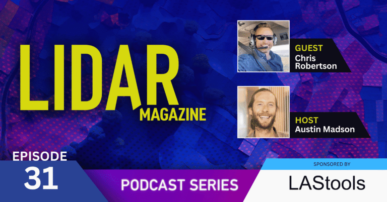
Chris Robertson, director of the Colorado State University (CSU) Drone Center, brings more than a decade of UAV experience to a career that also includes an extensive background in law enforcement. In this episode, Chris introduces us to the Center’s four primary areas of focus and to Christman Airfield, one of Colorado’s oldest continuously operating airports. With its distinctive infrastructure and in-house team of subject matter experts, the CSU Drone Center supports a diverse range of research and educational initiatives—from a specialized GPR test bed to an intensive, hands-on short course exploring the principles and practical application of lidar and photogrammetry.

Episode Transcript
#31 – Chris Robertson
August 31st, 2026
{Music}
[Austin Madson]
Hey, everyone, and welcome to the LIDAR Magazine podcast series. My name’s Austin Madson, and I’m an associate editor at LIDAR Magazine. Thanks for joining us today as we continue our journey exploring the many different applications of lidar remote sensing. We’re happy to have the opportunity to sit down with Chris Robertson today. He’s the director of the Colorado State University Drone Center over in Fort Collins, Colorado. Chris Robertson spent two decades with the Colorado State University Police Department, and he’s been the director of the CSU Drone Center since 2020.
He’s got over nine years of experience in UAS operations, spanning both the public and private sectors. He co-founded the Larimer County UAS team, which offers drone services for fire, police, and search and rescue operations. Chris also founded the CSU Drone Flight School, which they helped to facilitate over 900 individuals in obtaining their part 107 FAA UAS certificate. Additionally, he serves as an adjunct professor with the Walter Scott College of Engineering, where he teaches UAS technology classes. He holds both an FAA private pilot and a remote pilot’s license. Chris is committed to leveraging technology for community safety as well as support. So let’s go ahead and get going. Thanks a lot for joining us today, Chris.
[Chris Robertson]
Yeah. Thank you for having me on the podcast. Really appreciate the opportunity.
[Austin Madson]
Great. Yeah. So why don’t we start by, by having you chat a little bit about your law enforcement background and how you came to be the director of, of the CSU Drone Center?
[Chris Robertson]
It’s kind of an interesting story. I don’t think it is uncommon now in the world of, of UAS. It’s pretty common to run into former law enforcement or military now in the UAS worlds. Um, so I spent, you know, I think if we went way back and, and looked at kind of where this story started was probably about 1985.
[Austin Madson]
Okay.
[Chris Robertson]
And I know a lot of listeners are starting to automatically do some math.
[Chris Robertson]
We’ll see if they can guess my true age eventually. But, let’s just say I was not born in this century and a few generations behind.
[Austin Madson]
Gotcha.
[Chris Robertson]
I can remember vividly sitting in my front yard, and, uh, it was in a little city called Celil, Washington, of all places, which is right beside a military installation called the Yakima Firing Range. And at the Yakima Firing Range, they’d have all these mock battles and crazy stuff, but specifically, they had a lot of A-10 airplanes. And they would fly over my house at, like, 500 feet. And as a 5-year-old kid, I’d just be sitting there staring at the airplanes, just dreaming of flying an airplane, and specifically flying an A-10 and being a pilot. That was one of my very long-term career goals all the way up through high school. Um, I just wanted to be a pilot. And I did a lot of things as a kid. My dad and I got heavy into RC airplanes.
[Austin Madson]
Cool.
[Chris Robertson]
And back then, they weren’t like today, you know, Styrofoam with the safe stuff and, you know, it was old 3-channel Futabas and radios. And, and it was more like we spent 3 to 4 months building one and 5 minutes crashing it; a couple more months putting it back together and 5 minutes crashing it until we both kinda luckily learned kind of how to fly and keep them alive a little bit longer than 5 minutes.
[Austin Madson]
Right.
[Chris Robertson]
And so really into that, that kind of served a fix as a kid, really to RC aviation, RC airplane aviation, which came back later in my career. But the sad thing was when I was 16 and I started driving, they realized I couldn’t see signs very well. So I ended up at the optometrist’s office and, uh, ended up with, you know, horrible glasses back then, which you’re staring at me now, and now obviously I’m wearing contacts.
[Austin Madson]
Right.
[Chris Robertson]
Yeah. And so back then, you couldn’t be a pilot before I said. There was no such thing as LASIK. They didn’t accept it. And so I kind of had to look and see some of my dreams were a little bit, uh, muted there about going in the Air Force and being an A-10 pilot, or let alone a pilot of anything, because that was kind of how you were prescribed back then. So I chose the next best thing, which I thought was law enforcement, and I spent 20 years in law enforcement. And about year 15 mark, I’d spent a bunch of time on patrol. I’d done a lot of cool stuff, motorcycle cop, uh, worked with, um, different tactical teams, um, did, uh, a lot of, uh, patrol work, uh, and, uh, became a sergeant, a training officer, the whole bit. Had fun, and then I ended up going upstairs to our administration division. And when I went upstairs, uh, a new technology was kind of hitting the shelves then, and that was the Phantom P1 and P2.
[Austin Madson]
Oh, wow. Yeah.
[Chris Robertson]
Yep. And so right when the Phantom 3 kind of rolled out and that, uh, Phantom 2, one of the other cops showed up one day at the shooting range with one and was like, “Check this out.” And I was hooked. This is now Chris’s RC dreams coming back to life. At least maybe I can fly this thing. And I ended up buying a Phantom 3 Advanced for about 1,000 dollars back there.
[Austin Madson]
Nice.
[Chris Robertson]
And wife at the time was like, “What are you doing?” Like, “You’re spending 1,000 dollars on a toy?” And I’m like, “No, no, no, you don’t understand. This is gonna be the next thing. I guarantee you. It’s gonna be the next cool thing. It’s, it’s gonna be a thing. I can use this for…” I started thinking about this ’cause at the time, I was getting into search and rescue.
[Austin Madson]
Mm-hmm.
[Chris Robertson]
I could use it for search and rescue. I could use it as a police officer, you know, and, uh, I could use it on crash scenes. I could do all this kind of cool stuff. And, and she’s like, “Sure.” “Fine. You know, it’s your overtime. You spend that money.” But there were some eyebrows raised. And, you know, right then and there, too, it was, you know, 2014. You couldn’t really legally fly a drone in the United States if you asked the FAA. So a bunch of us like-minded cops and firefighters and search and rescue people got together and went, “Gosh, wouldn’t it be cool if we could utilize this for regional response?”
[Austin Madson]
Totally.
[Chris Robertson]
Even, we didn’t have thermal cameras back then. Even just to go find somebody, take pictures of a crime scene from above, whatever it is. And we’ve heard this story 1000000 times, and drones are great for that. And so we ended up developing a co-op with the FAA and a training group to go through this whole long, year-long stand-up training process. And this is before 107 hit. And we got our 1st operational pilots, um, spring, summer of 2016. And then, of course, we all know what happened in August 2016. They dropped 107 and a bunch of us immediately went out there and tried to take the 107 test. Some cops failed miserably because there was no prep materials then… And I kind of developed a whole prep material packet based upon, you know, the FAA’s test questions, the pilots have aeronautical knowledge.
You know, I just dove in and developed, like, this 200 question test bank, these kind of training resources. I got my hands on a copy of, like, drone use test material and looked at that and, you know, kind of prepped myself and was able to actually pass the 107, which what I thought was a high score of 88%. Super excited. But long story short on this one, um, we stood up this whole program and it was wildly successful for a lot of, lot of crazy stuff. And, uh, when it came to the first responders, uh, side of stuff, and it was very helpful for also the search and rescue world.
And it slowly led CSU also recognize, across the university recognize that they were having a lot of researchers and students engage in the use of this technology, and that they needed a group and a center that could come together and say, “Okay, we have some resources. We have some aircraft. We have some subject matter experts. We have some pilots, and we have the ability to advise on policy, help people get their research off the ground, help our students do this and manage kind of some of this liability the university was not intentionally holding because we had people out there flying drones that they purchased with s- you know, state funds, basically.”
And they set a little money aside. That was kind of the idea in the beginning of the drone center. Um, and throughout 2018 and 2020, I helped them, uh, kind of get this stone started up. You know, I was kind of still doing the cop thing and still, still getting this drone center off the ground, no pun intended. And then in 2020, it was such a success, they were like, “Hey, do you want to stop wearing kevlar and having the general public be mad at you for just showing up on your presence and come just be the drone nerd for us?” And I’m like, “Well, yeah, that sounds great.” So that’s kind of how I came to be into this, this drone technology question.
[Austin Madson]
Wow. Yeah. So was, was it a hard decision for you to almost shift careers, albeit some- some Venn diagram overlap?
[Chris Robertson]
Yeah, it was. And I’m a huge storyteller, so I hope it makes your podcast interesting. So one thing I forgot to mention that I think is important on this, this career shift was in 2017, a huge hailstorm hit Colorado. And at that point in time, there were some private drone companies, service providers who was just getting into that roof inspection business type thing. And I signed up to be a pilot, just figuring, you know, you know, I’d make some side money, you know, whatever was hot, be a little tiny side hustle for Chris to have money. And, um, well, it turned out that they, uh, the hailstorm came through and they had, like, hundreds and hundreds of roof inspection contracts. So I took a week off of work and made 3000 dollars with that 1000 dollar drone back in 2017. And it was really fun to go home. Maybe this is why I’m not married anymore. I’d be like, “You know, that 1000 dollar hobby drone I did just paid for itself 3 times over.” And like, look at long term, right, it paid for itself significantly more.
[Austin Madson]
Right.
[Chris Robertson]
So, um, but th- the question was… Yeah, it’s, it’s a valid question. It was a big shift.
[Austin Madson]
Right.
[Chris Robertson]
So I… It was an ultimatum. You know, my chief had been supporting this kind of hybrid, me helping, helping set up the drone center, um, and, you know, the… It was taking me away from the PD and my responsibilities there. And, uh, you know, the ver- 1st university was really happy what I wanted to do, and they offered to match my salary. And the chief was basically like, “Hey, I can’t support this anymore. I need you back as a full-timer, or you go over there.”
[Austin Madson]
Right.
[Chris Robertson]
And I remember sitting down with a close friend, and we talked about it ad nauseam, and then they were just like, “Hey, I think you should do this. I think this is gonna be good for you. I think it’s gonna be next step.” And I took that advice and you know, a couple of times there’s been some bumps where I’m like, “Ooh, is this gonna make it?” But looking where I’m at now, I’m so happy I took that advice. It was a really great shift for a new career path and new, new learning, um, set of skills and a new development there as a person, as well as to see the drone center take off and go where it’s gone.
[Austin Madson]
Right. Well, speaking, speaking of the drone center, Chris, can you talk a little bit about what it is and, and what makes it unique? And, and, and then we’ll dive into a little bit of those nuances and, and uniqueness.
[Chris Robertson]
Yeah. So the core of the drone center is really like… I like to say we do 4 things, uh, 4 main things, you know. And it’s a little… That’s actually simplifying it a little bit. The beauty of working here is there’s not a day you don’t walk into the drone center and find a surprise of something cool we get to work on today we get to do next, right? Uh, and so the 4 things we did is really at the core, uh, of what we is. We’re a core facility within the university. And what that means is we’re expected to make our own budget, but we’re here to support the university, the students and the researchers primarily, with services that may not be available in the community or specifically to the research side of itself.
So, a big piece of what we do is supporting research. And when I say supporting research, it’s anywhere from helping, um, CSU researchers or government researchers or industry researchers even, um, develop proposals for different levels of funding. So it might be getting, um, some preliminary data to show that an idea using, utilizing UAS is possible or a new way of utilizing this technology in the research space for atmospheric measurements, remote sensing measurements, uh, different li- things like that, getting a data set, then helping support them through the application process. And then hopefully, you know, if they win, we win, and we get to provide s- uh, support services throughout that research campaign and project.
[Austin Madson]
Gotcha.
[Chris Robertson]
Um, we also support currently funded research projects. We also work, um, with, uh, a lot of, uh, private industry as well to support their research, whether it’s, um, you know, like, uh, an STTR or a SBIR or some sort of different type of technology transfer program that’s out there getting funding for. A lot of times, they’re like, “We have this interesting piece of tech that needs to go on a UAS, but we don’t have a pilot, a place to fly, or we don’t wanna spend the next 6 months developing that skill set.”
[Austin Madson]
Right.
[Chris Robertson]
We can step in and offer next-day services essentially with our platforms, our pilots, our subject matter experts for, uh, obviously a fee. So a huge research, um, focus here, and we work a lot in different, different modalities of research. Atmospheric is one of them. Remote sensing is next top contender, if not the top contender, what we do with the UAS, the development of counter UAS technologies. We don’t really develop them, but a lot of times, we’ll help the counter UAS technologies by advising or providing, um, sample products or sample drones for them to be able to understand how to do counter technology, counter UAS technologies. Um, those are some of the big areas that we, we produce research in. Next area is education.
[Austin Madson]
Okay.
[Chris Robertson]
Um, I heard you read my bio earlier, and I, I was like, “Oh, boy. I need to go to the website and update it.” It’s been, been a hot minute.
So more than 900 folks that you’ve trained.
[Chris Robertson]
We’re, we’re over about 2,000 now.
[Austin Madson]
Wow.
[Chris Robertson]
Um, yeah. So we offer 3 main products. Um, the biggest one and our most popular is the CSU Drone Flight School. And it is really aimed at helping beginner, um, drone pilots get into the game. So not only it, it doesn’t, uh, not only does it teach you all the knowledge you need to pass the ADUG test or the commonly known as the, the UAS or part one and 7 exam with the, the FAA, um, but it also teaches you how to fly a drone. So we take 5 days. It’s an in-person work stop style event with a maximum of one to six instructor ratio, up to 18 students.
[Chris Robertson]
And we teach you all that information, and you walk in. You can walk in literally day one and not know anything about drones. And if you pay attention, walk out on Friday, be able to pass the one 7 and know how to pilot a drone. So that’s kind of our, one of the biggest things we offer. We offer about once a month, sometimes twice a month.
[Austin Madson]
Oh, wow.
[Chris Robertson]
Uh, we do offer it here at, at CSU. Um, that is pretty much targeted pretty squarely at CSU students, faculty, local community members, first responders in the area. Uh, but we also do offer it, um, in partnership with different groups around the United States. We were in Oregon recently teaching that class to Oregonians with Oregon State University partnership out there. So that’s one of our big education courses. We also teach a mapping and modeling course, which you’re probably teaching this; we have a three-day course which is all about how to go out and get good data with drones. You know, there’s lots of courses on how to use that end data, or there’s lots of, you know, like Pix4D or different company-supported trainings that you can take online to understand that process. This is how to go out there and collect the data in a manner that provides good results, you know, before you even start the process and you know you’ve got basically good agreements for a great, uh, you know, 2D or 3D or mosaic, whatever you’re working on.
So that course is 3 days, and we teach hands-on with that as well, um, either NDAA or a blend. So we have both NDA aircraft, um, or we have also, you know, a competitor country like DJI or Autel aircraft you can learn on as well. And that goes over, uh, photogrammetry, uh, and lidar, uh, and multi-spectral as well. So it covers all those gamuts. It’s a hybrid in-class, hands-on with the last day being a mission. We try to, like, we try to line up a client mission where you actually get to go out, where it’s been a whole day from planning to execution to actually, uh, uh, finished product, um, development at the, the drone center here. So that’s a pretty popular course, the UAV mapping modeling. We also have a 1st responder course. We also teach Red Hawk. So a lot of times people come to us and they’re like, “Hey, I bought this brand new drone. I don’t know what I’m doing. Can you…” You know, “It’s $10,000. Can you get me through my 1st couple of flights so that I don’t crash it?” So we’ll spend 4, 5 hours working on that. So education’s another big piece we do. Service, being just real quick on it, service is pretty easy. It’s anything usually the university needs.
[Austin Madson]
Gotcha.
[Chris Robertson]
So it could be videography. It could be supporting them with flight operations. It could be reviewing flight plans of other pilots who might be coming in, just being an advisor and helping the university with any type of UAS needs that they have. And then the 4th leg is one we’re pretty proud of and just got a lot of work done to it, is the Chrisman UAS Flight Facility, also known as Chrisman Airport. Most people don’t realize CSU owns an airport. It’s the 3rd oldest, uh, completely operated airport in the state of Colorado. We’ve been here since 1928. I certainly haven’t been there since 1928, so it’s been here since 1928.
We just completely rebuilt the airport for our phase one construction, new runway and whole bunch of new updates to it, and it is our UAS test flight facility. So we manage certain waivers that allows the drone centers to either provide their own work or come work with us to get access to, like, high altitudes. So we fly up to 10,000 feet there. We currently are redoing our beyond visual line of sight waiver for 2 miles around the field. We’re working on a high-speed waiver to be able to test above 100 miles per hour at the field’s location. So we work with a lot of industry to have them come here. We have hangar space, teaching education space, all sorts of space for them to work, set up, design, and have a true open hangar door, up and go fly experience here at Crisman for UAS and airplanes as well.
[Austin Madson]
Right.
[Chris Robertson]
And helicopters. So that’s kind of the big mission of the center. Um, if you broke it down into 4 things, there’s a 1000000 other things we do. But that- that’s kind of our mission and what we engage with almost on a day-to-day basis.
[Austin Madson]
Yeah. It’s, it’s really unique to have that airfield at, at your disposal. Can we, can we talk a little bit about how, how you use that with respect to the UAS and the different payloads that you have, and maybe in particular, how you would like to use it more?
[Chris Robertson]
Yeah. So, uh, the 1st thing is it’s, it’s 400 acres of space behind the fence in class golf airspace. So we control that. Um, people can’t be out there, so a lot of those strategies from the FAA, uh, you know, are easy to justify, right? ‘Cause how do you not fly over other people? Well, we have private land that’s behind a fence and marked no trespassing, and we’ll do a survey and make sure nobody’s out there. So it’s really easy to test those things. So, uh, bringing in the remote sensing side, we often do a lot of, uh, testing of different types of remote sensing payloads and aircraft out there, so we have, uh, you know, many campaigns going on for both for multispectral and lidar right now in the agricultural space.
And so a lot of times we’ll use that space as our initial testing ground to make sure sensors are working, aircraft are working, run our calibrations on them, make every sure we got the, everything dialed in before we hit the field. We also frequently use the runway as a test bed for, for lidar and remote sensing payloads where we can run 4 or 5 different types of payloads and aircraft over them, run all of, create all of the models, and then, um, do a side-by-side comparison on how they came out in terms of both, uh, accuracy and, you know, fidelity, GSD. So right now, the, the area is used for a mixed kinda use of drone center use, uh, for different types of work. Um, client use, we have anywhere from usually about 5 to 15 clients that utilize the field to come out and do their field campaigns and testing there. And it, it’s actually beyond drone technology as well.
So some robotic testing, um, some camera platform testing. Uh, we also have our SIT site that has been slowly developed there over the last couple of years we’ve been developing, which is our subsurface imaging technology test site. A lot of words, I know. We developed, we were like, “SITs, that works great.” And now everybody calls it the SIT site, and you go, “But I just said sits t- or site twice.” And so it’s the, the SIT site, so you got a site site. I don’t know. But the whole concept for it was, uh, yes, drones are great at, at, you know, doing remote sensing of what’s on the surface, right?
Whether it be vegetation, whether it be hydrology, whatever it is, we’re great at taking photographs and using drones to locate what’s on the surface. But can we locate what’s below the surface? And that’s kind of the next leap. We’re seeing a lot of stuff in UAS technology getting developed. So flying ground penetrating radar, right? Flying magnetometers, um, uh, and lidar to some respects. Can we utilize them to see if there’s a, you know, shallow depression in the ground that might indicate something’s there using a lidar? Can we… There’s a lot of work in cemeteries at that to find either clandestine or unmarked graves. So we’ve been developing the site towards what is called UXO, which is unexploded ordnance. And so the, the look right now is can you use UAS, um, or robots, there’s a lot of ground robots that are being involved for this as well, to, you know, either tow or fly a magnetometer or a GPR and be able to locate unexploded bombs or landmines underneath the surface.
[Austin Madson]
Cool.
[Chris Robertson]
And how do you do that? How do you train that? How do you verify it? How do you validate that it’s accurate? And can you not only locate, but can you quantify? Can you say that, “Yes, this is a 20 millimeter shell,” or, “No, it’s a piece of trash,” right? Or, um, “This is… Yeah, this, this appears to be a 155 millimeter shell.” Uh, or, “No, it’s a couple discarded paint cans,” right? And so the validity piece there is huge. Um, some of these ranges already exist, but they’re generally behind closed doors. When I say closed doors, like Aberdeen Proving Grounds, great places, but it takes a lot of paperwork and it takes a lot of time and a lot of processes to even get access to these sites. And you may even be demonstrating it in front of your potential clients, which could be the US government other people who might be buying this technology.
And so the 1st time you test and develop this, you really want this in a space where you might have your own… you don’t have an audience and you can come out and repeatedly test. So we developed the SIT site into this location where it has 2 current test lanes. Both are for UXO. One is simulated industry standard objects, so objects that have the same magnetic resonance as 30 millimeter, 60 millimeter, and 105 millimeter shells. They’re all surveyed in place up to 2 centimeter accuracy, so we know their depth, their orientation, their position.
[Chris Robertson]
And so we have the, the basically the, the scorecard, so you can come in and test in the blind and we can give you the scorecard where everything is, or you can come in and test and know the results ahead of time if you need to, like, build that. So that’s test lane one. Test lane 2, um, we’ve worked to develop, which is actual UXO. Uh, it was a fun conversation to have with, with who I joke is my boss, which is the research, one of the research deans here at the university. And I said, “Hey, uh, I’m gonna pay students to go bury 155 millimeter shells. That’s okay, right?”
[Chris Robertson]
But of course, like, you know, I set him up and he was just like, “Uh…” But, oh, and we’re gonna put landmines in the ground. And he went, “Uh.” I’m like, “Don’t worry. They’re from, you know, a legit source. They’re certified inert. They’re either practice rounds. There’s no explosives in all of them be set.” But yet if you look at my website, lo and behold, there’s a, you know, a master student burying 155 millimeter shell- … a meter deep in my field, right? And so this UXO test lane has, uh, 25 objects, everywhere from 20 millimeter up to 2.75, um, rocket, and has actual landmines in it that you can go test your equipment on to be able to see if you can locate these items what location accuracy can you get, can you quantify them with your system. And we also have a set, area set aside for, um, additional testing that we can work with you on. So ad hoc testing. If you’re like, “Yeah, I want this specific item,” we still have a catalog of about 60 items to come back for these testing scenarios.
[Austin Madson]
Right. Yeah, I remember when, when y’all were putting those in, I saw, I saw it posted on LinkedIn. I, and I thought it was fantastic. A, a great test bed. And to know the exact location, depth, and orientations is, is almost priceless, especially, you know, not behind, not behind a governmental process of getting access to it.
—
The LIDAR Magazine Podcast is brought to you by rapidlasso. Our LAStools software suite offers the fastest and most memory efficient solution for batch-scripted multi-core lidar processing. Watch as we turn billions of lidar points into useful products at blazing speeds with impossibly low memory requirements. For seamless processing of the largest datasets, we also offer our BLAST extension. Visit rapidlasso.de for details.
—
[Austin Madson]
And so the GPR test bed is, is really cool. Can, can you do something similar with, with lidar? And if so, what, you know, what kind of test site would, would that be, and what would that look like?
[Chris Robertson]
Yeah, there is, there’s been a couple questions on archeology. We’ve taken about 5 acres and held it back on that test site as a potential archeology site. And you know, so whether we wanna go out there and build, you know, ancient fire rings, right? Or burn, you know, build and burn structures and then bury them. Uh, the issue we keep coming up to is how to make something new old. How do we put something in the ground and make it mimic a 2000-year-old prehistoric site or something? Um, there’s also been a lot of interest in clandestine graves.
So, either mass graves or, um, you know, criminal investigation, or just, uh, unmarked graves. So can we utilize technology? Can we basically go out there and create grave sites in different configurations and then come back in a couple of years, possibly down the road and utilize that lidar technology to find, you know, basically a grave site, um, depression, right? That would be able to help law enforcement or help an investigation or help some sort of a mass grave investigation that could have international standards, things like that. Um, so there’s a lot of questions being asked about that. We’re very interested in it.
[Austin Madson]
Sure.
[Chris Robertson]
Right now, we’re kind of actively seeking a partner who’s willing to, uh, help us develop that, um, that test case, ’cause we just don’t wanna go out there, put something in the ground if we don’t know it’s gonna give a good representation of what we’re actually looking for. So we’re kinda looking for that expertise. We’re also looking for that partner that comes in and wants to work with us and potentially seek funding through research to develop the site. So…
[Austin Madson]
Yeah, that, that’s really cool. And I keep, I keep thinking back at my intro and, and thinking at, at how I was like, “Oh, you know, Chris has helped 900 different folks get their Part 107,” and then come to find out it’s actually, actually 2000. I, I think it’s great what you’re doing for the research community at Colorado State, and wanted to talk a little bit more about, about how you and your team are helping facilitate research at the university there, in particular using UAV lidar.
[Chris Robertson]
Yeah, excellent.
[Chris Robertson]
Uh, great question. So, probably many people listening to this podcast know more about lidar than I do. I’m a humble drone nerd.
[Chris Robertson]
I just, you know, like things that fly, and I love looking at pretty lidar models. They’re great. But we’ve seen their use in the research in a, in a couple specific places that we’ve supported a lot. So, the one that’s interesting right now, and I’m still waiting for the paper to come out and publish is looking at using lidar for crop analysis. So we do a lot of work in the agricultural space with multi-spectral. Commonly when you are doing a research crop trial, you’ll go out there and you will set a series of plots. And then throughout the course of the growing season, you do different things to the plots, right? So, if your research could be in disease… You may have some plants that are inoculated against the disease, and you have a control group, and then you have your plants that’s not. You’ll introduce the disease and watch how it spreads throughout the plots.
[Austin Madson]
Okay.
[Chris Robertson]
Or you might have a research topic that’s going on, um, drought resistance. So maybe you’re trying to breed a crop that is more drought-resistant. So you will, you know, plant again your research plots and your control groups and your test group. And, um, you go through and introduce a, a drought and see which crop survives, uh, longer. And so over the course of the growing season, we end up flying these plots or these research cases, and these could be anything from one to 2 acres to 30, 50 to hundreds of acres a season.
[Austin Madson]
That’s true.
[Chris Robertson]
And mostly developing multi-spectral, um, NDVIs. That’s what a lot of people are after. That’s a way of seeing how green the plants are. And can we look at a plot-by-plot basis and be able to map out the progression of this throughout the season using UAV data? We’ve been doing this a long time. Um, it’s very interesting to see. I’m always excited to, like, at the end of the summer, look through all of the different developed models. So one thing we’re seeing is, could we do this with lidar? And specifically… And there’s some, some research done out there and already published on it. Specifically, can we basically measure the mass of the plant growth through lidar point cloud models throughout the growing season?
[Austin Madson]
Right.
[Chris Robertson]
So, okay, this control group, its average height and mass is X. The test group is Y. And the non-group is Z or whatever you’re using for other things. So, yeah. Okay, so this… We were trying to develop a drought-resistant crop, and it grew more than our control group, because we can see that in the measurements from the lidar. So there’s a lot of questions, and we’ve been working a lot with that. Um, the other place we’d use lidar within that space is actually developing, um, you know, DEMs of the field. And, and hyper-accurate DEMs of the field prior to the crop growing. So especially in fields that are irrigated by flood instead of sprinkler, you can see where the water’s gonna go where you’re gonna get pooling, and then you can take some of that out of your questions of your hydrology of “Hey, you know, this is a pool spot.” So yeah, the plants are gonna be greener because my flood irrigation’s sitting here longer or my sprinkler irrigation’s sitting here longer.
[Austin Madson]
Right.
[Chris Robertson]
So that’s one aspect. We did a really big, um, project last year with some corn. And I love lidar and corn. I speak lidar, or I hate photogrammetry and corn, because everybody wants these great models of the corn growing for, for their, their research projects, but if you know anything about photogrammetry, corn moves in the wind. And it’s a sea of green once it’s an adult, and you can’t see down below. So it’s actually really hard to get tie points in the middle of a field of corn. Often, your, your models will not stitch.
You cannot get your, your orthomosaic and your photographs to align because there’s just not enough tie points because it’s just a sea of green that is moving with every wind blast. So lidar actually brings that out a little bit. You don’t have to worry about it ’cause it’s just a measurement. You’re not trying to do photogrammetry on it. So lidar is interesting in corn. But we did a project last year where we were developing a LAS model that ended with about 2500 points per square meter over about a, a 3-acre corn field. And, um, that’s what I’m waiting for them to publish. I’m really curious to see if the results were, were they able to do that mass estimation. So it’ll be interesting to see that paper come out. Um, on the hydrology piece, we do a lot of work with lidar and hydrology.
[Chris Robertson]
So, uh, looking at, uh, uh, we have a project we’ve been working on. Um, it’s pretty much closed and done, but we were looking at, uh, hydrology of afterflow thunderstorms in burn areas. So how much erosion was occurring in burn areas from the thunderstorms that roll through the mountains ’cause you burned away all that ground cover. You’ve burned away everything that could hold the, the, the soil there. And so we spent a lot of time using lidar and photogrammetry to map the same channels post the campfire up here in 2020 for about 3, 4 years over and over again, looking at that different erosion analysis. Um, then there’s other things they brought in, like they brought helicopters and then dumped mulch over the whole area so we could create mulch to look at the differences. It’s more interesting, I think, from the photogrammetry side of point to see where the mulch got dropped and where it didn’t because it’s the helicopter dropping from the sky.
[Chris Robertson]
Uh, other processes we’ve used is, you know, erosion analysis and transfer of material downstream. So looking at creek beds and seeing how, um, material may be transferred and erosion might occur upstream, where is the positive downstream, and what that, um, downstream, like, basically fan will look like over time with it. And so some of these projects go 2, 3 years in the mix while we’re looking at different and developing different. And it’s, it’s a blast because we get to go out there, you know, set our ground control points. Sometimes we’re mapping 6, 7 miles of stream at a go.
[Austin Madson]
Oh, cool.
[Chris Robertson]
Uh, and developing those products on the back end. And, and the team just has a great day, great time out in the field- … around the world flying drones and then coming back, and you get to be excited to see all your results.
[Austin Madson]
Right. And you’re back at the desk filling out FAA documents, or are you, you go in the riverbank as well?
[Chris Robertson]
Um, unfortunately, you know, my job has moved to a little bit more of the administrator role where, you know, we’ve got… I have 2 full-time UAV techs plus an assistant director of education plus about, depending on the time, 10 to 15 students. And so I end up a little bit being more the organizer and more of the proposal development and grant writer and, you know, meeting person than actually “I get to go fly tomorrow”. I was excited.
[Austin Madson]
Oh, great. That’s awesome.
[Chris Robertson]
It was a project that we have like 3 years, and nobody else knows how to do it, so I made the case that I don’t have to sit at my desk tomorrow. I get to go fly a cool…
[Austin Madson]
There you go. Make yourself useful.
[Chris Robertson]
Yeah.
[Austin Madson]
I guess if you wait long enough for those shells and ordinance, um, you can turn them into your archeological site for, for lidar.
[Chris Robertson]
A long enough timeline, right? You know, honestly, they’ve been there almost a year now.
[Austin Madson]
Okay.
[Chris Robertson]
You might actually see some subsidence that you could pick up with the lidar now. So it’d be interesting. Might be an interesting case to go out there and actually see if we can figure out, identify, hey, we see on the dam that this could be potentially where it is. I mean, you could co-locate it with like the answer sheet and see if you’re right.
[Austin Madson]
Totally. Yeah, keep us updated there. I have, uh, just the, a last question to wrap up here, Chris. It’s kind of broad level, and I’m curious how the, the center keeps abreast of, of new technologies and, and how do y’all stay on, on the cutting edge to help provide all, all these multiple levels of support?
[Chris Robertson]
Yeah. That’s a great question. Um, that itself is almost a full-time job.
[Austin Madson]
Right.
[Chris Robertson]
So, um, there… One way that I do it is, is LinkedIn places. Um, you know, I call it the healthier social network for myself.
[Austin Madson]
Right.
[Chris Robertson]
Right? So instead of doomscrolling on, you know, Twitter, Facebook, whatever it is, I’ll, I’ll try to doomscroll on LinkedIn. That, it’s a pretty good place ’cause of course my feed’s all UAS stuff.
[Austin Madson]
Totally.
[Chris Robertson]
So I see announcements from companies and next things coming. So, um, and that’s one thing I offer to any UAS pilot, you know, professional getting into this game, is develop a LinkedIn and post professionally what you’re doing. It opens so many doors. I think that’s where you found me.
[Austin Madson]
That’s 100% correct, yeah.
[Chris Robertson]
Yeah. So LinkedIn is kind of the early strategy. Um, a podcast, just like you’re doing, there are a couple UAV podcasts out there that I follow, or some of them have did. There used to be a great one that was all about UAV news, and then once every week or 2, they’d come up and they’d just say, “Okay, this is what’s going on in the news,” and it was a great place. And then you follow up and look at it. But it’s been, talking to manufacturers, it’s, it’s kinda nice being a center of, of who we are. I can usually reach out to a manufacturer and request a demo or get my hands on early technology and give it a shot. And then of course funding. So that’s always the question. Many, many times we can, through research projects, fund the next generation of aircraft or sometimes the university has some seed money for cores where we can go and say, “Hey, this particular…” Like, bring it in. You know, let’s say we wanted to go for a yellow scan or something, lidar would be great for this project. We’ve got 4 researchers who have committed to utilize it. Um, we need some seed money to procure it and integrate it into one of our aircraft. So it is, it is a full-time job with the UAS world. There is almost something new coming out every single day, and like it’s… You almost need to take an hour every single day just to stay on top of it.
[Austin Madson]
Totally. Well, you guys are doing a really good job. Again, I think, I think the Drone Center is a fantastic model and, and, and is a role model for all university drone centers around the country, not to mention the Christman Airfield I think is a fantastic resource. But that, that’s really all we have today for this episode. I wanna thank you again, Chris, for chatting with us today.
[Chris Robertson]
Yeah, it was a pleasure. Thank you for having me on. Um, and it, it, it’s a great opportunity to talk to your listeners.
[Austin Madson]
Totally. And thanks again to everybody else for listening in. As always, I hope, I hope you’re able to learn something new. If you haven’t already, make sure to subscribe to our, our podcast episodes automatically via the website or Apple Podcasts or Spotify or whatever your poison is. And stay tuned for other exciting podcast episodes coming out in the next couple of weeks and months, and take care out there. Thanks again, Chris.
{Music}
Announcer:
Thanks for tuning in. Be sure to visit lidarmag.com to arrange automated notification of new podcast episodes, subscribe to newsletters or print publication and more. If you have a suggestion for a future episode, drop us a line, here. Thanks again for listening.
This edition of the LIDAR magazine podcast is brought to you by rapidlasso. Our flagship product, the LAStools software suite, is a collection of highly efficient, multi-core command line tools to classify, tile, convert, filter, restore, triangulate, contour, clip and polygonize lidar data. Visit rapidlasso.de for details.
{Music}
THE END