Legacy buildings with architectural and historical significance require preservation. Renovating architecturally significant legacy buildings supports urban revitalization by preserving historical structures and extending their lifespan without new construction. Traditional surveying methods can be invasive, causing physical damage and destabilization. Point cloud to BIM and digital twin technologies offer non-invasive solutions for accurate restoration.
Point cloud scanners capture detailed 3D visuals without physical intrusion, minimizing damage to heritage buildings. Converting this point cloud scans into 3D BIM models at LOD 400 using tools like Revit ensures precise digital representations of legacy buildings, including rooftops, components, and structural elements.
Point Cloud Generation: Tools and Technology
Terrestrial LiDAR scanning (interior and exterior)
Terrestrial LiDAR scanning uses ground-based scanning tools that project rapid laser pulses on a building’s interior and exterior surface. This results in a highly accurate and dense point cloud that represents the actual physical state of a building in 3D space. This technique serves as an invaluable tool for heritage preservation and As-Built documentation. It removes the need for manual measurements, ensuring lower risks, greater time savings, and reduced costs.
Photogrammetry and drone-based data capture
Photogrammetry supports surveying firms by creating 3D models from overlapping photographs. It is an ideal solution to document building roofs, building facades and external surrounding spaces. Aerial scanning equipment like drones enhances this process, providing a vantage point for quick image capture. The use of photogrammetry software processes the images to build point clouds that offer higher visual context. This is a great solution for projects that show complexities in site access and need to be cost effective.
Considerations for Point Cloud to BIM: Resolution, Accuracy, and Environment
When creating point clouds, these parameters are critical.
- Accuracy: Accuracy shows how well the 3D digital model matches real-world conditions. This is significant for renovations that require new elements to fit with older ones. The right set of tools and methods determines the accuracy of the point cloud.
- Scanning Resolution: It refers to the density of the captured points. Greater details lead to higher resolution, but also create large files, leading to greater system processing. Scanning resolutions are set based on project needs.
- Environmental Factors: The accuracy of point cloud scans can be affected by temperature changes, wind, rain and extreme sunlight. Performing scans during favorable conditions helps preserve the data integrity of the point cloud.
The above-mentioned factors can affect the precision and quality of the Scan to BIM model.
Risks of Inaccurate Measurements and Low Detail in Point Cloud Data
Point cloud data errors result in low-quality BIM models, causing misalignment of design elements, clashes during construction, and increased rework. Inaccurate BIM models lack detail, affecting precise design and decision-making.
Data gaps and environmental factors contribute to inaccuracies and necessitate costly rescans. Scanning resolution impacts model accuracy and workflow efficiency; high resolution captures complex details but requires more processing time due to larger file sizes.
Point cloud processing
Data cleaning, noise reduction and filtering
Point cloud processing uses scanner data to create 3D BIM models. Cleaning removes errors like moving objects and reflections, while noise reduction refines data for accuracy. Filtering isolates specific objects or areas, streamlining analysis and ensuring precise BIM models of legacy buildings’ existing conditions.
Registration and alignment of multiple scans
Alignment and registration are critical steps while processing point clouds from a large set of point cloud scans. Legacy buildings that hold significance require accurate alignment and registration through multiple scanning positions to create a unified model. Registration helps with finding overlapping areas between scans and performing calculations to get them in the right place. Alignment adjusts the orientation to generate a smooth fit.
Software tools for point cloud manipulation
The use of specialized software is essential for working with information-rich point clouds. Tools such as ReCAP and CloudCompare offer capabilities to manipulate point cloud data.
- Cleaning and Filtering: Eliminate outliers, noise, and unwanted elements to make the point cloud data seamless.
- Alignment and Registration: Combine multiple scans into a unified 3D model.
- Segmentation and Classification: Divide the Point Cloud into required sections, including floors, walls, and MEP equipment for BIM model creation and analysis.
- Meshes: Create surfaces from point cloud to model and visualize elements.
- Compatibility: Export point clouds in formats that are compatible with BIM tools.
Turning point clouds into BIM models: The workflow

Importing point clouds into BIM software
Importing point cloud scans into BIM software closes the gap between the physical structure and the 3D digital model. Compatibility is crucial for achieving a seamless workflow. BIM authoring tools like Revit support the creation of point cloud. data through dedicated tools, supported file formats, and direct and linked point cloud imports. Supported file formats include RCP and E57, while file sizes can impact point cloud file edits in the BIM model.
Object extraction and modeling
Object modeling and extraction transform the point cloud into smart BIM elements. Semi-automated feature recognition utilizes algorithms to identify walls, floors, shapes, and beams within the point cloud. While more time consuming, this offers higher control over complex shapes and ensures the model reflects features of the legacy building.
Identifying structural elements (walls, floors, columns, beams)
Identifying structural elements within the point cloud is required for renovation projects. This allows architects and engineers to analyze structural integrity and perform modifications to ensure designs seamlessly integrate. Identification of structural elements includes visual inspection, segmentation algorithms, shape recognitions and references to As-built documentation.
Level of Detail (LOD) considerations for the intended use case
Level of Detail (LOD) is critical while working with Point Cloud to BIM conversion. It determines how detailed the Point Cloud to BIM model will be. The goals include:
- Clash detection: Avoid clashes and ensure accurate modeling of MEP systems
- Early design and planning: Done for space planning and feasibility studies
- Facilities Management: Highly detailed model supports the enrichment of asset information and maintenance.
- Cost and time balance: Greater LOD means higher processing and modeling times, leading to greater costs.
Accuracy Verification and Validation of Point Cloud to BIM models
Comparing the BIM model against the original point cloud
Overlaying the BIM model on the original point cloud drives visual comparisons. This supports the identification of ambiguities between the design and as-built conditions that highlight areas for rework. Tools for deviation analysis deliver quantifiable measurements that aid in quality control.
Clash detection and deviation analysis
Clash detection within the Point Cloud to BIM model is used to identify conflicts between the existing structure and design elements captured within the point cloud. Analysis of deviations points to the exact degree of deviation between the BIM model and the real building.
Quality control procedures and error tolerances
Deploying robust quality control processes and defining error tolerances is vital for Point Cloud to BIM workflows. Error tolerances between the BIM model and structures in the physical world are shown by the point cloud. The quality control process includes:
- Comparison of the BIM model against the scanned point clouds
- Using software to conduct deviation analysis with visualization to flag discrepancies
- Pre-determine tolerances for various model elements
- Flag and address errors beyond the required threshold
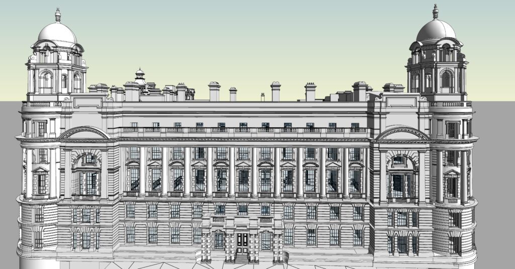
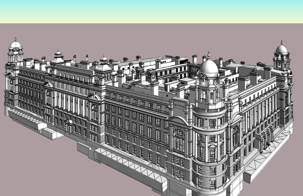
A laser scanning service provider built a Point Cloud Scan to Revit model at LOD 400 based on existing conditions for a 16th century heritage monument in the UK. The final 3D BIM model supported the client with a documented and digitized copy of the legacy building. It also helped the client calculate accurate material quantities and meet renovation schedules.

Point Cloud to Revit Model

Revit BIM Model at LOD 400
Challenges with Point Cloud to BIM adoption for legacy buildings
- Completeness and data quality: Old buildings lack accurate and detailed construction documentation. Inaccurate or fragmented data from point cloud scans from shadows, occlusions, or inadequate scan resolution leads to issues within the BIM model. Extracting filtered or noise-free data from complex geometry and retaining missing information requires a greater skillset and multiple site visits.
- Complexities within point cloud data: Large monuments can generate massive data sets. Managing, processing, and storing large point cloud data volumes would require exceptional computing power and specialized software. Translating large datasets into Scan to BIM models can be laborious and time intensive.
- Integration with current building systems: Renovating legacy buildings requires new components to be integrated into the present infrastructure. Modeling objects behind walls or ceilings can pose challenges. Being perceptive of vital details like electrical conduits, pipe sizes, and HVAC ductwork from point cloud data can be demanding and require investigative metrics.
Advantages of Point Cloud to BIM for legacy buildings
Accurate as-built representation
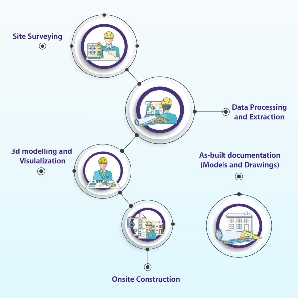
As-built models or drawings capture the final state of a project, reflecting changes made during construction and deviations from original plans. Laser scanners and 3D modeling tools ensure precise measurements and a comprehensive representation of structures. Accurate as-built representations are essential for maintenance, renovations, and facilities management, resolving challenges caused by inaccurate drawings and supporting informed decision-making.
Using surveying technologies like 3D scanning and LiDAR ensures precise documentation of existing buildings with minimal error, enhances project coordination and reduces rework costs. These precise representations serve as a foundation for design changes, promoting streamlined project progression.
Reduced rework and improved coordination
Combining point cloud scans with BIM tools creates digital twins that enable clash detection before actual construction begins. HVAC, plumbing, and electrical systems are virtually modeled to highlight clashes with structural components. This approach removes expensive rework, streamlines communication, and ensures a seamless transition from the design phase to the construction phase. This leads to mitigated onsite surprises and lower change orders.
Long-term value for facility management
Point Cloud to BIM helps create a dynamic digital twin. The 3D model updated with scan data, provides spatial representations of the physical space. This can be leveraged for improvements in maintenance planning, better work order management, predictive maintenance and troubleshooting.
Also Read: How to Choose your Ideal Point Cloud to BIM Outsourcing Partner
AI and ML supercharge legacy building renovations with point cloud and BIM
The future of renovating legacy buildings relies on Point Cloud to BIM technology enhanced by AI and ML. These technologies analyze data from existing conditions and digital twins to identify renovation needs, predict issues, and recommend layouts and materials. AI generates clash reports and ML optimizes space use based on historical data, revolutionizing renovations by minimizing surprises, optimizing workflows, and ensuring cost-effective transformations.
Conclusion
Point Cloud to BIM workflows provide a precise method for renovating legacy buildings. Integrating intelligent point cloud data into BIM tools creates an accurate digital twin of the existing structure, enabling early interference detection and reducing on-site reworks. Detailed spatial data extracted from point clouds ensures new building elements fit seamlessly, optimizing material use and enhancing renovation efficiency.
About TrueCADD
TrueCADD is a premier provider of BIM modeling solutions with operations in India, the USA, and the UK. We offer high-quality, cost-effective BIM outsourcing services to a global clientele, including architects, designers, engineers, surveyors, contractors, manufacturers, fabricators, and building owners. Our extensive in-house capabilities, combined with vast experience and a robust resource base, enable us to understand and meet the diverse needs of international clients, delivering reliable BIM services and CAD drafting solutions across a wide range of industries. https://www.truecadd.com/
