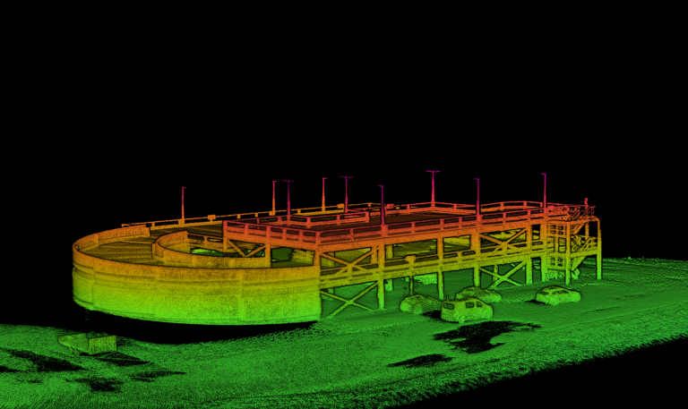
Mobile mapping is helping make some of the most ambitious technologies and projects of recent years a possibility. Digital maps created using scanners mounted on vehicles are helping autonomous vehicles know where to go, speeding up surveying projects for construction, improving the efficiency of conservation and public safety projects and even helping film and video game designers create accurate models of real-world locations for use in their work.
The number one concern therefore when mobile mapping, is of course, accuracy. If the maps that your work produces are inaccurate by even a small margin of error, it can make the end product unreliable at best, or unusable at worst. With this in mind, it’s particularly important that mobile mapping vehicle positioning is carefully considered for each project.
The way to map accurately is to combine a scanning element with technology that helps you precisely locate the vehicle conducting the scan, both on the earth and in relation to the world around it. If you know exactly where the vehicle is – down to the centimetre – then you can ensure that your maps/reports are accurate. Knowing values such as pitch and roll also helps you to ensure that your scanning apparatus remains accurate. This is particularly important over a long distance, protecting the integrity of the data.
The question is: how do you ensure your vehicles are accurately located? In this blog, we’re exploring a few different technologies that you can use in this endeavour. We also demonstrate the value of our favourite – a GNSS-aided inertial navigation system (INS).
Option One: GNSS Only
You may choose to use a GNSS receiver on its own to calculate your position. For the uninitiated, GNSS stands for global navigation satellite system. A receiver is a hardware sensor that uses a group of satellites to work out its position. GPS is an example of one of the groups of satellites, also called constellations, that GNSS receiver technology can use. The others are GLONASS, BeiDou and Galileo.
A GNSS-only method can be accurate (to the centimetre) under the right conditions. Namely, in open skies with a clear line of sight to six satellites. However, GNSS struggles in locations such as dense tree cover, or urban canyons (large groups of tall buildings which restrict your view of the sky). This can make GNSS alone a rather unreliable method of getting an accurate position of your mobile mapping vehicle. On top of this, GNSS can’t give you data such as the roll or pitch of your vehicle. Without this information, if you’re surveying using a LiDAR, it’s very difficult to keep your scan data coherent as you scan over a large distance, limiting the usefulness of the data.
Option Two: SLAM
SLAM stands for simultaneous localisation and mapping, and is a method of mapping a space while also understanding your own location in that space. SLAM has been used in a variety of applications.
SLAM’s biggest limitation is that over time, unavoidable errors appear in the map and eventually the volume of errors grow to the point that the data is unusable for determining your location with absolute accuracy. This makes SLAM best used for small spaces such as indoors, or for helping autonomous cars park, where relative accuracy (understanding your position relative to a local reference frame rather than global) is the most important thing. Similar to our next solution, and unlike the previous, a SLAM solution does use pitch and roll measurements to compute accurate position, however, because it creates a map for you, it doesn’t output these measurements.
Option Three: INS
An INS, or inertial navigation system, uses a collection of sensors including accelerometers, gyroscopes, and sometimes a magnetometer (together these are known as an inertial measurement unit, or IMU) and a GNSS receiver to calculate its position. It uses the GNSS for positioning, with the IMU aiming to ensure position accuracy when the INS moves out of GNSS coverage by a process known as dead reckoning. The combination of sensors in the IMU also mean an INS can help a user understand a mobile mapping vehicle’s heading, pitch, and roll to give a very precise position. This is essential if surveying with a LiDAR.
Because an INS doesn’t rely solely on satellites, it can also perform well in an urban canyon or underneath a tree canopy. Additional technology, such as tight-coupling software, can improve the accuracy of your data even further. An INS with a tightly-coupled GNSS receiver and IMU can improve position drift which naturally occurs when a GNSS receiver loses satellite signal. OxTS’ gx/ix tight-coupling is one such technology that can help overcome position error in tough GNSS conditions.
If you’re on the search for the right technology for your mobile mapping needs, our INS systems are worth investigating. All our devices contain high-quality IMU sensors, and are equipped with survey-grade GNSS receivers. As well as tight-coupling technology to help you overcome position drift in difficult GNSS conditions, every person who purchases an INS will receive our NAVsuite INS software free of charge. NAVsuite enables OxTS INS users to configure, monitor, post-process and analyse their survey data.
If you’d like to talk to us about your mobile mapping needs, we’d love to help get your payload just right – contact us at https://www.oxts.com
Consider OxTS for your Mobile Mapping INS
For more than 20 years OxTS has been providing INS and GNSS devices for a range of applications, including ADAS and autonomous vehicle testing and operations. Our range of mobile mapping INS devices deliver you all the accuracy and information you could wish for, at a lower price than many of the traditional players in this space.
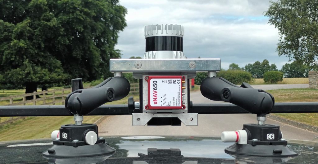
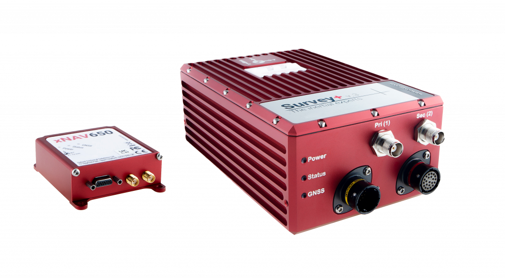
The Survey+ is the ideal companion for many land-based mobile mapping projects, whereas the smaller, more compact xNAV650 is suitable for more SWaP constrained applications.
If you would like to quickly and simply georeference LiDAR data using your choice of navigation data then our LiDAR georeferencing software OxTS Georeferencer can help.
Using our INS technology means you’ll enjoy:
- Tight integration of INS and GNSS data to ensure complete accuracy even in tough GNSS conditions
- IP65 hardware that’s been proven to last ten years without failure
- Complimentary configuration, analysis and post-processing software
- ISO 17025-accredited calibration services, which last for two years on average
- In-territory checks to see if your INS needs recalibration without having to send it back to the UK
- Powerful georeferencing software that helps you create high-quality pointclouds from your scans
If you’d like to find out more about our mobile mapping Inertial Navigation Systems, get in touch with us today: https://www.oxts.com


