
Routescene Ground Control Target being deployed at a project in Sand Canyon, Colorado, USA
29th September 2020 – Improving and verifying accuracy is a typical objective of any survey… and this becomes more complex to achieve when undertaking a UAV LiDAR survey. Deploying Routescene’s Ground Control Targets on known and accurately co-ordinated Ground Control Points prior to a UAV LiDAR survey provides the assurance that the survey has been properly executed and you can demonstrate the specified level of accuracy has been achieved.
Establishing ground control brings many benefits including checking for errors in your survey, so you achieve robust and quantifiable results; the ability to calibrate the equipment on every project; you will prevent unnecessary repeat visits to remote sites; it simplifies post-processing and avoids data alignment issues.
UAV LiDAR surveys are typically undertaken in remote, rural and sometimes hazardous locations where there are no fixed points available, such as solid surfaces or concrete features, that could be used as Ground Control Points. Routescene’s Ground Control Targets solve this problem.
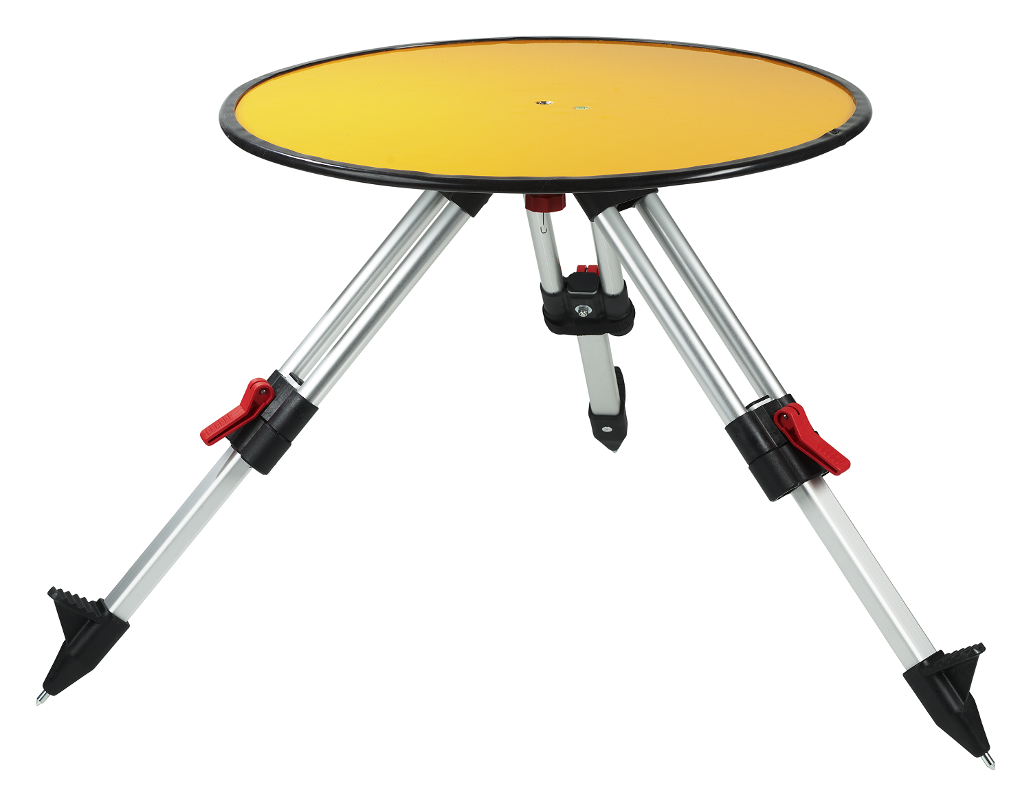
Ground Control Target, specifically designed and manufactured by Routescene, for use on UAV LiDAR surveys.
Specifically designed for UAV LiDAR surveys
The Routescene UAV LiDAR Ground Control Targets are quick and simple to deploy. Raised from the ground using a mini tripod, a built-in bubble level enables accurate levelling and removes the need for a tribrach. Robustly engineered, the targets stay in position during adverse and windy conditions, reducing the risk of repositioning during a survey.
Covered with highly retro-reflective material to provide high-intensity returns, typically each target will be hit 200-300 times by the lasers from the UAV LiDAR system. As a result the targets are easily identifiable and can be automatically extracted from the geo-referenced point cloud.
You can directly compare the known coordinate of the physical target with that visible in the point cloud. The difference between the two coordinates is the error: confirming the level of accuracy achieved in the survey.
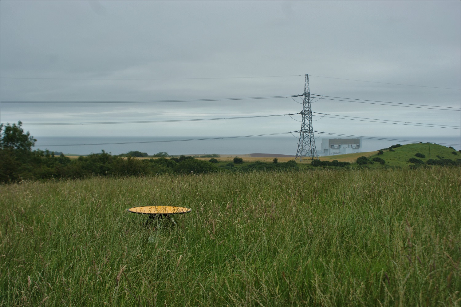
Routescene UAV LiDAR Ground Control Target visible even in long grass.
Routescene customer Vashaun Henderson from Rekon Solutions in Canada commented, “When working for engineering and survey clients accuracy has be paramount for us. Utilizing the special laser reflective ground control targets from Routescene we have been able to clearly identify survey monuments in the field, survey them and identify those targets in the scan. Having these targets enhances our ability to evaluate the scan’s alignment and our ability to evaluate and report on horizontal and vertical accuracy. It is something that has separated us from the pack. Rekon has had great success with deploying these targets.”
Gert Riemersma Routescene’s founder and CTO added, “At Routescene we have a strong ethos of Quality Control and Quality Assurance, based on my own foundations in land surveying and my many years of experience working in the offshore industry, where Quality Assurance and Quality Control was of paramount importance. Setting Ground Control Points using our Ground Control Targets enables you to verify the level of accuracy achieved, calibrate the sensors on the drone, identify any errors early and as a result improves your confidence in the accuracy of the survey. Investing in Routescene Ground Control Targets for UAV LiDAR surveys increases the value of your data. Taking that extra time and effort to install these targets and to generate Quality Assurance Reports will improve the quality and your confidence in your data.”
To read an in-depth article from Gert on improving UAV LiDAR survey accuracy using Ground Control Points visit: https://www.routescene.com/events/uav-lidar-accuracy-with-ground-control-points/
Routescene Ground Control Targets are now available to order, see more information at https://www.routescene.com/the-3d-mapping-solution/uav-lidar-ground-control-targets/
For more information please visit: https://www.routescene.com
About the Routescene UAV LiDAR System
 A turnkey UAV LiDAR solution designed specifically for use on Unmanned Aerial Vehicles (UAVs or drones). Developed to save time, improve efficiencies and productivity. It enables faster surveys and higher resolution outputs with Quality Assurance as standard. Perfect for applications where accurate mapping is essential but difficult to achieve such as hard to reach areas, hazardous environments and situations where you need to penetrate vegetation to reach the ground beneath. All the complex integration is complete – the result – an operational system ready for immediate use. Comprising workflow methodologies, quality assurance software, post-processing software, hardware and firmware.
About Routescene
Routescene® is a global operation. We offer authoritative insight across all aspects of data management and have industry recognition as data visualisation experts. We understand the problems the survey industry needs to solve and have combined intelligent thinking with experience to design a reliable and practical solution to deliver fast geospatial data capture, analysis and visualisation to improve commercial decisions and performance. www.routescene.com
