Capturing over 30% more data than previous generations, the new system increases coverage and gives operators the flexibility to adapt to a wide range of mapping requirements.
- Significant time and cost saving for customers: The Leica DMC-5 captures over 30% more data than previous generations, covering larger areas with fewer flight lines.
- Adaptable to different missions: Configurable field-of-view options enable operators to adapt coverage and ground resolution to different project and airspace requirements.
- Greater operational efficiency: Increased coverage and system flexibility help operators address a wider range of projects while optimising airborne operations.
Heerbrugg, Switzerland, (10 November 2026) – Leica Geosystems, part of Hexagon, today announced the Leica DMC-5 next-generation airborne imaging system. Built around the Leica MFC250 camera core within a configurable camera architecture, the DMC-5 helps operators capture large areas more efficiently and gives operators the flexibility to meet different mapping and flight requirements.
Built on the MFC250 camera platform, the DMC-5 delivers detailed, clear imagery and efficient large-area data acquisition.
More data, tailored to every mission
With two available configurations up to 68,800 pixels across-track, the DMC-5 captures over 30% more data than previous generations, significantly reducing the flight time needed to complete a project. Highly adaptable, field-of-view options range from 36° to 63° in the base configuration and up to 71° in the X configuration, allowing operators to balance image swath and ground resolution to conform to project and airspace requirements.
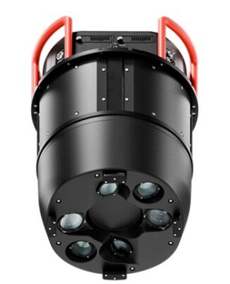
The Leica DMC-5 offers configurations up to 68,800 pixels across-track and field-of-view options from 36° to 63°,enabling greater coverage and flexibility for diverse project requirements.
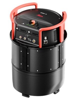
Building on the Leica DMC product line, deployed by national mapping agencies worldwide, the DMC-5 brings new capabilities to large-format airborne imaging while retaining traditional frame-based outputs for photogrammetric applications.
“Airborne mapping operators are being asked to deliver more, often within increasingly tight operational constraints,” said Tanja Birner, President at Hexagon’s Scanning & Mapping Division. “With the DMC-5, we want to help our customers make the most of every flight, take on new business opportunities and get a better return on their investment. It’s about enabling them to grow their business and stay competitive as market demands evolve.”
Trusted performance from acquisition to deliverables
The DMC-5 leverages Leica Geosystems’ exclusive mechanical forward-motion compensation (FMC) to maintain image sharpness at high aircraft speeds. Complementing this, the Leica PAV gyro-stabilised mount compensates for aircraft motion, supporting consistent image quality throughout every mission.
Integration with Leica HxMap provides a scalable processing workflow from data ingest and radiometric normalisation through to final deliverables.
To learn more about the Leica DMC-5, visit: https://leica-geosystems.com/products/airborne-systems/imaging-sensors/leica-dmc-5
About Hexagon:
Hexagon is the global leader in measurement technologies. Our precision measurement, positioning, and autonomous solutions transform the world’s most vital industries. From aerospace & defence, automotive, construction, general manufacturing, to mining and more, we provide the confidence that customers rely on to build, navigate, and innovate. Hexagon (Nasdaq Stockholm: HEXA B) has approximately 17,500 employees in 50 countries and net sales of approximately 3.7bn EUR. Learn more at hexagon.com.