Maysville, Kentucky, USA (October 6, 2026)– Carlson Software has released their latest CAD software versions—including Survey, Civil, Hydrology, GIS, Mining, and Point Cloud—introducing new features, enhancements, and powerful tools designed to boost user efficiency in the office. Carlson 2027 features IntelliCAD 14.1 as well as compatibility with AutoCAD® 2027. From native CAD tables and multiple ROW offsets to surface timelines and label style libraries, Carlson 2027 brings advances for every user. Here are a few of the highlights:
Multiple Point Spreadsheet Editor
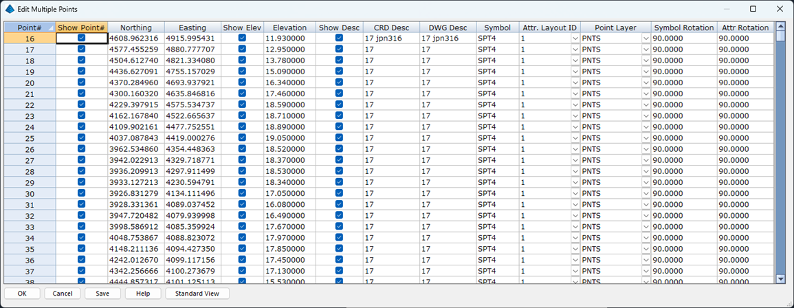
The Edit Multiple Point routine offers a new Spreadsheet editor to facilitate quicker point edits with an “easy to read” interface.
Custom Layer Targets
Carlson Civil (SiteNet pull-down) and Construction (Takeoff pull-down) has always streamlined the ability to estimate earthwork cut/fill volumes, topsoil, and select subgrade materials utilizing existing and design surfaces. Now the program has been optimized to incorporate user-defined custom layer targets for organizing non-surface design features (landscaping, lighting) or for calculating volumes at any stage of a project (preliminary, progress, as-built).


When a custom layer target has been defined, it now flows into the rest of the SiteNet/Takeoff workflow including quick commands such as Set Layer for Custom, Display Options Freeze/Thaw, Make User-Defined Surface, and Set Active Surfaces for Calculate Total Volumes.
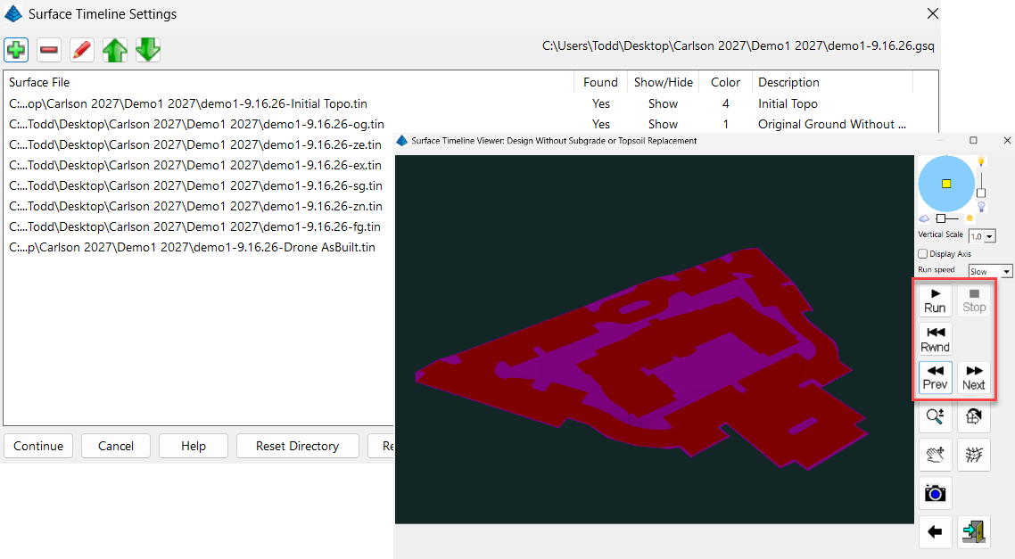
There is also a new Surface Timeline command that allows you to step through your surface models from original ground to finish grade and any others in between.
Label Style Library
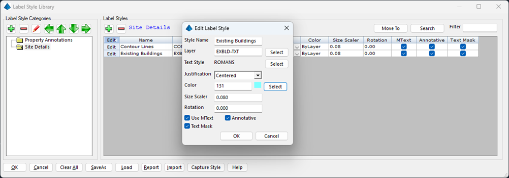
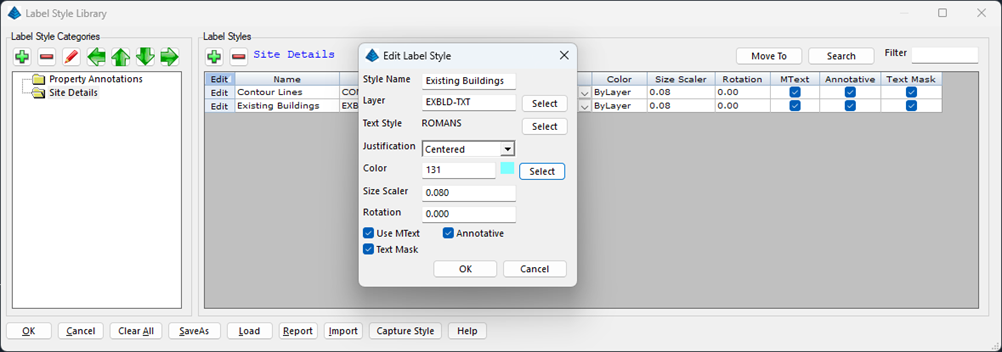
The new Label Style Library offers another step forward in setting up and maintain company standards within an office. Label styles can be created and then applied via a simple drop-down menu in many of the Carlson annotation routines.
- Within that library is Capture Style which allows you to create a Label Style by selecting any existing text entity.
LotNET ROW Multiple Offsets
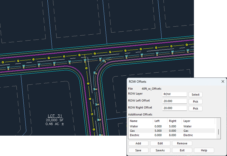
Improved options for multiple offset lines specified in the ROW file to assist in drafting typical roadway designs. Roadway edges, sidewalks and utilities can all be added to a plan simultaneously with the design of the road itself.
Point Cloud
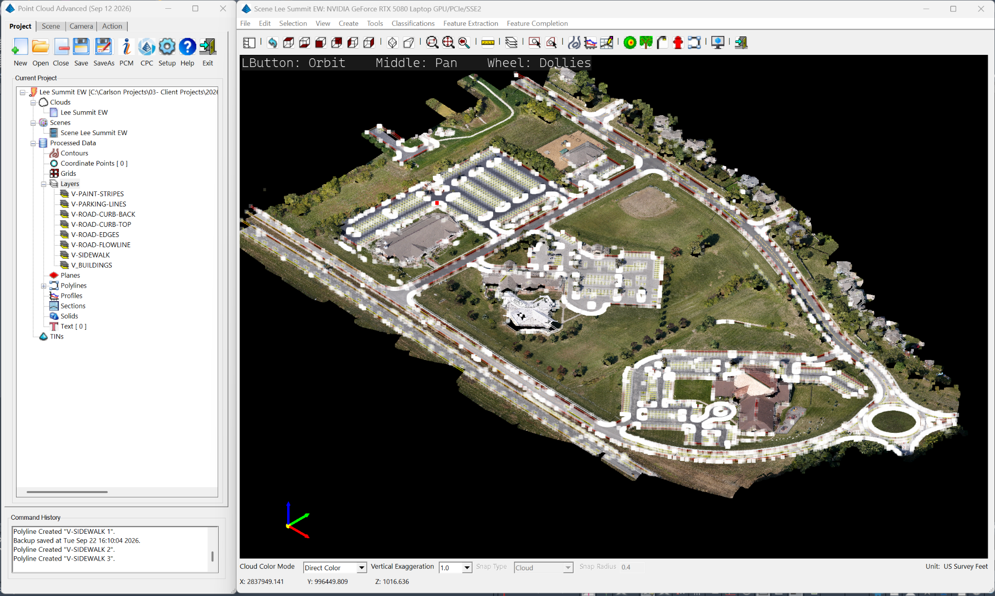
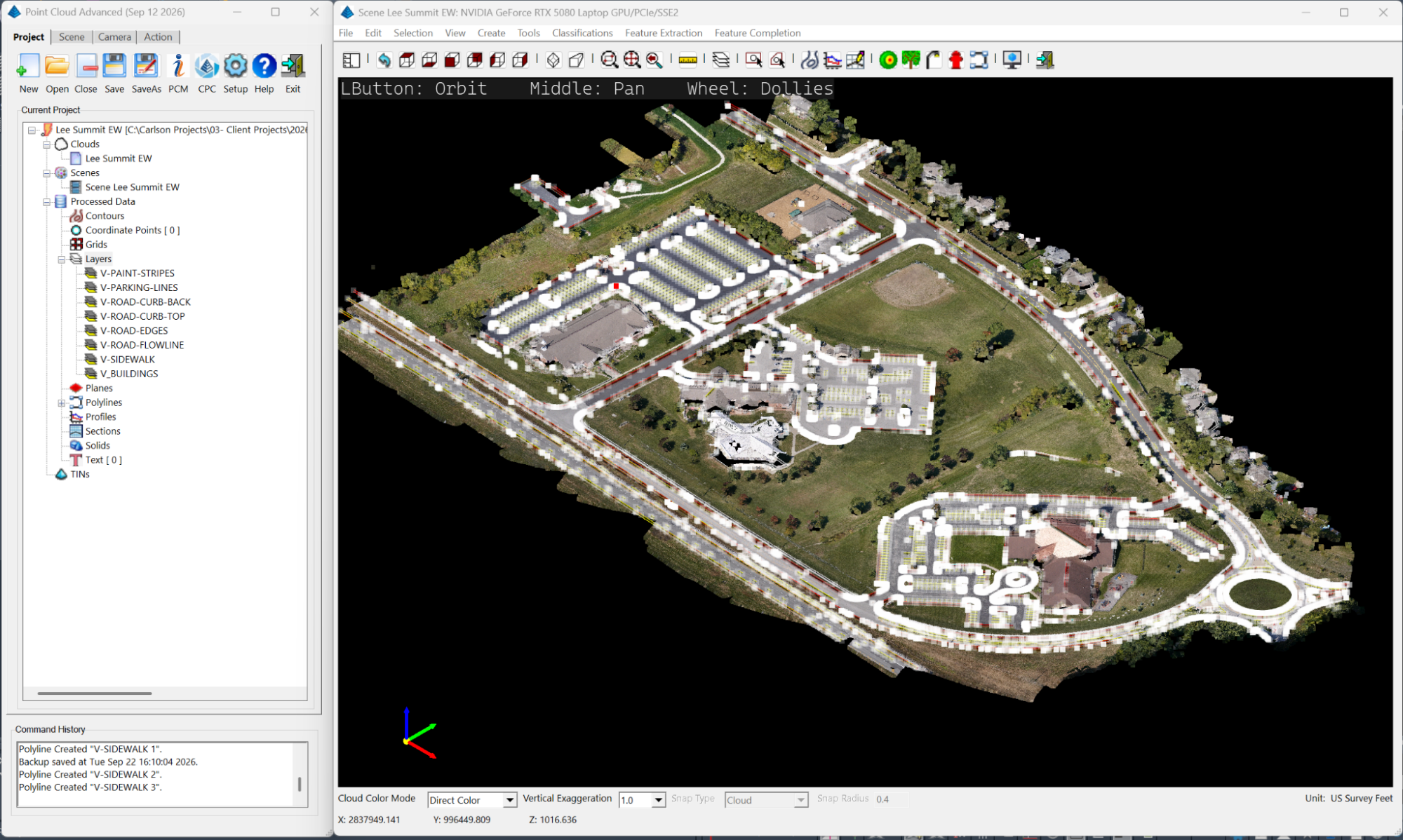
Vastly improved point cloud size capability. Point cloud under the hood improvements include the ability to handle massively sized point clouds without over taxing computer memory constraints.
Native CAD Tables:
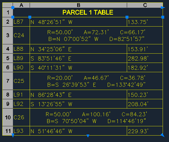
New option to use a native CAD table for annotating routines such as line and curve tables. This allows typical table edits, sizing and formatting for more control over table appearance.
Additionally, line and curve tables now have an option to combine all curve data into a single cell along with more header control.
Carlson Compass
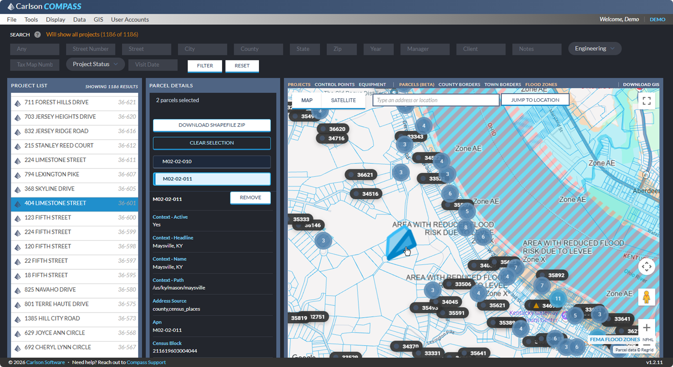
Introduced in early 2026, the new project management program, Carlson Compass, now has toggled options for display of:
- Control Points
- Parcel Data, County and Town Borders as well as FEMA Flod Zones, all downloadable via shape (SHP) file.
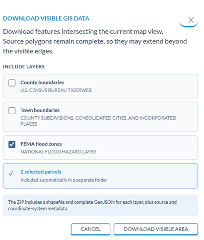
This program helps answer the perpetual problem of locating older projects as well as defining new ones complete with user defined fields such as project status, etc. and options to designate icon colors and shape for each.
Learn more about Carlson 2027, download a free trial, view the feature update list, or get your updated serial number at carlsonsw.com/2027

