From Himalayan rail tunnels to airport drone corridors, the same technology is redefining what reliable positioning means
For most of its history, the positioning and mapping industry has measured progress in centimeters. How accurately can you place a point? How tightly can you constrain the error? Accuracy was the ultimate arbiter of a system’s worth and in surveying, engineering and infrastructure, the cost of being wrong is very real.
But today, accuracy alone is no longer enough. The environments in which positioning systems operate are more complex, more constrained, and, in some regions, openly challenging to GNSS. Customers are no longer satisfied with, “How accurate is it?” They want to know, “Will it keep working when conditions change, and can I trust it in real-time?”
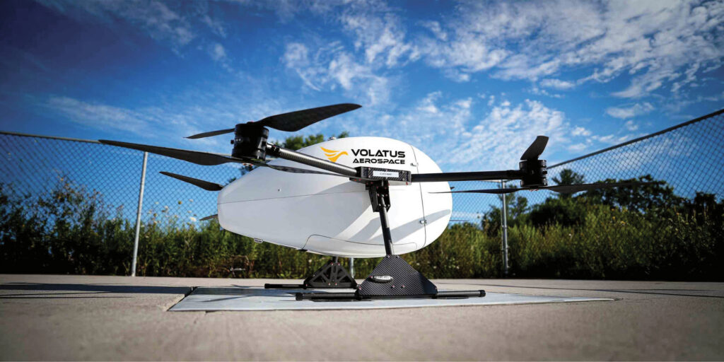
Volatus Aerospace drone stationed on a launch pad.
That shift is putting resilience, reliability and confidence at the center of system design. It’s reshaping how the industry thinks about sensor fusion, correction services and trajectory management.
In the following, you’ll see that it’s the common thread running through three different deployments: a mobile mapping system built for electric vehicles in urban environments, a rail survey platform operating through Himalayan tunnels, and an autonomous drone navigating active airport airspace. Three industries, three continents, three radically different operational challenges — each underpinned by the same goal: positioning that doesn’t quit when the environment pushes back.
The intelligence advantage
Mobile mapping has always been a power-hungry discipline. Traditional survey rigs laden with lidar scanners, cameras, GNSS receivers and inertial measurement units demand specialized vehicle installations and significant power draw. For electric vehicles, where every watt reduces operational range, that has been a barrier to adoption.
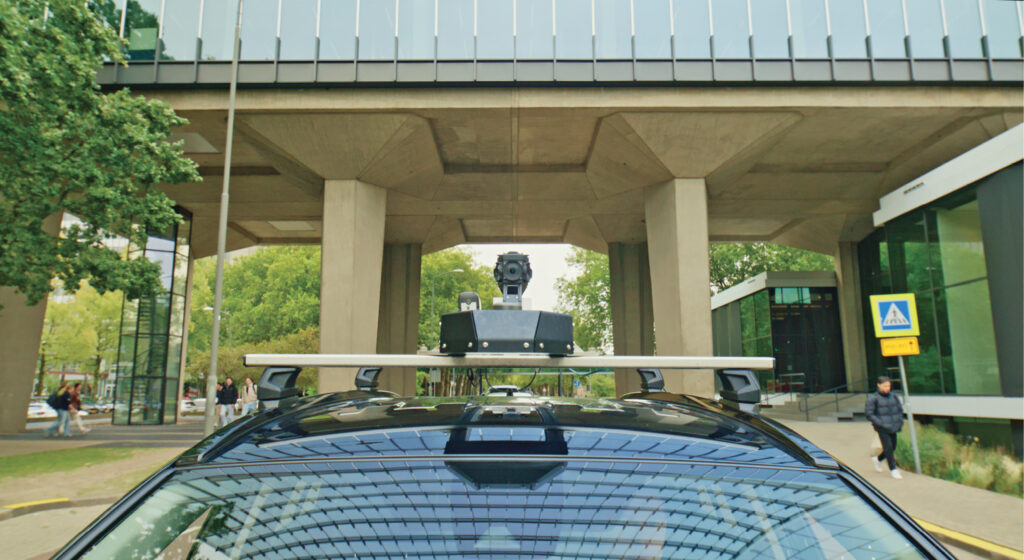
A vehicle-mounted mobile mapping system equipped with a 360-degree camera setup.
Horus1 set out to change that. Its goal was a professional-grade mapping system capable of centimeter-level accuracy running entirely off a standard 12-volt vehicle port. The result integrates GNSS and inertial positioning with lidar, thermal and optical sensors into a single-cable, lightweight platform representing a genuine engineering achievement in spatial and temporal precision at minimal power. By building on Trimble® Applanix’s sensor-fusion engine and trajectory-focused processing, Horus gains not just accuracy but the kind of consistency and robustness on which mobile mapping workflows depend.
A key part of that robustness is the use of Trimble RTX® correction services, providing a consistent, high-accuracy reference frame across large operating areas without the need to renegotiate real-time kinematic (RTK) networks as vehicles move between regions. That gives operators confidence that the positioning solution will behave the same way from city to city and country to country.
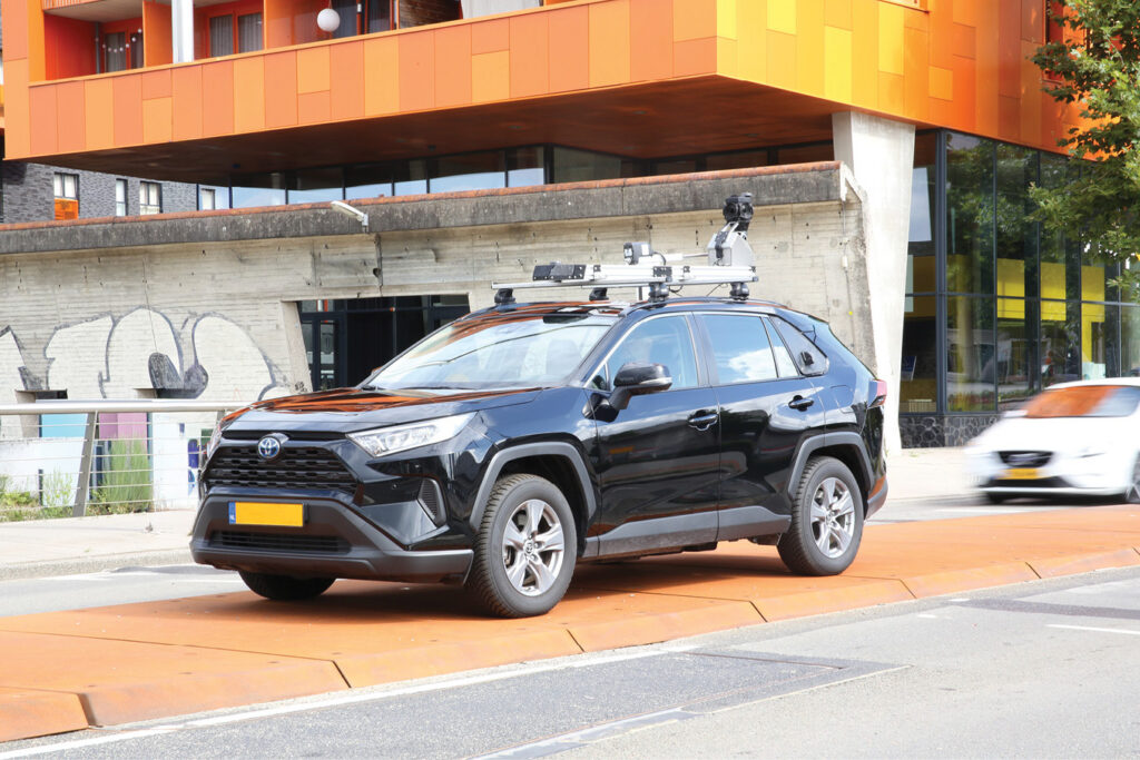
An urban mapping vehicle equipped with roof-mounted sensors and cameras, parked on a city street while collecting data.
What makes this deployment particularly forward-looking is edge AI. Rather than storing raw data for office post-processing, the system pairs its positioning hardware with onboard GPUs that run AI models in real time as the vehicle drives, detecting and classifying infrastructure assets, road signs and environmental conditions on the fly. The result is a 40 percent reduction in field time and, more significantly, a more resilient, automated workflow that reflects where the industry is heading: positioning systems that don’t just capture the world, but understand it and maintain operational continuity as conditions change.
Continuous corridors
While urban mobile mapping pushes the limits of efficiency and power, rail infrastructure demands positioning that can survive total blackout conditions.
Rail networks present some of the most challenging positioning environments on earth. Trains move at speed through tunnels, dense forests, deep mountain valleys, and urban canyons — all of which block or degrade GNSS signals. A rail survey system that depends on satellite positioning alone will produce accurate data in open country and useless data everywhere else. For a network that may run for hundreds of kilometers through varied terrain, that is not acceptable.
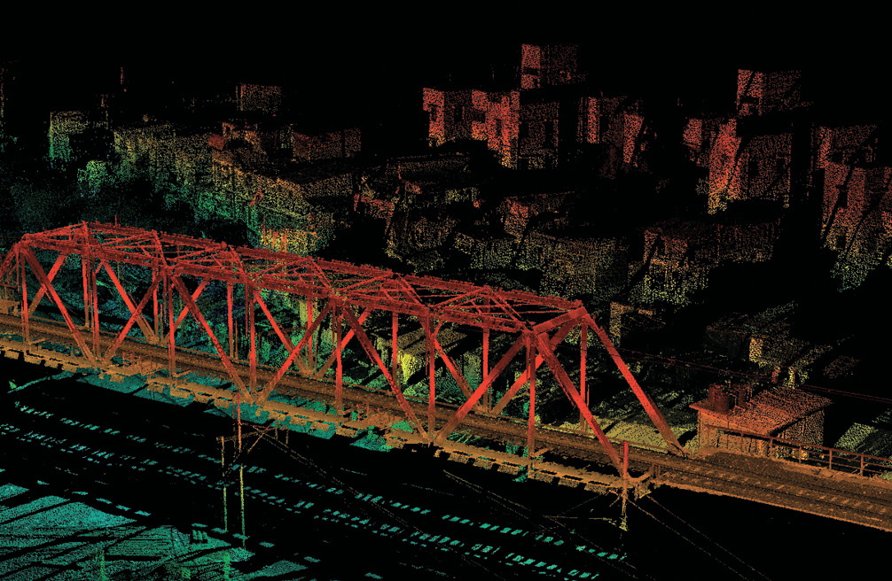
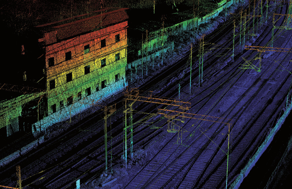
Above: 3D lidar point-cloud scan highlighting a steel truss railway bridge; Below: 3D lidar point-cloud scan of a railway corridor and a multi-story building, color-coded by elevation.
Roter Precision2, a rail survey company, operates in exactly these conditions, including some of the most demanding terrain on the planet. Their system achieves continuous, accurate positioning through deep sensor fusion built around a tightly managed trajectory. GNSS provides absolute positioning when the sky is clear; an inertial measurement unit, which measures acceleration and rotation, carries the solution through GNSS-denied segments using dead reckoning from the last known fix; and a distance measurement instrument tracking wheel rotation provides precise speed data that keeps the trajectory stable over extended signal outages. By treating the trajectory as the common thread that ties all sensors together, Roter maintains a solution that is not only accurate, but predictable and engineerable, and thus the basis for a resilient workflow rather than a fragile one.
The output is a continuous, high-fidelity 3D digital twin of the rail corridor that does not have gaps where the tunnels are. This supports clearance analysis, track alignment verification, and the kind of ongoing infrastructure monitoring — comparing this month’s scan against last month’s — that enables predictive maintenance before a structural problem becomes a safety incident.
This is resilience in its most literal sense: a system engineered to ensure uncompromised data integrity, through the very conditions that would break a less integrated approach.
Resilience through safety
True resilience is tested not just by difficult geography, but by environments where the consequences of failure are measured in terms of human safety.
Drone logistics are maturing rapidly, and the frontier of that evolution is autonomous operations in and around major airports. Automated delivery routes could dramatically reduce ground transport in dense urban areas, but the regulatory and technical bar is extraordinarily high. A drone crossing an active runway glide path is operating in some of the most tightly controlled airspace in the world, close to commercial aircraft carrying hundreds of passengers.
The positioning challenge is compounded by the airport itself. Terminal buildings, radar installations, and the density of radio frequency (RF) traffic create a challenging signal environment laden with multipath reflections, temporary signal dropout, and interference that would cause a purely GNSS-dependent system to behave unpredictably. Vision-based positioning systems, sometimes proposed as alternatives, are unreliable in poor visibility, low light, and adverse weather. Neither system is sufficient on its own.
Volatus Aerospace3, a Canadian aerospace and defense company, needed to fly autonomous delivery routes across an active international airport, crossing live runway glide paths, without relying on ground-based positioning infrastructure. By integrating GNSS and inertial sensors into a tightly coupled system and using Trimble RTX as a consistent global reference, the team achieved centimeter-level accuracy even when satellite signals blink out for seconds at a time. When GNSS is unavailable because it is blocked by a terminal building, reflected off a jetway, or overwhelmed by adjacent RF traffic, for example, the inertial sensors seamlessly maintain the solution, delivering all-weather, all-condition positioning without any additional airport infrastructure.
This infrastructure independence matters enormously for scalability. A system that carries its resilience with it through the integration of its sensors and the consistency of its correction service can operate under a single workflow across any airport, in any country, in any weather. The autonomous flight systems aboard these drones consume that positioning data to make hundreds of real-time decisions per second: adjusting rotor speeds, compensating for wind, and executing precise landings on small pads near active terminals. The accuracy of that data is not an abstract quality metric. It is the basis for operator and regulator confidence, and the direct enabler of safe autonomous operation in controlled airspace.
Raising the reliability bar
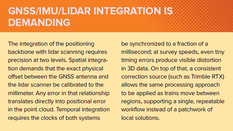
Three deployments, three industries, three continents with a single architectural principle at the heart of each: a precise, continuous trajectory that ties all sensor data together. This allows a lidar point captured at a specific millisecond to be placed accurately in three-dimensional space. It enables data from multiple sensors, each with its own clock, coordinate frame, and error characteristics, to be fused into a coherent whole.
What makes trajectory-based fusion so powerful is predictability. Trajectory errors have characteristic signatures, they drift in recognizable ways, correlate with identifiable conditions, and can be modeled and corrected for. That predictability is why a well-designed fusion system can bridge a tunnel where GNSS is lost, maintain accuracy through the multipath environment of an airport, or synchronize a lidar scanner to microsecond precision. Errors become predictable adjustments rather than systemic failures.
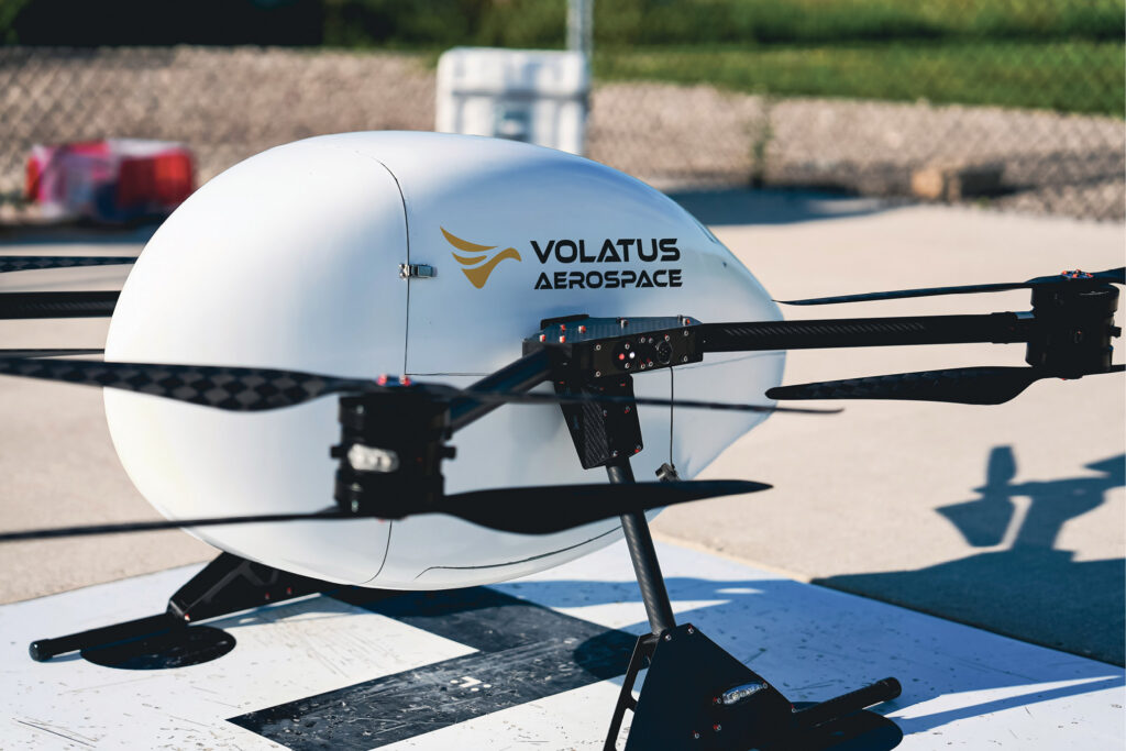
Close-up of Volatus Aerospace cargo drone.
Supporting all three deployments is access to satellite-delivered correction services that work consistently anywhere in the world, thereby eliminating the infrastructure dependency of traditional ground-based RTK and providing one workflow, one quality standard, everywhere from Tokyo to Toronto, from the Himalayas to Heathrow.
Sensor fusion is not new. What has changed is its maturity and accessibility. Where once it demanded deep specialist expertise and painstaking calibration, that complexity is increasingly absorbed into the tools themselves. Today, advanced fusion is made practical for more operators in more applications, thanks to automated quality checks, trajectory anomaly detection, and streamlined correction workflows.
This progress matters more now because the environment has become more challenging to GNSS. Signals that operators once took for granted are subject to disruption from congested RF environments, natural interference, and, in growing parts of the world, deliberate jamming and spoofing driven by geopolitical conflict. The answer is not better antennae alone, but systems that do not depend on any single input remaining available – where losing a satellite signal is a manageable event, not a failure.
These three deployments point to where the industry is heading: positioning systems that are not just accurate, but genuinely resilient systems that carry their reliability with them, wherever they go.
 As Director, Land and Air for Trimble, Kevin Andrews leads a team responsible for delivering advanced solutions and technologies to markets that require highly accurate positioning and orientation for the purposes of reality capture on moving, ground-based platforms. Previously, Kevin was the strategic marketing manager for businesses at Trimble that serve autonomous vehicle applications and, prior to that, product manager for Trimble’s Applanix land and indoor products. Kevin received his MBA from Schulich School of Business and BSc in Geomatics Engineering from the University of Calgary. He lives in the Toronto area with his wife, children and two cats.