There’s a persistent assumption in the geospatial industry: if you need centimeter-level ground resolution, you need a drone. The reasoning seems obvious — lower altitude, slower speed, more control. What a fixed-wing aircraft gains in coverage, it supposedly sacrifices in detail. Recent work carried out by a group of European geospatial specialists challenges that assumption, and the results are hard to ignore.
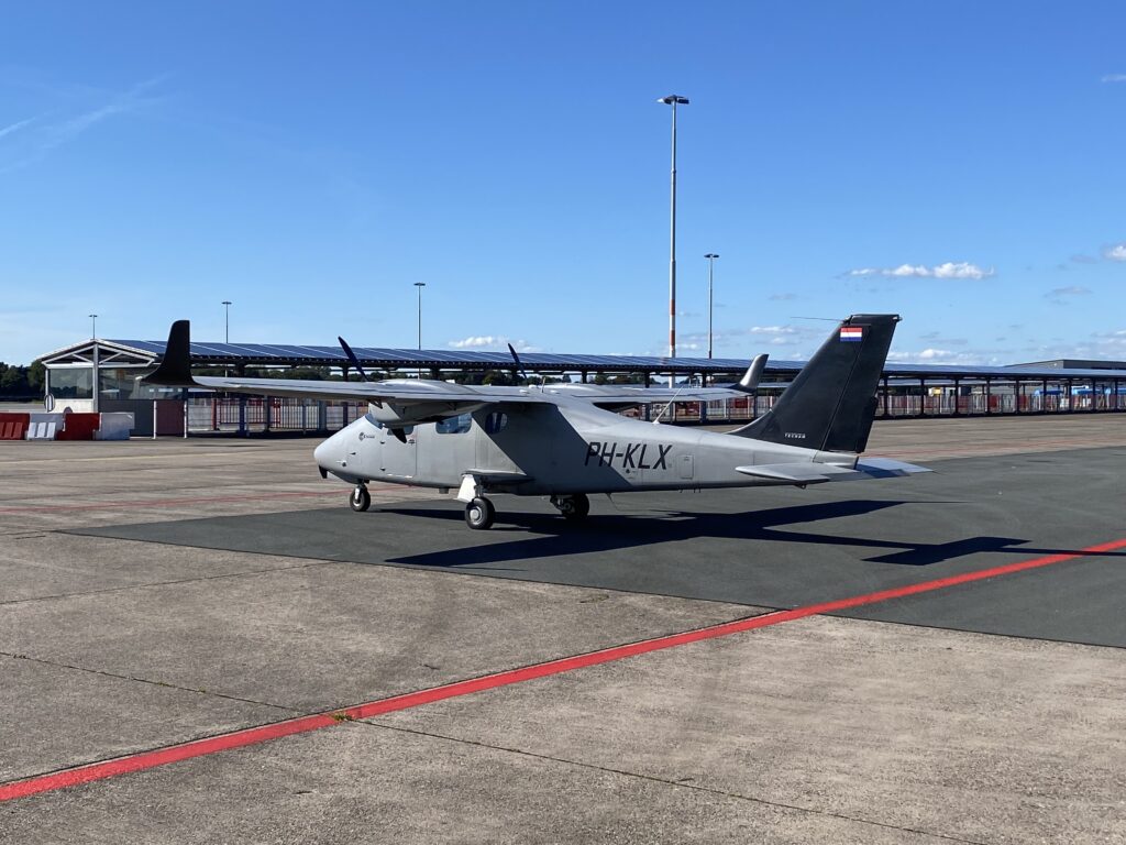
The survey platform: Kavel 10’s fixed-wing aircraft stationed on the tarmac, engineered for large-scale, high-efficiency corridor mapping missions.
The project brings together four members of the European Association of Aerial Surveying Industries (EAASI), Phase One, IGI, Kavel 10, and Esri, each contributing a distinct layer to what has become a tightly integrated operational chain. The camera, the airborne platform systems, the data collection workflows, and the GIS environment are no longer separate concerns. They’ve been engineered to function as one.
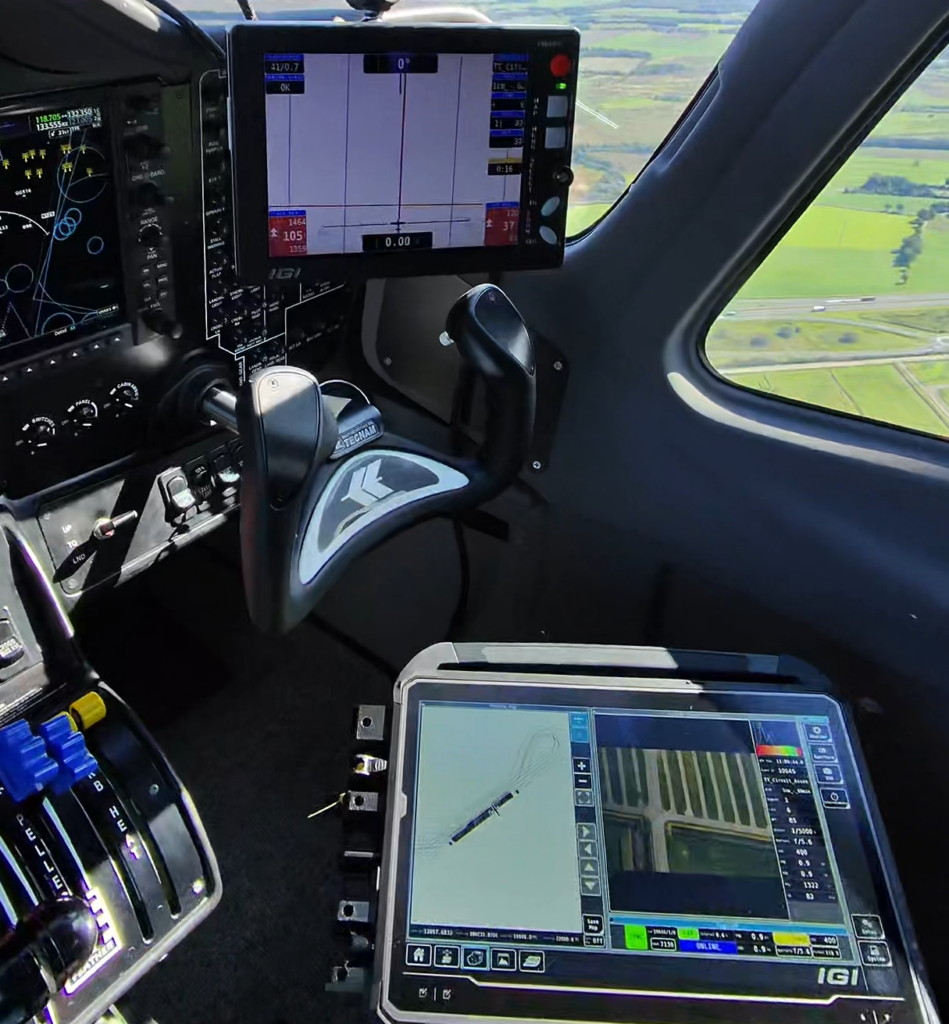
In the cockpit: The IGI CCNS-5 and IGIvisu flight management system guiding Kavel 10’s pilot through precise corridor flight planning over complex linear infrastructure.
At the core of the IGI CM-1 system is the Phase One iXM-FS130 camera, integrated with IGI’s airborne positioning and flight management technology. Phase One states that the camera uses Fusion Shutter technology, combining the advantages of an electronic global shutter with a mechanical leaf shutter. This is important in fixed-wing corridor mapping because high aircraft speeds makes motion blur and overlap management critical at 1 cm GSD. The system’s value lies in the integration of sensor, triggering, stabilization, and flight planning, which together make dense, high-resolution capture operationally viable. To keep 1 cm workflows practical at corridor scale, the system also relies on Phase One’s IIQ-X compression and accelerated processing pipeline, reducing the storage and processing burden typically associated with ultra-high-resolution aerial imagery.
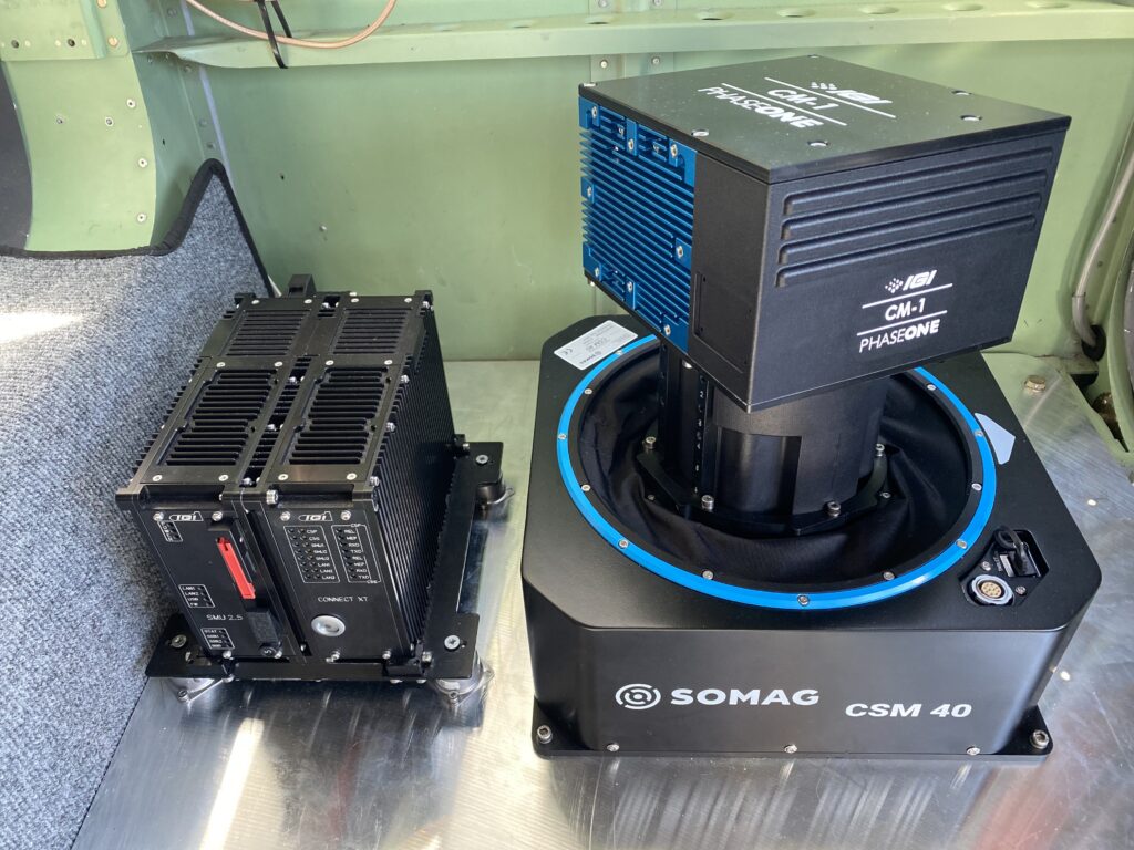
Inside the aircraft: The IGI CM-1 system in operation, consisting of IGI control electronics, Phase One iXM-FS130 camera and Somag CSM 40 gyrostabilized mount.
Kavel 10, a Netherlands-based aerial survey operator, has been central to putting the system through its operational paces in real-world, nationwide work. The jump from 5 cm to 1 cm is not simply a technical upgrade – it’s a qualitative shift in what the data reveals.
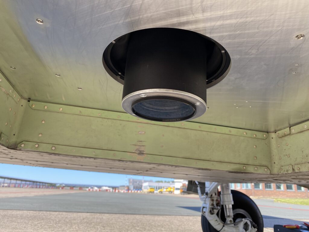
Under the hood: View of the sensor pod underside, showing the clean integration of the ultra-high-resolution optics within the aircraft fuselage.
At 5 cm, you see roads and rooftops; at 1 cm, lane markings, surface repairs, and crack detail sufficient for automated road monitoring and inspection workflows. But the same imagery also captures bicycle paths, individual solar panels, rooftop exhaust systems, and roof condition detail that previously required either a drone flight or a boots-on-the-ground inspection.
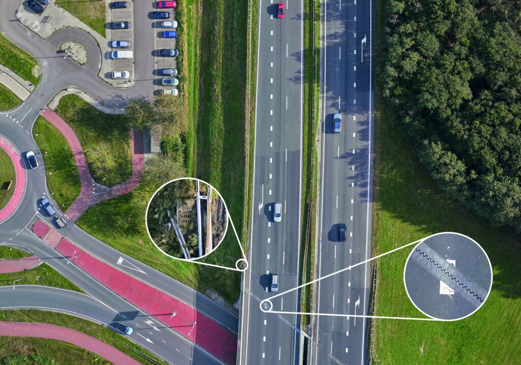
Ready for automated road inspection: Ultra-high-resolution freeway imagery revealing distinct lane markings, vehicle details, and surface textures crucial for AI-driven crack and wear detection.
One of the clearest demonstrations was carried out over a 20-kilometer stretch of the A2 motorway in Limburg, the southernmost province of the Netherlands, running close to the Belgian border. This sort of linear infrastructure makes fixed-wing acquisition genuinely difficult — long, curving routes that don’t follow neat parallel lines. Corridor flight planning, rather than conventional broad-strip acquisition, allows the aircraft to trace the road geometry more directly, reducing unnecessary image capture and keeping data volumes manageable. Where turns exceed aircraft limits, Kavel 10 segments the mission rather than forcing aggressive manoeuvers that would compromise image geometry. It’s a pragmatic engineering solution that keeps data quality consistent throughout.
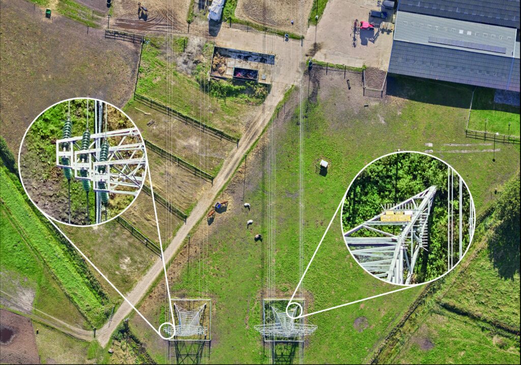
Utility and vegetation monitoring: 1 cm GSD imagery capturing structural elements of power pylons and fine vegetation details for precise encroachment and asset management.
Similar demonstrations covered railroad infrastructure and train stations in the Netherlands, where dense urban environments and complex asset geometries stress-test any acquisition system. Urban road examples showed how 1 cm imagery distinguishes between brick and asphalt surfaces, identifies repair patches, and resolves small-scale details that lower resolution simply smears together.
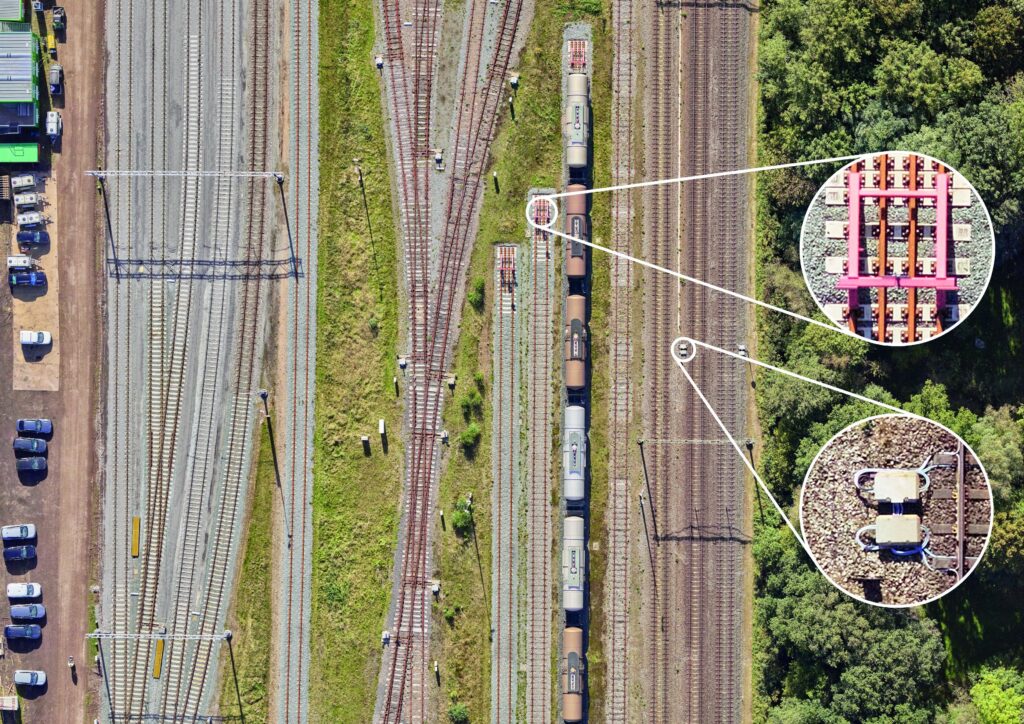
1 cm GSD railway view: High-altitude corridor mapping capturing crisp, clear track alignment and surrounding infrastructure from 450 m AGL. Magnified views of the railway track demonstrate the ability to inspect individual ties and components at sub-centimeter level without deploying drones or ground crews. The zoomed-in details of railway rolling stock and platform infrastructure highlight the power of the Phase One and IGI integration.
The project reflects the broader direction of the aerial survey industry in its relationship to AI and automated analysis. Esri, contributing the GIS integration layer, demonstrated through its Living Atlas a road crack detection model that specifies imagery finer than 2 cm per pixel as the preferred input. That puts 1 cm fixed-wing data squarely in scope for automated infrastructure inspection workflows. The principle extends to invasive species monitoring, digital twins, and condition assessment: machine-learning models don’t just need data volume, they need sufficient visual detail to distinguish reliably between features. At 1 cm, many of those distinctions become tractable.
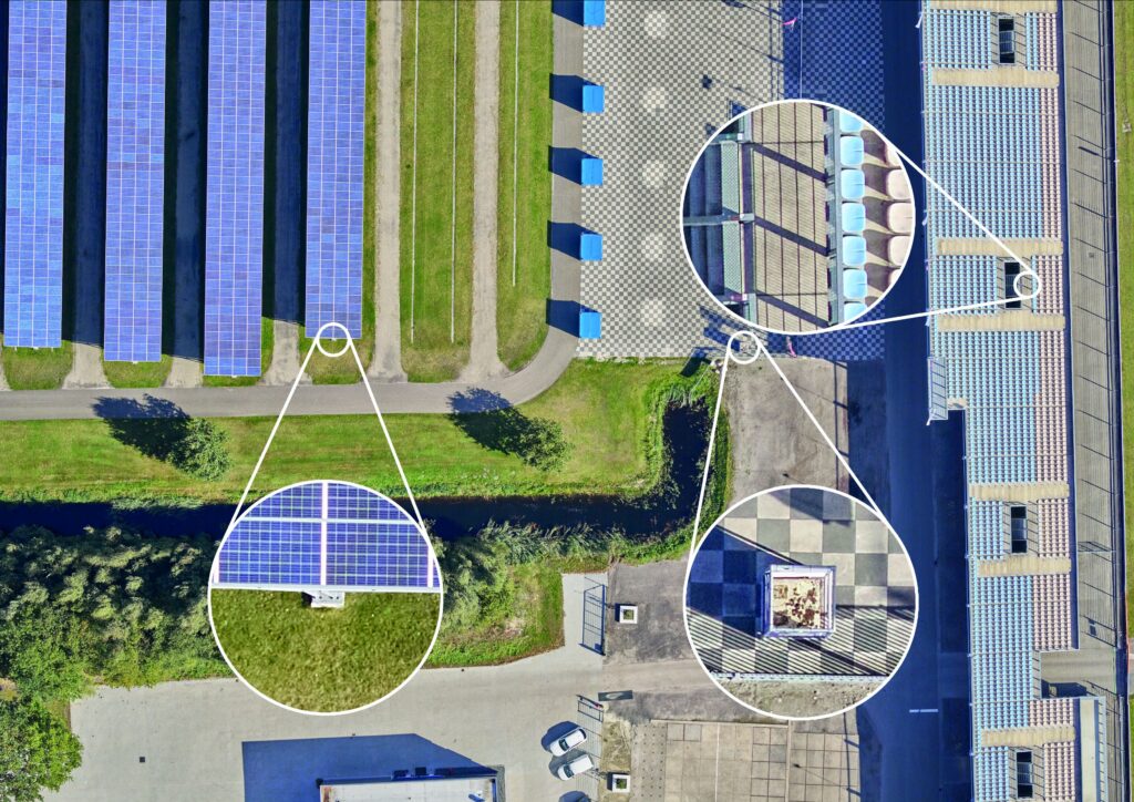
Smart city and solar asset management: Individual rooftop solar panels and structural elements are resolved clearly, opening new possibilities for automated audits of urban utilities.
This collaboration demonstrates that the European aerial mapping industry is responding to the growing demand for higher-resolution geodata in a way that plays to its strengths. Crewed fixed-wing aircraft bring something drones fundamentally cannot at operational scale: the ability to cover extensive corridors and complex infrastructure networks efficiently, under regulated airspace, with consistent geometry and predictable logistics. The resolution gap, long used to justify lower-altitude platforms for inspection-grade work, is closing — and it is closing from the air.
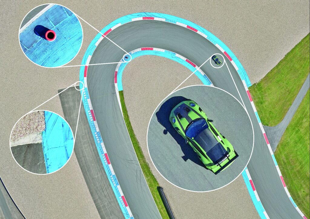
Dynamic tracking and surface texture: Crisp capture of a moving vehicle on a test track, proving the effectiveness of the Phase One Fusion Shutter technology in eliminating motion blur.