From a founding idea shaped by a uniquely European challenge to a seventh Partner Summit that tackled GPS jamming, decarbonization, and the future of professional skills: the European Association of Aerial Surveying Industries is earning its place at the table.
When EAASI’s founders looked at associations like MAPPS in the United States, they found inspiration rather than a template. Europe is not a single market in any meaningful operational sense for aerial survey operators. It is a mosaic of national aviation authorities, competing procurement traditions, and regulatory frameworks that rarely align across borders. Building a collective voice meant working across dozens of jurisdictions, cultivating influence at the European institutional level while remaining credible to member states that guard their own standards closely. That political complexity was the founding challenge—and it remains the defining context for everything EAASI does.
Within this fragmented European landscape, EAASI’s mission has evolved in response to a set of structural challenges shaping the aerial surveying industry today. Despite remaining the key technology for high-resolution mapping of large, nationwide areas, crewed aerial surveying increasingly finds itself positioned between two rapidly advancing domains: drone-based data capture and satellite remote sensing. In this crowded landscape, its distinct value is not always fully recognised.
Dr Roland Stengele, elected President of EAASI at the 2025 Partner Summit in Dubrovnik.
At the same time, the sector faces growing operational and market pressures. Regulatory frameworks for cross-border aviation are becoming more complex, while aerial survey operations often receive limited prioritization within air traffic control systems. Public procurement processes, frequently driven by cost considerations, can further constrain the ability to compete on quality. Alongside these challenges, the industry must also ensure it remains attractive to a new generation of professionals in an increasingly data-driven and competitive labour market.
Against this backdrop, EAASI has defined its mission around four core pillars: promoting the value of aerial survey data to decision-makers; amplifying the industry’s voice in political and administrative processes; underpinning quality through certification; and strengthening the sustainability of the sector, in both environmental and economic terms.
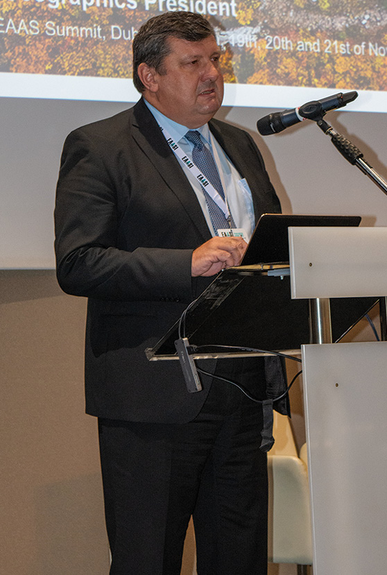
Tomaž Petek, President of EuroGeographics and head of Slovenia’s national mapping authority, delivering his keynote at the EAASI Partner Summit in Dubrovnik.
This mission has been carried forward by three successive presidents. Simon Musaeus led the association through its founding phase, establishing its structure and initial direction. Florian Romanowski expanded its scope, positioning EAASI as a platform that brings together operators, manufacturers, and software developers across the value chain.
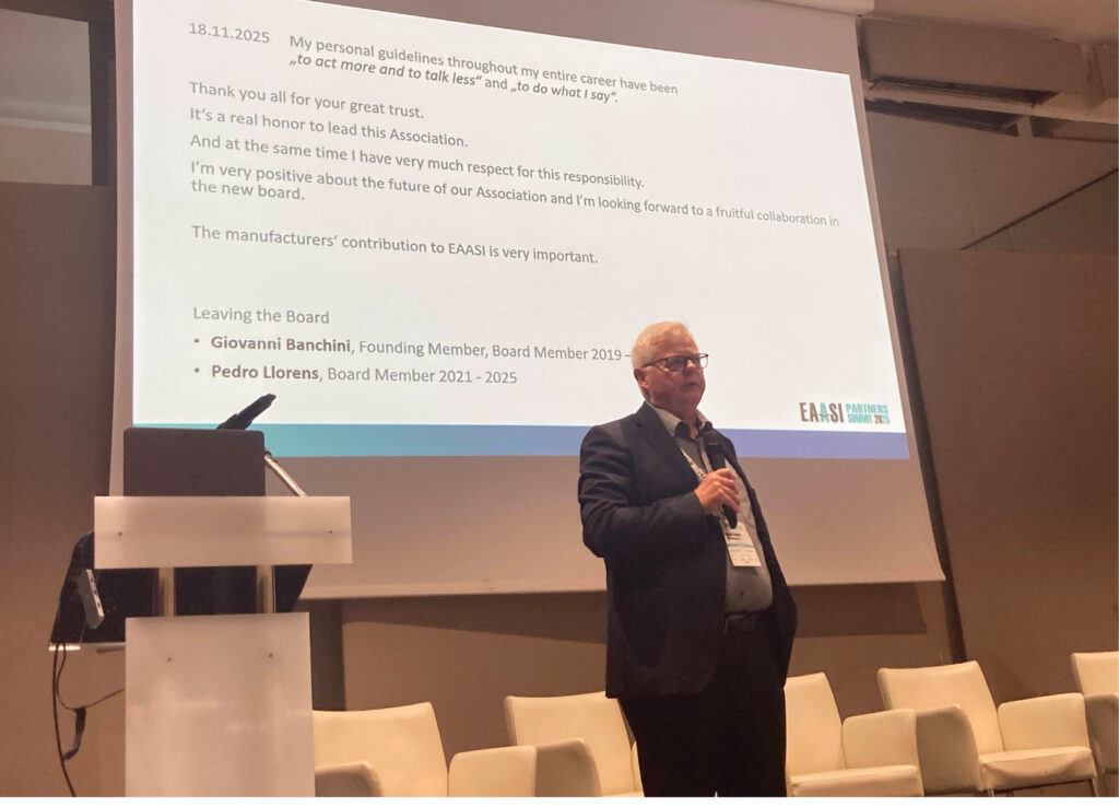
At the Dubrovnik summit, members confirmed the election of Roland Stengele, whose mandate reflects a phase of consolidation and strategic focus. His priorities include sharpening EAASI’s profile at the European level, building strategic partnerships, and advancing concrete measures to improve sustainability. At the same time, he emphasises the importance of maintaining alignment across the European aerial surveying community through shared standards, while strengthening links with academia to ensure the sector continues to attract and develop the next generation of professionals.
The seventh summit—and why that number matters
The Partner Summit in Dubrovnik was, by any reasonable measure, the most successful in the association’s history—in both attendance and the depth of its debates. It was also the seventh. The 2020 edition, forced online by the pandemic, was a test of resilience rather than a celebration of community. The summits that followed rebuilt momentum year by year. By Dubrovnik, EAASI had developed the convening power to attract not only its own membership but also the researchers, public officials, and technology leaders whose presence signals genuine institutional influence.
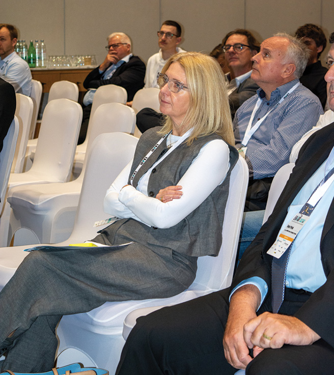
Audience Delegates at the EAASI Partner Summit in Dubrovnik, where a record attendance reflected the association’s growing reach across Europe’s aerial survey community.
Tomaž Petek, President of EuroGeographics and head of Slovenia’s national mapping authority, outlined how national mapping agencies are rethinking their roles in a world of persistent monitoring and AI-driven analytics. Fabio Remondino of Fondazione Bruno Kessler explored how artificial intelligence is reshaping aerial mapping workflows, from automated dense image matching to quality control. Croatian officials presented the country’s current cartographic programs. It is a sign that the conversations EAASI has been quietly building for years—with mapping authorities, research institutions, and public bodies—are now happening at the right level.

Networking industry professionals gather during a break at EAASI’s seventh Partner Summit—conversations that continued well beyond the conference room.
A contested sky: GPS jamming as operational reality
No topic at Dubrovnik illustrated the urgency of EAASI’s work more sharply than GPS jamming and spoofing. Geopolitical instability has made large swathes of European airspace electromagnetically contested, and for many operators this is now a routine hazard rather than an exceptional risk. One finding from the panel jangled warning bells: the assumption that flying higher reduces jamming exposure is wrong. At survey altitudes, an aircraft’s line of sight to jammers can extend 150 to 200 kilometres beyond the project area, multiplying interference sources and translating directly into degraded flight lines, data gaps, and compromised geometric quality.
Mitigation, the panel argued, requires a layered approach—multi-frequency receivers, controlled reception pattern antennas for specific scenarios, cryptographic signal authentication, and algorithmic spoofing detectors—rather than any single technical fix. Crucially, the challenge has migrated from avionics into data workflows: lidar trajectories are acutely sensitive to GNSS/IMU degradation, and processing teams increasingly rely on ground control, alternative correction services, and manufacturer-side trajectory recovery to salvage affected datasets. GNSS resilience is now as much a data management discipline as an avionics one.
Decarbonization: Incremental steps, strategic framing
The summit’s sustainability panel, moderated by Erik Admiraal, treated decarbonization as a set of concrete operational decisions rather than a communications exercise. Operators described trials of sustainable aviation fuels, mission planning optimizations designed to reduce sortie counts, and early exploration of hybrid-electric platforms for the light twin and turboprop classes that dominate the survey fleet—a pragmatic roadmap of efficiency gains now, with longer-term technology transitions in view.
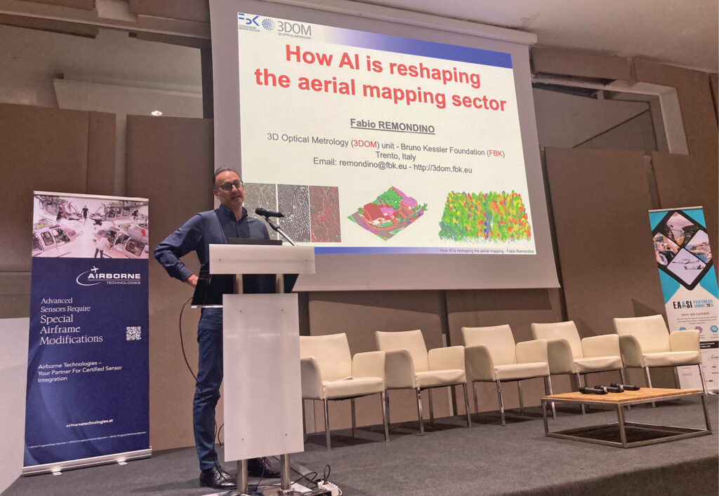
Dr. Fabio Remondino, Head of the 3D Optical Metrology (3DOM) research unit at the Bruno Kessler Foundation (FBK), exploring the role of artificial intelligence in reshaping aerial mapping workflows.
The panel’s framing carried a strategic message for public-sector clients: aerial survey is not a climate liability but an environmental asset. High-resolution airborne data underpins the monitoring, verification, and reporting infrastructure that responsible land and environmental management depends on—from habitat mapping and flood-risk assessment to infrastructure condition surveys and coastal change monitoring. The aircraft that must reduce its own emissions is simultaneously indispensable to understanding the environments it flies over.
Building the next generation—and the next conversation
Running through the summit’s program was a concern that the industry’s most immediate sustainability challenge may not be environmental but demographic. EAASI’s university and student engagement strand reflects growing anxiety about an ageing workforce and a shrinking pipeline into specialist photogrammetry and airborne sensor roles. Progress on cross-border standardization, meanwhile, remains slow—a regulatory landscape of national mandates and legacy specifications does not yield quickly to dialog. The work here is still largely at the level of raising awareness, though the relationships being built are a necessary precondition for anything more concrete.
Dubrovnik confirmed that EAASI has become what its founders wished: a voice for Europe’s aerial survey industry, calibrated to its own complexity. The seventh summit was not a milestone in the way that firsts tend to be; it was something more quietly significant—evidence that the association has the depth and the relationships to tackle problems no single operator or national body could address alone. In a continent of many authorities and competing frameworks, that is no small achievement.