YellowScan sensor facilitates modeling river channels and floodplains
Mapping major and minor riverbeds, particularly for river mobility studies, requires various cartographic methods. Topographic lidar is ideal for modeling riverbanks with centimeter-level precision and a strong ability to penetrate vegetation. However, it cannot map the submerged part of the riverbed, necessitating a second method to complete the data.
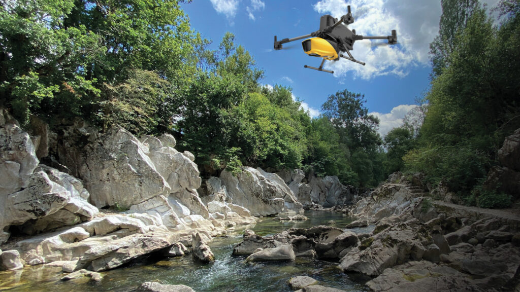
YellowScan Navigator topobathymetric lidar sensor deployed on a UAV above the Herault river in France.
Combining topographic and bathymetric methods
Depending on the site, accessibility may allow for regular transects to characterize different flow patterns in the riverbed. This conventional method is reliable and effective in many situations, offering centimeter-level precision. Nonetheless, operators may face challenges in navigating wooded or rugged river environments, deep zones, or strong currents.
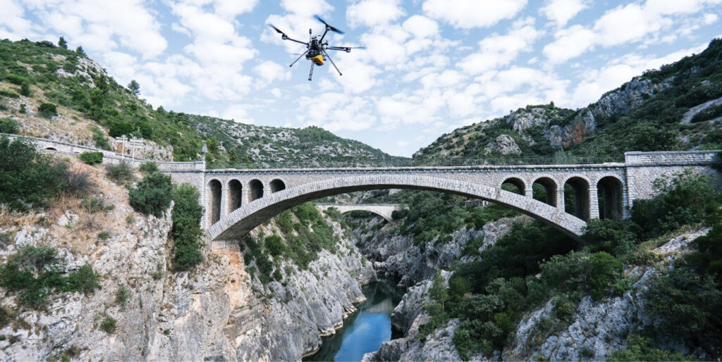
YellowScan Navigator topobathymetric lidar sensor deployed on a UAV above Le Pont du Diable, a bridge on the Herault river in France.
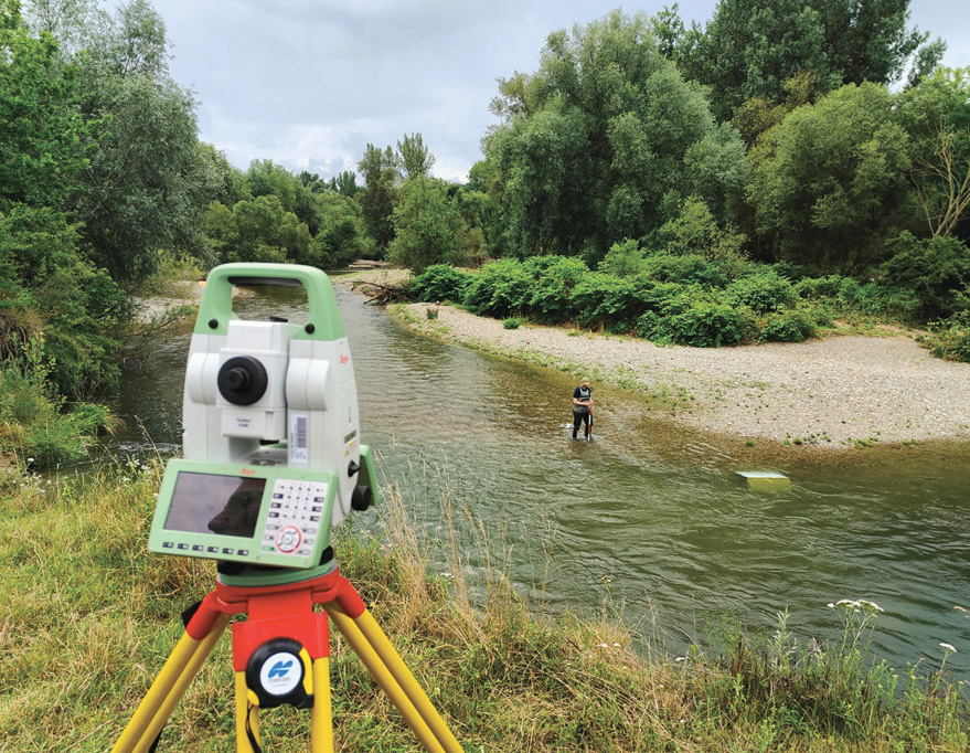
Conventional survey of a river using a total station and graduated rod.
In such cases, using a boat or a surface drone (USV) equipped with an echo sounder is effective in less cluttered waterways with moderate currents. This also requires good site accessibility to transport equipment.
Complementarity of methods
Conventional bathymetric methods, such as using poles or echo sounders, can be combined with topographic lidar to create a robust cartographic database. However, integrating topographic and bathymetric data can be time-consuming and may result in gaps or discontinuities between terrestrial and underwater data.
A new comprehensive method: Topobathymetric lidar
Topobathymetric lidar offers a significant advantage: drone-based acquisition can model the riverbed, water layer, submerged areas, and banks in a single operation. This creates a unified digital terrain model (DTM) with seamless continuity between underwater and terrestrial data, generated simultaneously. The point density underwater ranges from 20 to 50 points/m².
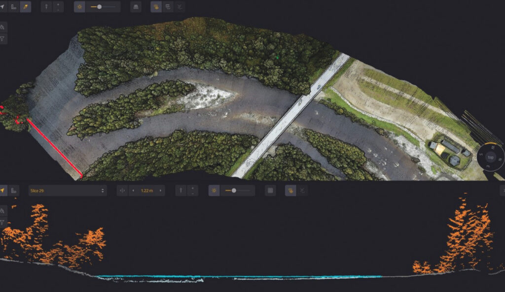
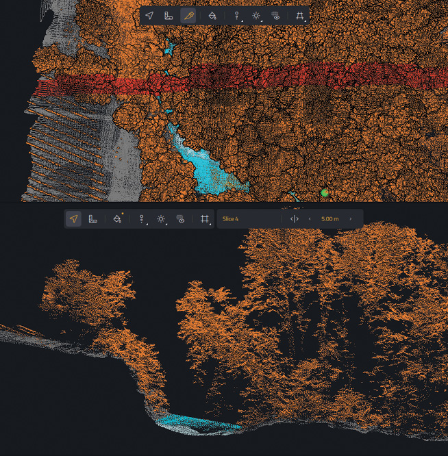
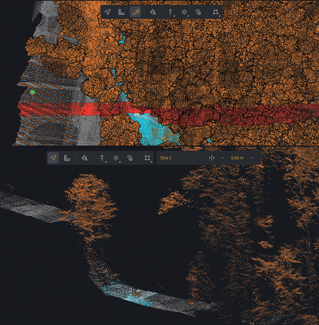
This stretch of river in Scandinavia exemplifies the complexity of a riverine environment. The position of the cross-section in the lower part of the graphic is shown in red in the upper part.
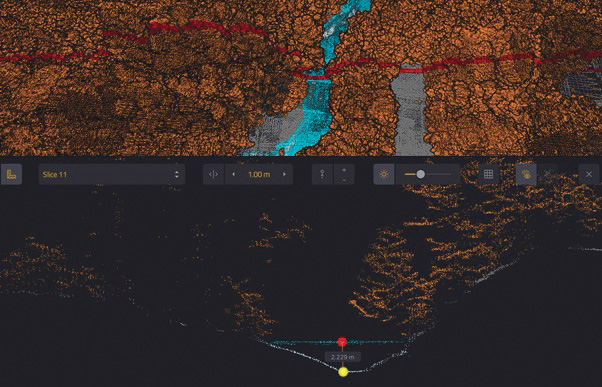
Example of a cross-section where vegetation cover extends over the river. Data is continuous even underwater at depths of over 2 m.
The ability of topobathymetric lidar to penetrate vegetation ensures continuity between the water surface and wooded banks, integrating riparian vegetation into topographic data. For example, a 309 m river section with 50 m of bank on either side can be mapped in 10 minutes, with data processing completed in under two hours.
Limitations of laser technology
The primary constraint is the ability of light to penetrate water and reflect off the bottom. Unlike echo sounders, lasers do not propagate through fine sediments. The generated points represent water depth without accounting for sediment thickness, such as silt or mud.
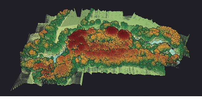
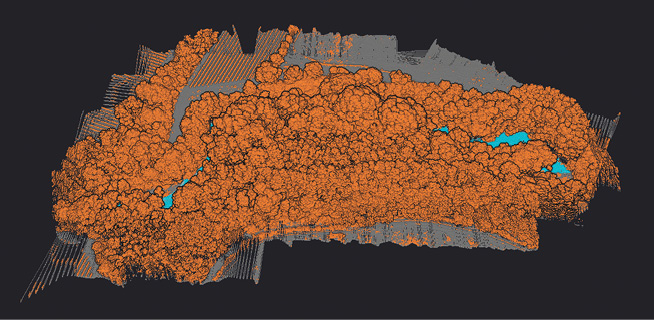
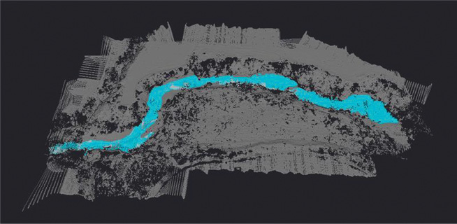
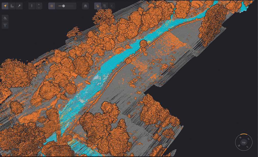
Three visualizations of a data set of the Lez River in France. From left to right: point cloud colored by elevation; point cloud classified into trees, water and other types; and point cloud filtered while retaining the water layer and the soil layer.
The performance limit is expressed in Secchi units, measured using a Secchi disk. The YellowScan Navigator topobathymetric lidar sensor can acquire data up to two Secchi depths. In rivers, if the Secchi depth is 3 m, it can map deep pools of 5 to 6 m. The reflection of the light beam depends on the coloration of the substrates, which must be considered when deploying this technology and processing data.

A data set covering part of the River Itchen in England. On the left, the points are classified according to their type. On the right, the data is colorized using imagery. Combining these two views can improve detailed data analysis, including estimates of aquatic plant surface area and volume.
Mapping a river while taking into account the alluvial forest provides a useful basis for addressing environmental issues in the most effective way possible. Lidar data analysis tools can be used to classify points and, in particular, to isolate vegetation from the rest of the data. This makes it possible to distinguish the relief of riverbanks, detect signs of erosion, and identify secondary riverbeds hidden by dense vegetation cover.
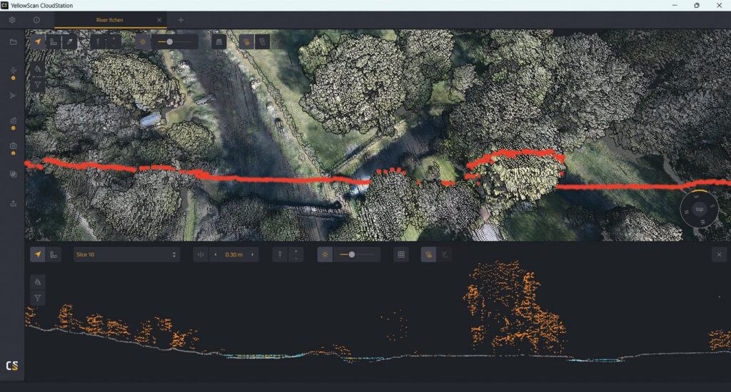
Cross-section of part of the River Itchen data set.
Colorizing of points and nature of substrates
Colorized point clouds can be generated when lidar data is combined with imagery. This is a feature offered by the YellowScan Navigator lidar with an integrated camera.
Depending on the clarity of the water and the bottom, the natural colors of the riverbed can be distinguished.
Aquatic vegetation can appear as “noise” in bathymetric data. The identification of “patches” of seaweed can be done in conjunction with the colorizing of points.
The mapping of a watercourse with diversion channels and hydraulic structures is much easier with the topobathymetric lidar data and accompanying imagery.
Contexts can sometimes be complex to map on foot, for example, changes in properties between diversion channels and the original riverbed. UAV-lidar scans properties without needing to conduct surveys on the ground or in the water.
Depending on their shape and size, structures appear in the digital terrain model. However, the terrain will need to be surveyed to obtain more accurate dimensions when sluices or underground channeled sections are present.
Erosion monitoring
The repeatability of UAV-based mapping is an asset for tracking erosion after each flood. For river mobility studies, topobathymetric lidar provides precise data to locate and measure problematic areas and assess sediment volumes from bank erosion.
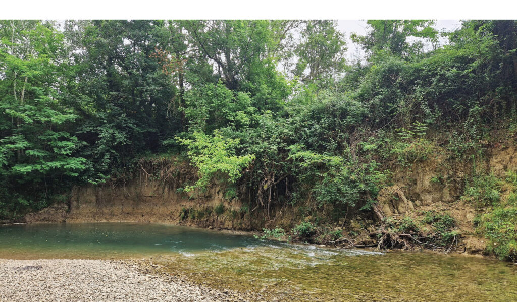
Example of a river with clear evidence of erosion on the far bank.
Often, one bank of a river is very steep and is frequently eroded by flooding. This is exacerbated where the bank is not properly protected by tree roots and vegetation. Lidar mapping can help river authorities to monitor erosion sites and plan actions where the situation may become dangerous.
Two examples of data sets of areas with significant erosion. Above, a cross-section with a steep, vegetated bank upstream of an eroded area. Below, a cross-section with a very steep bank subject to severe erosion.
Conclusion
Topobathymetric lidar technology complements traditional, robust methods used by surveyors and scientists. While aerial devices for river mapping are not new, the nature of the data produced has evolved.
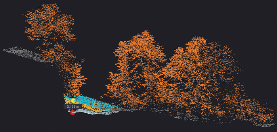
This example is a visualization of a steep, vegetated bank and a pool with a depth of 3.16m.
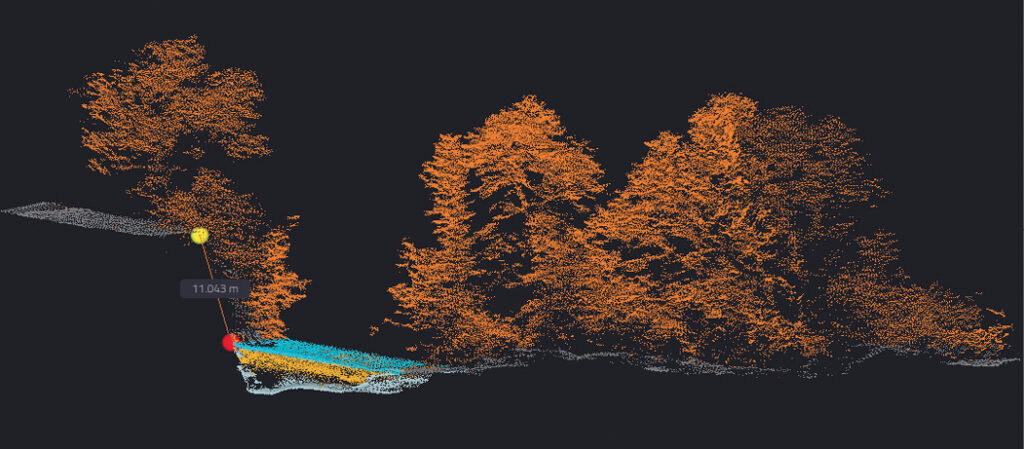
The height of the vegetated bank can be easily measured in a classified lidar point cloud. Here, there is a difference in elevation of over 11 m.
The limitations of the technology, however, must be recognized :
- The laser’s ability to penetrate water restricts its use to clear water and low-flow periods.
- Deploying a UAV with topobathymetric lidar requires a certified pilot and compliance with aviation regulations. Some airspaces may be restricted, necessitating authorization.
- Given typical UAV flight times and maximum payloads, topobathymetric missions are best accomplished by powerful and reliable UAVs to map over the water with a payload of more than 4 kg.

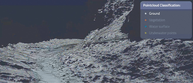
Visualizing a classified lidar point cloud of the Herault river in YellowScan CloudStation software. This automated functionality is a first step in leveraging field data. It is possible to refine this automatic classification to assign points to the data class according to best match.
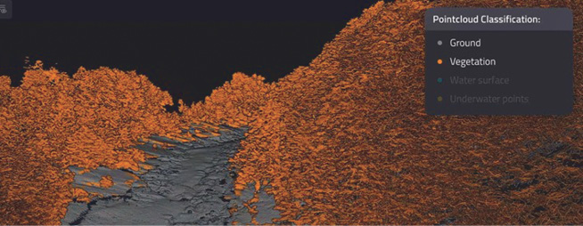
Visualization of terrain relief and vegetation without the “water” layer and without the points suspended in the water which can be linked to several components (vegetation, bubbles, suspended particles…).
The advantages of topobathmetric lidar performed with UAVs are considerable:
- Easy deployment on various terrains, even rugged or wooded areas
- Rapid data acquisition and processing
- Single DSM or DEM integrating terrestrial and subaquatic data
- Highly precise repeatability for mapping operations by reusing flight plans.
Visualization of terrain relief, which is mainly associated with mineral substrates and rock outcrops.
While topobathymetric lidar cannot replace all traditional river mapping and monitoring procedures, it is extremely valuable for fast, large-scale mapping. 
 Florian Caraveo is community manager for YellowScan, the French UAV-lidar supplier. He has built a career at the intersection of environmental expertise, marketing, and technological innovation. Committed to ecosystem preservation, he brings diverse experience in natural environment management, water habitat mapping, and science communication. Since 2023, he has specialized in UAV-lidar at YellowScan, discovering the performance of the company’s tools to advance environmental understanding and monitoring. By connecting innovation with sustainability, he contributes to projects that use lidar for population safety and environmental research.