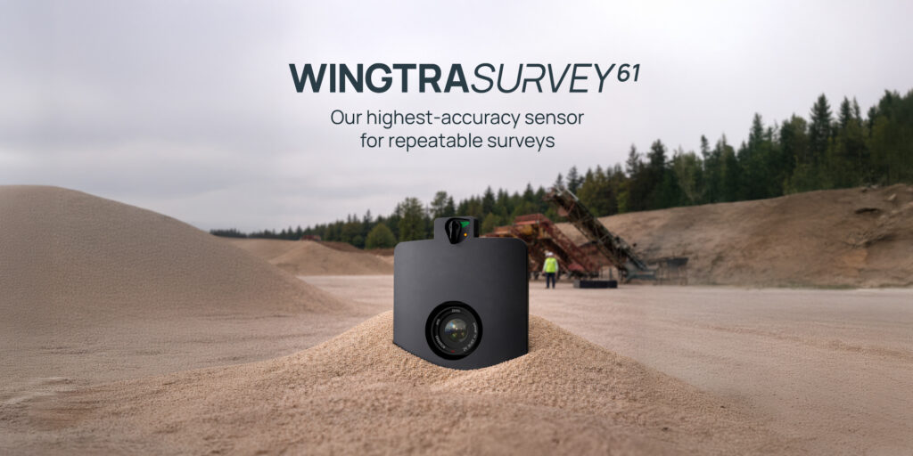
Zurich, Switzerland, February 12, 2026 — Leading provider of drone survey solutions, Wingtra, today released a revolutionary payload that cuts significant field time with a GCP-free workflow that offers repeatable results down to 3 cm (0.1 ft). Engineered with earthworks and topographical surveyors firmly in mind, the new SURVEY61, flown with the WingtraRAY drone, drives more frequent, high-accuracy site views for more cost-effective planning. All of this at a moment when US surveyors and GIS professionals are seeking Blue-listed systems that keep them ahead of regulations, even to federally-funded projects.
Surveyors and engineers get three key benefits with Wingtra and SURVEY61: First, the GCP-free workflow of SURVEY61 plus the single Wingtra toolchain empower smooth, fast data capture across hundreds of acres in just hours. Second, the quality of SURVEY61 data, and the speed of the platform, powers repeat volumetric updates that reduces discrepancies over time by 70 percent. So teams can plan and move the right amount of dirt at the right time, which cuts contract disputes. Finally, Wingtra, with its VTOL design and compliant parachute, empowers safe and regulations-approved flight over sites that are normally off limits due to safety hazards or operations over people restrictions.
“The market needs a solution that’s 100 percent dedicated to surveying and mapping,” said Julian Surber, Senior Product Manager at Wingtra. “We are this solution. With SURVEY61, you can send less field crew out for less time and ensure their safety, while getting survey-grade results over an area of any size, more often. Working without GCPs is a totally new chapter for earthworks, and while we know not every team is there now, we’re proud to pave the way to this as a norm for the future as professionals realize, trust and embrace this technology.”
SURVEY61 offers GCP-free accuracy down to 3 cm (0.1 ft) RMSE X,Y,Z. It captures <0.5 in/px (1.3 cm/px) resolution while flying at 400 ft (120 m) AGL, meaning high coverage in short flight times for easy scheduling.
6X faster field work than quadcopters, 60 % less labor cost per acre
It’s clear that drones speed up data capture, but that’s not where surveyors lose the most time. Wingtra develops solutions based on the precise points they do, and SURVEY61’s real power is minimizing site setup time to get repeatable survey-grade data at scale. In fact, for Wingtra customers, field work for a 50 acre site drops from four hours to just 40 minutes—that’s 6x faster than quadcopters.
This happens from three key directions:
- WingtraRAY + SURVEY61 simplifies field-to-office workflows with a synced system that geotags and processes everything in a few clicks, speeding up time to deliverables
- Slashed field time: with Wingtra, field time includes time setting ground control, setting up the drone, running pre-flight checks, flight and packing up—you can cover 400 acres / 4 linear miles of capture per field hour*
- Easy-to-adopt toolchain that’s scalable across teams and employees, even without a surveying degree
*This is based on the Wingtra workflow involving 10 min for 3 check points, 10 min preflight + buffer, 40 min flight with 1 mile VLOS. SURVEY61 @ 0.5 in/px (400 ft), 70% side, 70% front, 22 m/s flight speed
“SURVEY61 is a major milestone in delivering value and solutions to our survey customers,” said Marcos Bayuelo, Senior Vice President of Product and Growth at Wingtra. “Our engineers are 100 percent dedicated to making high-accuracy, repeatable data capture easier and faster. This latest product fully represents this as it reduces manual fieldwork. So teams spend less time on site setup and have more resources to focus on current, accurate views of their sites. We’re confident that, with this payload, our customers working with repeat earthworks will see more profitable planning, projects and business overall.”
Taking on more projects with robust compliance
WingtraRAY is the only platform in its class with FAA clearance for operations over people. This opens access to nine out of ten infrastructure projects without a waiver. Compared to those accessing only three out of seven sites with other US quadcopters, Wingtra customers enjoy the freedom and business advantage of flying over active sites, highways, and urban areas without losing time on waiver processes.
Confidence to expand into new markets comes from:
- Purpose-built FAA-tested parachute add-on for safe Category 3 OOP that unlock waiver-free surveys over populated areas in the U.S., and C6-mark for BVLOS operations in EU
- Collision avoidance feature for extra protection across busy, complex sites
- Blue-listed for pre-approved work on federally funded and government-related projects
Ground truth from the air
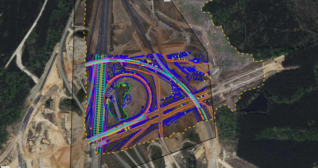
With the release of SURVEY61, Wingtra pushes the market forward with frequent, reliable surveys of active construction sites. This development is the latest step forward in delivering safety and cost benefits to a range of industries requiring verifiable ground truth across projects of all sizes and in all stages.
For more information, visit: Wingtra.com/ray/SURVEY61
About Wingtra
Wingtra is a leading aerial insights company for mapping and surveying applications. Founded in Switzerland in 2017, it developed the only drone solution built specifically for surveyors that covers the entire workflow. From easy flight planning to CAD- and GIS-ready outputs, surveyors walk through guided and connected steps. No more switching tools or guesswork. The result? Survey-grade results in hours—not days. In fact, today, large, renowned companies, government agencies and universities around the world turn to Wingtra for trusted data, no rework, and a more cost-effective way to survey.
