Graz, Austria • August 12, 2025 – GeoTech, a partner of MipMap Holdings, is a leading geospatial solutions provider with a strong presence throughout Saudi Arabia, Turkey, the Middle East and Central Asian countries, has recently expanded its technological capabilities with the acquisition of Vexcel Imaging‘s UltraCam Osprey 4.1 aerial camera system. Facilitated through our regional sales partner, Atay Mühendislik, this acquisition will support GeoTech’s groundbreaking project to create a high-precision Digital Twin of Jeddah, Makkah, Al Ula, NEOM and other cities, covering both urban and surrounding areas. These projects, commissioned by Jeddah Municipality, Makkah Municipality & Royal Commission for Makkah City (RCMC), NEOM, are among the first in the region to use the UltraCam Osprey 4.1, highlighting GeoTech ‘s commitment to innovation and state-of-the-art technology.

GeoTech Overseas chooses UltraCam Osprey 4.1 for Digital Twin Projects across Saudi Arabia.
A Key Asset for Digital Twin Projects
The UltraCam Osprey 4.1, predecessor to the Osprey 4.2, combines nadir and oblique image capture in a single flight, making it perfectly suited for projects that require detailed 3D city models, such as Digital Twins. The system boasts superior image quality, accuracy, and efficiency, capturing high-resolution images that offer rich details for urban mapping, infrastructure planning, and environmental analysis. Additionally, the ability to process data through the full UltraMap workflow provides GeoTech with an end-to-end solution from data capture to processing, ensuring the delivery of high-quality, actionable insights to their clients.

Thumbs up from GeoTech – the UltraCam Osprey 4.1 is ready to support smart city solutions across Saudi Arabia.
Alexander Wiechert, CEO of Vexcel Imaging, commented on the partnership: “We are thrilled to see the UltraCam Osprey 4.1 being used by GeoTech for such an important project. The Jeddah and Makkah Digital Twin initiatives demonstrate the value and potential of our technology in supporting smart city development and sustainable urban planning. We are proud to support GeoTech with a system that not only meets their high standards for quality but also enhances their operational efficiency.”
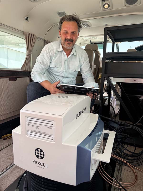
The UltraCam Osprey 4.1 large format aerial camera collects photogrammetry-grade nadir and oblique images simultaneously.
GeoTech’s Commitment to Technological Advancement
GeoTech Overseas Saudi Arabia, in partnership with MipMap Holdings, has built a strong reputation for its innovative solutions and dedication to adopting the latest technologies in the geospatial industry. With the addition of the UltraCam Osprey 4.1, the company is well-equipped to deliver high-quality data that meets the increasing demands for precision and accuracy in urban mapping and smart city projects, including 3D terrain, buildings and public space elements across the Middle East and elsewhere.
With 20,544 pixels across track, the Osprey 4.1 has a very wide flight strip resulting in higher flight collection efficiency.
“By investing in the UltraCam Osprey 4.1, we’re enhancing our ability to deliver sophisticated solutions to our clients,” said Prof. Kamil Eren from GeoTech Overseas. “This advanced imaging system will allow us to undertake complex projects with greater accuracy and efficiency, particularly in our mission to create a Digital Twin for cities across Saudi Arabia and Region. With Vexcel’s support, we are confident that this project will set new standards in geospatial data quality and utility in the region.”
The UltraCam Osprey 4.1 is expected to play a key role in Digital Twin projects across Saudi Arabia, supporting GeoTech’s mission to provide the most precise and comprehensive urban mapping solutions in the industry. This strategic acquisition underscores GeoTech’s commitment to serving as a leader in the geospatial technology field, providing innovative solutions that meet the evolving needs of cities and communities in the Middle East.

GeoTech Overseas team is ready for takeoff – empowered by Vexcel’s UltraCam Osprey 4.1 for Digital Twin mapping.
About GeoTech Overseas Saudi Arabia
GeoTech Overseas (GTO) is a global service provider specializing in Digital Twin, Geomatic Engineering, Remote Sensing, and GIS. GTO is a partner of MipMap, a global innovative company. MipMap has offices in KSA, Turkey, the Netherlands, the UAE, and the USA. GTO employs over 400 qualified staff members, many with advanced degrees in their respective fields (11 with PhD). GTO, through partnership with MipMap, is a platinum partner within the esteemed ESRI Partner Network. The Company is also partner of MIT Senseable City Lab, TU Delft, Eindhoven University of Technology and METU. To learn more about the company, please visit geotechoverseas.com.sa.
About Vexcel Imaging
Vexcel Imaging is a global leader in aerial imaging, renowned for its industry-leading UltraCam aerial cameras and hybrid camera-LiDAR mapping solutions. These systems deliver unmatched flying efficiency and exceptional data quality, ensuring best-in-class performance for every application. Outputs include photogrammetric imagery, LiDAR point clouds, and other derived products. The fully integrated UltraMap photogrammetric processing software enhances project workflows with advanced automation, efficient data interaction, and intuitive tools, enabling the creation of DSMs, DTMs, orthoimages, and 3D data of the highest standard. For more information, visit: www.vexcel-imaging.com.
