Englewood, Colorado, 12 August 2025 — CompassCom today introduced CompassAVL®, a fleet management application that improves operational transparency while delivering measurable benefits in safety and efficiency. The GIS-centric product provides real-time, public-facing visibility into municipal fleet operations on agencies’ websites to better serve their communities.
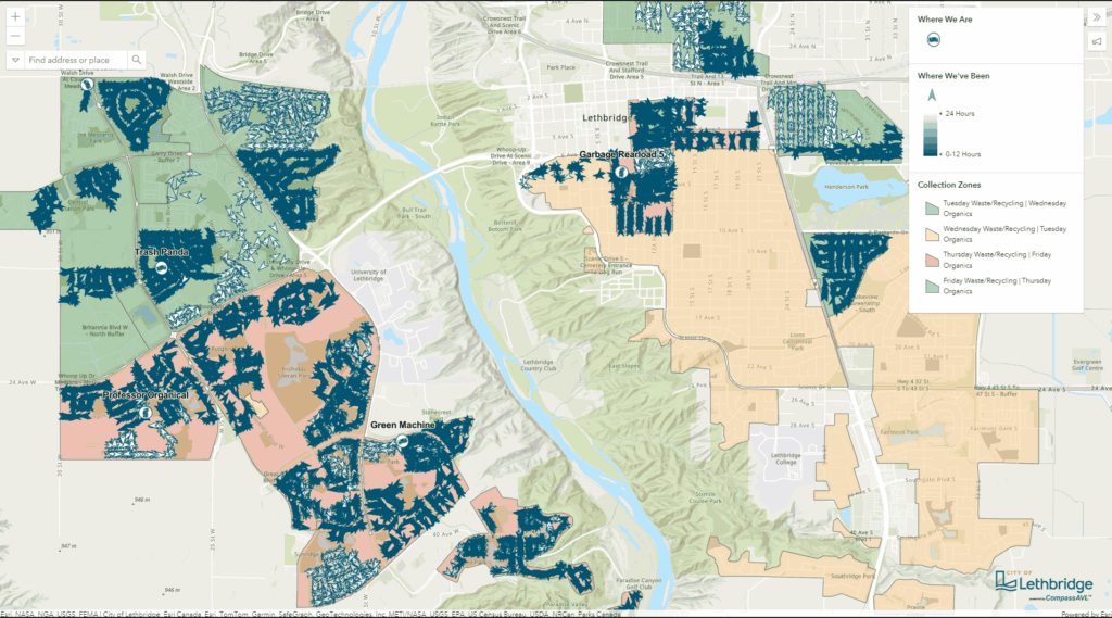
CompassAVL makes detailed real-time fleet operational data available through a user-friendly application to improve safety, efficiency and accountability.
CompassCom will demonstrate CompassAVL capabilities at the American Public Works Association PWX 2025 conference in Chicago, Aug. 17–20, in booth #3063.
Built on CompassCom’s 30 years of GPS fleet management expertise, CompassAVL tracks snowplowing, sweeping, solid waste removal, maintenance and other fleet operations. Automatic privacy filters remove sensitive locations using geofenced zones and exclude idling or parked vehicles. The system’s live GPS viewer integrated with Esri® ArcGIS basemaps displays routes and shows real-time vehicle telematics to keep citizens and staff informed, while enhancing driver safety.
By offering a controlled public view of operations, agencies build trust through complete transparency. The opportunity for citizens to answer questions themselves online reduces inbound status requests and complaints. Visible and easily accessible service activity supports better planning by the public and provides up-to-date information to chief stakeholders for decision making and efficient asset management.
“A public-facing dashboard tells a story, giving citizens the information they need to plan for snowstorms, trash pickup, street sweeping, and more,” said Brant Howard, Founder and CEO of CompassCom. “Expectations for transparency are rising. Public works, utilities, and DOTs can now meet those expectations with technology that makes sharing operational information seamless.”
The CompassAVL solution is interoperable with multiple wireless communications systems—broadband, cellular, land mobile radio (LMR), satellites—ensuring coverage over broad areas. By integrating vehicle sensors and equipment data, the platform monitors critical metrics including plow position and salt spreader rates. By optimizing routes, reducing fuel consumption, and making data-driven decisions agencies can improve service delivery while controlling costs.
About CompassCom: Real-Time Location for Real-Life Impact
Since 1994, CompassCom has delivered Automatic Vehicle Location (AVL) and telematics solutions powered by real-time GIS and AI technology. Our fully configurable platform leverages Esri ArcGIS data to enable real-time tracking of vehicles, workforce assets, land mobile radios, smartphones, and IoT devices—on-premises or in the cloud—meeting stringent cybersecurity requirements. Trusted by Public Works, DOTs, Public Safety, Utilities, National Government, and Defense agencies, CompassCom drives measurable ROI, improves operational visibility, and ensures connectivity anywhere through broadband, LMR, and satellite networks. Visit us at www.compasscom.com and follow us @compasscom.
