About the fusion
ITRES has successfully fused data from its SAVI-1000 hyperspectral imaging system with Leica SPL100 single photon LiDAR sensor, combining best-in-class spectral and spatial data for high resolution, high-efficiency remote sensing data.
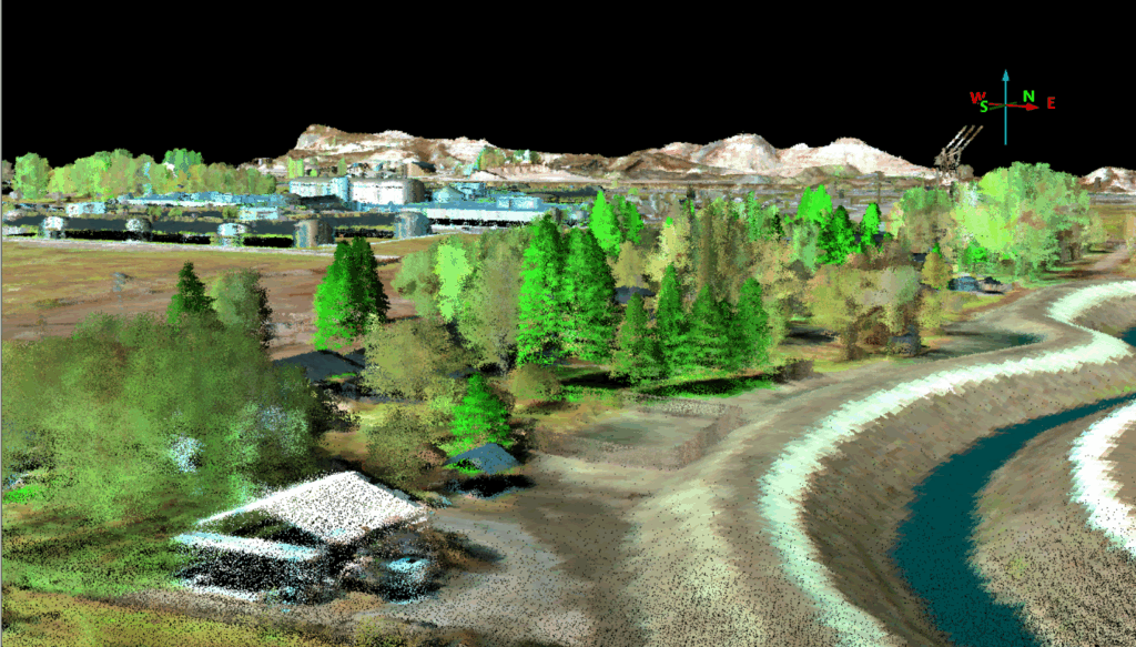
LiDAR shows you where something is down to every rooftop, every ridge, every tree. Hyperspectral reveals surface characteristics such as vegetation type, mineral identification, water quality, even synthetic materials. By fusing Leica SPL100’s dense 3D point clouds with the SAVI-1000’s deep spectral signatures, you don’t just get terrain maps you get terrain intelligence.
Why does this fusion matter?
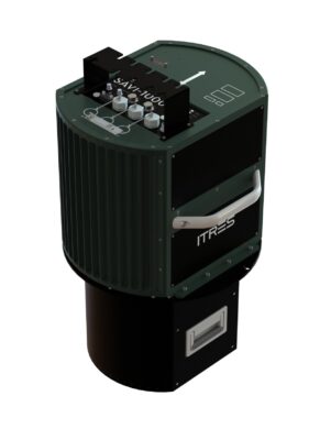
ITRES SAVI-1000
A standout strength of the SAVI-1000 and Leica SPL100 fusion lies in their uncompromising data quality at high altitudes, a rare achievement in remote sensing. While most LiDAR systems sacrifice point density and many hyperspectral imagers struggle with signal-to-noise ratio (SNR) at high elevations, this duo delivers both spectral and spatial precision without compromise.
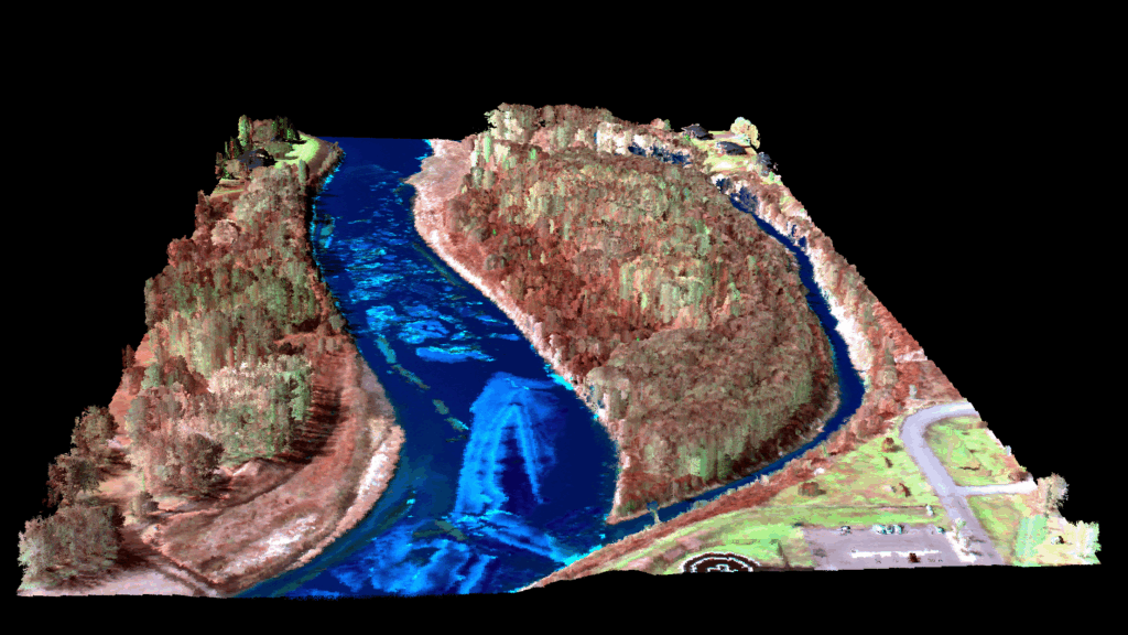
The SAVI-1000 captures 256 VNIR and SWIR bands using a single detector with 1000 across-track pixel resolution, eliminating the need for resampling or realignment between detectors. Leica SPL100 achieves up to 6 million points per second and up to 30 points/m², even through challenging conditions like fog or dense tree canopy.
This fusion seeks to set a new benchmark for cost-effective, wide-area mapping combining high-fidelity spectral and elevation data at scale. With the ability to cover up to 600 km² per hour and leverage high-speed Leica HxMap pipeline, this solution is not only powerful but scalable, upgradable, and field tested.
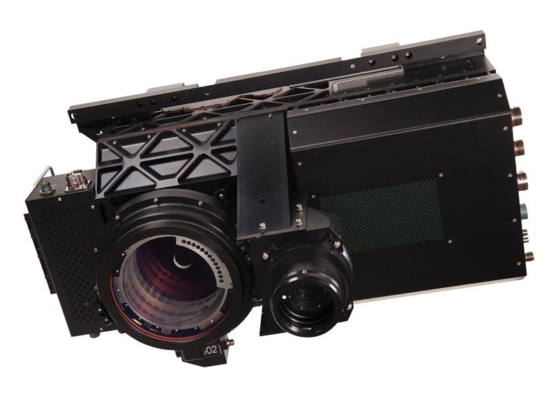
Leica SPL100
When asked about this collaboration, John Welter, Geospatial Content Solutions’ President said, “The fusion of ITRES’ SAVI-1000 and our Single Photon LiDAR data marks a major step forward in airborne remote sensing, enabling customers to move beyond maps to a new level of geospatial insight.”
Steve Mah, President and CEO, ITRES Research added, “This partnership brings a new dimension to remote sensing, one that empowers faster, smarter, and more informed decisions across sectors. Whether it’s protecting national assets, managing forests, building resilient cities, or unlocking natural resources, this collaborative fusion of hyperspectral and LiDAR capabilities are designed to deliver clarity at scale.”
From national forests to underground formations, complex ground features and 3D structures, the fusion of Leica SPL100 and SAVI-1000 delivers actionable intelligence across domains.
In forestry, Leica SPL100 maps tree height, canopy shape, and crown volume, while SAVI-1000 identifies species, health status, and invasive growth enabling scalable classification, biomass estimation, and change detection.
In defence, anomaly detection reveals spectral and statistical deviations, and feature extraction isolates hidden threats using spatial, spectral, and textural cues ideal for reconnaissance and surveillance.
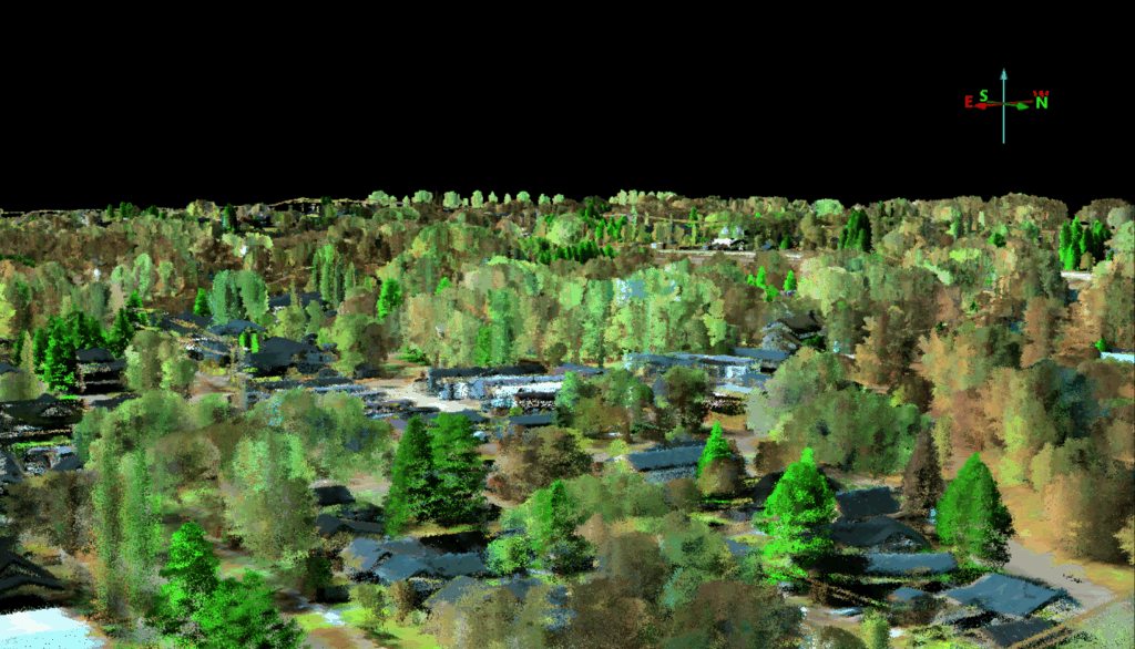
Urban mapping benefits from hyperspectral detection of materials like roof types, road surfaces, and pollutants, while LiDAR outlines the 3D structure of every building, bridge, and barrier supporting smarter planning and infrastructure monitoring.
In geology, hyperspectral imaging uncovers detailed mineralogical data as LiDAR defines terrain and structures in 3D, allowing for precise mapping of mineral deposits and formations, enhancing exploration accuracy and safety.
Click here to learn more:
ITRES SAVI-1000
Leica SPL100
About ITRES
ITRES is a leading-edge technology company specializing in the development, manufacturing, and use of hyperspectral airborne sensors. ITRES imaging systems cover the visible and near infrared, shortwave infrared, midwave infrared, and longwave infrared wavelengths. Services include providing airborne hyperspectral imaging for defense and humanitarian applications, and environmental and commercial mapping applications in forestry, agriculture, wetlands, water quality, coastal zone, mineralogy geology, heat loss, wildfire mapping, and search and rescue.
About Leica Geosystems
With more than 200 years of history, Leica Geosystems, part of Hexagon, is the trusted supplier of premium sensors, software and services. Delivering value every day to professionals in surveying, construction, infrastructure, mining, mapping and other geospatial content-dependent industries, Leica Geosystems leads the industry with innovative solutions to empower our autonomous future.