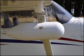
Aschau i. Chiemgau, Germany 24.09.2024 – GeoLas Systems is excited to announce the launch of the ELMAP-P, a revolutionary airborne LiDAR pod designed specifically for Cessna aircraft models 172, 182, and 206. This turn-key LiDAR solution integrates GeoLas Systems’ industry-leading ELMAP LiDAR technology, along with advanced GNSS and IMU systems, into a specialized pod that easily mounts onto the wing struts of compatible Cessna planes.
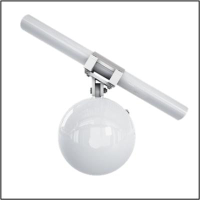
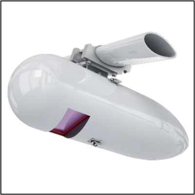
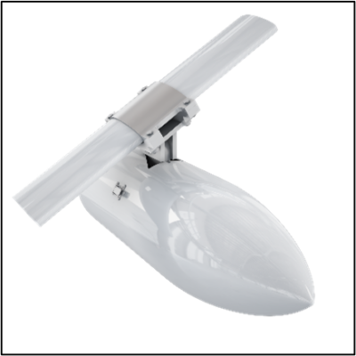

The ELMAP-P represents a leap forward in airborne LiDAR technology, boasting an impressive LiDAR performance of 1’400’000 shots per second, an 80° field of view, and a maximum operating altitude of 2,100 meters AGL. These advanced capabilities allow operators to achieve highly accurate laser mapping across diverse terrains, enabling more efficient data collection for various applications. Designed for simplicity and performance, the system aims to make high-end airborne LiDAR technology accessible and affordable to thousands of aircraft owners worldwide.


“The ELMAP-P system reflects GeoLas Systems’ commitment to delivering cutting-edge, yet practical, solutions for aerial surveying,” said Dr. Christoph Hug, CEO at GeoLas Systems. “By focusing on ease of installation and certified integration with popular Cessna models, we’ve made high-quality airborne laser mapping more available to a wider audience of professionals.”

ELMAP Airborne LiDARs are known for their precision, reliability, and ease of use, making them the go-to choice for mapping, surveying, and geospatial data collection.
GeoLas Systems continues to set the standard for airborne LiDAR solutions with the ELMAP-P, designed to meet the growing demand for cost-effective, high-performance airborne laser mapping.
For more information on the ELMAP-P or to inquire about purchase and installation, please visit www.geolas.com or contact sales@geolas.com.
About GeoLas Systems
GeoLas Systems is a leading provider of advanced LiDAR solutions, specializing in high-performance laser-scanning technologies for airborne, mobile, and terrestrial applications. With a commitment to innovation and precision, GeoLas Systems delivers cutting-edge products that enable efficient and accurate data collection across a wide range of industries.