Register Today to go “Beyond the Surface” with Paul Burrows, Evan Carlson, and Tyler Shriver on May 16th from 11-11:45AM (EDT) highlighting RIEGL Bathymetric LiDAR.
On this webinar you will learn how RIEGL Bathymetric LiDAR is being utilized by Whiteout Solutions on various projects and discuss how UAV-based LiDAR has streamlined their mission to map the impacts of climate change.
Read more on Whiteout Solutions projects featuring the RIEGL VQ-840-GL topo-bathymetric system integrated onto a Harris Aerial UAV platform: Whiteout Solutions Tackles the Impacts of Climate Change with RIEGL Bathymetric LiDAR Solutions | The RIEGL Newsroom
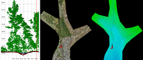
Data collected for the Pleasant Grove Mitigation Survey
Webinar Date: May 16th from 11:00-11:45AM (EDT)
Highlights:
· How RIEGL Bathymetric LiDAR operates
· The different RIEGL Bathymetric LiDAR options
· Real-world examples and results
· Drone integration
· Applications and market verticals
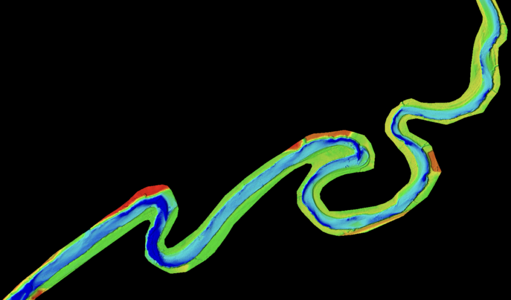
Lyndon River Corridor data collection
