Prof. Dr. Nicola Lercari, Director of the Institute for Digital Cultural Heritage Studies at the LMU Munich (Ludwig-Maximilians-Universität München) provided us with some exciting details from their latest project, where they used RIEGL’s VUX-1UAV22 UAV LiDAR sensor to uncover further secrets of the ancient Greek city of Heloros in Italy.
The LMU Munich Institute for Digital Cultural Heritage Studies Makes the Past Visible with RIEGL UAV-Based LiDAR
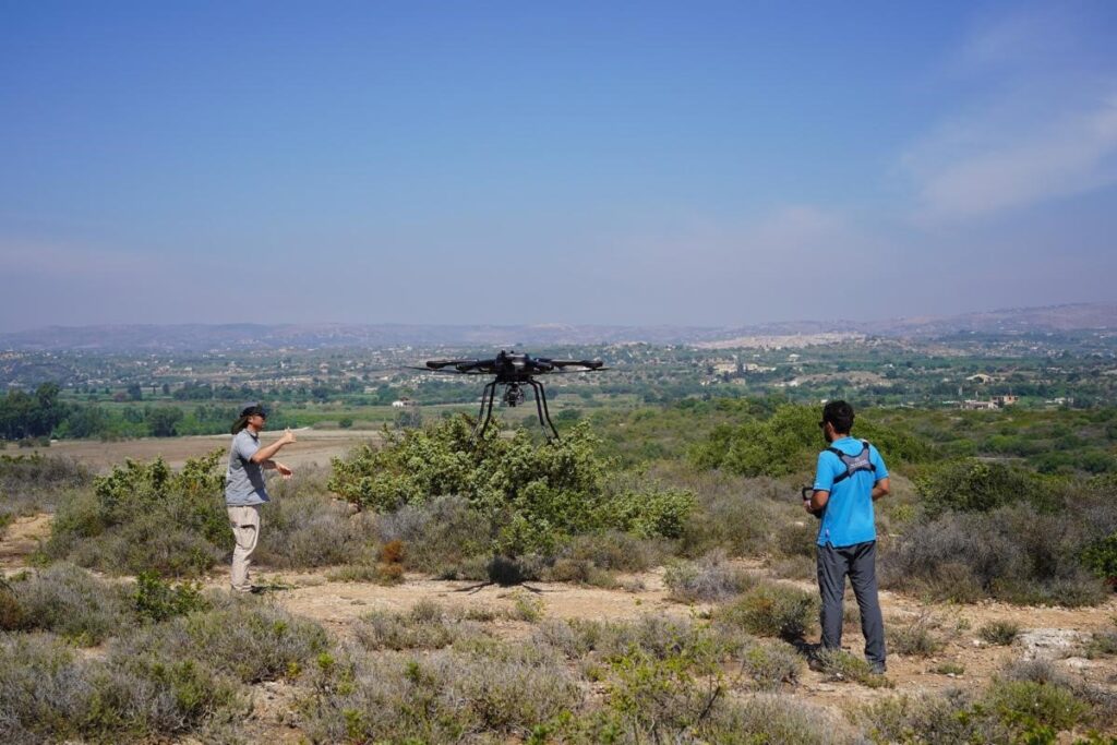
RIEGL’s UAV-based LiDAR technology has been proven to be highly effective in archaeological research at the ancient Greek site of Heloros in Southeastern Sicily, which is covered by dense Mediterranean vegetation. In September 2023, Prof. Lercari and the Heloros Advanced Digital Exploration and Surveying (HADES) project team (LMU Munich Institute for Digital Cultural and University of South Florida, Institute for Digital Exploration) used a RIEGL VUX-SYS (with VUX-1UAV22 and Applanix APX-20 included) mounted on an ACECORE NOA drone to capture high-precision 3D data of Heloros’ landscape and hidden archaeological features. This complex task was accomplished by leveraging the RIEGL VUX-1UAV22 LiDAR sensor’s ability to penetrate the canopy of trees and shrubs with sufficient point density and accuracy.
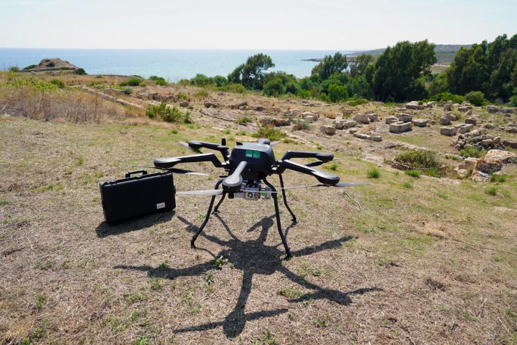
The LMU’s ACECORE NOA with RIEGL VUX-SYS.
The ancient Greek city of Heloros is situated on a low plateau, covering around 12 hectares, and standing 20 meters above sea level. It is located along Sicily’s Ionian shore, approximately 30 km south of the city of Syracuse. Archaeologists have determined that Heloros was the first subcolony established by Syracuse, likely founded in the late 8th century BCE. This conclusion was drawn from examining the site’s archaeological artifacts and assessing the strategic importance of its topography. Heloros was considered a formidable fortress at its peak, and its harbor was of great strategic importance to the Syracusans.
Extensive archaeological excavations were conducted at Heloros between 1899 and the 1980s. These excavations revealed that Heloros was a thriving city during the Classical and Hellenistic periods, featuring remarkable monuments. The city boasted imposing fortification walls, a heavily fortified North Gate, a theater, several temples, and a Sanctuary of Demeter with a monumental stoa and a well-planned urban layout. However, despite the vast collection of excavated materials, the site is among the least-known Greek settlements in Sicily, and it has never been explored using modern archaeological methods and surveying techniques.
Consequently, there are still many open issues about the history of ancient Heloros, even after more than a century since the first excavations. For these reasons, as part of the research activities of the HADES project, the team conducted a week-long campaign over Heloros’ landscape, flying twelve missions and scanning an area of three-square kilometers, which is around four hundred twenty football pitches. During the flyovers, they used the state-of-the-art RIEGL VUX-SYS system to capture high-resolution point clouds as well as imagery using an integrated 64-megapixel RGB camera.
The system recorded billions of measuring points in its memory, allowing the team to produce incredibly high-resolution georeferenced Digital Terrain Models of Heloros’ structures and topography, complete with realistic colors and free of vegetation. This was possible because each measuring point under the canopy is furnished with exact geodata recorded in real-time by a GNSS sensor included in the system and a reference station on the ground, along with corresponding color information retrieved in the RGB photographs. To make the registration of the measured points even more accurate and deal with the vibrations caused by the drone flight path from winds and thermals, the RIEGL VUX-1UAV22 LiDAR sensor was combined with an integrated Applanix APX-20 IMU, which was used to correct the drone’s trajectory.
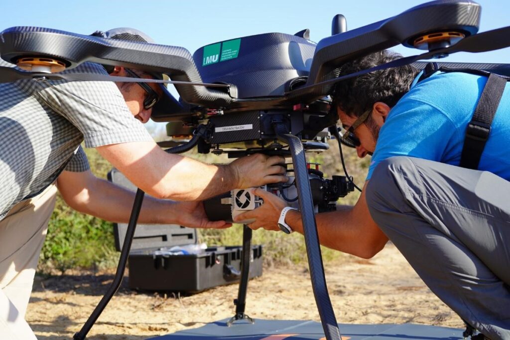
In the field: RIEGL VUX-SYS of LMU Munich with integrated VUX-1UAV22.
Using the RIEGL UAV-based LiDAR technology and the RiPROCESS point cloud classifier tool, the team of Prof. Lercari was able to penetrate through the thick Mediterranean vegetation that covers the rugged landscape of Heloros, filter out this vegetation, and clearly identify and map the underlying archaeological features with a sufficient point density. Specifically, these findings demonstrated that this technique successfully detected stone quarries and cart tracks located North and South of the site, as well as towers and fortification walls that were excavated on the Heloros hill in the 19th and 20th centuries, which were later covered by trees and shrubs.
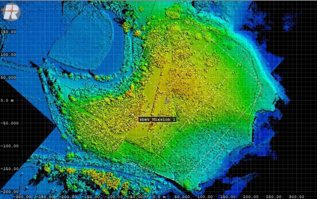
The ancient Greek city of Heloros: DMT with archaeological features which are actually hidden by vegetation.
“The investigations carried out in Heloros have garnered international attention at archaeological conferences such as the CAA2023 Annual Meeting in Amsterdam and the 3rd Archaeologia Aerea Conference in Lecce, Italy. Moreover, these investigations have been the focus of several published scientific articles, such as in the high-impact journal Digital Applications in Archaeology and Cultural Heritage. Consequently, in our upcoming LiDAR mapping campaigns, we plan to make full use of the capabilities of the RIEGL VUX-SYS system to conduct extensive surveys of the landscape in Southeastern Sicily. Our aim is to study the ancient transportation systems constructed by the Greeks in the southern region of Syracuse and connect them to the broader research on the economic exploitation of this area during ancient times.” Prof. Lercari said.
The RIEGL Team wishes Prof. Lercari and his team every success for the upcoming projects and look forward to further reports!
All pictures have been provided to RIEGL under license of Prof. Lercari, LMU Munich.
HADES Project Partners:
LMU Munich, Institute for Digital Cultural Heritage Studies, Munich, Germany
University of South Florida, Institute for Digital Exploration, Tampa, FL 33620, USA.
Parco Archeologico e Paesaggistico di Siracusa, Eloro, Villa del Tellaro e Akrai, Syracuse, Italy.
Web Links for more information on the HADES project:
https://www.dkes.fak12.uni-muenchen.de/research/current-projects/hades/index.html
https://www.usf.edu/arts-sciences/institutes/idex/research/hadesproject.aspx
https://doi.org/10.1016/j.daach.2024.e00327
About RIEGL
RIEGL is an international leading provider of cutting-edge technology in airborne, mobile, terrestrial, industrial and UAV-based laser scanning solutions for applications in surveying. RIEGL has been producing LiDAR systems commercially for over 40 years and focuses on pulsed time-of-flight laser radar technology in multiple wavelengths. RIEGL’s core smart-waveform technologies provide pure digital LiDAR signal processing, unique methodologies for resolving range ambiguities, multiple targets per laser shots, optimum distribution of measurements, calibrated amplitudes and reflectance estimates, as well as the seamless integration and calibration of systems. RIEGL’s Ultimate LiDARTM 3D scanners offer a wide array of performance characteristics and serve as a platform for continuing Innovation in 3D for the LiDAR industry. From the first inquiry, to purchase and integration of the system, as well as training and support, RIEGL maintains an outstanding history of reliability and support to their customers. Worldwide sales, training, support and services are delivered from RIEGL’s headquarters in Austria and in the USA; main offices in Japan, China, Hong Kong, Australia, Canada, UK, and Germany; and a worldwide network of representatives. www.rieglusa.com www.riegl.com
