CartoData, located in Jalisco, Mexico, has become the first professional survey firm in North America to take delivery of the RIEGL VQ-1460 airborne laser scanner. This new sensor model collects high-density, high-accuracy LiDAR point clouds and imagery for intake into CartoData’s proprietary production workflows and web mapping platform optimized for urban planning and smart city applications. Latin America has a history of challenges related to urban planning and an abundance of rural settlements, leading CartoData to embark on a path of Cartomorphosis with local and state governments to modernize the current cadastral framework. The RIEGL VQ-1460 will be central to that effort moving forward.
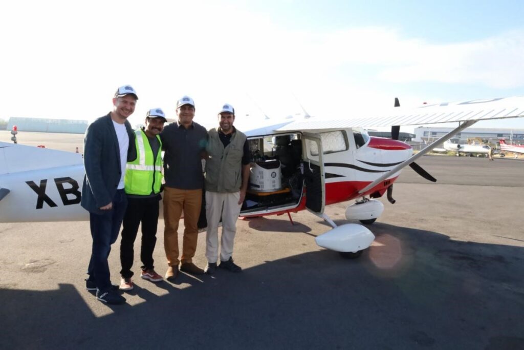
CartoData’s VQ-1460 wide-area laser scanner installed in a Cessna 206 single-engine aircraft.
CartoData recently completed a 1,500-kilometer mapping project in El Salvador with the RIEGL VQ-780 II airborne laser scanner. With the addition of the RIEGL VQ-1460, CartoData is expanding its scope of work and increasing its collection level of detail and production efficiency. The key to this is the extended range and point density performance available from the VQ-1460, which enables high-definition data sets that are exploitable by AI. CartoData acquires imagery and LiDAR simultaneously for all missions. The VQ-1460 now tilts the scale on LiDAR favor, as the new density and pattern crunched by AI allows for automatic or semi-automatic extraction of DEMs, vegetated areas, infrastructure elements, and many other layers with unprecedented assertiveness over stereo compilation operators.
“It’s not only the 4.4 million pulses per second, but also the regular pattern and the highest laser power in the market today that enables high altitude missions with a level of detail never seen before.” said Felix Audirac, CEO for CartoData. “This capacity empowers our technological offer, offering wide-area surveys at a detail achievable previously only available with lower altitude acquisitions. The VQ-1460 is an enabler for AI LiDAR applications.”
Two Years and 100,000 Square Kilometers
Looking to the future, CartoData aims to fly over 100,000 square kilometers with its new RIEGL airborne system for country-wide mapping across Latin America. CartoData completed the first 8,000 square kilometers at the time of this writing with incredible results. The examples below show the point densities achieved at flying heights above ground of 1,300 m. and 2,600 m
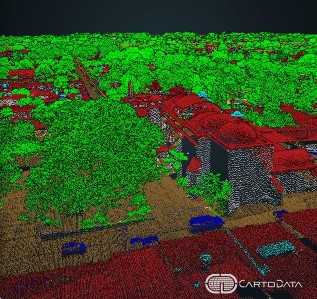
Low altitude flight, 1,300 m AGL with a density of over 100pts/m2, clearly showing urban infrastructure.
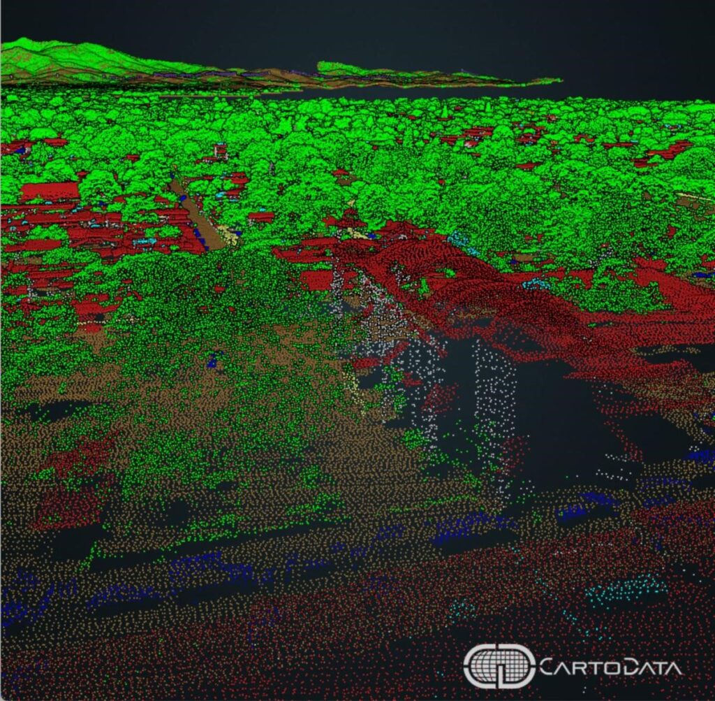
High altitude flight 2,300 m. AGL with a density of over 20pts/m2 allows highly assertive classifications, which are only attainable at lower altitudes with earlier sensors. Notice the mountains in the background.
“We have been very impressed with CartoData’s leadership and support of cadastral modernization in Latin America,” said Michael Sitar, RIEGL USA’s Division Manager for Airborne Laser Scanning. “With their investment in the VQ-1460 and the first delivery of RIEGL’s next-generation LiDAR sensor platform for area and city mapping, we are proud to support their ongoing efforts in this challenging environment.”
CartoData has been leaving its mark in the region and impacting towns and cities’ transformation with highly accurate mapping data on the path to Smart Cities and strategic Urban Planning.
Below are a couple of highlighted articles spotlighting how CartoData and RIEGL are making significant regional impacts.
Cartomorphisis: Starting with Cadastre
CartoData has implemented its Cartomorphisis framework at different levels in over 63 municipalities and two countries, including El Salvador, to design a smart city. Read more in the following article: Cartomorphosis: an evolution that starts with Cadastre | GIM International (gim-international.com)
El Salvador Maps Project
Through the National Registry Center (CNR), the government of El Salvador is embarking on a large-scale project to map the complete country, and the entire dataset was made available to the cadastral office and the rest of the municipal areas through eCarto, CartoData’s web mapping platform. Read more in the following article: How El Salvador is empowering growth and efficiency through mapping | GIM International (gim-international.com)
About the RIEGL VQ-1460
The VQ-1460 is one of RIEGL’s latest airborne laser scanning systems, which sets a new standard for a wide field of applications – from high-point density wide area mapping to ultra-high resolution city mapping or corridor mapping.
About RIEGL
RIEGL is an international leading provider of cutting-edge technology in airborne, mobile, terrestrial, industrial and unmanned laser scanning solutions for applications in surveying. RIEGL has been producing LiDAR systems commercially for over 40 years and focuses on pulsed time-of-flight laser radar technology in multiple wavelengths. RIEGL’s core Smart-Waveform technologies provide pure digital LiDAR signal processing, unique methodologies for resolving range ambiguities, multiple targets per laser shots, optimum distribution of measurements, calibrated amplitudes and reflectance estimates, as well as the seamless integration and calibration of systems. RIEGL’s Ultimate LiDAR 3DTM scanners offer a wide array of performance characteristics and serve as a platform for continuing Innovation in 3D for the LiDAR industry. From the first inquiry, to purchase and integration of the system, as well as training and support, RIEGL maintains an outstanding history of reliability and support to their customers. Worldwide sales, training, support and services are delivered from RIEGL’s headquarters in Austria and in the USA; main offices in, Germany, Japan, China, Australia, Canada and the UK; and a worldwide network of representatives. www.rieglusa.com www.riegl.com
About CartoData
At CartoData, we believe in a better world with decisions empowered by geospatial information and tools. CartoData’s customers engage in a transformation quest by acquiring detailed geospatial datasets, creating customized tools to make the most out of this new information about their territory, and professionally modifying their existing processes to make the most of the latest technology. We call cartomorphosis three overlapping pillars: Omnidata, Geosoftware, and Professionalization. Omnidata: CartoData assembles airborne and ground-collected imagery with LiDAR within a custom processing workflow that includes a staff of over 150 professionals, AI, and custom on-premises and cloud tools to create outstanding geospatial datasets. Geosoftware: CartoData has its software factory certified in CMMI Dev level 3 focused on creating software to create tools such as AU4 (DPW) and eCarto (smart maps online platform). Professionalization: CartoData’s consulting arm analyzes how customers can improve their processes using new datasets and tools. CartoData’s headquarters are in Guadalajara, Mexican Silicon Valley, with offices in Monterrey, Mexico City, and El Salvador, serving the US and Latin American Markets specializing in cadaster, mining, and infrastructure mapping applications. www.cartodata.com
