March 12 – The Universidad Nacional Autonoma de Mexico (UNAM) via the Institute of Geography department in Mexico, recently purchased a RIEGL VQ-1560 II-S Airborne system as part of a full kit they are adding to their project workflows for research and development at the university. Their main focus is to learn more about naturally occurring changes to the environment, and the impacts human interaction has on that landscape. This is vital information when it comes to mitigating risks to the region, planning development, and learning more about the impacts of climate change over time.
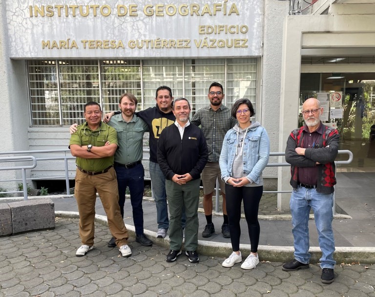
Geography Department within the Universidad Nacional Autonoma de Mexico along with RIEGL during their training and integration of the VQ-1560 II-S.
“For UNAM, having this team is a milestone in terms of Research and Development. This equipment will allow us to meet a tremendous demand in the field of research and study of natural phenomena and human activity in the territory throughout Mexico.” said Armando Peralta, Technical Secretary of Liaison for the Institute of Geography, UNAM. “This state-of-the-art LIDAR system will help us obtain very important results for disaster risk management, territorial planning, the study of ecosystems and the search for strategies for adaptation and mitigation of the effects of climate change in vulnerable areas of the country. It will be used in all areas of research throughout the University and allow for experimentation with new applications and also to train specialists in the use of LIDAR. We are very pleased with the acquisition of this technology and have already completed the installation and calibration, so we will soon start carrying out surveys on major projects”.
Geography Department within UNAM after the successful integration of the VQ-1560 II-S.
As the university continues to deploy this RIEGL system on more research projects, it will further develop students to become the next leading generation of specialists in these fields. RIEGL looks forward to being a key collaborator and supplying needed cutting-edge technology to further this educational initiative.

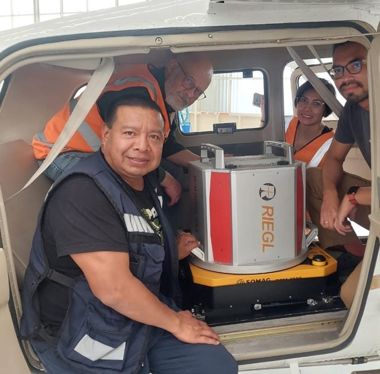
RIEGL VQ-1560 II-S ready to take off for its first project with UNAM.
“We feel honored with UNAM and their final decision to purchase one of our most sophisticated units, the VQ-1560 II-S. said Claudio Avello, RIEGL USA’s Regional Manager for LATAM. “And at the same time, we are confident that our technology and solutions will bring them all kinds of new opportunities to study and analyze the Mexican Geography and be part of important projects that will positively impact the population. We look forward to continuing our support for UNAM in this new LiDAR Era for them”.
About the RIEGL VQ-1560 II-S:
RIEGL’s VQ-1560 II-S wide area mapping sensor is a dual-channel hybrid laser and imaging system that features a unique “cross-fire” scan geometry for maximum canopy penetration and improved vertical detail often required for urban, forestry and corridor applications. The system is typically equipped with a gyro-stabilized mount and an internally integrated 150-megapixel RGB or 4-Band metric camera system to enable the co-collection of high-resolution imagery and high-density LiDAR data for maximum application success.
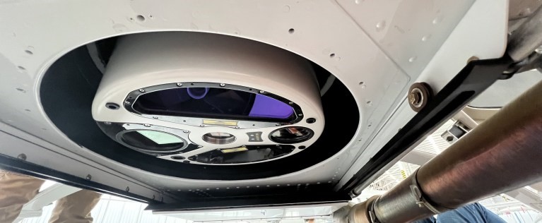
UNAM’s RIEGL VQ-1560 II-S fully integrated on their aircraft.
About RIEGL:
RIEGL is an international leading provider of cutting-edge technology in airborne, mobile, terrestrial, industrial and unmanned laser scanning solutions for applications in surveying. RIEGL has been producing LiDAR systems commercially for over 40 years and focuses on pulsed time-of-flight laser radar technology in multiple wavelengths. RIEGL’s core Smart-Waveform technologies provide pure digital LiDAR signal processing, unique methodologies for resolving range ambiguities, multiple targets per laser shots, optimum distribution of measurements, calibrated amplitudes and reflectance estimates, as well as the seamless integration and calibration of systems. RIEGL’s Ultimate LiDARTM 3D scanners offer a wide array of performance characteristics and serve as a platform for continuing Innovation in 3D for the LiDAR industry. From the first inquiry, to purchase and integration of the system, as well as training and support, RIEGL maintains an outstanding history of reliability and support to their customers. Worldwide sales, training, support and services are delivered from RIEGL’s headquarters in Austria and in the USA; main offices in, Japan, China, Australia, Canada and the UK; and a worldwide network of representatives. www.rieglusa.com www.riegl.com
About the Institute of Geography at The Universidad Nacional Autonoma de Mexico:
The Institute of Geography is the oldest and most important center of its kind in Mexico, currently its structure is composed of three departments (Economic Geography, Physical Geography and Social Geography), a Geospatial Analysis Laboratory (LAGE), an Editorial Section (SE) and two support units (Information Technology Unit – UTI) and the Library that has more than 35,000 titles and houses the most complete and important collection in the country in the United States. the field of Geography, as well as one of the best map libraries, made up of more than 20,000 documents). www.geografia.unam.mx
