Bellevue, WA. (Jan. 8, 2024) – VirtualGrid is delighted to unveil VRMesh v12.0, the most recent iteration of its user-friendly and versatile point cloud processing software. Renowned for its distinctive technologies encompassing point cloud classification, feature extraction, and point cloud meshing, VRMesh continues to offer advanced capabilities for efficient data processing.

Site Design on Point Clouds
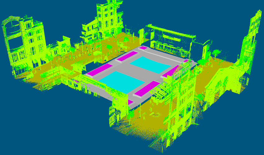
In this latest release, a significant addition comes in the form of polygon modeling. Now, you can create, edit, and optimize polygons directly on point clouds, allowing you to export a precise low-poly mesh for subsequent applications. The comprehensive workflow provided by VRMesh enhances efficiency and boosts productivity in the fields of architecture, engineering, and construction.
Site design typically involves the use of multiple software tools, each serving a specific function. For instance, one tool may be employed for point cloud classification and feature line extraction, while another handles polygon modeling. This segmented approach can be time-consuming and costly. VRMesh offers a streamlined and cost-effective solution by automating point cloud classification, directly fitting a polygonal surface to point clouds, and allowing for easy editing of a polygonal surface on point clouds. In the end, all components seamlessly merge into a single, highly accurate low-poly model.
The new version now supports the GLTF format, enabling you to export projects with multiple textured objects into a single file. This functionality is particularly useful for digital twin applications, including platforms like Nvidia Omniverse, Unreal Engine, or Unity.
For a live demonstration, visit Booth 921 at Geo Week, taking place from February 1 to 3, 2024, at the Colorado Convention Center in Denver. We look forward to showcasing our versatile workflows across various applications.
About VirtualGrid
VirtualGrid has pioneered VRMesh, an advanced 3D point cloud and mesh processing software tool. Renowned for its state-of-the-art technologies, VRMesh excels in point cloud classification, feature extraction, point cloud meshing, and polygon modeling. This software offers a streamlined workflow tailored for the Architecture, Engineering, and Construction (AEC) industry. For further details, we invite you to explore www.vrmesh.com.