Mad Nadir Mapping is pleased to announce the Mad Nadir Mapping Lidar System (MNMLS) — the lightest (~730 grams) and most affordable ($5,000) UAV lidar mapping solution currently available on the market. The MNMLS contains a tactical grade inertial measurement unit (IMU) coupled with a multi-frequency GNSS receiver.
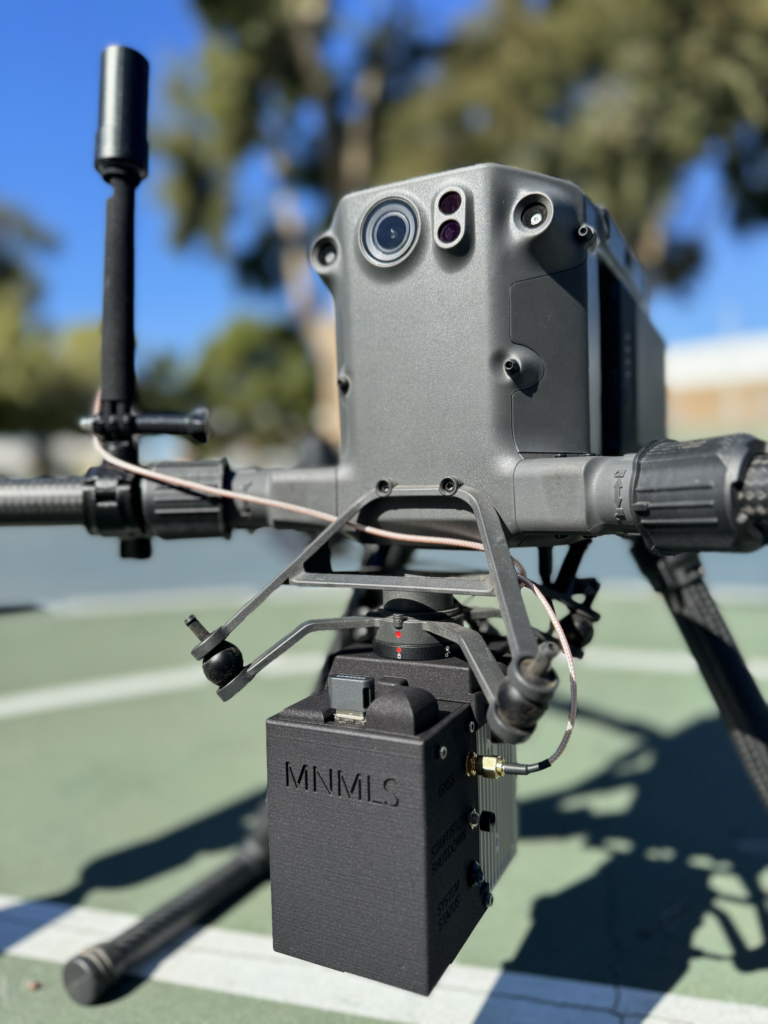
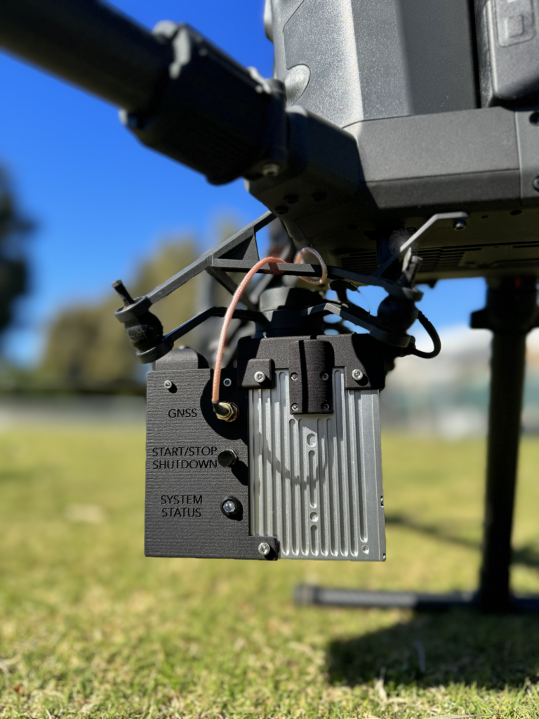
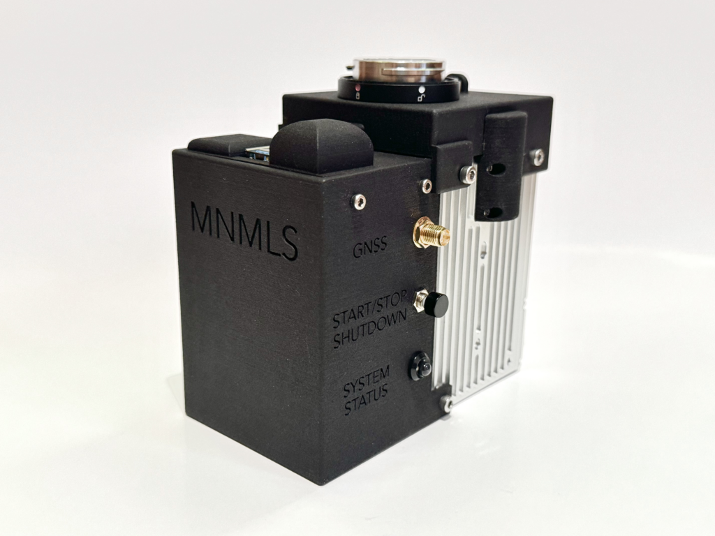
Combined, these two components make up the highly accurate inertial navigation system (INS). The system uses a multi-return lidar scanner capable of recording single, double, and triple returns. The MNMLS allows for push-button data logging and also contains a web-app interface for system checks, IMU calibration, data logging, etc.
All MNMLS purchases include a perpetual processing license for the Mad Nadir Mapping Lidar Processor (MNMLP) software. The MNMLP software is easy to use and includes a custom MNMLP lever arm and boresight tool, PPK trajectory processing, does not require an active internet connection (field-based processing), contains no hidden post-processing steps, employs multi-core processing techniques, consumes low amounts of RAM, requires zero license fees, and includes free software updates.
The software seamlessly ingests the raw MNMLS data and outputs a georeferenced compressed point cloud file (.laz) that can be brought in to any lidar post-processing software. Georeferenced point cloud outputs from the MNMLS are comparable to other entry-level systems on the market, but at a much lower price point.
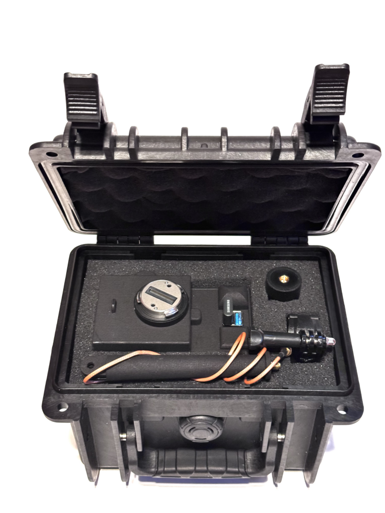
The purchase of this system includes a hard case, the MNMLS hardware, a GNSS antenna and mount, and the MNMLP software (including a perpetual license). The MNMLS is an all-inclusive and turn-key system that is ready to acquire actionable data right out of the box!
![]()
MNMLS units are designed and assembled in the USA and all software is written in-house. Mad Nadir Mapping ships globally. We are happy to arrange custom shipping solutions and are open to regional and/or national wholesaling. Contact us directly to discuss these options. Follow the link to our website for system specifications, contact information, or to purchase an MNMLS. https://www.madnadirmapping.com
Sample output data from the MNMLS can be found here.
About Mad Nadir Mapping
![]() Mad Nadir Mapping (MNM) was founded in 2020 with the goal of supplying the global UAV mapping community with affordable options for UAV lidar data collection systems and lidar point cloud georeferencing software solutions. The founder of MNM has a PhD from UCLA* and works as an assistant professor at the University of Wyoming* with a specialty in UAV and ground rover construction, active remote sensing (lidar/radar), and large-scale scientific data computation.
Mad Nadir Mapping (MNM) was founded in 2020 with the goal of supplying the global UAV mapping community with affordable options for UAV lidar data collection systems and lidar point cloud georeferencing software solutions. The founder of MNM has a PhD from UCLA* and works as an assistant professor at the University of Wyoming* with a specialty in UAV and ground rover construction, active remote sensing (lidar/radar), and large-scale scientific data computation.
*Mad Nadir Mapping has no affiliation with this entity
