Single partner for combining engineering-grade data acquisition with geospatial analytics and solutions to support operational business decisions at airports
NV5 Geospatial, North America’s most comprehensive geospatial data firm, today announced the ability to provide a complete solution for airports combining acquisition services, mapping and analytics products with cloud migration, managed services and powerful enterprise GIS platforms for asset location, inspection and work order management. With this seamless capability, airports and their partners can leverage NV5 Geospatial’s high-quality geospatial data collected for Federal Aviation Administration (FAA) compliance for actionable intelligence that improves all airport operations.
“NV5 Geospatial has long been the source for engineering-grade lidar and photogrammetry products to support FAA reporting. Yet, many organizations were not extending the full benefits of this high-quality data to a variety of operational solutions,” said David Grigg, Aviation Program Director, NV5 Geospatial. “Our acquisition of Axim Geospatial brings powerful enterprise GIS solutions into the mix, facilitating a complete ‘one-stop’ capability addressing today’s pressing airport needs.”
About NV5 Geospatial Airport Solutions
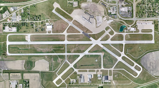
Many of the largest U.S. airports – including Minneapolis-St. Paul International, Hartsfield-Jackson Atlanta International, and Harry Reid International – and their partner firms rely on lidar, imagery, mapping data and enterprise GIS solutions from NV5 Geospatial. With the highest-quality NV5 Geospatial data as a foundation, these airports can build on their Esri-based enterprise GIS solution for FAA compliance, as well as develop or support specialized asset management tools to better manage, integrate and visualize data for better airport planning and maintenance.
The NV5 Geospatial Airport Solutions includes:
- Asset and environmental data acquisition – Lidar, thermal, imagery and hyperspectral sensors can be deployed via airborne, unmanned aerial vehicle, mobile and terrestrial platforms both inside and outside of a facility. The combination of these tools enables collection of engineering-grade data to support FAA reporting, including airport layout plans (ALPs), obstruction and vegetation surveys for mitigation and management, and indoor terminal mapping for facility management.
- Cloud migration and managed services – Confidence in the availability, scalability and performance of the technology infrastructure that underlies an enterprise GIS is central to successful implementation and adoption. Geospatial Cloud Services encompass assessments, design, implementation, migration and ongoing managed services. NV5 Geospatial provides the platform to support not only enterprise GIS, but complementary solutions for asset/work management (airside and landside), safety management, inspections, document management and more.
- Enterprise GIS systems and applications – One of only 17 global Platinum Partners of Esri and Cityworks, Axim Geospatial, a division of NV5 Geospatial, integrates data, as well as other business systems and applications, into a single dashboard available via desktop or mobile devices. The easy-to-use interface enables airport managers and their partners to visualize operational data – both indoors and out – to support informed, intelligent decision making.
- Modern digital twin applications – Data is delivered at an unprecedented level of detail, enabling development of an operational digital twin, or detailed representation of the physical environment, including interior, exterior, fixed and moveable assets. Using open data and APIs to power operational and management applications, digital twins can support a wide range of tasks, including property, utility and pavement management; noise monitoring; incident tracking; physical security and intrusion detection; and facilities, emergency, wildlife and concession management.
- Indoor digital twin and facility solutions – As an experienced, Esri Indoors software implementer, NV5 Geospatial can extend airport data acquisition to interior spaces with lidar, oriented/spherical imagery and infrastructure extraction, to support increasingly seamless routing, navigation, and next-generation experiences and facilities management. With expertise in building automation solutions, NV5 Geospatial can leverage indoor digital twins to drive energy efficiency and return on investments.
Our airport services also leverage industry partnerships, as well as our Esri Technical Certifications, that recognize our expertise in specific solutions. These include AWS Partner, Safe Software (FME), ArcGIS Cloud Services, ArcGIS System Ready, ArcGIS Indoors, ArcGIS Hub, Network Management, ArcGIS State and Local Government and ArcGIS Marketplace provider.
For more information about NV5 Geospatial’s Airport Solutions, please CLICK HERE to visit our webpage, or contact David Grigg at david.grigg@nv5.com or call 803.351.3136.
About NV5 Geospatial
NV5 Geospatial is a provider of geospatial services, providing end-to-end solutions and insights to organizations that need geospatial intelligence to mitigate risk, plan for growth, better manage resources and advance scientific understanding. We combine the widest array of advanced remote sensing technologies with proprietary processes, analytics tools, algorithms, and analyses tailored to meet our clients’ needs. For more information visit nv5geospatial.com, join us on LinkedIn, or follow us on Twitter @nv5geospatial.
