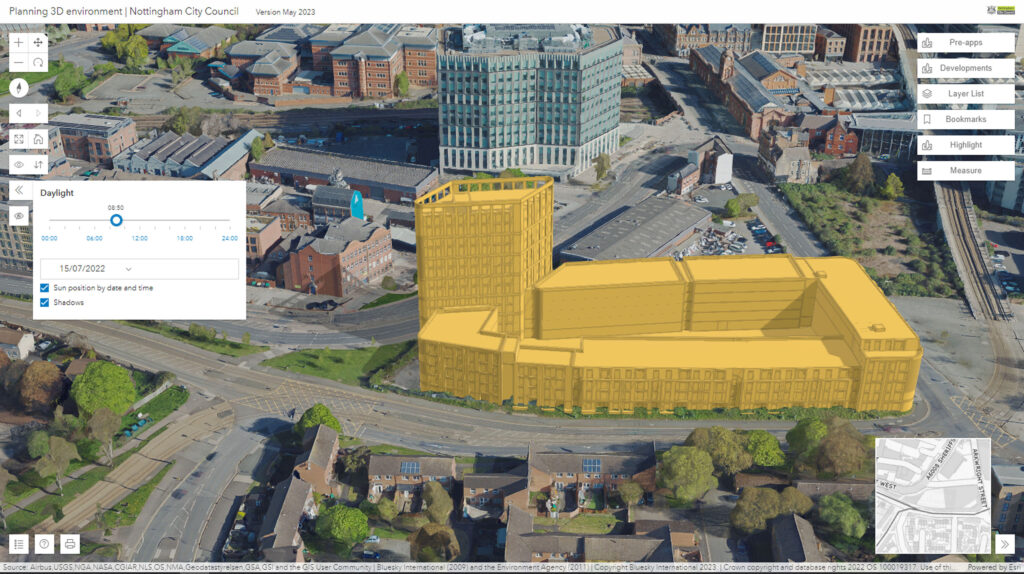
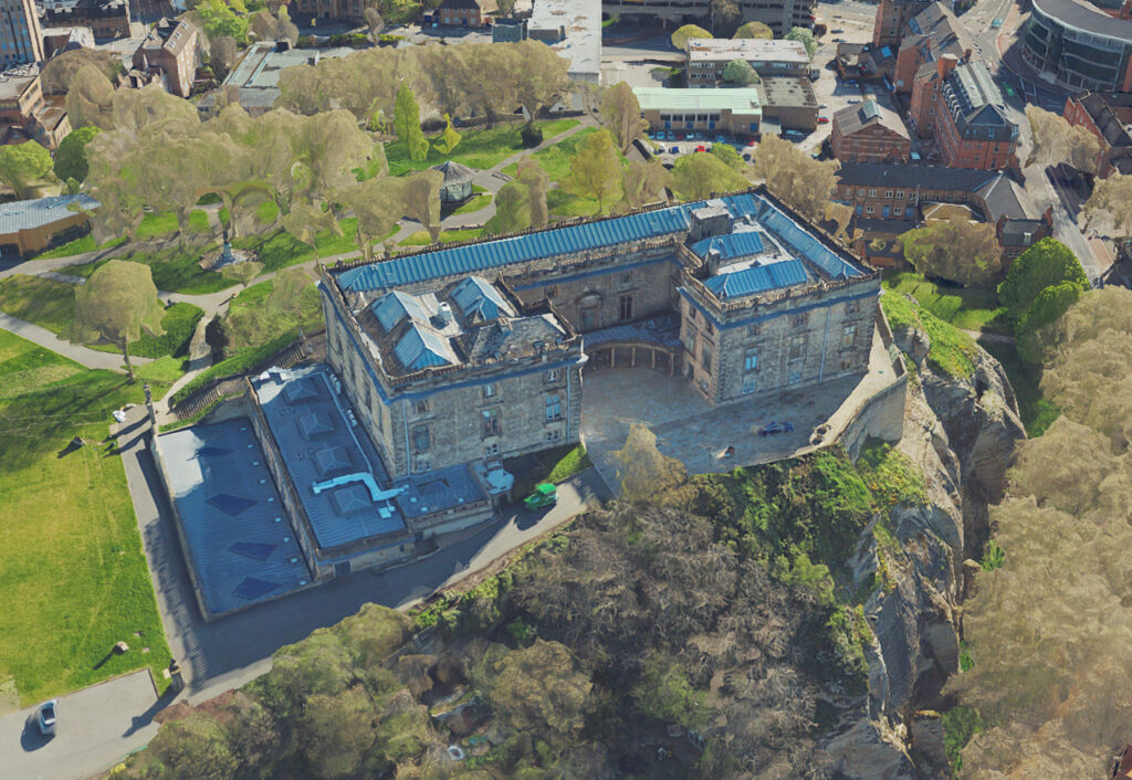
Leicestershire, UK, 07 August 2023 – Nottingham City Council is a step closer to achieving its vision of creating a digital twin for the city. In what’s believed to be a UK first they are combining the intricate, rich MetroVista 3D mesh with existing photogrammetric 3D modelling within the same application. This enables the visualisation of new developments in an immersive real-world environment whilst retaining the ability to engage with their broad network of development stakeholders. Developed using the innovative MetroVista 3D mesh model product from East Midland-based Bluesky International, the new tool will ensure accurate data is driving decision making in a bid to offer transparency and increased engagement with the planning process.
Bluesky’s MetroVista data combines ultra-high resolution aerial photography and oblique images with high point density LiDAR to create photo-realistic mesh models.
“We have always had 3D aspirations, and our planning department pioneered its use nearly two decades ago,” commented Laura Pullen, GIS Business Development Manager at Nottingham City Council. “However, at that time the city model was on a single, standalone computer that had to be carried from meeting to meeting! More recently we deployed a number of light-weight GIS applications using simplified 3D buildings, but we were keen to create an internal tool utilising high-detailed 3D data at its core which could also exploit our GIS data holdings.
“We now have a fully integrated internal assessment tool which is delivered online and accessible anywhere; throughout the planning department, enabling planners to undertake advanced visualisations, constraint checks and spatial analysis. In addition, it sits alongside a public application which is shareable with partner organisations, external stakeholders and the public. The online tools have Bluesky MetroVista data at its heart making it easy for non-professional users to engage with and interpret.”
Nottingham City Council began its journey from vision to virtual reality when it won a competition organised by Esri UK to find local planning authorities with innovative ideas for how best to use geospatial technology to help modernise the planning process. Supporting the Ministry of Housing, Communities and Local Government, published ‘Planning for the Future’ white paper that presented the importance of geospatial technology and data for the digital planning reform of the country, the work by Nottingham and the other Esri projects was nominated for the Digital Leaders 100 Geospatial Initiative of the Year award.
Earlier this year, Nottingham City Council was selected as one of 15 Local Planning Authorities to be funded by the Department of Levelling Up, Housing and Communities (DHULC) PropTech Innovation Fund. In a joint project with Bradford Council, Nottingham is now trialling 3D and exploring VR and AR visualisations as well as physical models, using the Bluesky MetroVista data within its online tool, to ensure data driven decision making and transparency in planning, and to provide a common platform, maximising the use of existing spatial data holdings which could be used as a blueprint for other Local Planning Authorities.
“The focus of this project is around digital engagement within the planning process. The core 3D data within the tool was critical and we were keen to include photo realistic models, alongside traditional 3D building data, as we believe it will enhance engagement with members of the public and other stakeholders,” Pullen continued. “In fact, it’s all about having the right data for the right audience.”
“Bluesky was keen to engage with us from the start and already had data available off-the-shelf. With a focus on public and stakeholder engagement, the MetroVista photorealistic mesh model is an ideal product to include within this tool as it brings things to life. Users can identify buildings and features they are already familiar with and the data is easy to consume, hosted within our existing online storage service so we don’t need big servers internally, is editable, so redundant buildings can be dynamically demolished and new developments ‘dropped’ in, and is compatible with our other geospatial datasets including traditional 3D building models and other data such as flooding, conservation areas and live CCTV streams.
“We hope to build on the work to date and, as we move forward, start to create hybrid-mesh models incorporating street level photo capture for applications with transport planning and biodiversity studies, for example,” she concluded
Ralph Coleman, Chief Commercial Officer at Bluesky commented: “It has been fantastic to see the vision we had for our MetroVista product realised through the work Nottingham City Council have done. We see MetroVista as a key data tool setting the geospatial foundations for smart cities and citywide digital twins to be built. It has been inspiring working with the Nottingham team and I am confident that their innovative work will be shared as best practice with other local authorities in the UK.”
Bluesky’s MetroVista data is acquired using a Leica CityMapper sensor, the world’s first hybrid airborne sensor that simultaneously captures vertical and oblique imagery together with high point density LiDAR, which allows for the production, with minimal manual interaction, of accurate and detailed, citywide mesh models. MetroVista data is becoming increasingly popular for smart city applications. By providing a geographically accurate and detailed 3D representation of the urban environment, MetroVista data has already provided insight for a range of applications including urban design, defence and security modelling, insurance assessments and utility and telecom planning.
About Bluesky
Bluesky International is the leading aerial survey and geographic data company in the UK producing and maintaining seamless digital aerial photography and height data on a national scale in both Great Britain and the Republic of Ireland. Bluesky also undertakes bespoke surveys, including LiDAR, for a range of public and private sector clients. Bluesky International operates a range of aircraft and sensors including three Ultracam Eagle Mark 3s and two CityMappers 2s which allow the simultaneous collection of vertical and oblique imagery, as well as LiDAR data, and a Galaxy LiDAR which is mounted with a thermal sensor and survey grade camera. These systems put Bluesky International in the enviable position of being able to provide customers with unique and cost-effective geospatial solutions. As well as being an established and respected aerial survey company Bluesky International is also highly innovative and continually strives to develop new products and services by embracing new technology and methods. This has resulted in the development of some unique products such as the National Tree Map (NTM). These datasets underpin long term contracts with local and central governments and many major blue-chip companies from a range of market sectors including financial services, utilities, telecoms, web portals, construction and environment. Bluesky International has offices in the UK, US, Republic of Ireland and a dedicated production centre in India. https://www.bluesky-world.com/


