These new survey-grade systems provide highspeed data acquisition for superior aerial mapping and surveying
Huntsville, AL – July 19, 2023 – GeoCue, a global leader in geospatial solutions for LiDAR mapping hardware & software, announces the release of three new, high-end TrueView 3D Imaging Systems. With unmatched precision and advanced capabilities, the all-new TV625, TV680, and TV680LR are set to redefine the standards of aerial imaging technology.
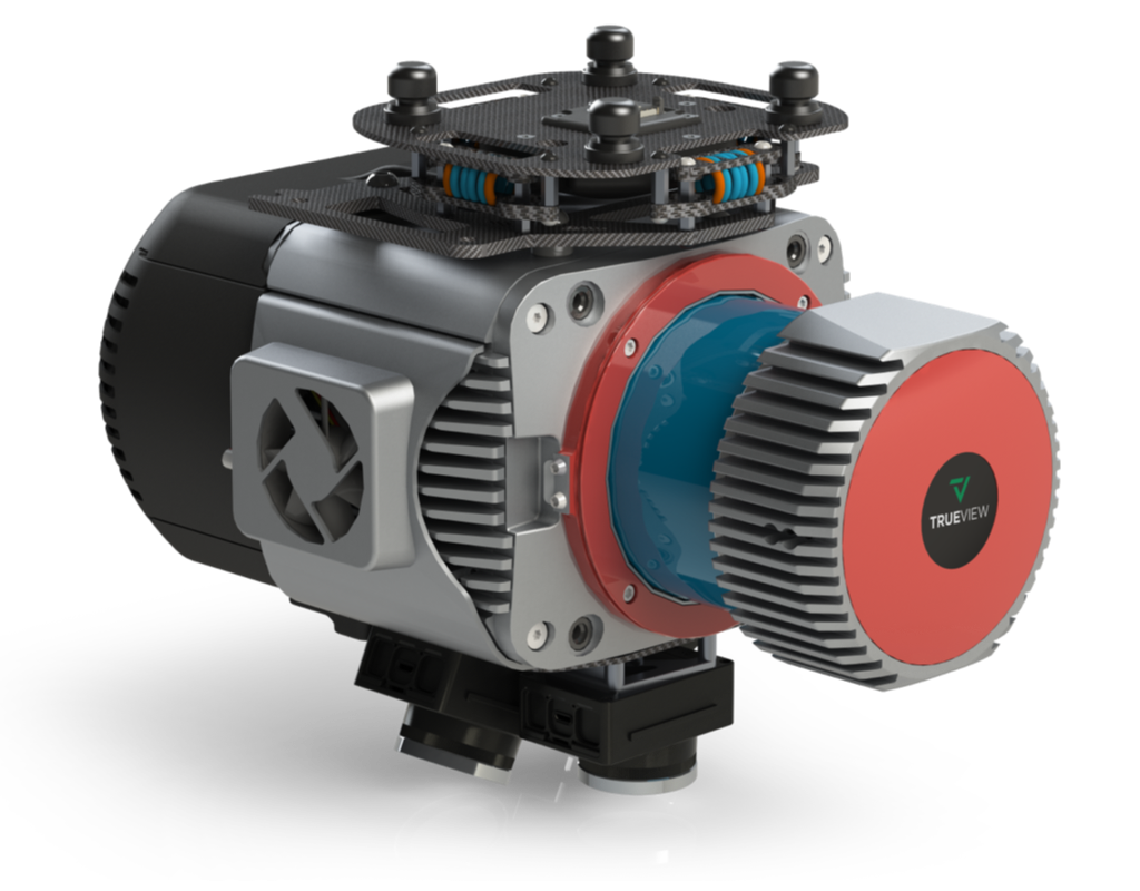
The TV680 & TV680LR offer incredible performance, in terms of accuracy and density and provide users with more customization depending on customer application.
These three news systems, designed and manufactured in the USA, combine a very lightweight and compact laser scanner with 3 cameras to deliver unparalleled accuracy and efficiency in geospatial data collection. Besides integrating state-of-the-art components and cutting-edge technologies, the new TV625, TV680, and TV680LR systems are NDAA compliant, empowering professionals across a wide range of industries, including surveying, construction, infrastructure management, and environmental monitoring.
Frank Darmayan, CEO of GeoCue, recognizes the expansion of the TrueView portfolio gives customers access to a full range of advanced-level systems for collecting photogrammetry and LiDAR. “The TrueView product line has long been acclaimed for its exceptional quality and reliability, and the latest additions to the series build upon this legacy. Combined with our LP360 software, we knew that we could deliver a powerful one-two punch into this segment, starting with the new TrueView 680 and 680LR”
Darmayan added, “TrueView 680LR is built with the Riegl VUX-1LR with up to a 360-degree field of view, five LiDAR returns, and typical accuracy of 15mm and precision of 5mm. The 680 is integrated with the Riegl VUX-1UAV providing unmatched 10mm survey-grade accuracy and an extremely dense dataset with up to 400pts per m2 at 80m flight height. Both systems capture highly detailed survey data enabling our customers to generate unmatched deliverables.”
Vivien Heriard-Dubreuil, CEO of GeoCue’s parent company mdGroup explained “We are continuously aligning our products with customer needs. We are also pleased to announce the release of the new TrueView 625. This system is based on the Riegl mini-VUX 1, similar to our TrueView 655/660, with triple cameras… but hits a sweet spot on price and performance. It’s already getting quite a bit of attention from our customers, who say it fills an important niche. Best of all, all TrueView 600-series payloads are NDAA-compliant.”
Vincent Legrand, VP of Sales said, “We offer turnkey solutions for our customers and dealers. Of course, each of these systems includes LP360 Drone software for seamless data processing and generating deliverables. Getting the hardware, software, workflow, training, and support from one company is a unique advantage that we can offer, and we’re excited about the growth that comes with that.”
About GeoCue and Microdrones
GeoCue and Microdrones have joined together to bring geospatial experts the very best in drone surveying equipment, geospatial software, workflow, training and support for high accuracy LiDAR and drone mapping to help civil engineering and surveying professionals achieve successful data collection, processing, and management. With TrueView drone LiDAR/Imaging sensors, LP360 point cloud data processing software, and fully integrated systems from Microdrones, we are the leader in LiDAR mapping processing in North America able to meet customers where they are in terms of technology adoption, budget, and resources. To learn more about GeoCue, visit www.geocue.com. To learn more about Microdrones, visit www.microdrones.com.
