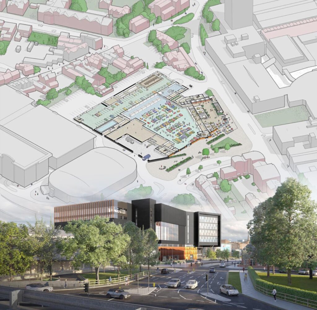
Leicestershire, UK, 06 July 2023 – 3D building models from aerial mapping company Bluesky International, are at the heart of plans for a landmark development in the centre of Coventry, UK, informing Virtual Reality (VR) presentations and digital walkthroughs.
Designed by creative architectural studio Buttress, the multi-million-pound City Centre Cultural Gateway (CCCG) will see the transformation of the former Ikea building into a multi-purpose collections and cultural facility, thought to the be the largest of its kind in the world. Forming part of the studio’s Building Information Modelling (BIM) workflow, the Bluesky models provide real-world context for the bold design, which takes reference from Coventry’s rich architectural environment. The 3D models help Buttress understand the true impact of the development and communicate with decision makers and stakeholders.
“The Bluesky 3D Building Models provide a geographically accurate and up-to-date representation of the site and its locality,” commented Paul Thornborough, BIM Manager at Buttress. “This means our design team can take into consideration how the development will be viewed and accessed from any location in the vicinity and the impact it will have on the surrounding buildings and neighbourhood.
“The models are also an essential tool in how we communicate and engage with our client, the public and planning officials,” he continued. “Due to the scale of the building and its prominence within the cityscape we have designed a bold new façade for the CCCG helping to establish and reaffirm its new identity. Bluesky’s 3D models allow us to present and communicate this design, in its real-world context and in a way that is easy to access and understand for all interested parties.”
Andy Hoskins is Bluesky’s Head of 3D. He said, “Our 3D models are an enabler for businesses and organisations that need accurate visualisation models offering detailed visual representation of the built environment, allowing interaction, analysis and interrogation of urban landscapes on an unprecedented level – and all from their desktop.”
The CCCG is a collaboration between Coventry City Council, CV Life, Arts Council England, the British Council and Coventry University and has been designed by Buttress with future flexibility in mind. A landmark cultural destination at the heart of Coventry which, it is hoped, will make a lasting physical, economic and cultural contribution, adding to the ongoing legacy from Coventry’s year as the UK City of Culture. The CCCG will include a nationally significant Collections Centre together with a cultural hub. Onsite facilities will include teaching areas, research space and attractions, such as a gallery, café, library, dance studio, artists’ studios and a shop, and many will be open to the public or available to hire.
Created from the latest aerial photography Bluesky models provide a geographically accurate and up-to-date 3D representation of both the underlying terrain and existing properties and infrastructure. Buttress imports the data into its Revit BIM software, where it sits alongside architectural drawings or design strategies. Following a degree of post processing to create realistic and relatable representations, the data is then exported to Buttress’s visualisation software to further enhance this realism. The resulting presentations are then shared and accessed by any interested party via mobile devices, using scannable QR codes or immersible VR experiences.
Photogrammetrically derived from stereoscopic aerial photography, the models are fully rendered and are provided as either wireframe or block models in a format suitable for use in both CAD and GIS software. The Bluesky data is supplied complete with a Digital Terrain Model (DTM) and can be created to different levels of detail (LOD). Additional features, such as transport infrastructure or environmental features can also be added.
Buttress is a leading design studio based in Manchester. Providing architecture, urban design, interiors and conservation design services Buttress believes that architecture is as much about people and buildings, and that buildings should be shaped by their surroundings, their role and the people that will use them.
About Bluesky
Bluesky International is the leading aerial survey and geographic data company in the UK producing and maintaining seamless digital aerial photography and height data on a national scale in both Great Britain and the Republic of Ireland. Bluesky also undertakes bespoke surveys, including LiDAR, for a range of public and private sector clients. Bluesky International operates a range of aircraft and sensors including three Ultracam Eagle Mark 3s and two CityMappers which allow the simultaneous collection of vertical and oblique imagery, as well as LiDAR data, and a Galaxy LiDAR which is mounted with a thermal sensor and survey grade camera. These systems put Bluesky International in the enviable position of being able to provide customers with unique and cost-effective geospatial solutions. As well as being an established and respected aerial survey company Bluesky International is also highly innovative and continually strives to develop new products and services by embracing new technology and methods. This has resulted in the development of some unique products such as the National Tree Map (NTM). These datasets underpin long term contracts with local and central governments and many major blue-chip companies from a range of market sectors including financial services, utilities, telecoms, web portals, construction and environment. Bluesky International has offices in the UK, US, Republic of Ireland and a dedicated production centre in India. https://www.bluesky-world.com/
