“We want to keep pushing. And with the success we’ve had in the last couple of years, it’s exponential. All we see is growth.” – Philippe Simard
Philippe Simard
In May 2023 it was my pleasure and privilege to interview CEO Philippe Simard and CTO Louis Simard, cofounders of premier photogrammetry software firm SimActive, on the occasion of SimActive’s 20th anniversary and the release of version 10 of Correlator3D, the high-end and highly innovative suite of photogrammetry processing tools the brothers invented, developed, and brought to market in 2003. It’s fair to say that SimActive revolutionized early 2000s photogrammetry by being among the first to recognize and exploit the power of the graphic processing unit (GPU)—as opposed to the core processing unit (CPU)—for use when processing digital images. Until then, GPUs were primarily seen as useful in gaming and video rendering. Philippe says:
Louis Simard
“The gaming industry has been a big driver in developing better processors. Normally in a standard PC you’ll have a CPU, which is a general processing unit, if you wish, that can do any kind of calculation. And in the gaming industry, they developed specialized processing units, GPUs, that sit on the graphics card and are geared toward repetitive and intensive 3D calculations—they came out about 20 years ago. It seems like the beginning of the 2000s were really a key point in technology from multiple sides. But basically, we were the first ones to use these GPUs, which were really meant, if you think about it, at taking a virtual 3D world, and producing 2D images out of it, right? And we made them do the opposite, to make 3D deliverables from a 2D image. It was challenging, but we were basically the first product out there to make use of these GPUs to really accelerate processing times.”
And “accelerate” here doesn’t mean just a little faster, or even two or three times as fast. “It basically means multiple times, so many times faster because we’re using the GPU.” 20 years later, that’s still the case. SimActive credibly claims a “processing time of 300 images @ 20MP” of less than half an hour, as opposed to up to ten hours for competing solutions.
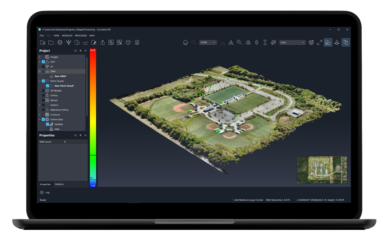
Correlator3D Version 10
It makes for a heckuva business strategy. “Today, we’ve got thousands of clients in more than a hundred countries around the world” says Philippe. “We have positioned ourselves as…—well, I like car analogies—we really are the Ferrari of photogrammetry software. Our clients will come to us when they really are managing super big projects, and they want faster turnarounds. All this GPU we discussed, basically, it leads to faster processing and faster turnarounds.”
As interview subjects, the Simards are friendly, unassuming, brilliant, speak with charming French-Canadian accents and perhaps most outstandingly—given their combined 40 years in a challenging business—are enthusiastic about the present state and bright future of geospatial. Here’s what they have to say on the 20th anniversary of SimActive.
- What prompted you, 20 years ago, to start a business focused on photogrammetry?
Philippe: We were raised in a family of entrepreneurs. Our father was an entrepreneur, and our grandfather and great grandfather, they were in the clothing business for decades. And so, we always wanted to do something together at some point. We both did grad studies in computer vision, so electrical, or computer engineering. We went to work for a couple of years, including at the Canadian Space Agency. And then, when I finished the PhD, we exchanged some ideas about technology for change detection using images.
Louis: And Philippe, if I remember, the pain then was really extracting the 3D information. Because it was extremely time consuming for photogrammetrists to manually extract the contours, and everything. We thought we could make a piece of technology where they could simply input the images, and get a 3D model area, which was an elevation model back in those days.
- How did you get your first (and most important) customer?
Philippe: It was the Canadian Army, or as they’re called here, the Department of National Defence. We met them in the first year, and they said, “Look, we have just purchased a bunch of digital cameras.” They were involved in Afghanistan at that time. And they were doing aerial photography. And the way they were doing it prior to 2003, they were flying these film cameras with the big films, scanning them afterward, and then digitizing them to do the processing. And some traditional stereo plotting, and more of a traditional photogrammetry workflow back then.
They were just starting with larger format digital cameras and the software they were using was very difficult. It took months of training for the people to use, and it was slow. So, they basically said, “Look, if you were to develop something that’d be much faster, much easier, without compromising the accuracy … ” because as always in our field, it’s all about accuracy, “… then we’d be the first ones to buy.” And so, we got a big contract from them, a program that lasted five years to basically develop the technology. Since then, our business model has been solely based on selling software licenses. So, this is what we do. And I’m happy to say that we’ve been profitable from the beginning.
Our main functions back then were surface models, 3D models, and orthomosaics. And so, the way we were doing … I guess your question relates to the DSM part, the auto correlation, coming from a computer vision side, we saw things very differently from everyone else in the photogrammetry industry. So, it really gave us an advantage when developing the technology to give it the computer vision twist, which allowed us to use GPUs.
Louis (laughs a little): I mean, the truth is we would meet with them monthly during that program. Each time, they basically taught us the ropes of surveying, and how to adapt our technology to the surveying world. So, yes, as Philippe mentioned, accuracy was key for them. It’s not always easy for the Army to have traditional controls for obvious reasons—they can’t necessarily land to set control! But, yes, they basically set the requirements, which were, in retrospect, the same as any serious surveying firm, or company, or organization that does aerial photogrammetry. So, that’s how we learned to survey!
- Building on this initial contract, the brothers pursued more business with an unusual strategy; rather than approaching geospatial firms directly, they established relationships with the aviation companies conducting flights with digital cameras.
Philippe: We started approaching flyers who were flying Vexcel cameras: they own airplanes, they own these large format cameras, and they fly all the time. So, we started approaching them, demoing the software, and we started selling to these people, basically. And today, delivering a DTM is kind of a standard. But back then, it was still stereo plotting, feature points, contours, contour lines, and stuff. So, it was really the beginning of more of a 3D complete product if you wish.
- And then SimActive expanded into satellite imagery and eventually drone flights.
Philippe: We adapted the software for satellite data. Because some of these government agencies, mostly, they will use satellite data. And then, I guess in 2015 or ‘16, the drone came in. They basically opened up the market to a whole bunch of smaller users. So, now we cater to all these three platforms or all these types of data. The customer, independent of the platform they’re flying, in the end, they come back at the office or even in the field, they have a bunch of raw images, and they will use our software to perform aerial triangulations.
- After 20 years of business, has there ever been temptation to sell?
Louis: That’s a good question. We have to ask ourselves all the time, “What is it we want to do next?” Each year, we get approached by large organizations to acquire the company. You’re right in saying that it’s family owned. So, it’s just me, and Philippe, basically the owners. We love what we do and we like to see ourselves as the Ferrari of these software. We want to keep being that.
Philippe: And we’ve seen, over the years, some of our competition getting purchased by much larger organizations. And a few years later, their product has not evolved anymore. People complain about the support that has gone to almost nothing. Yeah, I mean these larger organizations, they don’t like to take risks. They like to squeeze the lemon as much as they can, and then find another lemon.
Louis: And we keep pushing the technology. It’s not like we’re just maintaining what we’ve did so far. We keep doing R&D, exploring new avenues, and everything. So, for version 10, the first thing we did is simply—well, that was not simple—but we redesigned the interface to make something that was extremely easy to use. And then we completely redesigned the way we generate point clouds. We spent something like three years developing a new piece of technology that basically takes several images, and comes up with a nice colorized 3D model with extreme precision. And you can even distinguish small details in the scene. So, you can distinguish road signs, and everything. So, we really pushed the precision of what we were computing to a new level.
Philippe: So, there’s no plan for selling the company. We’re just too young for this, mid-40s, enjoying what we do. We want to keep pushing. And with the success we’ve had in the last couple of years, as I mentioned, it’s exponential. All we see is growth. So, these are exciting moments for us, and we’ll be around a while still.
Angus Stocking is a former licensed land surveyor who has been writing about infrastructure since 2002.