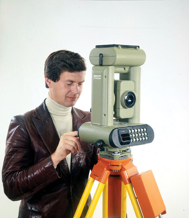
The company “Heinrich Wild, Werkstätte für Feinmechanik und Optik” was founded in Heerbrugg, Switzerland, on April 26, 1921. Over the decades, this company developed into the world-renowned Leica Geosystems AG, an essential component of the Hexagon technology group. Founder and master innovator Heinrich Wild revolutionized surveying with smaller, more practical, yet more accurate instruments. Heerbrugg has repeatedly been the source of major innovations, such as the first optoelectronic distance meter in 1968; the first electronic theodolite with digital data recording in 1977; the first surveying system based on GPS signals in 1984; the first digital level in 1990; the first hand-held laser distance meter in 1993; the first airborne digital image sensor in 2000; and the smallest, lightest and most user-friendly laser scanner in 2019. What was the recipe for success in this hundred-year history of innovation?
A difficult start
The structural crisis in the embroidery industry in the early 1920s hit eastern Switzerland and especially the Rhine Valley so hard that its impact in the region exceeded that of the global economic crisis ten years later. Because the major Rhine-regulation projects were coming to an end at the same time, new employment was urgently needed for the people of the Rhine Valley.
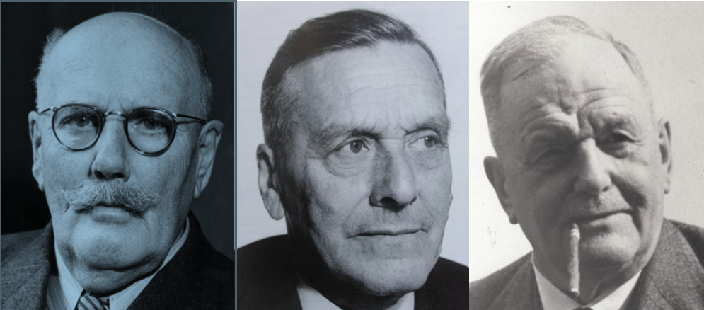
Left: Heinrich Wild 1877–1951, the inventor. Middle: Jacob Schmidheiny 1875–1955, the financier. Right: Dr. Robert Helbling 1874–1954, the practitioner.
After working for the Swiss Federal Office of Topography1, Heinrich Wild had built up the geodetic department as chief engineer of the Zeiss-Werke in Jena, Germany. He already had a reputation as a brilliant inventor in the surveying world. Because of the uncertain future after the Great War and the constant devaluation of money, he wanted to return to Switzerland with his family. With design plans of geodetic and photogrammetric instruments in mind, he looked for partners in Switzerland to found an optical precision-mechanical experimental workshop. He remembered his fellow officer Dr. Robert Helbling in Flums: the owner of a well-known surveying office would be very good at assessing the market needs. Helbling knew Jacob Schmidheiny, an industrialist from the Rhine Valley, from their time studying together at the ETH2. Schmidheiny took a liking to the project. As a successful entrepreneur, he had the right sense of purpose and the necessary money. Heinrich Wild repeatedly pointed out that precision-mechanics specialists would be available in the area of the watch industry in Switzerland’s western cantons. But Schmidheiny’s guiding principle was clear from the start: he wanted to create jobs for people in the Rhine Valley.
On April 26, 1921, the three signed a contract to found a simple company under the name “Heinrich Wild, Workshop for Precision Engineering and Optics, Heerbrugg.” The production of Heinrich Wild’s new level began, but many of his innovative ideas and designs were not yet technically mature in 1921. After a year—even before the first instruments had gone on sale—the company’s capital was exhausted. In 1923, the company received an injection of new capital through the foundation of the “Verkaufs-Aktiengesellschaft Heinrich Wilds Geodätische Instrumente Heerbrugg” (Heinrich Wild’s Heerbrugg Selling Company for Geodetic Instruments). On a commission basis, this joint stock company provided credit and obtained orders for products. However, because of technical problems in productization coupled with a shortage of optical and precision-mechanics specialists, Heinrich Wild’s vision of a small, compact universal theodolite proved difficult to realize: in 1924, only 27 of the planned 350 T2 theodolites were completed. Not until 1929 was the company on safe ground and able to pay out a dividend for the first time.
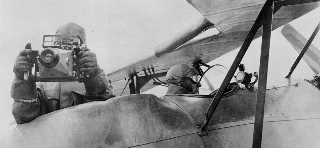
Heinrich Wild’s inventions also laid the groundwork for photogrammetry. This made it possible to produce accurate maps economically, such as the then-new Swiss national map. WILD’s phototheodolites, Autograph stereoplotters and aerial cameras quickly became reputable worldwide.
The test workshop becomes a company
The streamlining of the organization and the establishment of a worldwide sales network by the new director Dr. Albert Schmidheini brought about a first expansion phase with 250 employees in 1930. The 1930s economic crisis interrupted the expansion: in 1933 130 employees remained.
The increasingly threatening political situation in the 1930s triggered a need for military instruments in Switzerland too. In record time, prototypes of telemeters, telescopic sights, omnidirectional telescopes and instruments for artillery units were developed, built and demonstrated in Bern. As a result of this successful activity, WILD became one of the main suppliers to the Swiss Army, and expansion began again in Heerbrugg.
During its second growth phase between 1936 and 1941, the workforce increased to more than 1000. It remained at that level until 1951 and then continued to rise steeply, exceeding the 3000-mark in October 1961.
The inventive genius leaves the growing company
Around 1930, Heinrich Wild and his family moved from Heerbrugg to Zürich. He rarely came to the Rhine Valley anymore, and communication became increasingly difficult. In 1933, he left the company and went into business for himself as an inventor and designer. Heerbrugg continued to commission him until 1935, when he signed a contract with Kern & Co in Aarau. He remained loyal to Kern until he passed away in 1951. However, the name “Wild” remained omnipresent in the company name and product names until 1990, when the Leica era began. For many people of the Rhine Valley, “Wild” is still synonymous with the Heerbrugg factory.
Skilled workers in short supply
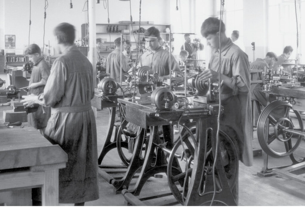
Recruiting personnel from the optical centres of the time helped counter the acute shortage of skilled workers in the optical and precision-mechanics sector, but the goal was to recruit and train Rheintalers. As early as 1921, two apprentices selected personally by Heinrich Wild began their apprenticeship in Lustenau. A dedicated school was founded in 1924 to provide even more targeted training. In 1930 this became the Fachschule für Feinmechaniker und Optiker, the Technical School for Precision Mechanics and Opticians.
The culmination of the precision-engineering epoch
In 1943, WILD drawing instruments were brought onto the market. The impulse for this was not least the Kern DKM1 theodolite, which bore the inscription “Construction Dr. H. Wild” despite protests from Heerbrugg. The T4 astronomical theodolite was the pinnacle of optomechanical precision when it was launched in 1944. This instrument enabled a direct reading of 0.1” with an accuracy of ±0.3”—still legendary today.
WILD also collaborated with international research partners. In 1952, for example, the BC-4 ballistic camera—developed together with the Ballistic Research Center in the USA—went into production. This camera combined the high angular-measuring accuracy of the T4 with the high-resolution capacity of the special aerial-imaging lenses. The BC-4 camera would later also be used for satellite triangulation and thus for constructing the first global positioning system.
Optical flights of fancy
In 1947, WILD continued its pioneering work in the field of microscopy. The first research microscopes produced in series in Switzerland, the M9 and M10, had their market launch. Hans A. Traber—who later became famous for his natural-history program on Swiss radio and television—joined Heerbrugg in 1947 and headed the Microscopy Department from 1949 until 1956.
Thanks to management’s vision and WILD’s reputation as an employer, the company succeeded in attracting top-class specialists to the Rhine Valley. In February 1946, Ludwig Bertele joined Heerbrugg as Head of Optics Development. The former specialist for the design of photo lenses at Zeiss-Ikon in Dresden was probably the most important optics designer of the time. He was entrusted with the development of a new type of high-performance lens for aerial photography. Under his leadership, the optical design office for the first time used an electrical calculation device to design and optimize the lenses. The device they used, the Zuse Z22, was one of the first “computers” to be produced in series. WILD was the first Swiss industrial company to purchase such a system. With this electronic calculator, it was possible to calculate about 3000 refractive or reflective surfaces per day. Using traditional mechanical calculators, two experienced employees would have spent 20 working days to complete the same task.
On the night of July 21, 1969, people worldwide sat with bated breath in front of their television sets as the first humans, astronauts Neil Armstrong and Buzz Aldrin, set foot on the moon during the Apollo 11 mission. NASA made use of various instruments from Heerbrugg in its lunar landing program. The T3 was used in the orientation of the Inertial Guidance System and the T2 for the optical alignment of the LEM lunar module during construction. During the television broadcast of the spectacular moon flight, an astronaut could be seen on screen carrying out positional measurements. WILD had supplied the lens system of the instrument he used.
The age of electronics begins—with a cooperation
In 1958, an electronics department was set up in Heerbrugg. At the 10th Congress of the Fédération Internationale des Géomètres (FIG) 1962 in Vienna, the first microwave distance meter was presented: developed in cooperation with the electronics company Albiswerk Zurich, the Distomat DI50 was the world’s first electronic distance meter, with a measuring range of 100 m to 50 km. Radically new technologies were often brought into the company via cooperations or acquisitions. In 1963, a Distomat DI50 cost around 40 times the monthly salary of a surveyor. Radically new technologies are often costly initially and therefore only economical for very specialized applications.
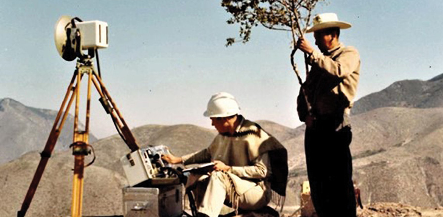
To measure a distance between 100 m and 50 km, a DI50 was set up at each end-point and the distance calculated by measuring the transit time of the microwave radiation. The picture shows a DI50 being used in Mexico.
The new premier discipline—optoelectronics
The first infrared distance meter, the DISTOMAT DI10, was a joint development with the French company Sercel (Société d’Etudes, Recherches et Constructions Electroniques) in Nantes, and was launched in 1968. This first close-range distance meter revolutionized surveying technology. It did not yet use a laser, but instead the infrared radiation of a gallium arsenide diode. It marked the beginning of optoelectronics, which became a core competency in Heerbrugg. At the 14th FIG Congress in Washington in 1973, there was a great deal of interest in the new DI3 infrared distance meter. It became a geodesy best-seller, and the name DISTOMAT became synonymous with distance meters.
A Volkswagen from Heerbrugg
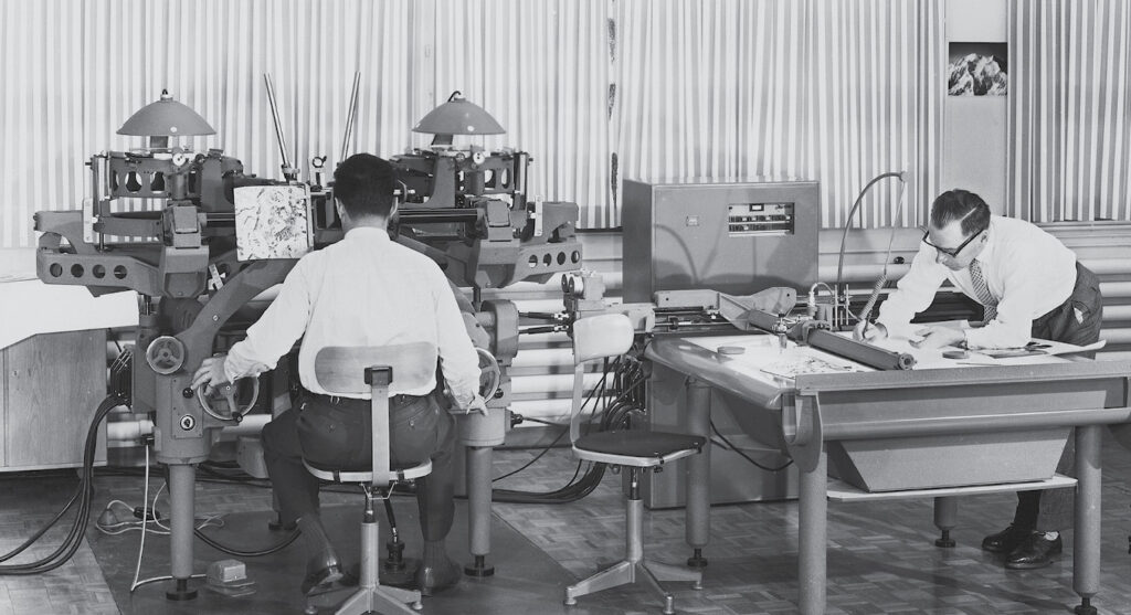
In the 1970s, analogue photogrammetry reached its peak. By 1975, 1000 A8 Autographs had left the Heerbrugg factory. The A8 was often referred to as the “Volkswagen of photogrammetry.” But technological developments, and digitalization in particular, ultimately brought the Autograph business to a standstill. Image processing and computer science became the new premier disciplines for the digital photogrammetry that followed.
Innovation requires technical excellence in new disciplines
An intensive exchange with universities was an essential motor for innovation. Dr Hugo Kasper, previously a professor of geodesy at the Technical University in Brno, joined WILD in 1948 and took over the newly formed Research and Development Department for Photogrammetry. The A7 and A8 Autographs and the B8 Aviograph were developed under his leadership. In 1961 he was appointed professor of geodesy, especially photogrammetry, at ETH. He remained in contact with WILD until his retirement in 1973. In 1955, Hans Tiziani completed his apprenticeship in optics and mechanics at WILD. After training as a technician and qualifying as a mechanical engineer, he studied optics at the Sorbonne and the Paris School of Optics. He graduated as an engineer in 1963 and received his doctorate from Imperial College London in 1967. From 1968 to 1973, he was responsible for establishing and managing the Optics Group in the Department of Technical Physics at ETH. From 1973 to 1978, he was head of WILD’s central laboratory. In 1978, he was appointed to the University of Stuttgart and led the Institute of Technical Optics until his retirement in 2002. To this day, he remains in intensive contact with “his” company in Heerbrugg.
Max Kreis, a graduate in mechanical engineering from ETH, joined the Heerbrugg design office in 1932. Throughout his professional career, he was a strong advocate of higher education. As president of the executive board, in 1968, he was a founding member of the Institute of Technology in Buchs (NTB), which today is part of the Eastern Switzerland University of Applied Sciences. Dr. Albert Semadeni, later president of the board, initiated the construction of a cantonal school in Heerbrugg by tabling a motion when he was a member of the St. Gallen Cantonal Council. The school opened in 1975.
Surveying 4.0 begins in 1977
The fully automatic electronic infrared tachymeter TC1 was presented at the 15th FIG Congress in Stockholm in 1977. Electronics took over the measurement of the distance and the angles as well as the logging of the measured values. A cassette was used for data storage. This marked the beginning of the era of computer science in surveying. In the beginning, however, digitalization was a bulky and weighty affair. For the first time ever, in 1980, the GEOMAP system enabled continuous data flow from geodetic field measurement to the finished graphical plan using the interactive graphical workplace-computer Tektronix 4054.
In December 1984, the WM Satellite Survey Company was established as a joint venture with the Magnavox Government and Industrial Electronics Company in Torrance, California. The new GPS surveying system WM101 was presented as early as May of the following year, marking the beginning of the GNSS success story that continues to this day.
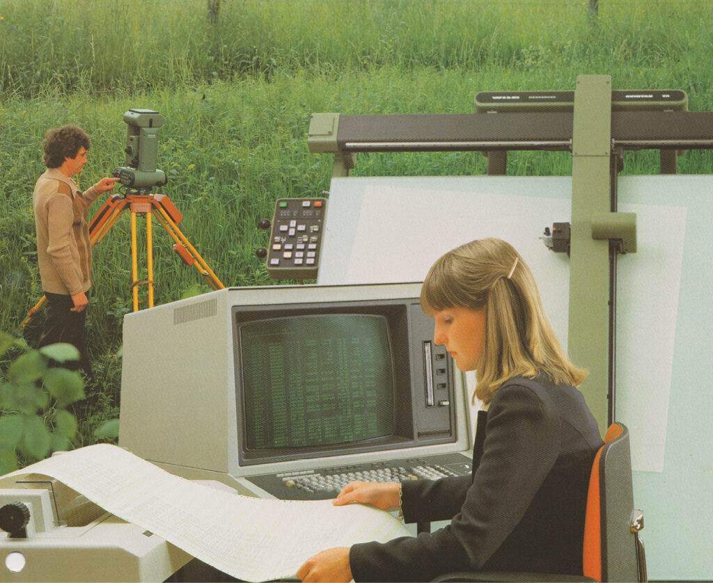
The GEOMAP system. The screen was used to display the graphics. To the right the plotting table is shown.
Wild Heerbrugg—Wild-Leitz—Leica—Leica Geosystems
The period between 1988 and 2000 was eventful in terms of company names, composition and ownership. The acquisition of Kern in Aarau brought a bundle of industrial-measurement technology to Heerbrugg, and today this still represents an important market segment within the Hexagon Group.
Crazy ideas sometimes become successful products
In 1990, the NA2000—the world’s first digital level—attracted a great deal of attention at the most important surveying congress in the USA in Denver. It was awarded the innovation prize in photonics. The device’s real magic is in its associated algorithm: industrial mathematicians optimized the evaluation algorithm that worked on a PC so that it also delivered good results on a field device in an acceptable time.
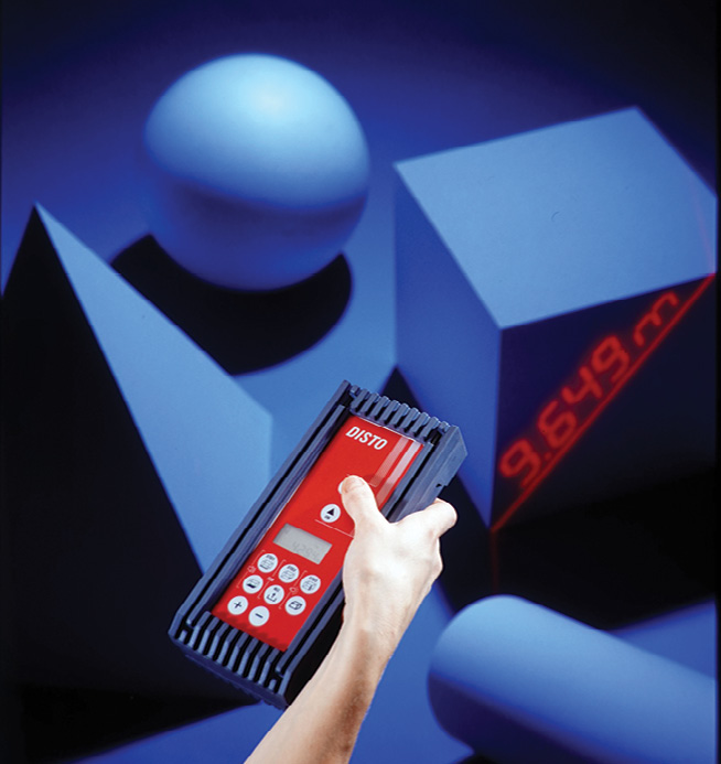
The idea of launching a more accurate alternative to the ultrasonic devices and steel measuring tapes available on the market, based on all the experience with high-quality add-on distance meters, was greeted internally with a tired smile. In the end, however, the DISTO, the world’s first hand-held laser distance meter, set new standards. When it was presented in 1993 at the international construction fair BATIMAT in Paris, this new development created a real stir and received a prize for innovation.
Everything is digital—workflow and stock-market launch
The first digital aerial camera, the ADS40—developed jointly with the Institute for Optical Sensor Systems of the DLR3 (German Aerospace Center)—was presented in 2000. The sensor’s success was mainly due to a robust workflow, which required effective, frictionless processing of the massive amounts of data generated during flight operations. Software innovation was the key to this.
Acquiring the Californian company Cyra Technologies in 2000, Leica Geosystems was the first surveying company to invest in laser scanning. This technology was quickly internalized and developed further in Heerbrugg. Under the slogan “High Definition Surveying,” the next-generation laser scanner HDS3000 was presented alongside the new Cyclone 5.0 software. In 2006, not only the development but also the production of the scanners was concentrated in Heerbrugg.
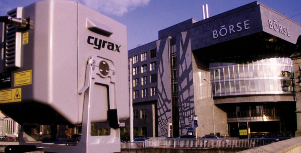
On the occasion of Leica Geosystems’ stock-market launch in 2000, the Zurich stock exchange was transformed into a point cloud using a Cyrax 2500.
Stronger together—sensor fusion
Acquisitions complemented the company’s own innovation activities as it expanded its solutions. This trend was further accelerated by the acquisition of Leica Geosystems by the Swedish technology group Hexagon AB in 2005.
In the past ten years, the acquisition of nearly 40 companies strengthened the company’s presence in emerging markets and supported its expansion into new markets. In 2013, for example, the acquisition of Italy’s Geosoft laid the foundation for the Pegasus mobile mapping product line, which records images and lidar data in a GIS-enabled platform while in motion, thus enabling complete capture of the surrounding area. The acquisition of the Berlin company Technet in 2015 added GIS software solutions for railway applications to the Pegasus product line. Acquiring Italy-based IDS GeoRadar in 2016, the company obtained extremely competitive radar solutions, such as ground-penetrating radar systems that can precisely detect nonvisible underground pipes and cavities. In combination with Pegasus, recorded underground infrastructure can be linked to the spatial data recorded above ground.
CityMapper, the world’s first “fused sensor” for aerial photography, with newly developed cameras and laser sensors, was introduced in 2016. It consisted of an RCD30 multispectral camera in the center, four oblique RCD30 cameras angled at 45° and a Hyperion lidar unit. It was specially designed for challenging 3D city views and formed part of the RealCity overall solution for 3D city model creation.
In 2017, the first GNSS with true tilt compensation was introduced. The GS18 T was the world’s fastest and easiest-to-use GNSS RTK rover. Now, professionals could measure points more quickly and more easily, as they no longer had to hold the pole vertically. The development of a robust tilt compensator had been an R&D target for decades. The solution was an IMU (inertial measurement unit) integrated into the GNSS antenna. The IMU recorded acceleration and rotation values and offset them against the GNSS position data.
Smaller, lighter, simpler and mobile
On November 18, 2016, CTO Burkhard Boeckem presented the BLK360 to the public at Autodesk University 2016. The timelessly elegant laser scanner with its compact design, weighing only 1.1 kg, was the smallest, lightest and most powerful device on the market. The BLK360 won countless design and innovation awards. A dedicated team brought this product to market in a surprisingly short time using the latest development methods.
The first hand-held imaging laser scanner BLK2GO was presented at HxGN LIVE 2019. In real-time, as the user moves, it digitizes rooms in 3D using images and point clouds. The integrated SLAM technology (simultaneous localization and mapping) enables the precise determination of the movement path while simultaneously capturing the space’s geometry. And, once again, the spirit of Heinrich Wild beckons—“small, light and mobile” like the T2.
In addition to surveying-related applications, the BLK2GO is also increasingly used in other areas, including forensics, the film industry and archaeology—thus considerably expanding its market.
100 years and still raring to go
Hexagon’s Geosystems division will continue to innovate in its five core industries: surveying, construction, heavy-machine control, mining and geospatial solutions. But the range of possible applications for new and emerging technologies also opens new markets: mobile 3D scanning technology and software solutions allow investigators to preserve digital copies of crime or crash scenes but also enable new insights for architectural scientists and archeologists. Lasers, GNSS receivers and total stations enable media and entertainment professionals to create digital replicas of real-world objects or environments to incorporate into movies and games; urban planners use the same technology to model city development. Easy-to-use monitoring solutions can help professionals screen for natural hazards, facilitate building maintenance or assist in monitoring assets in the railway industry—to name but a few examples.
Hexagon invests between 10% and 12% of its turnover into research and development each year. Successful innovation, however, also requires the necessary corporate culture. Ever since the company was founded in 1921, it has always remained important to mix the good local conditions with new ideas brought in from outside. The diversity that results from Heerbrugg’s multinational workforce—with people hailing from 50 countries—enables and promotes a culture of innovation.
For its next chapter, Hexagon is committed to bringing this inventiveness to bear on developing innovative technology that drives sustainability by improving efficiency, increasing safety and reducing waste. By incorporating sustainability aspects in its innovation process, Hexagon seeks lower carbon dioxide emissions and combats climate change while helping existing and new customers tackle their challenges more quickly, easily and efficiently.
 Eugen Voit, a physicist from ETH, held various R&D management positions within Leica Geosystems, part of Hexagon, for 30 years before retiring in 2018. As a member of the workgroup “Historic WILD,” he is dedicated to the preservation and documentation of the company’s history.
1 Swiss national mapping agency, now also branded as swisstopo.
2 Eidgenössische Technische Hochschule Zürich
3 Deutsches Zentrum für Luft- und Raumfahrt.
