Fredericton, NB, Canada, April 27: Teledyne Geospatial, a Teledyne Technologies company, is pleased to announce the release of three new applications on its CARIS Cloud platform—the CARIS Bathy Data Service, S-57 ENC Service, and Chart Data Service.

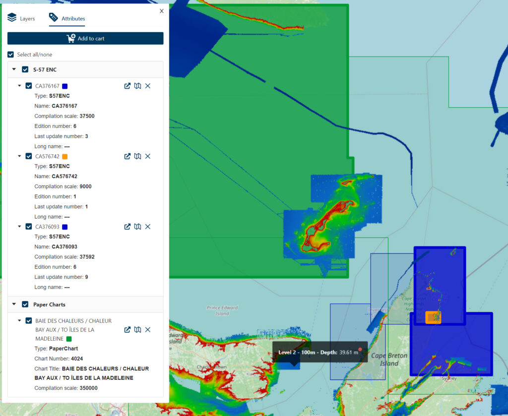
CARIS Cloud demonstration account populated with PDF paper chart, S-57 ENCs and Non-Navigational Bathymetry. Image courtesy of the Canadian Hydrographic Service
The robust and scalable CARIS Cloud allows for the management, processing, and distribution of hydrospatial data, all from one platform. Leveraging CARIS Cloud accelerates and automates product delivery, enabling hydrographic offices to focus on planning and implementing the transition to S-100. Teledyne has implemented the findings from several pilot projects with CARIS customers for this solution and CARIS Cloud turnkey applications have been tested to get the most up-to-date and authoritative hydrospatial information securely and promptly to stakeholders.
The S-57 ENC Service and Chart Data Service streamline the distribution of S-57 ENCs and digital “paper” charts from the production environment to stakeholders.
The CARIS Bathy Data Service is an innovative cloud hosted data service, which automates the generation and distribution of bathymetry products including S-102. This ready-to-use solution integrated with CARIS’ trusted Bathy DataBASE Suite and simplifies the journey of hydrographic offices transitioning to S-100 by the year 2026.
At the upcoming IHO Assembly being held in Monaco, May 2-5, Teledyne CARIS and the UKHO will present a seminar focused on planning for S-100 implementation: Countdown to S-100 Tuesday 2 May, 13:10 – 14:10, at IHO Assembly, Grimaldi Forum, 10 Avenue Princess Grace, 98000, Monaco. This seminar will be jointly presented by James Cooke, Head of Digital Delivery at UKHO and Peter Schwarzberg, Director of Business Development at Teledyne Geospatial.
Teledyne Geospatial unifies the hardware and software expertise of both Teledyne CARIS and Teledyne Optech. The new group provides customers with innovative integrated solutions. Offerings include turnkey systems, lidar and sonar integrated workflows and a range of systems and solutions that support holistic, precision data collection.