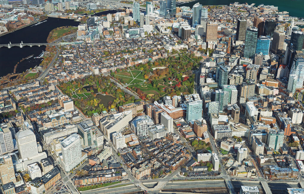
North Adams, Massachusetts, USA, 13 February 2023 – Bluesky Geospatial Ltd. has announced the launch of its MetroVista 3D aerial mapping program in the United States. The service employs a hybrid imaging-LiDAR airborne sensor to capture highly detailed 3D data, including 360-degree views of buildings and street-level features, in urban areas for use in creating digital twins, visualizations, and simulations.
Bluesky’s sister company, Bluesky International of Leicestershire, England, developed and introduced the MetroVista program in the United Kingdom in 2018 and has mapped more than 20 cities across the England and Scotland in 3D. For the U.S. program, Boston is the first metropolitan area completed by Bluesky Geospatial, which will feature in project presentations this week at Geo Week 2023 in Denver.
“For many clients, the MetroVista 3D data set serves as the foundation for highly detailed digital twins at the heart of Smart City initiatives,” said Bluesky Chief Commercial Officer, Ralph Coleman. “The rich information content of the 3D data enables accurate visualization of existing features for informed decision making and realistic simulation of future development for comparative analysis.”
The MetroVista product is already being used in city management and urban planning for agencies as diverse as emergency services, transportation, environmental protection, and utilities. Bluesky has seen rapid growth in the adoption of 3D data sets and digital twins in the AEC (architecture engineering construction), real estate, and insurance sectors.
For data collection, Bluesky flies the airborne Leica CityMapper-2 hybrid sensor which captures simultaneous oblique and nadir imagery along with LiDAR elevation measurements. Bluesky processes the data to create georeferenced 3D mesh models with 5-cm resolution and 10-cm accuracy. The 3D models are delivered in a variety of formats for direct ingest into GIS and CAD environments.
“The MetroVista 3D product allows managers and planners to measure, model, and analyze the terrain and features in their cityscapes with confidence – all without leaving the office,” said Coleman.
The MetroVista U.S. program builds on a nearly 80-year legacy of delivering accurate, reliable and quality mapping projects under the Col-East name since 1946 and as part of the Bluesky brand since 2017. Along with its full line of aerial mapping services, Bluesky Geospatial will perform MetroVista city projects for clients in the Northeastern U.S. and beyond, adding to its archive of aerial imagery, photography, and LiDAR products.
Geo Week 2023 attendees are invited to visit booth 315 at the Colorado Convention Center where Bluesky President Simon Tidmarsh, Account Manager Shaun Vincent, and Ralph Coleman will discuss the MetroVista program and other mapping services from February 13 to 15. Ralph Coleman will present on the Boston 3D project during the “Digital Twins at Scale” session at 2 pm on Monday, Feb. 13.
About Bluesky Geospatial Ltd.
Based in North Adams, Mass., Bluesky Geospatial specializes in providing the Northeastern United States with high-quality aerial photography, mapping, and LiDAR products and related services. In addition to aerial imagery and LiDAR data collection, the firm offers a variety of high-end processing services, including production of topographic maps, GIS base maps, true & standard orthomosaics, and FAA airport obstacle maps. Since 1946, the team has earned a reputation for high-quality, outstanding customer service, and timeliness in delivering innovative geographical data sets and services. www.bluesky-world.us
